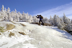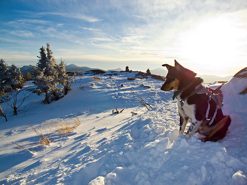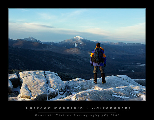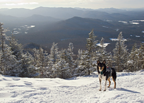
Showing posts with label ADK. Show all posts

Saturday, September 24, 2011

Taking Dix from both ends can leave you with a Whiteface!

Aim ascending Whiteface Ski Slide #1

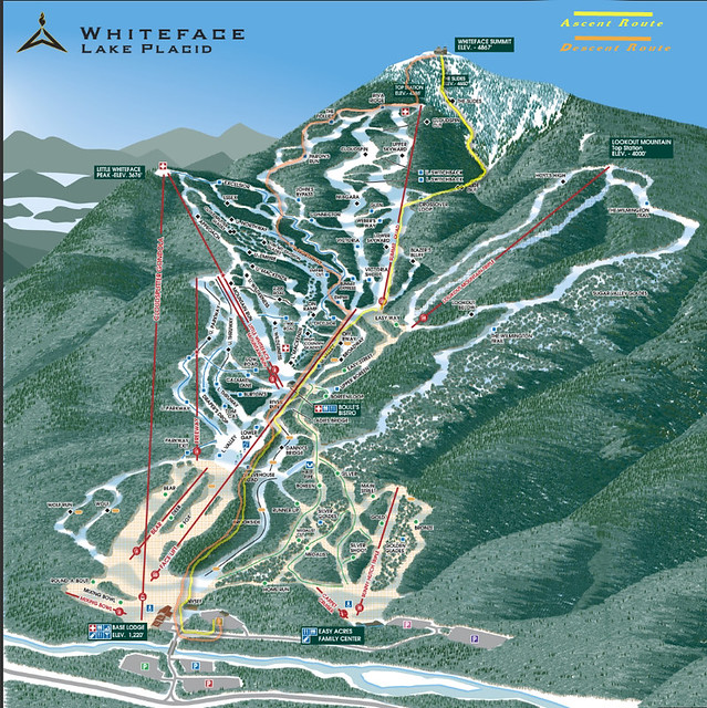
Following our removal from the Dix Wilderness by the DEC, we had to find alternate plans for the remainder of our vacation. Slide climbing had always been on the agenda for the second half of the trip, so with 3 major slide filled wilderness areas closed, my eyes turned to Whiteface.

Approaching and descending from a ski slope would seem to be easy. As you drive by them on the road you see grassy fields that look like a pleasant way to ascend and descend a mountain. Perhaps Whiteface is different than other slopes, but it was anything but a leisurely walk.

The ascent was fine. We actually took the Stag Brook Trail -lower and upper- which gained about 1500ft or so. This was in the trees, on a trail parallel to the beautiful rushing Stag Brook with it’s numerous waterfalls and cascades. I don’t know if Stag Brook is typically dry in summer, my guess is that it normally doesn’t flow quite this much. But following hurricane Irene, it was quite full and beautiful.
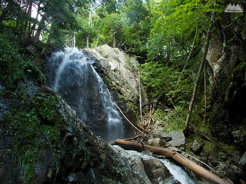
Stag Brook Falls

At the top of Stag Brook trail, we began the ascent via the ski slopes. Immediately the 80+F (26C) heat with high humidity became an issue. Mid summer heat and humidity in September, on a shadeless open slope = fun times.
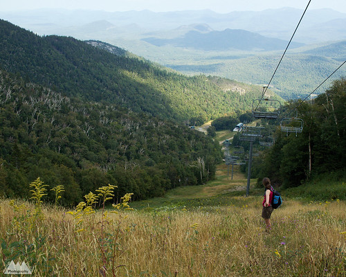
Understanding why you ski down them!

The slopes are actually quite pretty, many wildflowers and butterflies to be seen during the ascent. We could also see our objective quite clearly. Both the summit of Whiteface and the slide bowl -or as my wife refers to it, the hell hole.

It was about 4pm when we finally got to the base of the slide. Slides 1 and 3 are immediately visible in the bowl. Just bear left and start up #1, #3 is slightly to the right (center). #2 two splits near the upper half of #1, and #4 appears to require some bushwhacking to gain the base, but nothing heinous. My next trip here I will be doing Ski Slide #3 and then traversing over to Ski Slide #4 to summit via the crux pitches of #4. For this trip though we just did the easiest of the four, #1.

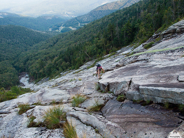
The slide was relatively dry as a whole, but there were many wet sections and many streams of water flowing down. Mixed in were a few slimy sections. For this reason we zig-zagged around a lot of the slide seeking the driest terrain versus the easiest terrain. Typically, I look for the harder climbing on class 2, 3 and 4 terrain to make things interesting, but this time we ended up on steeper and drier sections because of necessity. Oddly, I usually feel like the climbing is easy, but on this slide I felt like it was steeper and more dangerous than the trip reports suggested. I might be getting soft, or I might just have been concerned about Colvin.
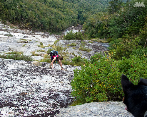
A concerned Colvin watches the ascent

Colvin climbed the class 3 slide with relative ease, but because of his extreme concern and loyalty for us, he put himself in dangerous positions several times by returning down from difficult sections to “assist” or encourage us. There were 3 sections where I roped Colvin. He was wearing his Ruff Wear Doubleback technical climbing harness, and I used a hip belay and 8mm static cord to give him a little assistance over some fairly steep sections that were above significant runout. In these sections, I felt a fall could become dangerous beyond the initial impact. It’s quite funny, really, but he is very comfortable climbing while roped. Whereas my last dog, Caney, who was a much better climber, almost human good on technical terrain, did not like being roped up.
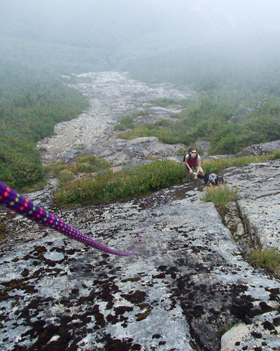
Final ascent before bushwhack
The mental crux of any of these longer semi-technical climbs is the exposure. There are sections of trail throughout the Adirondacks with slabs this steep, or even steeper, but few involve looking back down at hundreds, or even 2000ft, of unbroken fall beneath you. There were few sections on this slide where there was potential for fall for even a novice climber with a grasp of fundamentals, but if a fall were to happen, it could be fatal. I would say that if you were to fall on the first 200-300 vertical feet of the slide, you could potentially fall all the way to the bottom without stopping depending on your path during the fall, though more than likely you would stop. The higher up you got on the slide, the less steep it became. In many spots any sort of significant fall was near impossible, and it was just like hiking any steep, slabby trail.
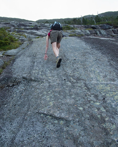
Climbing the slabs - Whiteface Ski Slide #1
Falling on a slab climb or slide is actually quite serious. More serious in my opinion than a beyond vertical rock climb with good protection. When you fall it’s not a matter of if you will hit something, but how far you will slide before you stop. Skin and rock don’t mix well. Even a minor fall can lead to weeks of healing. That said, I’m a confident, and I hope, a good friction climber, slabs have never bothered me, and I enjoy climbing them. Generally speaking, people either love or hate slab climbing. There is no middle ground.

The left side of slide #1, though not extreme left, is more ledgy with verticalish steps of 3-10ft. Staying towards the center is more a mix of ledges and slab, while far right is mostly smooth slab. In dry conditions, the right side seems like it’s the best route for friction climbing. In wetter conditions, the center left gives a nice mix of rest ledges with secure stances, dry friction, and good positive holds.

The extreme left, which would be on the treeline, is very wet, muddy and also slimy. I would not consider this an option unless it was already raining and you were using the trees for assistance. Even then, you might be better off towards the center or right sides.

While the easiest of these slides are really glorified hikes, and the hardest are technical rock climbs, I’d recommend people have some climbing experience before undertaking them. Also, I see a lot of hikers bring ropes with them while hiking, but few actually know how to use them. Figuring out a rope 750ft off the deck of a slide really isn’t the ideal place. Though I brought a rope, I did not bring human harnesses. I could have made a diaper harness from the webbing I had, but I think it’s a good idea to have harnesses for novice climbers and 100ft of rope, along with some webbing. Coincidentally, I did notice an old sling with a rappel ring on tree that had long since washed away. Apparently someone either descended the slide or got sketched and bailed on it.
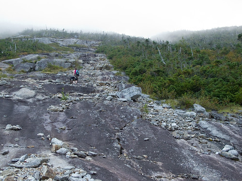
Clouding In

When Aim, Colvin and I reached the top of the slide we were on the right side of the slide. We were greeted by a wet 15ft slab of about 45*, which was above a 5ft shelf. We scanned for a herd path before committing to the upper section but did not see one. I climbed the crack to avoid the slab itself, then I belayed Colvin up the slab. The left-center looked easier, like it went further into the trees, but it was also wet and I preferred the safety of the crack system in the slab above us.
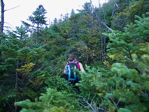
The best part of slide climbing, the bushwhack!

Once at the scrub line, we did a quick check for a herd path of any sort. One could not be found. Knowing Aimee’s desire to be done with the slide and get to the summit, I let her forge a path through the cripple brush. About 10 long minutes later, we climbed the last 150 vertical feet to the power cable path, and ascended to the summit station. Having escaped any sort of injurious behavior on the ascent to this point, I promptly fell into a crevice while entering the tourist section of the mountain.
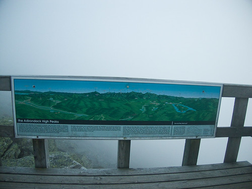
Thanks for the reminder!

The summit of Whiteface had been in the clouds for some time while we were on the slide. When we reached the summit things hadn’t improved. Views were 20 feet tops and the sun was just about to set. A few quick summit photos and then we pulled out the map. I took a compass bearing for the ORDA trail we planned to use for descent. In hindsight, this wasn’t necessary, the summit station viewing area is marked with direction markers for tourist to use when viewing the distant mountains. However, the only other time I’d been to the summit of Whiteface was skiing to the top in the winter and I had no idea where the trails were, as the ski route simply goes up the summer tourist road. Better to be prepared while in shelter than dealing with a map in 30 mph winds and fog. We headed south for the ORDA trail, pretty quickly we spotted yellow blazes, and were on the ORDA descent trail.
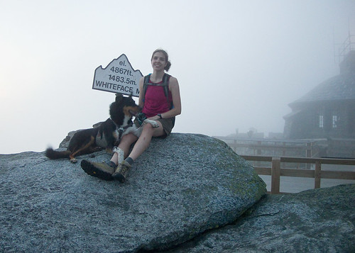
Aim and Colvin on the cloud covered summit

All I can say about the ORDA descent trail is HOLY $h!%!!! Wow! I was expecting some sort of paved tourist descent to the ski lifts, but this trail was in fact steep and interesting. It even had ropes set up to lower yourself down at least 3 sections. Though only one was really necessary.
Whiteface Slide #1

Unfortunately, this was the end of the interesting part of the day. Descending down the ski slopes in complete darkness, strong winds and occasional fog was interesting only in that we were not able to just plunge down the steepest slopes for a rapid descent. Having my mini headlamp, clearly anticipating a shorter day, I couldn’t see more than 30ft, so we took the longer moderate ski trails towards Little Whiteface, and then began a direct descent from Little Whiteface. (Coming back a few weeks later, I could see just how steep Niagara was, and was glad we didn't plunge down it's slabby decent).

Along the way, we crossed paths (literally) with a porcupine. While that was exciting in a horrific train wreck sort of way -we hate porcupines- the highlight of the knee busting, ankle twisting, back aching, filling loosening, brain jarring descent was seeing what I believe was a Fisher pop up in the grass about 50ft from us. His tightly spaced eyes and head movements led me to believe he was a predator, most likely a cat or weasel. He was directly downwind from the porcupine, and my guess he was hot on that bully of an animals tail...or rather head. 25 head bites later, that porcupine was going to be Fisher dinner.

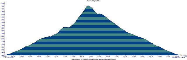
The descent went on forever, and finally at almost 9 hours into the day we arrived back at the car. I’m not sure of the total mileage, but I’d guess it was only about 6 miles. The total ascent/descent was 7500ft, which equates to well over 1000ft per mile. What really took so long was the ankle breaker scree on the ski slope descent. It was like walking on baseballs placed neatly on top of golf balls. That night and the next day, we felt like we’d done three times that distance. Even Colvin slept most of the next day. I’ve done 20 mile, 12,000ft gain and loss hikes this year and barely been sore the next day, so I was truly surprised how punishing the ski slopes were!
Whiteface Slide #1

All in all, it was a good day and a great adventure. Add this to your options for life outside the High Peaks Wilderness, but do yourself a favor, trust me on the ski slope brutality and figure out another way down the mountain! Even if you have to carry a sledge hammer to the summit to break your own femur with and call for rescue, it will be better than descending the ski slopes!
Friday, September 9, 2011

Scars of Irene on the Adirondack backcountry

This video is from the Adirondack Wild Center based in Tupper Lake, NY.

The aerial and ground based HD video is pretty compelling in both terms of destruction and the natural beauty of the Adirondacks. While watching it I couldn't help but be reminded why no matter where I am, I always seem to compare it to America's first wilderness -the Adirondacks.

Combined with the still images of the backcountry from the previous post, this should really start to put together the pieces of the puzzle that merely reading written reports left us unable to do.

Also of note, it appears this video was shot several days after the initial destruction, so things look pretty clean and orderly in the towns, in spite of the level of damage. Much of which was caused by relatively small streams jumping their banks. In Keene it was Gulf Brook, a stream that is less than 20ft wide most of the year, and that you can almost jump across in many sections just a few miles from Keene.

Those watching this from other parts of the country or world should be aware that the video covers a very small section of the New York State Forest Preserve, mainly the Eastern High Peaks Wilderness and surrounding towns. Though this is the most popular part of the Adirondacks, there are millions of acres that were largely unscathed from Irene, and also offer tremendous scenic beauty.

Thursday, September 8, 2011

Images of the the aftermath of hurricane Irene on the Adirondack High Peaks and John's Brook Valley

I highly advise anyone with some backcountry aspirations to take a look at the destruction -and in some ways, improvements- to the Adirondack backcountry as seen through the lens of Brendan Wiltse.

Some great photographs of the damage in an area not yet open to the hiking public: Hurricane Irene damage to the Adirondack High Peaks, John's Brook Valley Region, including several new slides along existing trails.

I say improvements because anyone that has hiked the Orebed trail will certainly appreciate it is no longer a steep, slick, slabby tree tunnel, but it now has some views and the trail is more like a true slide climb than an eroded hiking path. I always hated that trail, even more so when the ladders were missing this spring and early summer. Sadly, the Adirondack Mountain Club Pro trail crew was putting in new ladders just before the storm. Much of their work destroyed and mixed in with rubble from the slides.

Oddly, while a lot of damage was also done to lowland approach trails that is not good, the potential new routes up slides, and the opening up of the terrain on existing trails actually looks like it is a long term benefit. It will be interesting to see first hand just how different the views are off the mountains of the Adirondacks.

Also from Brendan's blog:

Wednesday, February 23, 2011

Colvin Surveys Cascade and Porter

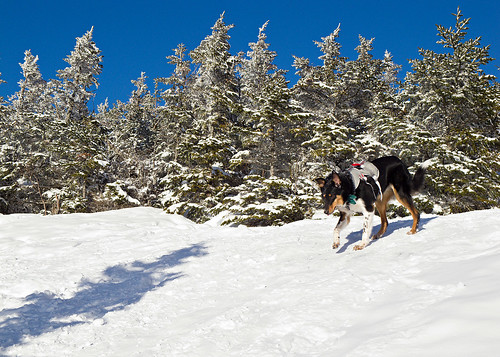
Colvin, wearing a Ruff Wear Doubleback harness, descending Cascade Mountain
Wow, it didn’t occur to me till today that Colvin Harrison had never summited a 46-R. Now don’t think he’s been neglected, it’s not like he hasn’t been up two of the highest peaks in New Hampshire and a (sub) summit of Vermont’s highest peak in the first 9 months he was with us, just none of the Adirondack high peaks from whom his namesake surveyed the Adirondacks over 130 years ago.

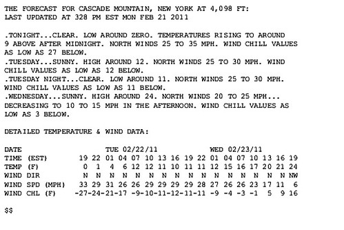
So we picked a day when the wind chills were hovering in the -27F (-32C) range, and the ambient temps at or below 0 on the summit for Colvin to summit his first two Adirondack high peaks! Despite the cold, it was actually a beautiful sunny day with perfect snow conditions.
This forecast data is from an experimental NWS weather forecaster out of Burlington, VT. Unfortunately I didn't get a screen shot before we started hiking. Still, winds were forecast in the 30s mph all day, and it actually was trending warmer as the evening progressed. Conditions at 5pm were at least as bad as 7pm.
 
If you have occasionally read this blog, you know I despise the Adirondack High Peaks Wilderness with a passion. That sounds bloody awful, perhaps I should explain (again). I hate the crowds, rules and fees of the Adirondack High Peaks Wilderness, which just happens to be home of the bulk of the high peaks. While I summited several ADK high peaks in the weeks preceding and subsequent to Colvin Harrison’s arrival in New York, he just wasn’t trail ready till late March of 2010. 

Unfortunately, because I was k9less during that time, I was able to use different access points than normal for all the high peaks I summited. The peaks that were in the HPW I reached via the Adirondack Mountain Reserve which is privately owned but accessible to humans (no dogs) via easements. This approach, while not a solitary endeavor, is usually less used than the other access points. 

Then the spring came, and mud season with it. We had planned for him to hike the Colvin Range last spring, but it got pushed off by bad weather, and eventually by paddling season that is a necessary escape from the summer heat and humidity.

So oddly, it was 53 weeks before Colvin reached the summit of his first Adirondack high peak. Originally the Upper and Lower Wolfjaws were planned for various reasons, including solitude and the irony of a dogs first 46-R being the “wolfjaws”, but the closer parking area being unploughed and not wanting to walk in the road (almost no shoulder during the winter with the snow banks) while trucks and cars whizzed by at 55mph, I aborted the Wolfjaws via Deer Brook. And damn the cliche, decided to climb Cascade and Porter, two of the Adirondacks easiest high peaks and often an aspiring 46-Rs first ticks on a checklist. 


Aim ascending Cascade (Jan 2005)
Cascade is a mere 2.4 miles from the trail head which begins at a lofty 2000ft. Being one of the smallest of the 46-R’s it’s a mere 2000ft ascent. In terms of steepness, it’s pretty mellow. Even the steeper sections aren’t all that steep.  And throwing in Porter adds another 1.4 miles round trip, but a mere 460ft elevation gain/loss over that 1.4 miles. Precisely why Cascade is often the very first high peak people climb.

We arrived at the Cascade/Pitchoff trail head to find it packed. Cascade and Giant Mountain are probably the two most hiked high peaks in the Adirondacks, and on any weekend day you will find both trail heads packed with cars. So I drove towards Lake Placid and stopped at the Cascade ski shop, then we drove up Mountain Road to check out the conditions on the Jack Rabbit trail. Plenty of good quality snow despite the recent heat wave. When we got back to Cascade there were still too many people on the trail, so we took a little nap in the warm sun (yes, direct sun in a car is warm even when it’s around zero outside). 2 hours later the parking areas were thinning out, and we were off. 

Colvin at a wind break  just below the summit.

Obviously I was accepting I was going to be sharing the trail with people, unlike the desolate Wolfjaws via Route 73. However, while I was ok with making a deal with the Devil to get a good hike in on a pristine day. I didn’t want to be ascending during an exodus of hikers. Killing a few hours so I could catch the late afternoon light from the summits and only see a few people on the trail was easy enough. If timed just right I wouldn’t even need to use my headlamp. Very rarely are conditions this clear in the Adirondacks, and Cascade is a mountain that lives up to it’s record summit attempts.  You can see 30 of 46 high peaks from it’s completely unbstructed summit and the best time to do so is in the early morning or late afternoon when the mountains really stand out with some depth.
 
Aside from that, I’ve always hiked Cascade either before sunrise or on a weekday. So despite the throngs of hikers that ascend it during peak days, I’ve pretty much always had the upper mountain to myself. Yep, I’ve only seen 2 other people on the summit of Cascade ever


The photographer taking in the early morning light, alone on one of the Adirondacks most hiked peaks (January 2008)

If I had any doubts about the conditions on the summit, I didn’t need verbal verification. The last group of hikers we saw descending were dressed like they were on a winter ascent of Denali, one of the coldest major summits on earth. 

Colvin below the summit

Colvin and I were on the summit of Cascade in about 2 hours which wasn’t bad considering I had to attempt a field repair of a rivet on my MSR Denali. Messing with bolts, washers and nuts in 0F temps is pretty much futile unless it’s life and death -as I write this, it just occurred to me that in 2003 I had a crampon malfunction on Cascade as well.  Eventually I gave up, I ditched the snowshoes below the summit of Cascade.

Ascent up the summit slabs (January 2005).

The climb up the summit slabs of Cascade was mostly bare rock with some avoidable ice, only one or two spots would crampons have made things safer, naturally I fell in one of those spots (the safer of the two, and the spot I fully expected to go down) on descent, otherwise bare booted to the summit over the rock, snow and ice without incident.

Colvin just feet below the summit as we began our descent.


Caney a few feet ahead of Colvin (January 2008 sunrise) 50mm vs about 105mm, side lit vs. backlit background. Notice the difference in compression and dimension with the telephoto vs the normal lens and the different lighting?

Colvin did great. There was a section I thought he might have problems with, and the wind has never been his favorite force of nature. But he shot up the last .3 of a mile almost effortlessly picking the marked route perfectly unless he saw a better route. I didn’t have to give him an assist or verbal cues up or down. He’s getting much better on the trail and much more confident.

Another cold winter day on Cascade (Jan 2004)
We were both pretty cold when we got back to the Porter intersection, though we both had all our insulating layers in my pack if we needed more heat than movement would provide. I debated not going to Porter, it was already after 5pm, but the trail was well packed and descent would be fast. In the end it was too easy to pass up this BOGO summit. Besides, herding dogs do winter ascents of Cascade as a warm-up before they eat breakfast and tick off a great Range Traverse in the afternoon. Colvin expected more than a measly 4.8 miles, so I put my snowshoes on while Colvin and I snacked and hydrated.

We made quick time to Porter as we tried to warm up. The 1.4 miles round trip took about 30 minutes. We were back at the Cascade intersection by 5:30pm. The 2 mile descent took about 45 minutes sans snowshoes with only a few butt glissades where my bare boots met an icy patch as I jogged down hill. Colvin would see me jogging and sprint ahead full blast, come to a skidding stop in the snow and sprint back up the trail as I continued jogging down. As is typical, he generally hikes/sprints at least 50% more miles than the actual hike requires.

We were back at the car by 6:15p with just enough light to not need the headlamp. 

Total stats for the hike. 2 ADK high peaks, 4600 ft gain/loss over 6.2 miles in 3 hours 30 minutes.  Winds 30mph from the North, 0F ambient, and unlimited visibility. Pretty much a perfect mid winter day!!!  


Wednesday, November 24, 2010

The Northeast US Top Five Long Distance Day Hikes

I often get asked what the best hike is, what the hardest hike is, and what my favorite hike is. There are a few hikes in the region that require tremendous effort and offer great reward for that effort, and coincidentally happen to be among my favorite hikes.

I'm much less a mileage guy than an elevation, weather, scenery, aesthetics, and technical terrain guy. After all, if you just want to ambulate a long distance, put away the hiking boots and all the gear and go run a marathon. A hike like the King Ravine or Huntington Ravine, Acadia's Beehive and Precipice Trails, or an Adirondack slide such as Eagle or the Gothics north face is much more enjoyable than walking endlessly over well footed trails while buried in a tree tunnel. As such, all the hikes on this list require you to either battle the weather or ascend steep and rugged terrain, in some cases requiring you to use your hands as much as your feet. None of the hikes on this list are contrived, or require any sort of far out antics to complete. They are simply real, hard, rugged hikes through some impressive wild places. Most importantly all are aesthetically pleasing, making them more then a sufferfest without reward!


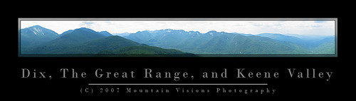
Dix Mountain, Great Range, and Keene Valley (bite size)

1. Great Range Traverse, High Peaks Wilderness, Adirondack Forest Preserve, NY. The Adirondacks are generally not the type of mountains you can string multiple summits together, but the Great Range makes up for that. The elevation gain and distance are very similar to the Presidential Traverse in NH, with one exception, on the Great Range elevation is gained and lost in massive chunks over just half the trip, while the Presidential Traverse spreads it out quite evenly over the 20 miles. The minimum Great Range traverse is 22 miles long and gains and loses 18,500ft. 11.5 miles are along the spine of 9 peaks over 4,000 feet in elevation. Over those 11.5 miles just under 15,000ft is gained and lost. Because of trail head relocations and the loss of a loop option, very few people actually start at the true start. The true traditional traverse adds 2 smaller peaks, as well as the unofficial but spectacular Pyramid Peak (which is technically considered part of the Gothics, and in my opinion one of the top 5 views in the Adirondacks). The total for the true traverse is 22 miles and 19,700ft gained and lost. For the hard men and women, a slightly more contrived addition of Mt Skylight can be added making the hike 23.2 miles with over 21,900 feet of gain and loss.

In the winter the Range has an almost 0% success rate because the steep slopes and deep snow drifts are ordinary facts. Generally speaking, even the most fit hikers and mountaineers would have trouble doing the Great Range in mid winter due to the deep snow and short durations of good weather in the alpine zone. Some of the trails in winter border on technical mountain terrain, with slopes steep enough that run out falls are entirely possible. In the summer, it is water that becomes a limiting factor high on the Range.

Summary of ADK Range options:

1) Traditional traverse (includes Rooster Comb, Hedgehog, and Gothics): 22 miles, 19,700ft G/L
2) Short traverse loop: 22 miles, 18,500ft G/L
3) Long Traverse (includes Gothics, Skylight, Rooster Comb and Hedgehog): 23.2 miles, 21,900ft G/L


In The Mountains of NH, Men are made.
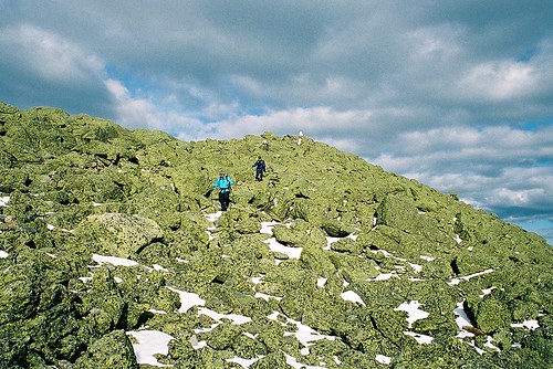
Descending Mt Adams summit cone, Northern Presidential Range, NH.

2. Presidential Traverse, Presidential Range, White Mountains, NH. The Presi Traverse is perhaps one of the most difficult hikes possible because of the weather. Although much of the trail has good footing over trails like the Gulfside and Crawford Path, nearly 15 miles of it is exposed above treeline and susceptible to some of the most consistently dramatic weather on earth. So consistent is the drama, that it is as inconsistent as you could ever dream of (you know, like an enigma wrapped in a Pandora's Box). Weather aside, the full traverse (including all summits from Madison to Webster) still involves over 23 miles and 19,000ft of gain and loss. Assuming you climb all the summits and leave the well footed trails on the spine of the range, even if the weather is perfect, a true rarity, your feet will most likely feel like you beat them with a meat cleaver at the end of your hike.


Franconia Ridge, White Mountains, NH
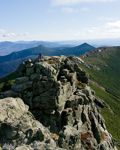
Franconia Ridge, Pemigewasset Loop, NH. Mt's Liberty and Flume prominent in background.

3. Pemigewasset Wilderness Loop, Pemigewasset Wilderness, White Mountains, NH.
The Pemi loop is longer than all the rest by almost 10 miles, but it has a unique (dis)advantage of having several miles of hiking done on an old railroad grade. This loop is really more about mileage than any of the others, but the scenery is so spectacular I had to include it. The basic Pemi loop gained and loses 19,400ft over 31.5 miles. The book time for this hike is a mere 20 hours, and that assumes you are hiking it in sections. However, the grades are less steep then some of the other hikes on this list, and the bulk of above treeline hiking is over one of the most heavily used and well footed trails in the White Mountains. While the Franconia Range does take the brunt of bad weather and high winds coming from the east, you spend significantly less time above and significantly more time close to the edge of treeline for weather to be an overwhelming factor in success or failure of this trip in comparison to the Presidentials, or even the Great Range. That said, many people have under-prepared for this trip, had to drop off tens of miles from the trail head and beg for a ride, or worse walk 20 miles over highways and roads to get back to their car. I've read many a trip report of people sleeping in ditches on the side of I-93 because of poor preparation and fitness. It's fine line between moving fast and light, and being under-prepared on this loop as a day hike. While the Pemi is the biggest mileage hog and least technical hike on the list, it isn't without it's aesthetic bonuses. The Franconia and Bond Ranges in themselves are among the most heavily hiked, and most beautiful ranges in the Northeastern US. Combining the two over a very long day in the mountains makes for a phenomenal double marathon like adventure.

Options for the Pemi Loop:

1) Minimal Loop: 31.5 miles, 19,400ft G/L
2) All Spur Summits Loop (includes Galehead, North Twin, West Bond): 36 miles, 21,000ft G/L


Climbing Out Of The Col
Ascending Slide Mountain on an exposed slab from the Cornell Slide Col, Burroughs Range, NY.

4. Burroughs Range Loop, Slide Mountain Wilderness, Catskill Forest Preserve, NY. The Catskills are actually a rugged eroded plateau that would look more like the high desert of Arizona and Southern Utah if the mountains were devoid of trees. The Burroughs loop is a ~13.5 mile loop, originating at Woodland Valley in the heart of the Catskills. The circuit ascends the spine of a range of 3500+ft peaks that include Whittenburgh, Cornell, and the Slide Mountain (one of only two 4000ft peaks outside of the Adirondacks, and the highest in the Catskills). The basic loop has a gain/loss of nearly 10,000ft. However, there are two optional ways to naturally extend the trip:

1) do an out and back spur to Panther Mountain adding 5 miles and 3,000ft gain and loss. Making the total distance 18.5 miles and 12,500 gained and lost.

2) spotting a second car at Fox Hollow trail head and hiking over Panther Mountain adding 6.25 miles and 4200ft gained and lost. The later makes the hike a total of 14,000ft over 19.75 miles, but also eliminates one of my favorite things about the Burrough's, the fact it is a true loop with a campground start!  Yes, you can wake up in your tent at 7am, hike the Burrough's and be back at your campsite eating a gourmet meal later that evening.

With even the hardest option on the Burroughs still being significantly easier than either the Great Range or the Presidential Traverse, should the Burroughs make 4th on this list? Absolutely. This isn't purely about difficulty or distance or elevation, it's also about the aesthetics of the hike. The Burroughs is significant for the fact that outside of the alpine regions of NY, VT, and NH, this is in my opinion the most scenic, fun, and historically significant hike that would probably please both the hard men and women who merely enjoy suffering on the trail, and those just looking for a fun challenge while still being able to enjoy themselves. Doing the minimal loop gives you unparalleled 360 views from various vantage points of the entire Catskill Forest Preserve. Beyond that, the Burrough's loop also includes enough steep climbing and scrambling to keep most hikers who prefer technical hiking terrain happy with plenty of chances to use their hands. Besides, how many great loop hikes of this magnitude start and end at a state run drive in campground?


Catskill Mountain Highs...And Lows!!!
View south towards the Ashokan Reservoir from Sugarloaf Mountain, Devils Path.

5. Devil's Path, Catskill Forest Preserve, NY. The Devil's Path is consistently rated by backpacker as one of America's hardest day hikes. It's over 25 miles long, and while it can hardly be called traversing the spine, it certainly is a direct path over many of the higher peaks in the Catskills. The DP gains and looses almost 20,000ft over it's length, much of it is lost in giant chunks of a few thousand feet at a time as it dips from long flat 3000+ foot summits down into steep narrow hollows (commonly called passes or gaps out west) and immediately reascending the next mountain without any drawn out approach. Along with the challenging ascents and descents, the DP also shares similar rugged hands and feet terrain as the Burroughs Range loop. Scenically, however, the Devil's Path simply isn't on par with it's neighbor, and for this reason it falls to 5th place on my list. Most of the scenery on the Devil's Path comes on the eastern half, and in my opinion, it is largely unspectacular from Mink Hollow onward making the entire second half of the hike fairly monotonous, and much more of a grind than it needs to be. In terms of shear difficulty, however, the Devil's Path could easily rank in the top 3.

For those that prefer even more technical hikes without all the unnecessary miles on the trail, keep on the lookout for a followup of my most challenging "They Call THAT a Trail" hikes.

If you have an alternative to my top five feel free to drop me a comment or send an email!

Monday, November 22, 2010

Phil Brown Fought the Law, and the Law....

She Said: Is That A Boat, Or Are You REALLY Happy To See Me?
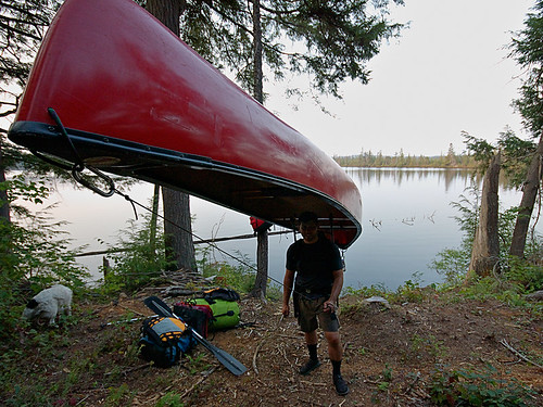
Almost the end of a short day of paddling and a long day of portaging, camp is across the lake!


...well we'll find out just what the law is and how it pertains to paddlers, thanks to our fearless editor of the Adirondack Explorer.

Phil Brown, editor of the Adirondack Explorer, and a pretty good writer and outdoorsman, doesn't just talk the talk, he walks the walk and paddles the boat. As a result, the Brandreth Park Association (which appears to be a single person or family) and Friends of Thayer Lake have decided to make an example of Phil Brown in order to keep its waters safe from navigation by the rest of the paddling community. Phil, of course needed a lesson, after all, his pen is mightier than the potentially illegal signs and barriers that shoreline owners have erected to illegally prevent navigation.

First, Phil is hardly a criminal. The New York State Department of Environmental Conservation has already informed the above groups that paddlers DO have a right to paddle through the private shoreline in question. All Phil did was exercise his legal rights and remind others about their rights. Secondly, if you've ever read Phil's columns or blog post then you know he doesn't tiptoe around controversial topics. This was clearly no different.

Brown said he paddled through the private land and wrote about it because he believes the public has a right to. “The Lila Traverse is one of the best wilderness canoe routes in the Adirondacks,” he said. “Replacing a long slog on foot with an hour or so of great canoeing only makes it better.” - via Syracuse.com

The issue at hand is centuries old common law which has been upheld in various state courts of law, but the Adirondacks seem to be an exception to this. As a matter of fact, the famous author and paddling advocate, Paul Jamison, remarked how the laws of navigation within the Adirondack Park were strangely different from outside of it. The reason this is odd is that the majority of the land within the Adirondack Park is state forest preserve -Forever Wild- and owned by the people of the state for free use. However, much of that land is in a piecemeal checker board layout that means quite a bit of private land borders state lands. Often and in-holding separates two parcels of state land. This of course causes quite a bit of contention in many cases.

Oddly, in the Adirondacks it is assumed that if a body of water, though accessible and navigable without need to trespass on land, is surrounded by private property, the water is off limits to boaters. However, in the rest of the state people regularly paddle and boat through waters surrounded by private shorelines without incident.

The issue is sticky, but has centuries old legal precedent because: 1) water was/is essential for transportation and commerce; 2) you technically cannot own water or the water bed of navigable water ways, in such cases the state owns the stream bed and it must be left open to public egress. Thus, it's generally accepted that provided you remain below the high water mark of a generally navigable waterway you have the right to travel on that waterway, even if you have to exit your boat due to temporary obstructions, low water levels, or to line your boat downstream or upstream. Keep in mind there are lots of little exceptions that prevent this from being a free for all. As an example, just because I can paddle into an outlet less lake without stepping on land, it doesn't mean I am not trespassing. If the lake is surrounded by private land with no outlet or egress to state land, it's off limits. Likewise, if a body of water isn't considered navigable during median flow, it is off limits. The key thing I'm trying to point out about navigation rights is that they are in fact about navigation and commerce, not the erosion of people's property rights as the Brandeth Park and Thayer Lake groups would have you believe.
 
Harrington Brook Portage
This particular issue resonates deeply with me, and is more than just an opportunity to stand on my soapbox. In 2007 my wife and I were one of the first groups to paddle the not yet officially opened Whitney Traverse, which essentially allows you to paddle from Little Tupper to either Lake Lila, the Bog River, or a complete circle from Round Lake. Truthfully, you can essentially go anywhere within hundreds of miles via various options, but those are the basic options that make up the trip. Regardless of how far you travel, you always have to portage over several sections of land when starting from Little Tupper Lake, but one section is clearly avoidable just by looking at the map.


Hey!! Is this the trail? Uh, yeah, right through those trees!!! (literally)
Portage path from Lilypad Pond
On our trip in 2007, I briefly considered doing what Phil Brown did. Quite frankly, I wasn't planning on doing it to make a point or exercise my rights, portaging the only expedition sized boat we had was no easy task. We did the trip over 9 full days, of which only 4 involved real travel, it was a leisurely excuse to do something challenging yet also relax deep in the Adirondack wilderness at locations that were really not ideally accessible on a weekend trip. Despite the leisurely nine day itinerary, we actually covered tremendous ground on travel days. As an example, the first three days we just decompressed while moving a grand total of 10 of 75+ total miles. However, moving 150+lbs of boat and equipment is a heck of challenge, and while I genuinely enjoyed it, I'm a paddler, not a pack mule. As a paddler, I know portaging (also called carries in this part of the world) is part of any long distance paddling trip, but it eats time, energy, has most risk of injury necessitating rescue, can lead to bears or animals scavenging your food stores, and is really the hardest part of any multi-day expedition. As a straight paddle my wife and I could have easily covered the 75 miles in three days, perhaps even two days fully loaded. It was the overland travel that really slowed things down.


Paddle and Portage: 2007 ADK Lake Traverse
Pulling 150lbs over low water mud
In the end, I wasn't 100% sure of the navigability of the bodies of water in question; 2007 was one of the lowest water years I have seen in a decade of Adirondack paddling, and old timers commented that by historical measures it was extremely low. While on Hardigan Pond we had to resort to pulling our canoe over mud flats that formed when the water receded, I certainly didn't want to get us into a sketchy situation on private property. That factor alone caused us to paddle a measly half mile across a pond only to unpack an entire boat, hoist it overhead and return for the rest of the gear on a second trip, a method known as a double carry! If my memory is correct, it worked out to be about 2.25 land miles through thick spruce thickets and horrendous brush on a yet unmarked and not fully cut portage trail. The alternative was a pleasant paddle surrounded by private land.

A Dream Is Like A River...Ever Changing As It Flows..
Portage to Harrington Brook


Often legal action is threatened but never used when the outcome is uncertain, in this case it's clear the plaintiffs could lose. As a matter of fact, it seems unlikely they will win because while they chose Phil Brown, they are really taking on the state of New York and legal precedent. I'm genuinely hoping Brandeth Park Association and Friends of Thayer Lake played their cards poorly in this last ditch effort, and when the gavel drops we have a definitive ruling that upholds the rights of navigation for paddlers and other boaters inside and outside the Blue Line!

Good luck Phil Brown!

Phil Brown paddling the meandering scenic  Shingle Shanty Brook

For more on this issue:

http://www.syracuse.com/news/index.ssf/2010/11/adirondack_landowners_sue_padd.html

Wednesday, November 17, 2010

Post Sunset Moonrise Over the Adirondacks Crane Mountain

Crane Mountain Moonrise, Adirondack Mountains

I'd moan about how hard landscape photography is, that if you're standing on a wind blown summit at sunset it means you have to hike back in the dark...but I confess, I'd have it no other way. I love hiking at night! In fact so much so that following this wonderful scene, which didn't end with this photograph, I didn't turn on my headlamp until I reached the slab below the pond outlet, just shy of half way back. Much of that time the 3/4 moon cast a shadow in my path as I walked through the forest. Hiking by the glow of the moon is really very peaceful, even more so than via headlamp, and it's nice to get lost in the solitude of the softly lit darkness.

Darkness though is what makes November a depressing month in this part of the world, the sun only shines about 30% of possible daylight hours, and daylight is only about 9-10 hours at the start of the month. The positive is that provided you can see the sun, you don't have to wait 18 hours between nautical twilight's like in the summer. Photography is best done at the ends of the day, and November is temperate enough that spending an entire 10 hour visible light day outdoors isn't all that hard most days if you get a sunny day. Or you can time a sunset blitz hike like this ascent of Crane Mountain, and still be home in time to eat dinner at a reasonable hour, rather than midnights like you do in the summer!

I have a few "local" places where I can gain some reasonable elevation since moving to Saratoga County a few years ago, although I do miss my 30 minute drives to challenging 3,000ft+ single summit days in the Catskills, 90% of the time I'm glad to be at the foothills of the Adirondacks even if it means the same drive gets me only 1500 foot single summit days. Crane Mountain is not only a favorite semi local hike (about ~55 miles and 50 minutes) but it's a favorite hike overall in the Adirondacks. Barbara McMartin once said it was among the most beautiful summit views in ALL the Adirondacks, and although I never found the distant views to be amazing, I've always loved the general challenge of the rugged trails and steep cliffs that make Crane Mountain.

Crane is not only a great hiking mountain, but it's home to a hot bed of new Adirondack rock and ice climbing route activity. In the last 10 years Crane has seen dozens of new rock routes and tens of ice routes, some of the ice is 3-4 pitches in length.

In the trail register many people complain of the sparsely marked trails, and the first time hiker might have to be careful, more so after dark. The mountain sees at least a few dozen hikers and climbers a weekend, creating a well worn though still rugged foot trail. Though with a little care, a map, and just basic route finding skills you should be able to figure it out. Although I know the mountain well now, it was just as poorly marked the first time I hiked it!

Unfortunately, hiking isn't all glorious sunsets, moonrises, and pleasant walking via the glow of the moon. About 1/3 of the way down the very steep outlet trail, I took a pretty decent fall on one of the many sections with deep dry leaf cover over roots and slabby ragged boulder piles. This time of the year dry leaves have become waxy, and the combination of dry waxy leaves and steep descents make it like walking downhill on ball bearings. I took a jump down from one boulder into a crevasse between two boulders and the next thing I knew I was on the ground several feet below my target with my elbow and arm bleeding. The arm will heal, but I lost Black Diamond Flicklock pole when my feet came out from under me and the pole snapped in defense of my fall. One of the reasons the Flicklocks are great poles, and hadn't yet made it to the graveyard of poles in my garage, is unlike most poles with expander nuts, the expanderless Flicklocks hardly ever (perhaps never) collapse. The downside is they are made from thin gauge aluminum and are the only poles I have ever owned that I have bent...over and over and over again! They are easy enough to rebend, but at $90 a pair, I wish they were just a bit more sturdy!

Alas, it was a small price to pay for an almost summer like mid autumn day in the Adirondacks.


Wednesday, November 3, 2010

Beam Me Up Spotty!

The Spot personal locator beacon has grown a strong following over the years, such a reputation in fact as a bare bones PBR with a twist that even this, "I escape to the mountains to escape technology like this" backcountry purist has considered one.

As I noted in my prior post, shit happens! While a lot of rescues are avoidable, not all are negligent, and some of us aren't particularly good at sticking to plans. Plans are for work, projects, corporate planning, not for getting out into the mountains. Spot seems like a great way to deviate from plans, yet let someone know where you are headed. Using Spot messaging service you can ping location updates, non emergency help pings to your contacts, and full out SOS to the GEOS International Emergency Response Center. Say I had no particular reason to return home on a Monday, or worse I simply underestimated the difficulty of a hike and decided to spend another night out, I always envisioned being able to send an OK ping and be done with it.


On Sunday, October 17th one of the short falls of relying on something like Spot and it's bare bones limitations can be seen from the DEC Region 5 Ranger Activity Report below:


Town of Newcomb, High Peaks Wilderness Area On Sunday, October 17, 2010, at 3:43 pm, the DEC Dispatch Center in Ray Brook received a call from a woman requesting assistance in locating her husband in the vicinity of Moose Pond. Mathew Crowell, 29, of Syracuse, NY, had been hunting in the area for several days and reported his location each morning and evening using his Spot Locator. Mr. Crowell had not reported in since 10:00 am on Saturday. Mrs. Crowell became concerned that her husband might be injured after learning of the presence of snow in the higher elevations. A DEC Forest Ranger responded and located Mr. Crowell’s car at the Moose Pond Trail Head and started to search the 6 miles of trail into Moose Pond. At 6:05 p.m. the Forest Ranger heard a shot and found the subject in good shape, at the last spot location he had sent to his wife. According to Mr. Crowell, he had sent his wife points from the Spot Locator throughout his trip but obviously the signal didn’t get out due to the steep drainages. Always provide someone at home with your itinerary and when you expect to return. Electronic devices are useful in providing information and communicating with people outside the backcountry – be aware of their limitations.

What this highlights is two things 1) the reason I like a Spot is because of my inability to stick to itineraries. I don't veer from them every trip, but it's not uncommon for me to do so. Spot proved here that when everything is OK, that it might not be the best option for this sort of thing since I would probably use it quite similarly to how this hunter was using it. 2) It shows the limitations of both Spot and satellite based navigation as a sole form of backcountry navigation or communications.

I still like Spot for it's one way only communication, which I find is probably a reasonable compromise for most purist. However, I don't find it to be terribly reassuring that it isn't able to consistently send out pings. In the eastern US forest we have extremely thick forest cover even in fairly open terrain, this often at times creates problems with GPS signal reception, the same signals Spot uses to locate and transmit. Add in steep drainages, canons, cliffs, frequent cloud cover and other features very often found and this device might not be useful when it's really needed. Spot starts looking pretty flaky as a surefire option for location and rescue.

The flip side of this of course, is that if the hunter was pinging his wife his location 2X a day, she should have been able to inform Rangers of his last coordinates and made locating him somewhat easier. So even in the worst case of it working poorly it certainly can be useful in narrowing a search area down.

Wednesday, October 20, 2010

Summer 2010...

A little slice of summer 2010 in photos.

Hit the full screen box in the corner for a larger slide show. Most images are uploaded at 1080P. If they are pixelated, and you are using a higher resolution screen, chances are nothing is wrong with your monitor or the images, they are just lower resolution than your monitor at full screen size!


Tuesday, July 21, 2009

Sweet Kisses For You...Thank You Very Much

Second backpacking trip to Harriman (1999)
(photo: November 1999)

From July 12th 2009:

When we got Caney in June 1999 he came out of the box with the ability to give kisses. You would do the kissy sound, and say kisses, and he would give them. Pretty cool.

Several years down the road he realized that kisses were special and only for when you deserved them. He developed what I call "sweet kisses" and "fake kisses." He still acknowledged the kisses command, but he would not kiss your lips or face. Instead he would come up short, almost like a peck that didn't quite reach. If it did reach it was quick and half hearted, just barely a peck. Sometimes I wouldn't accept that, and I'd grab his snout and give him a big fat kiss right on his lips. Believe it or not, I've had vet techs and veterinarians comment on his lips, and for a dog they are pretty nice. I once had a vet tech give him a kiss right on the lips while he was in for an appointment. When he was a puppy they were pink so they really stood out like real lips, along with pink spots on his nose. As he got older they turned darker, as did his nose, but they are still handsome.

Today we were sitting on the shoreline of the Hudson River and just hanging ou at the Pines and Caney came over unprompted and gave me sweet kisses, and lots of them. That made me feel good because I felt like he was saying we are doing a good job, and he loves us.

What Aim and I have noticed recently, is that while he has always been nervous and less happy when we were separated, he seems to not want us to be apart at all right now. If we leave together he wants to be with us, and if we are apart he seems much more larthargic. He won't walk with me to the mail boxes, but tonight Aim came out with us, and he was eager to walk.

During the course of the day Caney made a few friends, ate a hot dog that was offered from some people BBQing on the river, and got his usual attention and compliments from strangers every time we crossed paths with someone.

He obviously didn't have a ton of desire to get in the river and swim, but he did swim for about 5 minutes, and chase a few sticks. Overall we walked about a mile through the forest along the shoreline. Not a big day for a border collie, but he had a little pep in his step and was definitely happy to be out there.

He even amazed me when Aim wanted to go down a steep shoreline embankment, I said I don't know if he can make....(and as I was in mid sentence) he shot down the near vertical incline in 3 hops. It took us quite a few more. On the way up, I was certain he would need help but he was up top giving us one more encouraging (and arrogant) look of encouragement, coupled with disappointment for his much slowy 2 legged hiking partners.

Aside from the 1lb of steak he had, the 1/4lb of ground beef, and the croissant, he had pizza with us on the deck of Nino's in Lake Luzerne. The pizza was actually pretty good but in hindsight this was way too much for him. Nevertheless, it was nice to spend a beautiful day together outdoors.

Wednesday, June 24, 2009

Hadley Should Be Called "Not Too Hardley"

Hadley is listed as an "easy" family hike in many guide books, sure Hadley is a mere 2 miles, but it's steep. Vertically steep? No, actually not a single section of the trail can be categorized as a scramble., You never have to use your hands but it is constantly steep with an average 7% grade over the 2 miles.

Is it hard? Not at all, the footing is excellent for the most part on the ascent, but the descent can be a bit slippery in bad weather. Hadley is one of those deceptively more difficult peaks being  a 2600 foot peak that gains 1500 feet en route to the summit. Of course that can be said about many of the hikes in the northeast where trail heads can start out as low as sea level and climb as high as 6000ft.

Caney and I headed up to Hadley via route 9 by way of Wilton off the Northway, which much to my dismay is only 34 miles. Yes folks, Hadley is closer than Glens Falls, which means I was driving excessively far to get there. Probably 10 more miles going through Glens Falls. Going to short route sometimes takes longer, but aside from the annoying speed zones, it was actually a fast drive.

We got on the trail at 7pm sharp and hauled up the summit in some rain showers, I was hoping the weather would be much like it had been all week a mix of nasty storms and clearing blue skies. Great rainbow weather, and great weather potential for a great sunset. We did the 2 miles and 1500ft in 50 minutes.

Under the summer tree canopy unless the rain is constant and hard you really don't tend to get very wet. When we reached the summit at 7:50pm it had mostly stopped raining, and was just very lightly drizzling. I pulled my camera gear out of my LowePro Primus AW, which several months after buying it remains the best photo bag I have ever owned.

I set up my panoramic head, leveled everything and set my K10D to f/9 at 1/4th second, ISO 100, using a cable release and 2 second MLU. The resulting image is about 65MP at full size, from eight 10MP images.


We retreated off the summit after watching the beautiful lightening show in the distance, that eventually was overhead striking the fire tower (luckily we were already off the summit). The hike down took slightly longer than the trip up, and was a lot more wet.

Despite the weather it was a beautiful day in the mountains.


Blogged with the Flock Browser

Friday, February 6, 2009

Too Big, Too Much...Is Big Tupper Unstoppable?


When you look at a state like Vermont, one of the things that makes it Vermont is the size of things. Its not necessarily easy to explain but you know Vermont when you are in Vermont.

The Adirondacks are similar. One of the few places in this part of the country that doesn't look the same as everywhere else. To a large degree this alone is something that makes the Adirondacks have some appeal. The fact that in many ways the Adirondacks are more wild today than they were 120 years ago is also somewhat special. Many biologist have noted that the Adirondacks are one of the largest intact biomes in the US.


Tupper Lake is one of the more developed and densely populated areas in the Adirondacks, but it's surrounded by some of the more wild wilderness areas.

As we've been taught through experience, nothing done at the hand of man is inconsequential on the natural world. We certainly have come a long way to understanding ways to lessen the impact but this is still largely a game of chance. Nature is resilient, and if left alone it almost always makes a comeback. Occasionally nature slaps us right back for tampering with it, but all too often it seems we refuse to heed the warnings, and push it to the breaking point.

Would this be good for the local economy? Maybe. Why only maybe? Because the Catskills have long had these grand plans of a big boom, and short term success has always been followed by a period of bust. Unlike, the Catskills the Adirondacks have been much better planned thanks to the APA. And while I've noted time and again that the the APA is either loved or hated with a passion by the people who care about the Adirondacks, there is no doubt APA oversight has been a model for master planning, and the sole reason the Adirondacks don't look like the Catskills.

Short term the economy will benefit through construction jobs and service jobs, but what will be the long term guarantee that this development will be good for the Adirondack Park in general 20,30,40 years down the road.

Recently we've all been forced to come to realize that big business and it's investors are greedy. Think about the mortgage industry, everyone was making money, and no one cared that this giant smoke and mirrors scheme could not go on forever. Certainly the government didn't either; rising home prices were good for taxes, increased home ownership was good for taxes, everyone was a winner!

If we've learned nothing else it's that business needs to regulated because business has one priority, making money! There is nothing wrong with that priority, after all if you wanted me to invest in your business I'd expect a return. The issue is when profit comes at the expense of common sense, decency and ethics. All too often the quest to turn a profit comes with the sacrifice of basic principles which unfortunately have resultant collateral damage.

So, I sincerely hope that whatever compromise is eventually reached is done with some forward thought to what this will do to one of the last remaining great wilderness areas in this part of the country, not just short term but a generation or two down the road.

Controversial project in Adirondacks still alive

Parks agency says firm wants to push ahead with Big Tupper plan

By LEIGH HORNBECK, Staff writer
Last updated: 6:42 p.m., Thursday, February 5, 2009
RAY BROOK — Talks have stalled, but the biggest housing proposal ever made in the Adirondack Park is still on the table, a spokesman for the Adirondack Park Agency said today.


Closed-door efforts to resolve objections to the 700-unit project planned for 4,600 acres around the Big Tupper Ski Area have been on hold since last fall.

The proposal by Pennsylvania-based Preserve Associates surfaced in 2006. Plans called for hotels, estate homes, hundreds of condos, a golf course, marina and a shooting range. The centerpiece would be reopening Big Tupper, which closed in 1999.

Reaction was mixed. Some thought it would revitalize Tupper Lake, a community of 3,600 people in Franklin County. Others said it would destroy the rural beauty of the area.

The APA began holding hearings in front of an administrative law judge in the spring of 2007, but they were delayed twice at the request of Preserve Associates, which then asked to move into private mediation with 32 groups that had a say in the proceedings.

Mediation was "suspended indefinitely" in October at the request of Preserve Associates, according to APA spokesman Keith McKeever.

Despite the delay, McKeever said the company has not withdrawn its application.

"It is the agency's understanding that the project sponsor wants to continue in mediation and continues to prepare revised drawings and analyses to address the 10 issues raised in the (hearings)," McKeever said.

Preserve Associates spokesman Michael Foxman could not be reached for comment.

Source: Albany Times Union
Blogged with the Flock Browser

Friday, May 23, 2008

Snowy Mountain, The High Peak That Isn't


Snowy Mountain is higher than two "official" Adirondack High Peaks, yet doesn't get much attention from peak baggers. Generally if it's not required for the 46er patch it's not worth hiking till you knock off the official 46.


The ADK 46 is a sickness of sorts. Luckily my only affliction is avoiding list during my free time. As such I'll eventually hike all 46 (in winter no less) but perhaps 5, 10, 15 years. When you actively seek the patch your life becomes enslaved to checking off peaks as rapidly as possible. I've hiked with people who admitted to a certain peak being a favorite but refused to hike it again because it was checked off the list. On the other hand, I've hiked the same peak in consecutive weekends before with no regrets. Nothing wrong with either route, but the list route just isn't for me.

That said, Snowy is definitely harder than a handful of official 4000 footers, and it's officially only 110 feet shy of being a true 4000 footer.


I've never hiked Snowy but it's been on my "list" for some time. So I lied, I do have list. I should have said, I don't like being committed to schedules.

The first thing I noticed on the drive up in early afternoon was no traffic on the roads or cars at the trail heads. As we drove down Route 30 towards Indian Lake and the Snowy Mountain pullout and trail head the roads remained quiet. At the pull out it was empty aside from a few cars, two of which were leaving as we pulled in. We didn't see the first group on the trail to halfway in, and only saw 5 people all day.


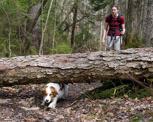
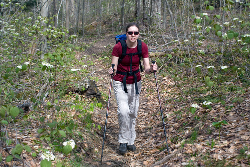
On the trail we were immediately greeted by wildflowers filling the forest floor, and black flies filling the air. The flies weren't biting but they were swarming. At one point, just before the flies disappeared at about 3250ft I had to cover my mouth to keep the flies out while trying to move fast enough to keep them from bugging me to death. Well I'd like to say as a conservationist I wasn't using DEET or any other bug spray because the flys need to eat as well, but truth is like that first sunburn of the year, I just need a little reminder of how bad the bugs can be. However, I usually avoid the DEET till i can't take it anymore. That stuff really isn't good for anyone and the less I use the better.


Aim was breaking in the new boots she got the weekend before for the first time on trail, and with a few attempts at getting some wildflower macros with the test K20D and 35mm Macro Limited we ended up taking a slow 3.5 hours to hike the 4 miles to the summit.


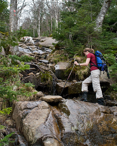
At about 3500 feet the trail got steep and deep with about 3 feet of snow still on the ground, along with some water soaked slabs, and a few drippy rock scrambles. Everything that makes a mountain fun to climb in the spring. Well, everything but the rotten snow that didn't hold me too often.


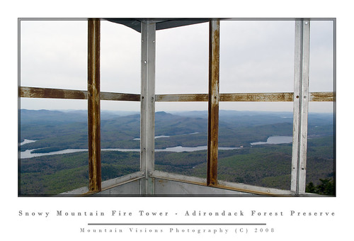
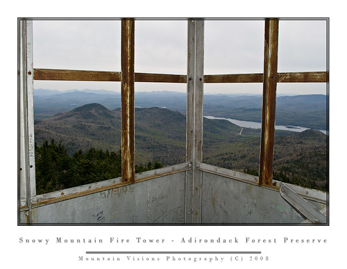
The summit has a nice east facing overlook right off the trail which you can see about 180 degrees or more, and there are some additional overlooks around the mountain. Snowy Mountain offers excellent rock climbing, a slide climb, and a recent first ascent of a moderate ice climb. Snowy has no reason to be envious of it's neighbors to the north. This almost High Peak has everything you typically find in the high peaks, plus it has a fully restored fire tower.


We spent about 30 minutes in the cab, snacking and taking photos. The wind was pounding the tower and I'd guess the air temperature was in the high 40s. Unfortunately the sky had clouded up by this point so the views were a bit distracted by the gray skies.


The trip down was a blast for me. Everyone knows my penchant for taking the fast route down a mountain, and give me a few hundred feet of snow on a steep mountain side and I'll be down as fast as gravity allows. Aim on the other hand is slower than Christmas. So no matter how fast Caney, with his built in 4 paw drive, or me with my magical ability to prove the theory of gravity get down the mountain, we have to wait.,,and wait...and wait.


6h45m and 4400 feet later we were back at the car.


Blogged with the Flock Browser