Thursday, March 31, 2011

Underhill Under Snow, Mountaineering On the Good Side of Mt. Mansfield!


I’ve been planning this trip with George for quite some time, but like all good trip plans there must be options B, C, D, and the nuclear option as a fail safe. And of course, safety of the group is always the most important priority. All too often a group forgets that it is only as strong as the weakest and least prepared members, and this is when bad things happen.

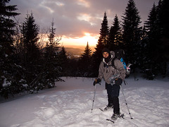
After doing the Franconia Ridge last October, George mentioned that he wanted to try Mount Washington in winter. Though Mount Washington via the Lions Head route is technically no more challenging than any other walk-up winter mountain anywhere, it does require the same gear as all higher mountaineering objectives, and there is a better than average chance you’ll need and use all of it, rather than just stow it in your pack “in case”.

Looking for something a little more moderate, that also potentially had a higher success rate and lower commitment ratio, while still getting him a taste of winter, this trip came to mind. Mount Mansfield is one of Vermont's few true alpine summits, and while the mountain is by my standards ruined due to roads, radio towers and ski resorts, it’s still a beautiful mountain with plenty of wild character on the northern, western, and eastern slopes to keep even the most puritanical of us happy. While it’s heavily used in the winter, it’s possible to avoid other groups of people by taking less traveled paths.

Though George had wanted to test out some winter backpacking/mountaineering, he had absolutely no experience beyond some tiny taste of the Northern Presidential’s late April last hurrah of winter, followed by 2 sunny, windless 60F summit days on that same trip. George had never really traveled in a winter mountainscape, he’d never been on snowshoes, and I’m not really sure if he used crampons on any of our previous shoulder season hikes.
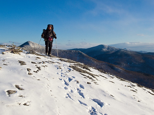
Maple Ridge
The trip objective was Mount Mansfield and it’s various summits via Frost Ridge, Maple Ridge, the Wampahoofus Trail, the Long Trail, and Sunset Ridge; finally looping back on the CCC road and back down the Frost trail. The trip was around 15 miles over 3 days, not too hard. Actually, this trip is a good day hike in the summer months. We would break the trip up with 2 nights of hut camping at uninsulated summer huts. Ambient temps in the hut would actually be colder than pitching a tent, but we’d have some space to spread out and relax, and also the shelter of the hut to pack and organize our gear; not to mention the fact we wouldn’t have to split the 8-10lbs that a 4 season winter mountaineering tent weights.

Friday we got a leisurely start, not leaving my place till 10:30am (i won’t bore you with how blessed I am to be able to leave at 10:30am and still have a full day in the mountains, refer to pretty much every other blog post where I do that). We arrived at the Mobil in Underhill at 1:30pm, changed and drove the last 10 minutes to the summer trail head. The road to the summer trail head was covered in several inches of fresh snow and ice, but was passable without resorting to 4WD. After putting our boots on, and doing a final gear check, we were on the trail by 2:45pm. My original plan was to be on the trail by 1:30-2pm at the latest. I really didn’t see this as a problem because the planned hike was less than 5 miles and we could always shorten it if need be. Besides, if my group finished a hike in the daylight, the world would surely spin off it’s axis and kill us all.

In hindsight, we should have just jogged up the Butler Lodge Trail, but I’ll be honest, what transpired was a lot more fun. Being out on an adventure, versus sprinting to a camping location, is why I strap a 50lb pack to my back and trudge up a mountain. If that wasn’t the case, I could just pull my car into a car camping site and camp without all the effort.

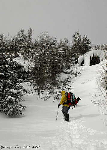
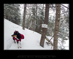
The Frost Trail started out pretty well, well packed but nice soft snow. George commented that his borrowed snowshoes and plastic mountaineering boots were actually pretty comfortable on the snow. A good sign for our travels.

At this point Colvin had been doing shuttle sprints for about 15 minutes. Running full blast for about 20 meters and then turning around and sprinting back. He had a weeks worth of energy he was determined to use up before we really started hiking. 

Once we got to the Tear Drop intersection, the trail was now mostly unbroken. As a matter of fact, we started down what I assume was the Tear Drop briefly, before realizing that we were starting down a ski trail.

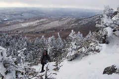
1st viewpoint looking west
I quickly pulled out the map and altimeter, we definitely weren’t at the CCC Road trail intersection yet, so we backtracked and ended up turning hard left on a small icy rock slab/ramp. From this point onward we were breaking trail the rest of the way. Everyone that had hiked the trail to this point was probably skiing the Tear Drop ski trail.

We did fine till the first view point picking our way from blaze to blaze, definitely not following any sort of trail, but the forest was wide open, and travel was easy.

First viewpoint looking South
Once we got to the first viewpoint on the Frost Trail, we lost the blazes. I was pretty sure the trail broke left over what would probably be rock in the summer, and then looped back right. Trails are always built over solid rock whenever possible, rock doesn’t erode or wear down like forest duff and vegetative surfaces, and trail builders are cognizant of this. However, we couldn’t find a blaze, most likely they were on the rock under snow and ice, and also on trees BELOW the snow. At this point we were hiking above the trail and into the tree tops. There was in spots over 6-8 ft of snow on the ground, with 92 inches at the snow stake that records official snow depth on the mountain.


Map work
I pulled the GPS out and located us, I then looked at my waypoints on the printed maps. I don’t have one of those fancy modern GPS with built in maps, and honestly I don’t want one because the maps suck on those GPS units. One day they will have something useful, but until then my system is the most efficient. For me it’s easy to read and navigate with a paper map, using the GPS to get my general location, and then set a bearing using my compass and/or line of site. I don’t envy those who walk with the GPS in front of them trying to line up the waypoints. Mountain terrain is rarely simple, and you often have to zigzag to avoid dangerous terrain or impenetrable forest cover. Besides, navigating like that puts your faith entirely in the electronics, whereas my system only uses the GPS to determine initial location. Once I have that information,  I can use the map and grid to determine a bearing to my next point.

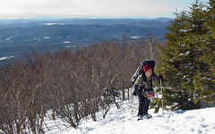
Once we figured out where we were, I set a bearing towards the high point on the ridge line below the CCC road intersection. George was understandably a little uneasy going cross country. The last time we went cross country bushwhacking we were headed for the Eagle Slide in the Adirondacks. We ended up not climbing the slide because we ran out of daylight after our herd path turned out to be headed towards Bottle Slide, and we had to bushwhack through the thickest of forest back towards Eagle. What ultimately happened was we wasted 1.5 hours getting back to Roaring Brook, which in hindsight we never should have left in the first place! However, unlike our summer excursions in the dank spruce gardens of the slopes of the Adirondacks, this was open terrain where we could move just as fast off trail as on it. As a matter of fact, being able to pick our route through the more open terrain was actually our fastest snowshoeing of the trip.

Staying on bearing and on the ridge line, after about 15 minutes of hiking we got to some rocks that had a blue blaze on them. I’m pretty certain George felt a lot better seeing things were going smoothly.

Emboldened at the site of the blaze we just continued going cross country till we regained the trail some time later. Of and on we couldn’t locate a trail, cairns or blazes. At this point the ridge was quite definable, and the terrain was mostly easy.

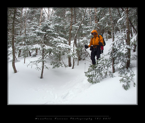
When arrived at the first rocky sections, we removed the snowshoes for the first time and scrambled up the rocks. George was hiking off the snow for the first time in his borrowed plastics, and after going from snowshoes to snow clogged rubber on quartz, your footing feels kinda slick. It always feels weird when you take off the snow traction, and climbing a slabby quartz rock face in rigid plastic boots is certainly not easy. Ridig boots, plastic or otherwise, do best when the terrain gets steeper and more technical.

Off trail ascent
We made it up the slabs,  then shortly after we were back in the trees crawling on our hands and knees through the tree canopy on multiple feet of snow. This was the first, but not the last, of these hands and knees through the tree canopy antics. The snow at this point was windblown and hard, and bare booting was the best option as we scaled up and down rock slabs and snow drifts. Once again we lost the trail, just taking the path of least resistance to remain high on the ridge as we pressed onward. We probably hiked about 3/4 of a mile off trail before finally regaining the trail for good.

We eventually regained the trail and hit the CCC Road intersection. From this point the trail was scrub, and pretty well defined with cairns and just the gap of the vegetation. We made good time to the Rock Garden trail.

Ah, the Rock Garden. There are many many trails in the mountains that are made simply to torment weary hikers looking for a shortcut. The Rock Garden just looked like one of those trails on the map. It reminded me precisely of the Cornice Trail in the Northern Presidential’s. It looks so inviting to avoid the 500ft over the summit of Jefferson on your way back down the Caps Ridge trail, but once you are about halfway on the Cornice, you realize it would have been easier and shorter to go up and over the summit. Well, the Rock Garden probably was equally craptastic in the summer, but in the winter it was just a lightly traveled borderline bushwhack, that cut across what was in spots very steep terrain. It wasn’t only the pushing through the trees that sucked, or the need to crawl on our hands and knees wearing snowshoes with 50lb packs, but the fact that every single tree was covered in 3-4 inches of snow. Each time we pushed through the forest it dumped all that snow down our jackets and on our packs. Wearing a hood just made me feel claustrophobic, and I hate not having peripheral vision, so every few feet I got a cold snow shower down my jacket!

Still not sure how heinous a gradual downhill trail can be:

Me: “Oh, we’ll be lucky to get down this in the light (it was just before 6:30pm). I figure 1 hour at best, maybe 1.5”
George: “.7 miles, mostly level to downhill, I think an hour is way to much.”
Me: “remember the Cornice?”
George: “Yeah, you think it will be that shitty.”
Me: “worse”

So 1.5 hours of semi bushwhacking through the tree canopy, on what was a mostly down but occasionally up traverse across the drainage, getting spun around several times, we finally got down to the hut. In hindsight, continuing up the well defined Maple Ridgem, and going back down the also rarely traveled Wampahoofus trail would have been a faster option. The terrain was more open and it was entirely downhill, rather than traversing a contour line on a gradual descent with a few short ascents mixed in to keep things interesting.

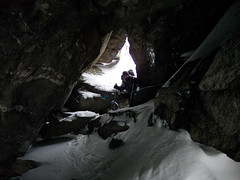
One cool thing on the Rock Garden was a chasm in the rock about ¾ of the way down. There were hanging curtains of ice over it that created almost an ice cave between a cleft in two rocks. Unfortunately it was dark by this point, and we couldn’t get a photo of it. It would have made a great photo if we were there an hour before, with the setting suns golden rays hitting the ice curtains.

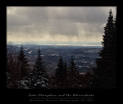
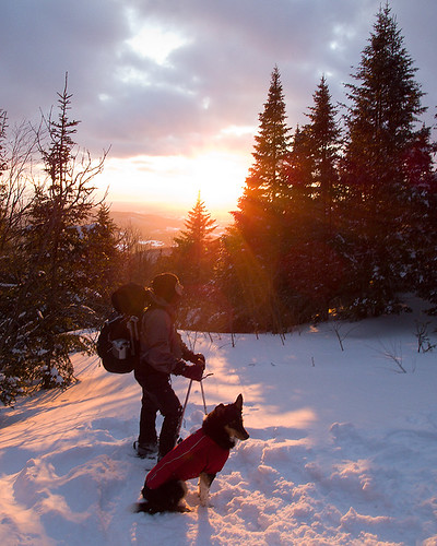
Sunset over Lake Champlain
So much for an easy 1st day! Of course, what would a hike with me be like if we actually got to camp in the light and could relax? It would seem like an alternate universe for sure!

We got to the hut at about 8-8:15 and quickly found that we were melting snow. I expected at this time of the year the creek that is next to the Butler Lodge to be our water source. However, if it was running, it was under several feet of snow and possibly ice. Without an ice axe or a shovel, there was no simple way to get to it. I always assumed melting snow was going to be our primary source of water and we quickly moved to begin that slow process.

Melting enough snow for 3 people (uh, more like 2.5 people) takes several hours. By now our short day turned into a pretty long day and we were in bed by about 12:30am, just about the time it had begun snowing quite heavily.

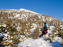
We woke up Saturday morning to 3-4 inches of fresh powder on the ground, more in spots where the wind blew it, as well as more falling. We didn’t have a big day planned, about 3.5 miles from Butler Lodge to Taft Lodge on the other side of Mount Mansfield, though almost 2 miles of it was exposed ridge line. We were officially woken up by a couple who stopped by the hut to have their morning coffee before continuing their day. They mentioned they rarely made it up the Frost/Maple Ridge trail in winter because it is so rarely traveled and so difficult to follow. I think George and I both felt pretty good for making as good of progress as we had the day before.

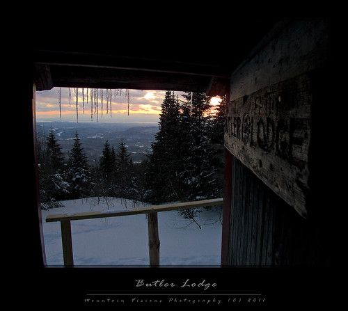
Sunset at Butler Lodge
 

We got up and began melting snow and storing water. Had breakfast and began packing.

By the grace of God, George was completely packed an hour before I was. This has never happened before, and I was a bit concerned, you know the whole alternate universe thing! Since I wore insulated leather mountaineering boots, which didn’t have removable liners (vs. double plastics which George borrowed from Aimee), and I didn’t sleep with the boots in my bag, I had to heat up 2 water bottles and put them inside a waterproof stuff sack with the boots. I then put the sealed stuff sack inside my sleeping bag and folded it over to create as much insulation as possible. I’ve never done this before, but it worked perfectly. My boots were not only melted out, but warm when I put them on, despite the sub 20*F ambient temperature in the hut.. The downside is you need about 30 minutes of free time, as well as 2 hot water bottles to do this. Also, since my sleeping bag needed to go into my pack from the top I couldn’t pack my pack till this process was done each morning.

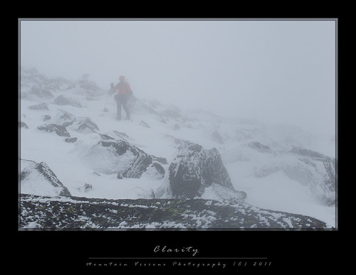
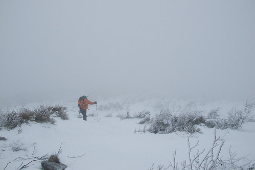
By the time we got on the trail it was about 2pm. The snow had stopped falling and the conditions on the ground were absolutely beautiful. 4-6 inches of fresh powder, without a snowshoe track on the trail because of the wind; what a treat this late in the season. However, the wind was brutal, and it was colder than the day before with more fleeting burst of sun.

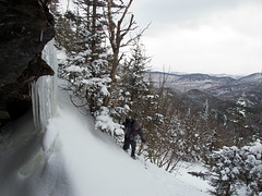
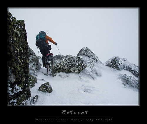
As we hiked towards the Wallace Cutoff and the Long Trail, and on to the summit ridge, I began to question the safety of going up on the ridge. Two weeks ago the wind conditions were similar, but it was much warmer and we were somewhat protected from the wind based on the direction and the summits blocking some of it. Going up to the summit of Mount Mansfield meant even more exposure than in the Presidential’s. Mansfield is a freak of a mountain, because nothing around it is close to it’s prominence it gets severe winds similar to Mount Washington. There was absolutely nothing north or west of use that would help shelter us from the winds. Beyond that, we would be exposed and committed to the ridgeline for nearly 2 miles.

At this point I hadn’t even put on insulated gloves or any of my insulating layers, I was still wearing my wet and frozen Gore-Tex glove shells from the day before. Nevertheless, I could feel how cold the wind was through the trees, something that typically doesn’t bother me. Thinking about the air temperature mixed with the wind chill I became concerned whether George and Colvin would be ok. George had the gear to safely get to Taft Lodge Saturday, but Sunday was actually forecast to be even more windy! Because our route back to the car traveled North and West, we would be committed to walking directly into the wind for the whole day Sunday as well.

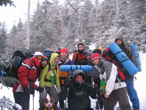
2006 Mansfield group, including Wonder Dog
Colvin certainly would have lead the way, but I had been in a similar situation in 2006 with a hiking group, and my previous trail dog. That day we hiked over Sunset Ridge towards Taft Lodge into 70+mph winds and ambient air temperatures below 0F. Caney was forced to endure those conditions for a shorter duration, and we were lucky he didn’t get frostbite. As a matter of fact, I got frostbite on that trip on my covered face because an inch below my goggles was exposed to the biting wind. It was so brutal on that day in 2006 that we were forced to abandon our plans. We bailed off the summit ridge into a gully, and bushwhacked through waist deep snow to the Cliff House where we emergency bivied.


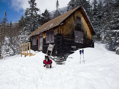
I made the decision that it just wasn’t safe for us to make the trip, George didn’t argue, and we then decided on what Plan B was. We could hike to the Taylor Lodge, which was about 3.5 miles away through the lower elevation forest. Or we could go back to Butler, unpack our gear, and day hike to the summit.


We both liked Butler Lodge and we were the only group there, so we decided to stay another night and go for the summit.

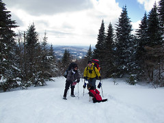
We got back, spoke with a group of hikers at the lodge, and exchanged opportunities to snap group photos for each other. Once back inside the hut we then unpacked most of our camping gear, had lunch, and repacked for the summit.

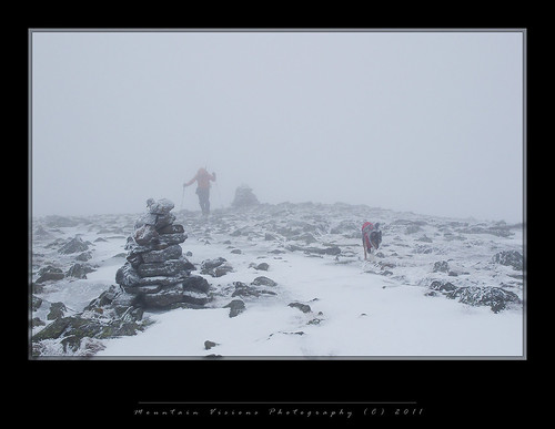
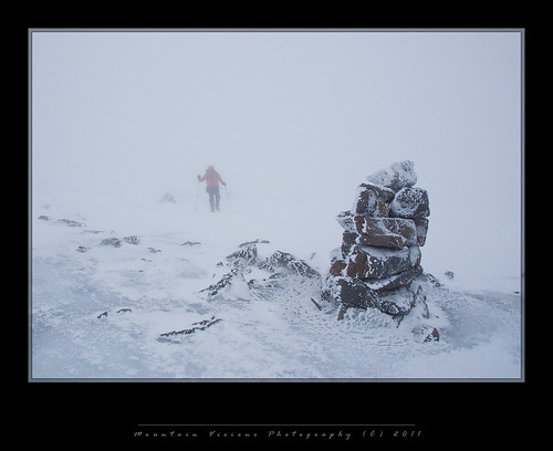
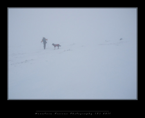
We began up the Wampahoofus Trail for some ways, but not too long after beginning the ascent towards Maple Ridge we lost the trail. There was a blaze right behind us at foot level but nothing else to be found. After 10 minutes of fighting spruce branches and crawling through the snow, we decided to just ascend the path of least resistance. It was open above us, and the trail had to go in the direction of the more open forest. We got to an open area where we could see the terrain above, I pulled out the GPS and from our location took a bearing to the closest landmark, the rock tunnel.. The rock tunnel on the Wamphoofus Trail, just before the Maple Ridge intersection, was about 700ft away at a bearing of nearly true north. I assumed it was the rock wall I saw some ways up, and we ascended to that over open snow slopes. We continued to traverse up and across the very steep slope that culminated with an ice flow.

As we reached the rock band, we cut across the base of the cliff, fighting our way through the trees to more open ground above. I kept sliding back down the slope because my pack would get caught on trees. I pushed up and through the snow, the trees would literally throw me back and I’d lose my balance, sliding back down the slope. While this was arduous, we were also concerned with a long fall down the slope, which was steep enough that if not a controlled glissade could have been a dangerous fall. Eventually,  I just used the trees for hand holds and for steps to propel myself through the steep snow.

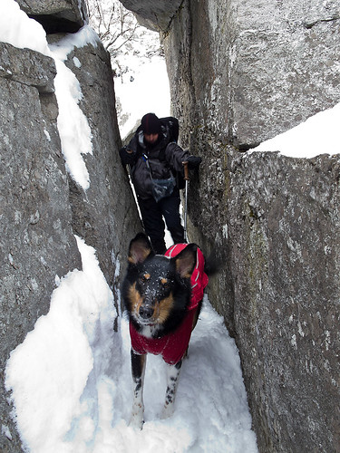
I went straight, George cut left, and while I thought there was a blaze in front of me, I lost it in the trees. George, however, confirmed it was in fact the trail, which we’d found after about .3 miles of off trail climbing.

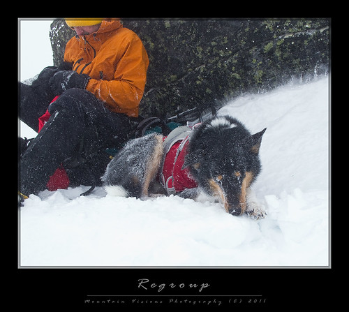
Within a short distance George, who was leading the way, lost the trail again. There was again no sign of a blaze, but Colvin continued on. I told George to follow Colvin, but make sure he didn’t blindly follow him. As George put it (and Regan before him, and Roosevelt before him), “trust but verify.” Colvin was correct though, as he had been each time he pushed ahead over the last 2 days. He is developing quite a sense of where he needs to go, I am very very proud of how well he has developed into a great trail dog.

We finally reached the tunnel, which was pretty much on course for the bearing I had set. George found a shortcut but wasn’t sure we were on the trail. We backtracked and sure enough the trail went through the tunnel on the other side of the wall we were at. Both routes were cool, but the tunnel was more fun!


We were now just 200ft from the Maple Ridge, climbing up and around rock bands, caves and cliffs. There were some very cool sheltered alcoves in the rock bands that I made note of. After one last battle with the spruce on our hands and knees, we were on the ridge proper. It was now after 6pm. I'd set a 6pm turn around time, but the summit was just .2 easy miles above us.

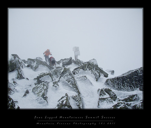
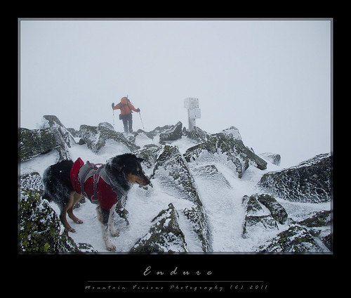
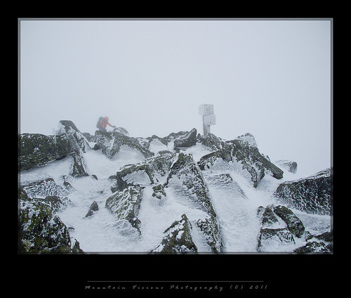
If you are a mountaineer, then you know that turning around that close to the summit is almost impossible to do, and even though our turn around time had passed, the descent was going to be fast and fun, and we’d have had plenty of time to get back to the hut before dark. Unfortunately, George doesn’t have that mountaineers summit sickness, although Colvin has acquired it from me. Both of us could smell the summit and wanted up, (you can see Colvin has no plans to turn around in the video). I told George that he could wait for us in the shelter of the tunnel. We’d only be about 20 minutes.

Since I often hike alone or with my trail dog, I rarely have to make decisions I don't want to partake in. Generally speaking, I don't care if it's dark, cold or I have way further to go than I expected. I'm always willing to change my plans on a whim just because I feel like it. However, when you're hiking with other people you have to consider the entire group, even if it's really not your ideal choice. The problem was I’d promised Aimee I wouldn’t leave George, even though I was quite willing to break that promise in this situation. I also needed to remove my snowshoes and put on crampons that were buried in my pack. The process was going to take 10 minutes in addition to the ascent and descent of the .4 miles round trip. I gave in to all the signals that it was time to turn around, and Colvin, George and I descended together.

The descent was in fact fast and fun. There were a few spots it was tricky but all of us had a good time glissading down the mountain. Colvin was concerned for us, but he got to run really fast in the deep snow.

We were back at the hut well before sundown, actually 20 minutes from when we turned around. This included clearing as much of the tree canopy as we could while on the trail. Even with the summit we probably could have been back by sundown.

Although we didn’t get the summit, I (we) had an awesome time forging a path towards the summit in the beautiful winter conditions and an even more fun time on the descent.

Saturday night was the same as Friday. Melting snow, hydrating, and eating a good dinner. My tortellini and smoked salmon, with olive oil and parmesaen sauce, was definitely better than George’s freeze dried beef stew. After dinner we just relaxed for a bit, before we knew it the time was pushing 1am.

Saturday night was clear and cold, but beautiful star filled skies were above us. If not for the strong winds we could have spent more time outside the hut enjoying the stars.

The winds pummeled the hut all night, and actually made it quite drafty inside. The hut is somewhat well sealed, but there are definitely gaps in the logs and roofing in spots. Snow and wind can force through the shutter style windows as well.

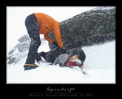
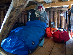
Sunday morning arrived and it was 12F inside the hut, blustery outside. We were in no rush to get out of our sleeping bags. George survived the drafty night, while Colvin and I slept quite well. I did, however, seal my sleeping bag on Saturday unlike Friday where I slept with it partially open. Colvin was wearing his K9 TopCoat Cascade suit, and his Primaloft sweater.

We burned the last of the fuel on both our stoves, about 37 total ounces over the 3 days of melting snow and cooking. This seemed like way more fuel than we should need at 4oz/person/day for white gas, but I realized Friday night we’d been lazy and just let the stove boil each pot rather than pour it off once it was melted. I think we used about 6 ozs more fuel than we should have needed.

We finally were packed at about 3pm, unfortunately I left my phone up at the hut and for some reason thought about it about 10 minutes down the trail. I unpacked everything on the trail and couldn’t find it. Then I realized I heard something fall behind the shelf when I was packing. George went back to the hut, and I followed behind him after repacking my pack. Sure enough it was behind the door where I thought it fell. Lesson learned, triple check the hut before leaving!

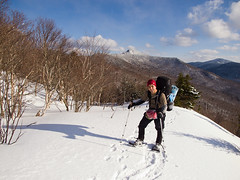
The hike out to the trail head was mostly down hill, with some level stretches throughout. However, the snow was perfect for snowshoe glissading when off trail and across the forest. George descends much faster than me, and my old man back can’t deal with the jarring of on trail descents. Packed out snow is just a little softer than the summer trail, before the snowshoe crampons bite with each step. In winter, when the ground is covered by deep snow, cutting switchbacks is perfectly acceptable. Technically there is no damage to the land, which is the primary reason to avoid it the rest of the year. I’d cut down through the forest in the steep sections and link back up with the trail. After one section where we had to re-ascend about 20ft to the trail, George stopped following me and just stuck to the trail. Fortunately this was the only time I had to re-ascend to regain the trail.  I was able to actually stay in front of George with this method rather than haul ass to keep up with him.

Scary glissade through the trees
Not counting the 15 minutes we spent going back to the hut (a 300ft ascent), we descended the 1.7 miles to the car in 35 minutes.

A stop at the Underhill Mobil to change, clean up, feed Colvin, get a snack; and then we were off to the Vermont Pub and Brewery in beautiful downtown Burlington, Vermont. Burlington is a nice little city, and it has amazing views of the Adirondacks across Lake Champlain, the sixth Great Lake.

The food at VPB is standard pub fare at a fair price, nothing special. If you order right it can be pretty decent. However, the reason you go to any brewpub is generally not the food but the beer! VPB has a great collection of ever changing beers, and we each had two pints. For the non beer drinkers, VPB also has locally brewed hard ciders.

I had a half and half of the Handsome Mick’s Irish Stout and another dark beer that doesn’t appear to be on the web menu. It was good! Then I had a citrusy IPA that was even better, a great IPA in fact! George had two different beers and both were very good.

The pulled pork po’boy was nothing special. In the defense of VPB, I am a BBQ aficionado and we (my wife and I) seek out great BBQ whereever we go. So if BBQ isn’t something you are passionate about, don’t be alarmed, what I got was quite edible, just not special! George said his burger was delicious! And my sweet potato fries were also quite good. Dessert was Ben and Jerry’s Vanilla on an Apple Crisp. This was ok as well, but it reminded me why I almost never get dessert anywhere.

If you haven’t figured it out, this was a really fun trip where we accomplished absolutely nothing in the sense of typical hiking/mountaineering goals. However, we had a great time and George got to experience real winter. Honestly, he probably learned more than he would have on a $500 two day guided trip, so I suppose we actually did accomplish a lot. Just like with anything, you can read a lot about winter backpacking and mountaineering, but it's not until you get to apply the principals of travel, conservation of warmth, staying cool and dry, hydration, and all the other little things that you really understand what it's all about. Not sure he is going to be dropping $1500 anytime soon to fully outfit himself for winter mountaineering/backpacking, but he definitely got an idea of what it was all about, and I think he had enough fun that he might come back out again for something similar.


Colvin continued to impress me with his progression. Going from Caney to Colvin has been both easy and hard. I had a perfectly capable trail dog, Caney, that was just a genius at navigating technical mountain terrain almost without any prompting from me, simply because he loved the challenge of solving the problem. Colvin, though, just gets better and better every single trip, every single month, and this was the 1 year anniversary of his first winter overnighter in the Northern Presidential's. He has come so far in that time. In the videos you can see how he is no longer a follower but a concerned leader with confidence in his abilities. You can see how concerned he is for George, and he is getting good at finding the trail, even under 6ft of snow!. It’s very satisfying to see that, and helping him progress has been a learning process for me as well. We worked on climbing the hut loft ladder Sunday morning, and he climbed to the top on his own (with me spotting him). He’ll be climbing ladders and technical rock faces this summer, I'm sure of it!


Wednesday, March 30, 2011

Freedom of the Hills, An Introduction To Winter Mountaineering

The full trip report is in the process of having the images added. Here is a video of some of our hiking.

I love how at the top of Maple Ridge, Colvin encourages George to continue, "follow me George."  You can also see by his body language he is very patient and concerned when George descends the Wampahoofus trail above the tunnel (this is where you should hit mute if Top Gun lines with potential profanity offend your sensibilities).

Sorry for the crappy editing of the video (the first 30 seconds have some errors, and an extra cut where Colvin's head appears), it was my first time using the very powerful Sony Vegas, and I think some perseverance with it will yield great results in the future! Having tried quite a few professional video editing tools, Vegas seems to be the one for me. Most output formats, most intuitive (yet still insanely complicated) interface, but great coding and fast previews.

Enjoy and take a look back tomorrow for the full trip report.


Wednesday, March 23, 2011

Mount Equinox, A Taconic Peak hiding out deep in the Green Mountain State

Map of the Mount Equinox Preservation Trust lands


For the last 5 years I’ve been saying, “This is the last year for this shell.” And every winter I manage to get to the end of the season wearing my 1999ish Marmot Thunderlight. At one time the Thunderlight was the lightest real mountain shell in production, and I snagged it for barely what store branded shells cost these days during a good sale. It’s still a good shell, but time erases DWR (durable water repellency), it stretches and de-laminates the Gore-tex membrane from the outer shell, and eventually seam tape and zippers wear out. I’ve re-DWR’d it several times over the years, including recently, and this works for a short while. Eventually the age of the fabric shows, and the DWR fails under moderate rainfall. Worst of all, the seam tape is peeling off. I could re-tape it myself, and I probably will, but it’s days as a bombproof all weather shell are done. Surprisingly, the jacket is still snow repellent, but extended rain soaks the outer fabric, and the inner Gore-tex cannot expire water vapor. I credit the Thunderlight for lasting so long because I took really good care of it, only wearing it in winter for the first 5 years, washing it gently, and Marmot USA’s bomber construction.

These days all the jackets for sale are light and flimsy. They lack redundancy and good hoods. The few that have all the features I want cost half a grand. That is too much for a shell that could get ruined in just a few years, or even a single trip! Most have waterproof zippers which can fail, but no way to seal the jacket if they do. If you are on Mount Washington ice climbing and your zipper fails, you have no way of sealing it, short of duct taping it shut. My Thunderlight had a velcro storm gusset over the zipper that would prevent this from happening. Sure, it added 2 ounces to the jacket, but what good is a jacket that doesn’t seal out the elements. Beyond the design choices, almost all outerwear are made in China these days, and while there is nothing wrong with Chinese textiles, the quality control is often not quite as good.

I was holding out for Wild Things new lineup, they still make their gear in NH, USA, but they’ve had several delays and my Thunderlight wasn’t going to last much longer. Anyway, I decided on the EMS Helix because it looks like a decent shell, it’s got newer System 3 membrane which should breathe a bit better (vs my original Gore-tex), and it’s backed by Eastern Mountain Sports guarantee, which is generally not too hard to fight for (but has been watered down quite a bit over the years from 100% satisfaction, to -"if we deem it worthy of of replacement we 'might' hook you up"- if something goes wrong. With the additional 30% off sale that was going on recently, I only paid a little more for this modern minimalist mountain shell than one of those cheap coated summer shells, so Wild Things is still a possibility down the line if the the Helix doesn’t meet my basic expectations.

A fellow Northeastern US blogger/adventurer has a brief initial impression of the Helix here. His impressions match mine in pretty much every regard, including the fact I haven't worn the shell outside yet either! That's all going to change this coming weekend when I will get to test it in what are expected to be full winter conditions. Blowing snow, 30+mph winds, sub zero windchills; you know, all the stuff that makes the Northeast a fun place to recreate!

Image from EMS.com via New England Outside


Since the shell was available in Manchester, Vermont, I pulled out my guidebooks and checked what was hikable near Manchester. Sure enough, Manchester has quite a few hiking options and it’s also a short and scenic 45 mile drive from my home in Saratoga County, NY. As a matter of fact, the peaks surrounding Manchester are higher and closer than similar sized peaks in New York. I’d have to drive 60-70 miles in NY to get to a ~4000ft peak, and Mount Equinox, which is literally in downtown Manchester, is just shy of 4000ft.

I know I’ve mentioned this before, but I love having lived in the region for a decade, some years getting out 40+ weekends a year (plus a year out of work, which was hardly wasted), and still have new places to explore. Not exploring Vermont with the exception of 2006 and 2008 was the best thing I could have done. I’ve come to really like Vermont, and not just view it as a speed bump in my drive to New Hampshire. I’ve now got a whole mountainous state that I’ve barely begun to explore, much of which is closer to me than the Catskills or Adirondacks! In some ways it’s cheaper too. Slower roads equal better gas mileage (but longer drive times regardless of distance), and Vermont gas is about 10 cents per gallon cheaper than New York.

I learned a few things too. Mount Equinox is in the Taconic Range, not the Green Mountain Range that covers most of Vermont. It’s also the highest peak in the Taconic Range at 3848 feet. The hike to the summit via the Blue “Summit” Trail is just shy of 3000ft elevation gain over between 2.7-3.2 miles, depending on what trailhead you start from. 3000ft gain is a pretty respectable ascent. You can hike 4000ft and even 5000ft peaks in the Adirondacks and barely hit 3000ft -and you can hike 3000ft peaks and narrowly miss 3000ft ascents in the Catskills and Adirondacks. Still, to me ascent is more important than height of mountain. For instance, Algonquin is 4.1 miles and ~2900ft ascent, and it’s the second highest peak in NY state. Though don’t be fooled into thinking that Algonquin's ascent is gradual. The first 1.5 miles of Algonquin are rolling flat terrain. The last .5 miles on Algonquin gains around 1000ft. Equinox on the other hand was a very consistent uphill from just about the start.

As I hiked up the Red Gate trail and the Blue Summit trail, I realized this could be a wonderful ski for a novice intermediate skier. The first 1500ft are over double track terrain with a gradual ascent and wide sweeping curves. The only problem is the locals tend to hike it in bare boots, and skiing could be treacherous. It’s too bad because on my visit the snow above 1800ft was perfect spring corn snow. Perhaps after a snow storm skiing this mountain is a real possibility.

There were lots of dogs out at the preserve, and Colvin had a good time playing with two of them. Colvin and one dog ran back and forth between myself and the other person about 200ft at full speed at least 5 or 6 times. He does love to run really fast.

The other thing I noticed, is despite the Equinox Preserve providing “Mutt Mitts”, which are overbuilt plastic poop baggies -you know ,so you don’t have to feel like you are picking up poop- AND a trash can, most people don’t bother cleaning up. There was poop within 10 ft in every direction of the trash can/Mutt Mitt dispenser. This really sucks for two reasons 1) some of us are reasonably responsible with our dogs waste 2) eventually the preserve will ban dogs. I don’t know why people cannot use the Mutt Mitt to pick up the poop and at least bury it 20ft off the trail and then double bag the used Mutt Mitt. This would mean you wouldn’t be carrying poop around all day and the preserve would still be opened to dogs in the future.

Ok, poop quiz? lets say you are 3 miles from the trailhead and your dog craps on the trail what do you do?

A) nothing, it’s not my problem
B) pretend you didn’t see it because you aren’t carrying dog poop all day
C) take a stick toss it into the trees and bury it under some duff

At Equinox A and B are the correct answers but in the real world C is the only right answer. And C is the only answer that makes (mostly) everyone happy and assures dogs can continue to come!

Please dog owners, clean up after your dog. It’s the responsible thing to do, and it’s the only way you will have places that you can hike with your dog.

Colvin and I didn’t summit Equinox, we were just about 500 vertical feet from the summit when my right heel started to get a hot spot. I’ve been trying to fine tune the fit of my Kayland Super Ice with stretching the boot and various sock combos. Despite sharing the A5 last with my Apex Trek boots, the best fitting boots I have ever worn, Kayland got cute with the toe box on the Super Ice and made it really narrow. Perhaps this was to give more control while technical climbing, but my average width feet just felt too cramped in the toe box on descents despite the rest of the boot feeling good. The Super Ice just arrived back to me after a months vacation in Colorado, and they are just about perfect now (right foot fits like a glove, left just a little snug). With a little tongue padding to force my heel to the back of the boot, they should be great. I could have taped my heel, but decided to call it a day.

Descent was fast, and as I usually do in the winter, I put on the snowshoes and cut cross country down some sections and linked back up with the trail. Off trail the snow was still knee deep in spots. Once I hooked back up with the trail, I took off the snowshoes and glissade stepped down the remaining trail, sliding a few feet with each step in the soft snow as Colvin and I ran down hill. It took us less than 30 minutes to get back to the car including putting on and taking off my snowshoes!

As far as Equinox, I’ll be back. The Manchester area will be great during a summer when gasoline might reach all time highs. I also really need to stay in hiking shape this summer, as I have several big fall backpacking trips planned, and paddling isn’t very good for hiking fitness. I’ll definitely be hiking more than paddling in the coming months. And like in the summer of 2008, I’ll be exploring Vermont a little more closely again, since most places are equally close to home as the Adirondacks and Catskills.

You can find out more about Mount Equinox and the Equinox Preservation Trust by following this link

Tuesday, March 15, 2011

Four Days and Four Paws: Coming Full Circle in the Northern Presidential's

Dave descending Mount Adams via the Air Line


“I didn’t mind the whiteout, it was the first time in a while my mind was clear.”


My partner said something like that after we were the only group (2 humans and a trail dog) to summit Mount Adams, New Hampshire’s second highest peak, on Saturday March 12th. Although other groups would try, with one group turning around less than 100 vertical feet from the summit as they ascended directly into the strongest headwinds, there was good reason we were the only group. It was quite warm and foggy for a winter day, upper teens to mid 20s depending on elevation, actually perfect temps for the formation of rime on everything from our gear and clothing, to our exposed hair. The winds were gusting to over 50mph, with sustained 30mph the norm. When combined with the fog and blowing snowfall, it created challenging conditions to navigate. At times visibility was only 10ft, with the average being more like 30ft. There were moments it would clear up to maybe 200ft visibility, but those moments were rare and so fleeting that you would miss them in a split second.

Colvin leading Dave up the summit of Mount Adams


Of note, this was Colvin’s 3rd trip to the Northern Presidential’s and his 3rd summit (2 in winter, 1 spring). His first overnight backpacking trip was at the end of March in 2010, and it was to Gray Knob. At that point, after working with him for a month, he was just trained well enough to be trusted off the leash and comfortable enough to ascend and descend a trail as steep as Lowe’s. He hadn’t yet been above treeline or experienced the adversity of the alpine world. Though all that changed in March 2010. 


Jumping ahead to March 2011, Colvin is turning into quite a trail dog. He is now carrying a loaded pack, he is fearless on steep slopes, and he isn’t afraid of 50mph winds. As a matter of fact, Colvin led the way up Lowe’s Path to Mount Adam’s almost without any trouble or hesitation, a sign of how much confidence he has gained in a year. The only spot he was uneasy was the steep icy descent off Adams 4, but I eased him down it and he was fine the rest of the day. He also led the way through quite a bit of the descent on Sunday, including a few spots that offered steep drops on the Cabin Cutoff. On a less interesting note, he went up and down the steep loft stairs at Gray Knob without any prompting. Last year I had to carry him up and down kicking and screaming.  I suppose those stairs look mighty easy after you’ve been training to climb vertical ladders.  Without a doubt he is gaining confidence and the skills to be a good trail dog for years to come. 

A rime covered Colvin ascending Lowe's Path with Dave in the background


As for how Dave, Colvin and I got ourselves into this:


Dave flew in from Pittsburgh Wednesday night, and we started out on a Thursday morning in snow and sleet towards NH. The drive took a little longer than I usually do it in. because of the weather and  single lane road traffic. Even so, we were in Randolph in just over 5 hours including several stops, the time was due to a few more tweaks in my perfect route. At this point, I now have all the fat trimmed from the drive, and my average speed is over 50mph. I can be in the Northern Presidential’s in under 4 hours from the Capital Region New York. It’s exactly 222 miles to the trail head. I’m pretty much in heaven with my location having access to the Gunks, Catskills, Adirondacks, Greens and Whites whenever I get the urge to visit.
 

Arriving at Lowe’s Store in Randolph at 2:20pm, the skies had held up through NH. As we put our boots on in the store, I asked the people in Lowe’s if the forecast had changed, they said, “We are supposed to be getting rain, sleet, snow but none of it has arrived yet...we'll see” Our biggest fear was having to hike up to Gray Knob in the pouring rain in 35 degree temps. If you have any outdoor experience you probably know that the absolute worst conditions are freezing rain. You get soaked, you get cold, and you can’t add insulation because you will either overheat or wet out all your warm clothes for camp. Your only option is to wear as little as possible and hike as fast you can.  We of  course had all our gear packed in waterproof sacks, in a waterproof pack liner, so we weren’t concerned about the packed gear. 


We started out on the trail in good conditions, snow bridges across all the brooks, decent snow under us. As we ascended the trail got steeper and more difficult to climb with the 50-60lb packs. I have older MSR Denali snowshoes, I was wearing the original lace-up model with my leather boots. These are great shoes and were cutting edge in 1998 when they came out, but recently MSR and Tubbs have surpassed these snowshoes in many regards. The issue with my old Denali’s is the warm wet snow was snowballing under them and they don’t have heel “televators”, which are essentially bars that level your heels (by raising them) as you ascend. Between the snow balls, my foot being back a little far in the binding and having to angle my crampon into the slope, I would sometimes walk 3ft forward and slide 4ft back on the very steep sections. From just below the Log Cabin the trail gets very steep, it levels off a bit between the cabin and 3500ft, but the last 1000ft comes pretty aggressively, and this is where I was having the most issues. Because the trail is so well traveled it also gets very icy in spots. By 4000ft I was mentally tired of carrying what I’d guess was a 60lb pack at that point with all the water drank. 


Regardless of my sliding issues we made it to Gray Knob in about 3:40 minutes. I think book time is around 3 hours, but the good news is the rain never came. We stayed fairly dry.

When we got to Gray Knob the caretaker, Garrett, was -for a caretaker- uncharacteristically unhappy to see us. I guess he assumed we were idiots for coming up in the impending weather conditions, which had been forecast for days and were forecast to continue. More than likely he assumed he would have to endure a soaking winter rain to rescue us after we did something stupid. Though because we had 3 remaining days to bag some peaks, Dave and I had little intention of doing anything more foolish than mountaineering itself. We had absolutely no plans to summit in rain coupled with 50-70mph winds, which combined feel like a fire hose was unleashed on you while standing in a freezer.

Colvin enduring a gust of wind at his back as he waits for his slower human partners catch up.


After a night of Gray Knob being pounded by winds, we got up early Friday morning and noticed a few inches of fresh wet snow, a good sign. Then we checked the forecast, and decided things were gonna get a lot worse before they got better. Dave and I went to fill up on water before the real rain started. Our only goal Friday was to not get wet or die of boredom. It rained steadily for much of the day, at times extremely heavily.


After lounging in the sleeping bags, rigging up Colvin’s harness and working on an equalizing system, a little reading and a few short walks, we managed to kill an entire day. We also did a bit of shoveling and helped keep the hut in order. We eventually cracked Garrett, who by now figured out we weren’t complete morons and that my dog was both well behaved and that I didn’t let him do as he pleased. I always say, there are very few problem dogs, only problem people with dogs that act like dogs naturally act.


Friday night we again had the place to ourselves. After a good nights sleep we woke to what appeared to be snow falling and not rain. A good sign, indeed. 

Forecast was for typical alpine summit weather 30-50+ winds, snow, fog, temps 20F colder than the valley. 


We packed our summit packs, checked the forecast once again and took off up Lowe’s Path towards Adams 4, now renamed (officially) to Abigail Adam’s. Conditions were perfect for crampons bottom to top. No need to mess with snowshoes, or bare boots. It was frozen rain soaked snow below treeline, and a mix of hard wind blown snow and mixed ice above treeline. Though not as much snow as the end of March last year, there was very little exposed rock. It was perfect crampon conditions.


I’m not sure if Dave was a little nervous at first because he asked me if I knew the way by memory. I said, I’d been up this trail and various others probably 30-40 times over the last 10 years so I definitely had an idea where I was going.  When we got to Adam’s 4, that experience and built in GPS system in the human brain took over. When we dropped over Adam’s 4 we didn’t see anymore cairns and it was full whiteout. We pulled the map and compass out, as well as the GPS. However, I knew that after Adam’s 4 we crossed a big snow field perpendicular to the fall line, essentially following a contour. This snowfield is crystal clear on a 1:24,000 resolution topo but not that clear in the typical store bought maps. I had my 1:24,000 topo printed on waterproof paper and this confirmed my memory. We took a compass bearing in the direction of Thunderstorm Junction just to be sure. 

Pushing above the Krummholz Zone


I’m not sure where we crossed the snowfield in relation to the cairns, we never saw them again. I believe it was below. Regardless, we hit Thunderstorm Junction as expected. It was so whited out Dave asked me if this was the summit. I laughed and said, it’s a shame you can’t see it, but it’s about .3 miles away and 300ft above us.


We got to the top of Adam’s from Thunderstorm Juntction in what seemed like record time. Between the whiteout and the howling winds you lose any concept of time or space. It’s similar to hiking at night, only without the headlamp.

Dave cresting Adams summit cone, he would be one of only 2 people and a trail dog to summit that day. Many others turned around in the face of strong winds and whiteout conditions.

I got to the summit a minute or two before Dave, waited behind a boulder to get a shot of him cresting. Then we moved as quickly as possible to get to the leeward side of the summit and drop down a few feet. Nothing makes a better wind break than a mountain itself, and we rested behind some boulders. The wind and snow were still blowing, but it was a lot warmer and more protected where we were.

Dave added some layers, I got out my face protection. It really wasn’t cold up there, though with the wind the temps were about 0F. I warmed Colvin’s face and ears, gave him some doggie energy bars and we were back off to the summit and down the Airline Trail with plans to summit Mount Madision as well. 


On the descent we met the only other group we saw all day, they were really just 150 or so vertical feet from the summit when we saw them. They asked me how far, and I said 10 minutes -maybe- with the wind coming at them perhaps more. My understanding is they turned around just below it.

We intersected with the Gulfside Trail, and ended up going a little too far and wound up at the top of the King Ravine trail. Again, I knew where we were based on having climbed the King Ravine and remembering it’s exit from the ravine. We cut across the terrain back to where we needed to be and started our descent to the Madison Springs Hut.

Dave is repacking for the descent as we hide behind a boulder on the "sheltered" side of the mountain. You may notice the blowing streaks of snow?


As we descended down towards the Madison Springs Hut, which is closed in winter, Dave lost a crampon. It was at this point I was beginning to become more concerned with Colvin. He had no hood or hat, and he’d now been in 50mph winds and 0F windchills for several hours. I periodically rewarmed his ears and face with my hands but he was getting cold and the winds were getting no less extreme.

I wanted to ascend Madison and I am certain we could have done it. I’m certain Colvin could have made it, but there is a point to where you have to consider every ones safety, and Colvin had done awesome to this point. I did not want to push my luck and turn this positive learning experience into something negative. The rationale behind this was while the wind was at our backs up Madison, it would be in our faces for almost 3 miles back to Gray Knob. Head winds are colder and more dangerous, and it’s why people who a lost instinctively walk with their backs to the wind despite needing to go in the other direction to get to safety.

Dave and Colvin retreating to the leeward side of Mount Adams to escape the wind


Because we would be in whiteouts, possibly getting dangerously close to the top of the King Ravine headwall; and because Colvin, while having claws and directional paw pads (like climbing skins) didn’t actually have steel crampons, I decided to rope him up. Short roping him turned out to be unnecessary, as we stayed well south of the headwall, and the terrain wasn’t quite as icy as it was in other spots. It was good practice for both of us using a tied off Kiwi coil and his Ruff Wear Doubleback technical climbing harness. 


After we turned around just above Madison Springs hut we returned via a combination of the Gulfside trail and various trail-less maneuvers that eventually got us to the intersection of Lowe’s Path and the Spur Trail. By this point we were pretty confused as to our actual location, though I wouldn’t go so far as to say lost. Finding that sign was a nice thing since many signs and cairns were either covered in snow or not visible beyond a few dozen feet. 


Although the Spur Trail option was more direct and got us to the safety of treeline faster, I thought Lowe’s was the safer option. People often get lost on Spur and wonder towards and into the King Ravine. Or they fall and slide into the King Ravine. More importantly, finding the entrance to the Spur trail at treeline is difficult. There have been times I have ascended via the Spur only to return and find my tracks completely gone, spending time and energy dodging spruce traps looking for the entrance.

Unlike out west, getting to treeline in the east isn’t really the goal unless you are in a survival situation. You need to find a trail that takes you down, or at least a trail entrance to below treeline. Our forest are too thick, which is why bushwhacking here is no small undertaking.  Add in spruce traps and 6 feet of snow underfoot and you actually have a situation where getting to the trees is a real safety problem in itself.


So we started down Lowe’s and took a bearing, then we spotted some cairns and were moving quite quickly without the need of the compass and map, so we thought. Something didn’t seem right to me, and it turned out later Dave said the same thing. It just seemed like we eventually started going in the wrong direction as the wind subsided some, and we never hit our landmarks. Of course my altimeter was way off, I hadn’t calibrated it in hours. The weather was all over the place with various fronts passing through playing havoc on the barometric pressure. So at this point I wasn’t relying on it for elevation. It turned out because the pressure had changed so much, it was off by almost 200ft at the end of the day. This is EXTREMELY rare for my Suunto Vector, and a sign of how quickly weather fronts pass through the Presidential’s. It’s also a real life example of why this is the most extreme small mountain range on earth! Fronts just pummel through the region causing massive changes in pressure and winds so intense that people often accuse me of lying about them. Yet, as the caretaker remarked when I commented on the 55mph winds forecast, “just a typical day above treeline in March.” I laughed, not at his statement but at the ridiculousness of that fact. 55mph is the norm, 70 and 100mph not uncommon. What is uncommon is a blue sky summit day without winds! 

Dave traversing a snowfield towards Thunderstorm Junction. Visibility is actually better than it appears, we can see cairn to cairn

By the time we got to what was essentially the end of the Spur trail above treeline, we realized without a doubt we were not on Lowes as we could now see perhaps 200ft. We cut left (west) into the wind after the last cairn and realized we were way off as we crossed what was a fairly steep and icy snow field headed to where we thought we should be going. This was the correct direction and had we continued on that bearing we would have eventually hit Lowe’s, but at this point we were a half mile from Lowe’s because the Spur and Lowe’s wishbone away from each other. We pulled out the map, compass and GPS. Got our coordinates and tried to figure out where exactly we were. Unfortunately, my 1:24,000 map while having the UTM 1000m grid overlay had degrees and minutes on the edges.  I don’t know why this was the case, as I use UTM almost exclusively with my compasses UTM corner ruler. This created a little problem that had to be solved. On the other hand I have no tools to measure degrees and minutes other than eyeballing them. UTM and the corner ruler became a useless tool and I had to get the GPS into the correct units (from UTM to degrees minutes) so we could roughly verify where we already figured out we probably were. You aren’t lost until you have no idea where you are. Even in a whiteout if you trust you compass bearing you will generally be able to get somewhere near your desired point. 

Dave crossing the snowfield below Sam Adams as Colvin waits for me to catch up


Dave roughly figured out we were someplace around the Spur at treeline using degrees and minutes, and I looked around and said I thought the King Ravine was due east from our position. If this was the case, the best thing to do was actually head towards the ravine at treeline, then backtrack west along the trees till we found the Spur Trail. 


Colvin was very cold at this point, laying down in a ball on the icy slope trying to not slide down, as we were all  taking the fall force of the winds that we had now turned back into. I told Dave we needed to head for the trees and the edge of the ravine and figure things out from there. 

Colvin resting on an icy slope behind a leeward windbreak below the summit of Mount Adams


Once in the trees the temps jumped 20F instantly as the wind ceased to be a factor. I could see the edge of the ravine and I knew the trail was maybe 500ft from the edge of the ravine lip. So we began searching. Once in the trees, snowshoe and boot tracks hang around a bit longer. We spotted what we thought was the trail and started to follow it, shortly after we found the snowshoe tracks and what felt to surely be a trail underneath. 


Descent was quick and effortless. We stopped by the Knights Castle hoping for views of the ravine. Nothing to be seen.


Reaching the intersection of Gray Knob trail, I stopped by Crag Camp and spoke with some members of the group that had just missed the summit. They were a nice group of French Canadian’s, they really liked Colvin and we chatted for a while.  It turned out they were a mostly inexperienced group and most turned around at Adams 4, others made it further. As we stood there, golden sunlight briefly illuminated the valley below, and the King Ravine appeared in front of us. They took their cameras out, happy to capture a fleeting view. Moments later it was gone! 


I hiked back to Gray Knob where for the first time in days we would have to be social and share space with many others. I think about 12 people were up there, plus another dog. The dogs owners were experienced hikers and knew Colvin (the mountain) and liked Colvin the dog.  Many other friendly people were at the hut that night as well. Losing our abundant space was tempered by the friendly atmosphere. So friendly in fact that two guys shared their water with us, saving us what I consider the longest “flat” .2 miles on the world to a spring serving up perhaps some of the worlds best unfiltered spring water. 


Sunday I figured we’d sleep in a bit and head down around 11am. Almost everyone else was up at 6-7am, so I woke Dave up, he was a bit shocked I was out of bed before 9am. We ate breakfast, packed and were on the trail by 10am. 


I really didn’t want to descend Lowe’s, which if I haven’t already mentioned is probably my least favorite trail in the Presidential’s for many reasons. Primarily it’s unscenic, secondly it’s a heavily traveled trade route to get to the shelters, and as such it’s heavily traveled by day hikers because it’s packed down and easier hiking. I actually haven’t hiked Lowe’s in years except during the winter months. I was thinking Spur Trail to King Ravine trail, Garrett who by this point almost seemed a little sad to see us go, and even complimented Colvin as being a really good dog, mentioned the Hink’s trail. I’d actually never hiked the Hink’s trail in all my years up there. So I said, sure lets go for it.

Colvin at the end of the Hincks Trail


Doing Hincks wasn’t the easy route home. Hincks is steep, and the trail  was unbroken crusty snow. Plus, because it was less packed down, the trail was higher into the tree canopy. Every few feet I’d dump snow down my back from the spruce bows hanging over the trail. We stayed dry for 3 days, but between the wet falling snow and the snow that fell off the trees, I was soaked by the time we got to the Log Cabin. Descent was pretty slow and deliberate. Eventually we hooked up with the Randolph Path and the Cabin cutoff which trends uphill will rolling from Hink’s to Lowes. In the end it took us 3 hours, several breaking trail to get to the Log Cabin. I mention the 3 hours because Log Cabin is perhaps 15 minutes of glissades from Gray Knob. Why? We were hiking out and doing something different is more of an adventure than glissading down a trade route.  Dave was all for it to. A good chance to see a little more of the topography of the White Mountains and add some mileage to the trip that lost a day to the rain. 


So we took 3 hours to go what could have taken 15 minutes and still had 2 miles and 2000ft to descend. In a total of 4 hours we were changing at Lowe’s Store though the lower trail had changed a lot over 3 days. Gone were the snow bridges over the small water crossings, as well as several inches of snow cover. Replacing it was several feet of slushy snow like material. 

Dave descending the Hincks trail


The drive home was pretty fast, though we ended up driving back via North Conway...your first hint that you are taking a bad route if that is the way you go. It took us 4:20 from North Conway which adds 40 miles and almost an hour to the drive, total drive time 5:30 from the trail head or an hour and a half more. Though we thought the side trip to EMS or IME might might be worth it for some good as-is or consingment merchandise, and the lack of sales tax was inviting. Sadly despite the large store, I have better selection locally and NY needs my tax money more than NH. 


As always it was a fun adventure, and I appreciate Dave making the commitment to come all the way from Pittsburgh to join me. It was obviously very rewarding to safely summit when others couldn’t, it was also very rewarding to see how far Colvin had come in just a year. Caney was the ultimate K9 mountaineer, but it looks like Colvin is going to do his best become a great K9 mountaineer himself!