Tuesday, December 21, 2010

Happy first day of Winter!

Via our friends at the Green Mountain National Forest and Vermont State Parks!
 

Just a friendly reminder that it's officially the hap-happiest season of all! Yep, the most wonderful time of the year is here!

Time to get frostbite, hypothermia, be blown off ridges, plummet down icy slopes, and cover those exposed bits of skin from hurricane force winds and sub-zero temps.

Brrr!!!!

Proof that you don't have to love winter to really love winter!

So break out the skis, snowshoes, crampons, ice axes, goggles, toboggans, ice houses, mittens, balaclavas, full Gore-Tex hard shell and get outside. Before you know it you'll be seeing trees of green and red roses too, and that my friends is not a wonderful world!

(you know you already have it playing in your head) Now sing it with me...

It's the most wonderful time of the year
There'll be much mistltoeing
And hearts will be glowing
When love ones are near
It's the most wonderful time
It's the most wonderful time of the year

Wednesday, November 24, 2010

The Northeast US Top Five Long Distance Day Hikes

I often get asked what the best hike is, what the hardest hike is, and what my favorite hike is. There are a few hikes in the region that require tremendous effort and offer great reward for that effort, and coincidentally happen to be among my favorite hikes.

I'm much less a mileage guy than an elevation, weather, scenery, aesthetics, and technical terrain guy. After all, if you just want to ambulate a long distance, put away the hiking boots and all the gear and go run a marathon. A hike like the King Ravine or Huntington Ravine, Acadia's Beehive and Precipice Trails, or an Adirondack slide such as Eagle or the Gothics north face is much more enjoyable than walking endlessly over well footed trails while buried in a tree tunnel. As such, all the hikes on this list require you to either battle the weather or ascend steep and rugged terrain, in some cases requiring you to use your hands as much as your feet. None of the hikes on this list are contrived, or require any sort of far out antics to complete. They are simply real, hard, rugged hikes through some impressive wild places. Most importantly all are aesthetically pleasing, making them more then a sufferfest without reward!


Dix Mountain, Great Range, and Keene Valley (bite size)

1. Great Range Traverse, High Peaks Wilderness, Adirondack Forest Preserve, NY. 
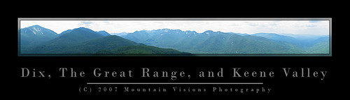
The Adirondacks are generally not the type of mountains you can string multiple summits together, but the Great Range makes up for that. The elevation gain and distance are very similar to the Presidential Traverse in NH, with one exception, on the Great Range elevation is gained and lost in massive chunks over just half the trip, while the Presidential Traverse spreads it out quite evenly over the 20 miles. The minimum Great Range traverse is 22 miles long and gains and loses 18,500ft. 11.5 miles are along the spine of 9 peaks over 4,000 feet in elevation. Over those 11.5 miles just under 15,000ft is gained and lost. Because of trail head relocations and the loss of a loop option, very few people actually start at the true start. The true traditional traverse adds 2 smaller peaks, as well as the unofficial but spectacular Pyramid Peak (which is technically considered part of the Gothics, and in my opinion one of the top 5 views in the Adirondacks). The total for the true traverse is 22 miles and 19,700ft gained and lost. For the hard men and women, a slightly more contrived addition of Mt Skylight can be added making the hike 23.2 miles with over 21,900 feet of gain and loss.

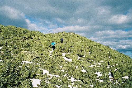
In the winter the Range has an almost 0% success rate because the steep slopes and deep snow drifts are ordinary facts. Generally speaking, even the most fit hikers and mountaineers would have trouble doing the Great Range in mid winter due to the deep snow and short durations of good weather in the alpine zone. Some of the trails in winter border on technical mountain terrain, with slopes steep enough that run out falls are entirely possible. In the summer, it is water that becomes a limiting factor high on the Range.

Summary of ADK Range options:

1) Traditional traverse (includes Rooster Comb, Hedgehog, and Gothics): 22 miles, 19,700ft G/L
2) Short traverse loop: 22 miles, 18,500ft G/L
3) Long Traverse (includes Gothics, Skylight, Rooster Comb and Hedgehog): 23.2 miles, 21,900ft G/L


In The Mountains of NH, Men are made.
Descending Mt Adams summit cone, Northern Presidential Range, NH.

2. Presidential Traverse, Presidential Range, White Mountains, NH. The Presi Traverse is perhaps one of the most difficult hikes possible because of the weather. Although much of the trail has good footing over trails like the Gulfside and Crawford Path, nearly 15 miles of it is exposed above treeline and susceptible to some of the most consistently dramatic weather on earth. So consistent is the drama, that it is as inconsistent as you could ever dream of (you know, like an enigma wrapped in a Pandora's Box). Weather aside, the full traverse (including all summits from Madison to Webster) still involves over 23 miles and 19,000ft of gain and loss. Assuming you climb all the summits and leave the well footed trails on the spine of the range, even if the weather is perfect, a true rarity, your feet will most likely feel like you beat them with a meat cleaver at the end of your hike.


Franconia Ridge, White Mountains, NH
Franconia Ridge, Pemigewasset Loop, NH. Mt's Liberty and Flume prominent in background.

3. Pemigewasset Wilderness Loop, Pemigewasset Wilderness, White Mountains, NH.
The Pemi loop is longer than all the rest by almost 10 miles, but it has a unique (dis)advantage of having several miles of hiking done on an old railroad grade. This loop is really more about mileage than any of the others, but the scenery is so spectacular I had to include it. The basic Pemi loop gained and loses 19,400ft over 31.5 miles. The book time for this hike is a mere 20 hours, and that assumes you are hiking it in sections. However, the grades are less steep then some of the other hikes on this list, and the bulk of above treeline hiking is over one of the most heavily used and well footed trails in the White Mountains. While the Franconia Range does take the brunt of bad weather and high winds coming from the east, you spend significantly less time above and significantly more time close to the edge of treeline for weather to be an overwhelming factor in success or failure of this trip in comparison to the Presidentials, or even the Great Range. That said, many people have under-prepared for this trip, had to drop off tens of miles from the trail head and beg for a ride, or worse walk 20 miles over highways and roads to get back to their car. I've read many a trip report of people sleeping in ditches on the side of I-93 because of poor preparation and fitness. It's fine line between moving fast and light, and being under-prepared on this loop as a day hike. While the Pemi is the biggest mileage hog and least technical hike on the list, it isn't without it's aesthetic bonuses. The Franconia and Bond Ranges in themselves are among the most heavily hiked, and most beautiful ranges in the Northeastern US. Combining the two over a very long day in the mountains makes for a phenomenal double marathon like adventure.

Options for the Pemi Loop:

1) Minimal Loop: 31.5 miles, 19,400ft G/L
2) All Spur Summits Loop (includes Galehead, North Twin, West Bond): 36 miles, 21,000ft G/L


Climbing Out Of The Col
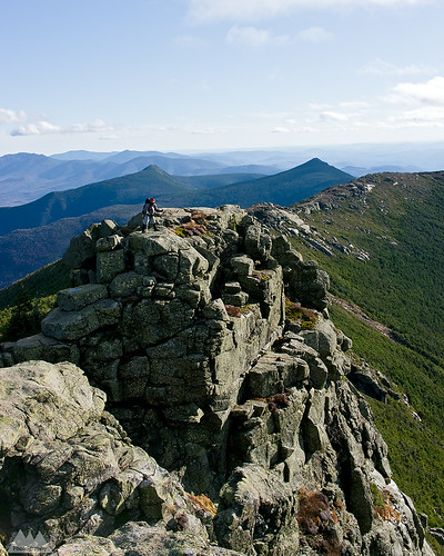
Ascending Slide Mountain on an exposed slab from the Cornell Slide Col, Burroughs Range, NY.

4. Burroughs Range Loop, Slide Mountain Wilderness, Catskill Forest Preserve, NY. The Catskills are actually a rugged eroded plateau that would look more like the high desert of Arizona and Southern Utah if the mountains were devoid of trees. The Burroughs loop is a ~13.5 mile loop, originating at Woodland Valley in the heart of the Catskills. The circuit ascends the spine of a range of 3500+ft peaks that include Whittenburgh, Cornell, and the Slide Mountain (one of only two 4000ft peaks outside of the Adirondacks, and the highest in the Catskills). The basic loop has a gain/loss of nearly 10,000ft. However, there are two optional ways to naturally extend the trip:

1) do an out and back spur to Panther Mountain adding 5 miles and 3,000ft gain and loss. Making the total distance 18.5 miles and 12,500 gained and lost.

2) spotting a second car at Fox Hollow trail head and hiking over Panther Mountain adding 6.25 miles and 4200ft gained and lost. The later makes the hike a total of 14,000ft over 19.75 miles, but also eliminates one of my favorite things about the Burrough's, the fact it is a true loop with a campground start!  Yes, you can wake up in your tent at 7am, hike the Burrough's and be back at your campsite eating a gourmet meal later that evening.

With even the hardest option on the Burroughs still being significantly easier than either the Great Range or the Presidential Traverse, should the Burroughs make 4th on this list? Absolutely. This isn't purely about difficulty or distance or elevation, it's also about the aesthetics of the hike. The Burroughs is significant for the fact that outside of the alpine regions of NY, VT, and NH, this is in my opinion the most scenic, fun, and historically significant hike that would probably please both the hard men and women who merely enjoy suffering on the trail, and those just looking for a fun challenge while still being able to enjoy themselves. Doing the minimal loop gives you unparalleled 360 views from various vantage points of the entire Catskill Forest Preserve. Beyond that, the Burrough's loop also includes enough steep climbing and scrambling to keep most hikers who prefer technical hiking terrain happy with plenty of chances to use their hands. Besides, how many great loop hikes of this magnitude start and end at a state run drive in campground?


Catskill Mountain Highs...And Lows!!!
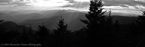
View south towards the Ashokan Reservoir from Sugarloaf Mountain, Devils Path.

5. Devil's Path, Catskill Forest Preserve, NY. The Devil's Path is consistently rated by backpacker as one of America's hardest day hikes. It's over 25 miles long, and while it can hardly be called traversing the spine, it certainly is a direct path over many of the higher peaks in the Catskills. The DP gains and looses almost 20,000ft over it's length, much of it is lost in giant chunks of a few thousand feet at a time as it dips from long flat 3000+ foot summits down into steep narrow hollows (commonly called passes or gaps out west) and immediately reascending the next mountain without any drawn out approach. Along with the challenging ascents and descents, the DP also shares similar rugged hands and feet terrain as the Burroughs Range loop. Scenically, however, the Devil's Path simply isn't on par with it's neighbor, and for this reason it falls to 5th place on my list. Most of the scenery on the Devil's Path comes on the eastern half, and in my opinion, it is largely unspectacular from Mink Hollow onward making the entire second half of the hike fairly monotonous, and much more of a grind than it needs to be. In terms of shear difficulty, however, the Devil's Path could easily rank in the top 3.

For those that prefer even more technical hikes without all the unnecessary miles on the trail, keep on the lookout for a followup of my most challenging "They Call THAT a Trail" hikes.

If you have an alternative to my top five feel free to drop me a comment or send an email!

Monday, November 22, 2010

Phil Brown Fought the Law, and the Law....

She Said: Is That A Boat, Or Are You REALLY Happy To See Me?
Almost the end of a short day of paddling and a long day of portaging, camp is across the lake!


...well we'll find out just what the law is and how it pertains to paddlers, thanks to our fearless editor of the Adirondack Explorer.

Phil Brown, editor of the Adirondack Explorer, and a pretty good writer and outdoorsman, doesn't just talk the talk, he walks the walk and paddles the boat. As a result, the Brandreth Park Association (which appears to be a single person or family) and Friends of Thayer Lake have decided to make an example of Phil Brown in order to keep its waters safe from navigation by the rest of the paddling community. Phil, of course needed a lesson, after all, his pen is mightier than the potentially illegal signs and barriers that shoreline owners have erected to illegally prevent navigation.

First, Phil is hardly a criminal. The New York State Department of Environmental Conservation has already informed the above groups that paddlers DO have a right to paddle through the private shoreline in question. All Phil did was exercise his legal rights and remind others about their rights. Secondly, if you've ever read Phil's columns or blog post then you know he doesn't tiptoe around controversial topics. This was clearly no different.

Brown said he paddled through the private land and wrote about it because he believes the public has a right to. “The Lila Traverse is one of the best wilderness canoe routes in the Adirondacks,” he said. “Replacing a long slog on foot with an hour or so of great canoeing only makes it better.” - via Syracuse.com

The issue at hand is centuries old common law which has been upheld in various state courts of law, but the Adirondacks seem to be an exception to this. As a matter of fact, the famous author and paddling advocate, Paul Jamison, remarked how the laws of navigation within the Adirondack Park were strangely different from outside of it. The reason this is odd is that the majority of the land within the Adirondack Park is state forest preserve -Forever Wild- and owned by the people of the state for free use. However, much of that land is in a piecemeal checker board layout that means quite a bit of private land borders state lands. Often and in-holding separates two parcels of state land. This of course causes quite a bit of contention in many cases.

Oddly, in the Adirondacks it is assumed that if a body of water, though accessible and navigable without need to trespass on land, is surrounded by private property, the water is off limits to boaters. However, in the rest of the state people regularly paddle and boat through waters surrounded by private shorelines without incident.

The issue is sticky, but has centuries old legal precedent because: 1) water was/is essential for transportation and commerce; 2) you technically cannot own water or the water bed of navigable water ways, in such cases the state owns the stream bed and it must be left open to public egress. Thus, it's generally accepted that provided you remain below the high water mark of a generally navigable waterway you have the right to travel on that waterway, even if you have to exit your boat due to temporary obstructions, low water levels, or to line your boat downstream or upstream. Keep in mind there are lots of little exceptions that prevent this from being a free for all. As an example, just because I can paddle into an outlet less lake without stepping on land, it doesn't mean I am not trespassing. If the lake is surrounded by private land with no outlet or egress to state land, it's off limits. Likewise, if a body of water isn't considered navigable during median flow, it is off limits. The key thing I'm trying to point out about navigation rights is that they are in fact about navigation and commerce, not the erosion of people's property rights as the Brandeth Park and Thayer Lake groups would have you believe.
 
Harrington Brook Portage
This particular issue resonates deeply with me, and is more than just an opportunity to stand on my soapbox. In 2007 my wife and I were one of the first groups to paddle the not yet officially opened Whitney Traverse, which essentially allows you to paddle from Little Tupper to either Lake Lila, the Bog River, or a complete circle from Round Lake. Truthfully, you can essentially go anywhere within hundreds of miles via various options, but those are the basic options that make up the trip. Regardless of how far you travel, you always have to portage over several sections of land when starting from Little Tupper Lake, but one section is clearly avoidable just by looking at the map.


Hey!! Is this the trail? Uh, yeah, right through those trees!!! (literally)
Portage path from Lilypad Pond
On our trip in 2007, I briefly considered doing what Phil Brown did. Quite frankly, I wasn't planning on doing it to make a point or exercise my rights, portaging the only expedition sized boat we had was no easy task. We did the trip over 9 full days, of which only 4 involved real travel, it was a leisurely excuse to do something challenging yet also relax deep in the Adirondack wilderness at locations that were really not ideally accessible on a weekend trip. Despite the leisurely nine day itinerary, we actually covered tremendous ground on travel days. As an example, the first three days we just decompressed while moving a grand total of 10 of 75+ total miles. However, moving 150+lbs of boat and equipment is a heck of challenge, and while I genuinely enjoyed it, I'm a paddler, not a pack mule. As a paddler, I know portaging (also called carries in this part of the world) is part of any long distance paddling trip, but it eats time, energy, has most risk of injury necessitating rescue, can lead to bears or animals scavenging your food stores, and is really the hardest part of any multi-day expedition. As a straight paddle my wife and I could have easily covered the 75 miles in three days, perhaps even two days fully loaded. It was the overland travel that really slowed things down.


Paddle and Portage: 2007 ADK Lake Traverse
Pulling 150lbs over low water mud
In the end, I wasn't 100% sure of the navigability of the bodies of water in question; 2007 was one of the lowest water years I have seen in a decade of Adirondack paddling, and old timers commented that by historical measures it was extremely low. While on Hardigan Pond we had to resort to pulling our canoe over mud flats that formed when the water receded, I certainly didn't want to get us into a sketchy situation on private property. That factor alone caused us to paddle a measly half mile across a pond only to unpack an entire boat, hoist it overhead and return for the rest of the gear on a second trip, a method known as a double carry! If my memory is correct, it worked out to be about 2.25 land miles through thick spruce thickets and horrendous brush on a yet unmarked and not fully cut portage trail. The alternative was a pleasant paddle surrounded by private land.

A Dream Is Like A River...Ever Changing As It Flows..
Portage to Harrington Brook


Often legal action is threatened but never used when the outcome is uncertain, in this case it's clear the plaintiffs could lose. As a matter of fact, it seems unlikely they will win because while they chose Phil Brown, they are really taking on the state of New York and legal precedent. I'm genuinely hoping Brandeth Park Association and Friends of Thayer Lake played their cards poorly in this last ditch effort, and when the gavel drops we have a definitive ruling that upholds the rights of navigation for paddlers and other boaters inside and outside the Blue Line!

Good luck Phil Brown!

Phil Brown paddling the meandering scenic  Shingle Shanty Brook

For more on this issue:

http://www.syracuse.com/news/index.ssf/2010/11/adirondack_landowners_sue_padd.html

Wednesday, November 17, 2010

Post Sunset Moonrise Over the Adirondacks Crane Mountain

Crane Mountain Moonrise, Adirondack Mountains

I'd moan about how hard landscape photography is, that if you're standing on a wind blown summit at sunset it means you have to hike back in the dark...but I confess, I'd have it no other way. I love hiking at night! In fact so much so that following this wonderful scene, which didn't end with this photograph, I didn't turn on my headlamp until I reached the slab below the pond outlet, just shy of half way back. Much of that time the 3/4 moon cast a shadow in my path as I walked through the forest. Hiking by the glow of the moon is really very peaceful, even more so than via headlamp, and it's nice to get lost in the solitude of the softly lit darkness.

Darkness though is what makes November a depressing month in this part of the world, the sun only shines about 30% of possible daylight hours, and daylight is only about 9-10 hours at the start of the month. The positive is that provided you can see the sun, you don't have to wait 18 hours between nautical twilight's like in the summer. Photography is best done at the ends of the day, and November is temperate enough that spending an entire 10 hour visible light day outdoors isn't all that hard most days if you get a sunny day. Or you can time a sunset blitz hike like this ascent of Crane Mountain, and still be home in time to eat dinner at a reasonable hour, rather than midnights like you do in the summer!

I have a few "local" places where I can gain some reasonable elevation since moving to Saratoga County a few years ago, although I do miss my 30 minute drives to challenging 3,000ft+ single summit days in the Catskills, 90% of the time I'm glad to be at the foothills of the Adirondacks even if it means the same drive gets me only 1500 foot single summit days. Crane Mountain is not only a favorite semi local hike (about ~55 miles and 50 minutes) but it's a favorite hike overall in the Adirondacks. Barbara McMartin once said it was among the most beautiful summit views in ALL the Adirondacks, and although I never found the distant views to be amazing, I've always loved the general challenge of the rugged trails and steep cliffs that make Crane Mountain.

Crane is not only a great hiking mountain, but it's home to a hot bed of new Adirondack rock and ice climbing route activity. In the last 10 years Crane has seen dozens of new rock routes and tens of ice routes, some of the ice is 3-4 pitches in length.

In the trail register many people complain of the sparsely marked trails, and the first time hiker might have to be careful, more so after dark. The mountain sees at least a few dozen hikers and climbers a weekend, creating a well worn though still rugged foot trail. Though with a little care, a map, and just basic route finding skills you should be able to figure it out. Although I know the mountain well now, it was just as poorly marked the first time I hiked it!

Unfortunately, hiking isn't all glorious sunsets, moonrises, and pleasant walking via the glow of the moon. About 1/3 of the way down the very steep outlet trail, I took a pretty decent fall on one of the many sections with deep dry leaf cover over roots and slabby ragged boulder piles. This time of the year dry leaves have become waxy, and the combination of dry waxy leaves and steep descents make it like walking downhill on ball bearings. I took a jump down from one boulder into a crevasse between two boulders and the next thing I knew I was on the ground several feet below my target with my elbow and arm bleeding. The arm will heal, but I lost Black Diamond Flicklock pole when my feet came out from under me and the pole snapped in defense of my fall. One of the reasons the Flicklocks are great poles, and hadn't yet made it to the graveyard of poles in my garage, is unlike most poles with expander nuts, the expanderless Flicklocks hardly ever (perhaps never) collapse. The downside is they are made from thin gauge aluminum and are the only poles I have ever owned that I have bent...over and over and over again! They are easy enough to rebend, but at $90 a pair, I wish they were just a bit more sturdy!

Alas, it was a small price to pay for an almost summer like mid autumn day in the Adirondacks.


Wednesday, November 3, 2010

Beam Me Up Spotty!

The Spot personal locator beacon has grown a strong following over the years, such a reputation in fact as a bare bones PBR with a twist that even this, "I escape to the mountains to escape technology like this" backcountry purist has considered one.

As I noted in my prior post, shit happens! While a lot of rescues are avoidable, not all are negligent, and some of us aren't particularly good at sticking to plans. Plans are for work, projects, corporate planning, not for getting out into the mountains. Spot seems like a great way to deviate from plans, yet let someone know where you are headed. Using Spot messaging service you can ping location updates, non emergency help pings to your contacts, and full out SOS to the GEOS International Emergency Response Center. Say I had no particular reason to return home on a Monday, or worse I simply underestimated the difficulty of a hike and decided to spend another night out, I always envisioned being able to send an OK ping and be done with it.


On Sunday, October 17th one of the short falls of relying on something like Spot and it's bare bones limitations can be seen from the DEC Region 5 Ranger Activity Report below:


Town of Newcomb, High Peaks Wilderness Area On Sunday, October 17, 2010, at 3:43 pm, the DEC Dispatch Center in Ray Brook received a call from a woman requesting assistance in locating her husband in the vicinity of Moose Pond. Mathew Crowell, 29, of Syracuse, NY, had been hunting in the area for several days and reported his location each morning and evening using his Spot Locator. Mr. Crowell had not reported in since 10:00 am on Saturday. Mrs. Crowell became concerned that her husband might be injured after learning of the presence of snow in the higher elevations. A DEC Forest Ranger responded and located Mr. Crowell’s car at the Moose Pond Trail Head and started to search the 6 miles of trail into Moose Pond. At 6:05 p.m. the Forest Ranger heard a shot and found the subject in good shape, at the last spot location he had sent to his wife. According to Mr. Crowell, he had sent his wife points from the Spot Locator throughout his trip but obviously the signal didn’t get out due to the steep drainages. Always provide someone at home with your itinerary and when you expect to return. Electronic devices are useful in providing information and communicating with people outside the backcountry – be aware of their limitations.

What this highlights is two things 1) the reason I like a Spot is because of my inability to stick to itineraries. I don't veer from them every trip, but it's not uncommon for me to do so. Spot proved here that when everything is OK, that it might not be the best option for this sort of thing since I would probably use it quite similarly to how this hunter was using it. 2) It shows the limitations of both Spot and satellite based navigation as a sole form of backcountry navigation or communications.

I still like Spot for it's one way only communication, which I find is probably a reasonable compromise for most purist. However, I don't find it to be terribly reassuring that it isn't able to consistently send out pings. In the eastern US forest we have extremely thick forest cover even in fairly open terrain, this often at times creates problems with GPS signal reception, the same signals Spot uses to locate and transmit. Add in steep drainages, canons, cliffs, frequent cloud cover and other features very often found and this device might not be useful when it's really needed. Spot starts looking pretty flaky as a surefire option for location and rescue.

The flip side of this of course, is that if the hunter was pinging his wife his location 2X a day, she should have been able to inform Rangers of his last coordinates and made locating him somewhat easier. So even in the worst case of it working poorly it certainly can be useful in narrowing a search area down.

Monday, November 1, 2010

I Ain't No Hollaback Kid...City Kids Don't Hollaback, Yo! Do you?

I will never forget the following sentence long as I live.

"Growing up in the city you never holler back." - three lost geniuses
I'm going to preface this post by saying that there is a reason I don't typically poke fun at backcountry accidents, injuries, bad luck or marginally stupid decisions that occur in the wilds. Quite simply, shit happens and karma is a bitch. But even karma has to give me a break on this one.

Per the New York State DEC Region 5 Ranger Activity Report for October:

Town of Indian Lake, Jessup River Wild Forest. On Sunday, October 10, 2010, at 2:00 am, the DEC Dispatch Center in Ray Brook received a call from the DEC Lewey Lake Campground reporting 3 overdue hikers. David Ciaccia, 23, and Samantha Ciaccia, 22, both of Conshohocken PA, and Abagail Kite, 23, of Owins Mills, MD, had not returned from a day hike of Watch Hill. DEC Forest Rangers responded and searched through the night, covering most of the ground around Watch Hill while repeatedly calling out the names of the three hikers. At 8:30 am, the Rangers located the subjects in good condition. They reported that it had gotten dark as they were returning to the campground and they did not have flashlights, so they lost the trail. When asked if they could hear Forest Rangers calling for them, they said they had but stated that “growing up in the city you never holler back”. Always carry a flashlight or headlamp. Remember that the sun sets earlier in the fall and plan trips accordingly. If lost, help searchers found you by staying in one place; starting a fire or make noise; and answer searchers calls.

Now, one wouldn't say I grew up in the "city" but in terms of growing up in an urban environment, few would argue that fact. I'll be perfectly blunt, I've never heard of Conshohocken, Pennsylvania or Owins Mills, Maryland; as a matter of fact, I didn't know Pennsylvania had a city NOT named Pittsburgh, Harrisburg or Philadelphia. So I did a little search, and it turns out these lost souls had about as much urban upbringing as me. They were suburban urbanites. That is they grew up a stones throw but not quite in the city itself..

So moving on from that little point of conjecture, let me get to the real question. Did any of you who actually grew up in the 'burbs of a major city learn that, "growing up in the city you never holler back." And if you did, can you possibly point me to some place this little piece of urban wisdom is outlined, certainly future generations will want to know about how young urban hipsters lived back in the year 2000.

Assuming this is some sort of rule, would this rule apply while being lost in a 3 million acre forest preserve, so far from a city that the stars are insanely bright due to the lack of urban light pollution? A place that has a permanent resident population about the same as Wyoming, the CONUS least densely populous state? I guess I am asking, what possibly would motivate you at the age of 22 and 23 to not holler back?
 
Dear Karma gods, please bless my wife, but as she noted...

"They were "city kids" lost in the woods, did they think people were coming to kill them by calling out their names? How did they know all their names?"

I don't know? I'm sure no one can actually answer this, not even the 3 geniuses who caused the DEC Forest Rangers to spend a night searching the woods within earshot of the NOT SO lost hikers.

As you know, I am not a fan of charging for search and rescue because I feel it's counter productive, and most likely will cause people do delay the inevitable, ultimately causing deaths and/or more risk to rescue crews. Not to mention the fact that outdoor activities funnel far more revenue into a region than rescues pull out. That said, even I would have loved to have seen the DEC have the power to charge these people for a search. I bet you that would get some holler back!

This also leads me to wonder if they were sitting there in absolute silence? I mean if they were talking, Rangers probably would have heard them. So my guess is they were just sitting there hoping to not be found out of embarrassment and came up with a lame excuse.

Once DEC dispatch is called a log is created. Even if you walk out on your own, once a Ranger is sent to assist you get into the activity report for the month. So, even if you are embarrassed for getting lost and having people out calling your name, you might as well stand up and say, "hey, we are over here." Chances are the rescuers have food, warm liquids, and warm clothing packed in case you need them. Damn, if Rangers are looking for me and I know they have a thermos of warm soup or Starbucks hot cocoa, you can bet I'm gonna be hollering back!

And if you are raising city kids, please remind them that when lost in the forest that they should always holler back!

Wednesday, October 27, 2010

Alexander "Pete" Grannis Died In Service of the DEC

Today the "New York State Department of Environmental Conservation is in the weakest position that it has been since it was created 40 years ago," with many "core programs hanging by a thread". Systematically dismantled with the precision of a hatchet over the last few years by America's most short sighted governor, the shell shocked DEC now has no leader.

Governor Paterson, not sufficiently happy gutting the DEC's budget, forcing layoffs and early retirements to unprecedented and dangerous levels, nor bargaining the state park system for part of the environmental protection fund, decided to go straight for the head of what he must feel is the states most greedy department, the DEC. No department of New York state has suffered larger cuts to it's budget than the DEC under Paterson's reign, and Friday it officially suffered the loss of it's commissioner, a rare man in politics who actually stood up for what was right.

Fired for insubordination, because he refused to resign, Alexander "Pete" Grannis is the most noteworthy in of victims in Governor Paterson's very aggressive goal of destroying the ability of the DEC to manage New Yorks environment, now and long into the future. Over the last 3 years about 20 percent of the DEC's scientists, engineers and enforcement officials have disappeared under Paterson's draconian budget cuts that seem to aggressively target the DEC more so than any other state agency.

Commissioner Grannis did a noble thing, he stood up to the lunatic running this state, and for it he lost his job. Grannis has been well liked by both hard core environmentalist, the groups those environmentalist support, and he's worked well enough with the other side to not be disliked. As a matter of fact, business and oil, gas, and mining lobbies were shocked that Grannis was fired. He was well liked within the DEC, starting as a lawyer with the DEC when it was founded 40 years ago, he then moved on to politics for 3 decades before being appointed by Governor Spitzer in 2007 to rebuild the DEC. You could say he was a model citizen, and a good public servant.

Paterson on the other hand has an absolutely appalling record when it comes to the environment, open space, regulation, and even appointments to the APA. He has used the DEC as his punching bag. A soft target that he can beat on without much opposition. There is not a single area this governor can be commended for when it comes to environmental protection. As I normally try to do, I'll leave Governor Paterson's string of sketchy ethical and personal character issues out of this discussion, but I will point out Pete Grannis lacks this trail of moral detritus.

Pete Grannis simply alerted Governor Paterson, via an internal memo, that the cuts that were being made once again to the DEC were unsustainable in the interest of the environmental health of New York State, and ultimately the health and well being of it's tax paying citizens. Unfortunately, or perhaps fortunately, someone leaked that memo, and the geniuses that most likely puppeteer Governor Paterson shot first and asked questions later. Unlike most politicians, Governor Paterson was neither elected to his current office, nor will he ever serve in elected office again. He has absolutely no reason to care what anyone thinks or what the repercussions of his actions are. For all we know, after he finishes turning the entire state into a "brown field", he might be off to another state that was run with more foresight.  Furthermore, because New York has no way to recall a governor, Paterson has absolutely no reason to care.

What Pete Grannis was trying to explain in his memo is precisely what many of my blog post over the past year have been about. Quite simply, the DEC cannot do it's job as outlined under New York State environmental conservation law with the minimal resources it has left. Apparently Paterson doesn't want you to know that. He must think it better for you to assume your water isn't being polluted and your air is safe to breath. That your forest and fisheries aren't being mismanaged, and that your economic well being isn't being jeopardized. After all, being blind works for him (and that statement I assure you has very little to do with his actual disability), why shouldn't it work for you! Just close your eyes, everything will be OK!

Or will it...

From Commissioner Grannis memo:


"The public would be shocked to learn how thin we are in many areas. In many instances we have offices or sections responsible for important permitting and monitoring functions staffed by only one or two people. Some regional offices have no capacity in certain areas because key items are unoccupied and can’t be filled. As a result, we are unable to meet the expectations of both the regulated community and the public with respect to countless activities...All of the meat has been stripped off the bones, and in some cases the bones have disappeared." -Pete Grannis

"Unlike many other agencies, DEC by design has a multi-faceted mission and our core activities accordingly encompass a wide variety of areas. For example, we are  responsible for ensuring environmental quality through the implementation of regulatory programs aimed at protecting air quality, water quality, managing hazardous and non-hazardous waste and cleaning up dangerously contaminated sites. We have statutory responsibility for the state’s invaluable natural resources, including all state lands, fish and wildlife populations, water-bodies such as the Hudson River, the Great Lakes and Lake Champlain, and our vast coastline. As a core element of our mission, we also provide recreational opportunities for the public, many of which are paid for directly by user fees and include heavily relied upon programs for sportsmen and sportswomen, as well as camping and hiking in New York’s constitutionally protected forest preserve. Each of our programs has a daily impact on people's lives and the health and economic well-being of the state. While each program has a vocal, politically active constituency, for purposes of this exercise we cannot treat all of them equally and still be able to operate."  -Pete Grannis

  • The DEC comprises 2.5% of the NYS workforce subject to executive control, yet it is required to layoff 10% of the 2,000 total positions planned to be cut
  • State agencies with 100% Federal or SRO funding are NOT required by Paterson to layoff workers. However, the DEC is disproportionately required to layoff
  • Although the DEC has an operations budget of $500M 75% of that budget is either federally funded OR from SRO (special revenue, other)
    • The Clean Air and Water Act for example is federally funded
    • SROs via game licenses fund fish hatcheries, pheasant farm, game law enforcement, wildlife and fishery biologist
    •  SROs finance discrete activities which means they cannot be used for the general fund
  • Prior to Governor Spitzer's administration the DEC was about 800 staff members short, while the regulatory responsibilities of the DEC actually grew over that decade! 
    • The 2007-2008 budget added 108 positions, which was a first step to returning to necessary staffing levels to "core" programs
    •  Since April 2008 the DEC has lost 595 employees or 16% of it's workforce
    • When the additional cuts called to be eliminated in 2010-2011 the DEC will have lost 21% of it's workforce since 2008
  • Since fiscal year 2009-2010 the DEC has absorbed a 40% NPS budget decrease and a general fund budget decrease of 13%
  • Commissioner Grannis does not feel the "extreme reductions" enable the DEC to fulfill it's state and federal mandates for regulation and enforcement
    • Each quarter the DEC reduces essential services to the public including
      • waste water enforcement, air emissions enforcement,hazardous waste, wetlands development, dam inspections, mining and drilling safety, shellfish safety, increase in time for issuance of impact studies, delays in permit approval, well plugging, reduction in game enforcement, reduction in backcountry patrols, transfer of responsibilities from sections of staff to singular individuals
  • Commissioner Grannis found it ironic that while the states wildlands have seen increased use, and in many areas of the state the DEC administered Forest Preserve is the chief source of economic sustainability, the DEC is taking the brunt of the cuts
    • DEC administered lands account for billions of dollars in tourism and business revenue
    • Economic development projects CANNOT start with DEC review and approval which now is severely backlogged, these include:
      • mining
      • shellfishing
      • oil and gas drilling
      • all water dependent activities
      • brown field site development
      • most manufacturing
      • commercial fishing
      • energy generation
      • general construction of bridges, tunnels, and power generating facilities
  • Commissioner Grannis points out that the Governors staff reduction requirements, which reduce DEC staffing by an additional 6% do not take into account the fact that many DEC staff are not paid for by the state
    • He further points out that the Governors goals actually inhibit the ability of the DEC to fill positions using federal or SRO only funding, essentially losing jobs that they aren't even paying for
All things considered, Governor Paterson's decisions are troubling because they do not look at the states health 5, 10, 15 years into the future. True, the governor can claim he hasn't mortgaged the financial future of the state with irresponsible budgets, but it's hard to not wonder if this isn't mortgaging the health -economic, environmental and human- of this state far into the future. Rebuilding the DEC will not be an overnight task, and the cuts the DEC has absorbed; the loss of skilled staff, scientist, engineers, and others will perhaps take a decade to undue. Paterson might not be carrying a deficit, but I have to argue that he has foolishly mortgaged the future of New York State!


Data cited from the full memo of Pete Grannis to Governor Paterson's Division of Budget:

http://www.pressconnects.com/assets/pdf/CB1657851021.PDF

Wednesday, October 20, 2010

Summer 2010...

A little slice of summer 2010 in photos.

Hit the full screen box in the corner for a larger slide show. Most images are uploaded at 1080P. If they are pixelated, and you are using a higher resolution screen, chances are nothing is wrong with your monitor or the images, they are just lower resolution than your monitor at full screen size!


Friday, October 8, 2010

Catamount...The Most Fun You Can Have At 3100 ft

Catamount Mountain Autumn Views


Often my favorite peaks are not the higher peaks. It's not that I don't appreciate numbers, after all the world is a quantity based place, but I just like the aesthetics of a hike, climb or summit more than most people who are enslaved to quantity based goals, like miles or vertical feet.

Catamount is a great example of this. It's a lowly 3100ft peak, sort of off the radar of peak baggers. It's too short to waste a trip from downstate to the North Country to climb, and it's not surrounded by anything that would draw a hikers attention to it. However, it's perhaps one of the most beautiful of Adirondack peaks, and the hike is absolutely amazing as well.

Catamount isn't a naturally bald peak and it's slabs for the most part aren't naturally bare. Like many places in the Adirondacks, the bare rock is the result of natural forces that play on the regions typically thin soils, such as slides from sustained torrential rainfall, man made fires. wildfire, or Colvin's surveys. I'm fairly certain Catamount was the result of all 3. The result is this quite steep, slabby mountain, covered with ledges, chimneys (really a boulder filled dike) and cliffs, which must be ascended to get to it's virtually bare summit. Once on top you can take in as much as 270* from many single vantage points, with the ability to see a full 360* with a little footwork from multiple vantage points.

Of course, if you've hiked in the Adirondacks you are already thinking, "but isn't that about 75% of Adirondack peaks, most of which are on some sort of tick list or a lot closer to the major population centers of the Northeast." You got me there, but I will say this, the scrambling is just plain fun on Catamount. In my opinion this is one of the most rugged trailed (unofficially trailed) hikes in the Adirondacks. This includes the High Peaks. Yet the reward to effort ratio is probably superior to anything in the high peaks.

Look, I'm one of the nuts that hikes down 2000ft from my camp in the White Mountains to crawl through caves and than hike back up trails that in many parts of the country would laughed at as insane. A pile of loose talus and house sized boulders you have to go over, under or around does not make a trail to most. Yet, this is exactly the sort of thing I seek out far more so than big mileage days, and Catamount gives a civilized bite sized taste of this without any of the effort required to do harder variations like Saddleback, the Gothics, Huntington Ravine Trail (another truly sick joke of a trail), the King Ravine, and many others.

Having done literally nothing for most of September, Catamount was exactly what the doctor ordered. Short, sweet and technical.

Catamount was also a perfect hike to work on Colvin's climbing skills. He probably won't ever be Caney on the steep sections, but he has already gotten a lot better in spite of really not getting much practice while paddling all summer. Dogs are like people, they need exposure and practice to ever become good at what they do. We did our best to teach him to "climb" this summer and he has improved a lot. Although he still doesn't independently control his back and front paws, he definitely has gotten a lot more proficient at slabs and short walls. Where Colvin still has trouble is he panics anytime he gets to a section he has to think about. He'll look around for alternate options, often finding them, but Catamount was his nemesis. Most of the hike was the easiest route up the mountain so he was forced to actually climb rather than take the long route around obstacles. Although he wasn't quiet about his angst with all the climbing, he made it up and down the entire hike without an assist by me. Pretty impressive considering he doesn't yet have the confidence he needs to be really good. I think with confidence he'll be able to slow down and not try to dyno through everything.

My favorite part of the hike was really that there wasn't any significant stretches of unappealing hiking. The start was a fairly flat grade through now reforesting fields, then the uphill hiking starts but quickly reaches the more scrambly open sections that afford great views of both Catamount and the surrounding landscape. Once on these sections you should be having so much fun you won't want to reach the summit too quickly!

Catamount Mountain USGS Benchmark

When we did reach the top we were equally impressed with the great views. The weather was perfect, and after accepting that I'd missed the good light to catch the remaining fall colors, I decided to take a nap on the summit slabs. The idea was to hang out on the summit long enough to catch the afternoon light. Colvin being very loyal and obedient slept with his head on my pack, growling at anyone that came near me or our gear. We are working on his over protectiveness, but it's nice to have a dog that does his dog duties well. I slept for about 2 hours and 20 minutes under the warm autumn sun with just a slight breeze.

Colvin on Catamount

When I woke up I realized we had a fair amount of time to go till the golden hours, thus deciding to head down part way to another vantage point. When we got there the light was still cool and contrasty, so I decided we might as well descend in the daylight and see if I could find something of interest on the drive to Lake Placid.

Colvin on Catamount

Monday morning we broke camp and hiked into Round Pond, not impressed with the scene or the lighting we headed out and went back to Roaring Brook Falls for a final shot.


Roaring Brook Falls Foliage, Adirondacks

I wish autumn in the Northeast could last longer, but with a little planning you can get about 6 weeks of foliage and temperate weather. Starting in the high mountains in mid to late September and gradually moving to lower elevations, on to larger lake shores (Great Lakes, Finger Lakes, and Champlain Valley), and eventually the coast as late as Halloween! 


Beaver Pond Autumn Reflections - Wilmington, NY


Gone Camping...

Although this blog hasn't seen an update since July, rest assured we've been out and about. Thus far 2010 has been my busiest hiking and paddling season since at least 2008. That said, it has been a slow year in terms of gaining and maintaining my mountain fitness. Part of this is because of my new trail dog, Colvin. As an energetic pup he still has a lot to learn, and as a trail human responsible for his short and long term well being I have to apply the brakes to our adventures. While this seems like a big inconvenience, it's really not. Taking it easy for 6-9 months is an investment in the next decade. The last thing I want is a broken down 5 year old dog, and you'd be surprised how many trail dogs are done long before their 10th birthday because of early life overuse injuries. Besides that, he had Lyme disease earlier in the summer and wasn't 100% for a little while.

For my part, following our vacation on the North Carolina Outer Banks, I was sick for several weeks. Finally on the last Sunday of September I felt well enough (with reservations) to go hiking on the Spier Falls tract in Moreau Lake State Park. The backside of Moreau is a gem and lots of fun to spend some time in the forest without any real goals. Our little 5 mile loop which covered 1000ft wasn't exactly noteworthy, but I didn't die, and it felt great to be out. A week later I was at full strength, only completely out of shape from a month of doing nothing.

I had anticipated doing some challenging fall hikes for remote landscape photography back in August, but autumn in the North Country was early, and now almost over. The leaves have browned and fallen off the trees early and unspectacularly due to the warm dry summer. Time now to make the most of the remainder of the best 8 weeks in this part of the world, while looking forward to the second best (but most inconsistent) season in the Northeast...WINTER! While the color and photographic beauty might be gone, this time of the year is still a favorite for a few more weeks. There might be snow and ice on certain sections of trails within a week or two, and certainly on any given day the summits can look wintry, but there will be at least a few windless 60F summit days that allow you to sleep soundly on a summit miles from the nearest distraction. No bugs + less people + a temperate October afternoon on a summit = perfection.

Unlike most years recently, I'm actually pretty up to date with my photography and while I said back in July I had some trip reports pending, keep an eye out because they really are coming.


Thursday, July 8, 2010

Finding Solitude In Obscurity

Fireworks Over Lake Placid & the High Peaks

A few years ago, I realized we are all interlopers in the space of others. This realization was an awakening to the reality that it's up to me to find solitude, rather than expect others to stay home and provide me with solitude. It actually got to the point where I didn't want to do anything on holiday weekends; however, you don't have to go that far.

Holiday weekends are a great chance to spend a few days exploring places that might not otherwise be on your list. I consider them a bonus, and for the most part, I am able to avoid crowds. I'll often spend a Memorial or July 4th weekend seeing fewer people than I see on a typical weekend.

This past weekend, July 4th 2010, the 3 of us spent the entire weekend in the Adirondacks. We didn't fight for a campsite, we didn't get squeezed by crowds, we weren't bothered by noise, and quite frankly while camped, paddling, hiking, or even watching fireworks in Lake Placid, we didn't see more than 20 people all weekend. However, this doesn't fit in with what I saw as I drove through the Adirondacks. Every public pull-out was packed with cars, every pond, lake, stream and trailhead was filled with crowds, it reminded me more of Central Park than Adirondack Park.

So if you hate being an interloper in the space of others, there is still a final 3 day weekend on the horizon, I encourage everyone to break out the maps and guidebooks, and look for something obscure that you probably wouldn't visit any other time. You never know, you might just discover a new "classic" location of your very own!

Wednesday, June 30, 2010

The Adirondack Mountains...A Wilderness Of Waterways

"New York's Adirondacks are rugged and dramatic, but what distinguishes them from the mountain ranges in Vermont and New Hampshire is their waters, the hundreds of lakes and ponds and miles and miles of rivers that the others simply do not have". - THE NEW YORK TIMES
Panorama From St Regis Mtn. (39 megapixels)

What the New York Times said has always been my thoughts when trying to explain the Adirondacks to people not familiar with the region. Sure there are mountains, beautiful rugged mountains at that, but it is the view from the summits of those mountains that is unlike most other places east or west of the Mississippi. I'm sure most people look out and see the other mountains, their next High Peak to bag on the way to a 46'er patch, but my primary interest when I look out is all that water!

Climbers look out at summits and cliffs looking for their next climbing objective, paddlers look out from summits in search of their next paddle. To me it's always been a wilderness of waterways first, with some mountains mixed in for fun during the winter months! The Adirondacks are one of the few publicly accessible places I can think of with such a mix of mountain and water, that is what makes them unique to me!

There are still dozens of bigger bodies of flat water with wilderness character, or perhaps even completely wilderness that we haven't yet paddled. My goal this year was to spend time on some of those, as well as some of the places we have only been to one or two times over the last 10 years. While we've paddled all the "old classics" time and again, it's nice to know there are many more future classics on the horizon!

The list this year includes the Grass River and Grass River Flow, Deer River and Deer River Flow, St Regis River and Santa Clara Flow, Madawaska Flow and Quebec Brook, Stillwater Reservoir, return trips to both ends of the Osgood River, perhaps a fall trip down the Fulton Chain after the summer tourist and motor boats have long gone. We might even look at pond hopping the Pigeon Lake Wilderness, but perhaps that is for next year. Of course, it's been almost 5 years since our last trip to the incredible Oswegatchie, this time though, instead of the usual 14 mile upstream paddle to High Falls, I think we'll do it as a paddle/backpack into some of the off river ponds!

With some regret, I'm putting the crown jewel of Adirondack river paddles, the Jordan River, off for one more year till we perhaps have a lighter 2 person boat or second single seater; both options would be better suited for pulling over obstacles on the beautiful -but blowdown choked- meandering wilderness river. It's been almost 3 years since we first paddled the Jordan but rest assured, we will paddle the entirety of the Jordan soon enough. The late Paul Jamieson made sure the once inaccessible river was indelibly ingrained in my imagination.

Monday, June 21, 2010

Garnet Lake Is A Southern Adirondack Gem


After 10 years of paddling in the Adirondack's we still haven't come close to paddling every reasonably accessible body of water, and that is a nice thing. This weekend we knocked another paddle off my list, Garnet Lake. A nice little lake I'd had on my list for a few years, Garnet is about 50% state owned shoreline and 50% private.

Although this is a nice short drive from home (about 1 hour, including 25 miles of winding secondary and dirt roads) it just isn't a big enough lake to really bother for a weekend trip. Aim and I easily knock out 15-20 miles a day in the Old Town Scout, which is pretty decent considering our high volume, gently rockered all purpose boat isn't the fastest on the water. Of course, we have been known to beat sleek sea kayaks on 14 mile flatwater paddles while paddling the Scout! Bearing that in mind, a 2 mile by 1/2 mile lake really isn't going to keep us busy for too long. However, every year we try to do our first paddle someplace cozy while we get our sea legs (and arms) back in shape.


Aside from our first paddle of the year, this was also Colvin's first paddle of his entire life! It wasn't without some fear that we undertook this first paddle, but Colvin did great in the boat, and he is just a weekend away from being able to swim. The first day we paddled with him without his PFD (or rather CFD) because I'm pretty confident if we rolled he'd have figured out how to swim really quickly. On day two we decided to put it on him because I've had some people tell me that they were able to get their dog swimming faster by putting a PFD (that's a life jacket to all you land lubbers) on them for the first few swims. I think as soon as he learns to swim we are going to have a hard time keeping him out of the water!


Other than peeing in the boat (our fault, he did try to tell us he had to go), Colvin actually did much better than Caney at listening to us, and of course he stayed in the boat and didn't swim the entire time we paddled. We didn't have a single group ask us if we were tormenting the poor dog by making him swim along side the boat like we did the first few years with Caney!

Garnet Lake, despite it's relatively small size, does have quite a bit of shoreline due to it's irregular shape and many coves. Almost 6 miles to be exact, and 2/3 of that is ringed by mountains making it quite scenic. The near 3000ft mountains thrust up 1500ft from the lakes 1400ft base elevation directly from the shoreline. The lake had quite a bit of wildlife, although we didn't see much. Some paddlers told us they spotted bald eagles on the southern terminus, we saw beaver lodges and other signs of beavers, and there were a pair of loons on the lake that we spotted several times. We also saw the less interesting ducks and geese.

Although the paddling is limited, the lake does have 2 short hikes that originate from it's shores. The first to Round Pond (one of many in the Adirondacks) and the second to Lizard Pond. The Lizard Pond hike is only accessible to those with a boat since the trail head is isolated and across the lake. Both hikes are less than 2.5 miles in each direction. I've definitely got Lizard Pond on my list as a paddle/backpack combo at some point in the future.

Saturday we set up camp at a pull-in site. We day paddled the state owned 2/3s of the shoreline and looked at the various campsites and trail heads. Most of the limited campsites were filled assuring us we made the right decision to car camp rather than canoe camp. After paddling and playing with Colvin in the water for most of the afternoon it started lightly raining when we got back to camp, I didn't feel like cooking, so we headed to North Creek for some pizza. Aim and I sat outside on the deck at Pete's Ah in North Creek while Colvin sulked in the car. The plan was to have him sit outside with us, but when I went to get him I noticed a DD's iced coffee cup thrown on my drivers seat. Unfortunately the cup had remnants of the ice water and some unfinished coffee/cream in it, actually a lot more coffee and cream than I'd have hoped for since it was a bad iced coffee. He got a bit of a earful and stayed in the car while we ate. When he hasn't been exercised I understand this behavior but when he spent all day playing and he was clearly tired (aka. happy in Border Collie terms), what he did was purely about spite because he was left in the car. This isn't the first time this has happened. I no longer have satellite radio as a result of 3 different chewing incidents in the car in which he systematically dismantled my well put together satellite system.


Saturday overnight it stormed so hard that we spent a good amount of time Sunday trying to remember when it stormed harder while we were camping. It definitely came in as a top 5 storm for rainfall severity and lightening, however, we've been in much worse when wind is factored in. I'm fine with the rain in the Marmot Swallow 2P, although the fly can get a little saggy if you don't restake it after it gets wet, the tent hasn't let me down yet on many a rainy weekend (or week)! For two people (and a dog) in summer conditions it's very livable and vents extremely well, even in the rain. But when I started seeing defined streaks of lightening hitting the shoreline of the lake outside my tent window, I got a little nervous!

Sunday, after spending most of the morning piddling around camp and drying out our gear, we packed up and eventually dragged the 70+lb Scout 500ft down to the water. Once on the water we paddled the private shoreline of Garnet Lake and then headed back towards the public half for a bit more exploring. In contrast to Saturday's hazy, hot and humid, Sunday was picture perfect. Lower humidity, better visibility and a mix of sun, blue skies and puffy white clouds. On a scale of 1-10 it was a 9.5 at least. Even the bugs were at a minimum.

All things considered, our fears were a bit over done, it was a perfect 1st weekend on the water, and a fun new place to explore. Colvin did great and I think we can head to some more difficult paddles from this point forward.

Wednesday, June 9, 2010

Legislature Successfully Defends Paterson's Assualt On EPF

The following is not without some negative. The legislature did in some ways gut the EPF, but it didn't allow David A. Paterson to milk the EPF to cover his shortcomings as a leader. The legislature prevented him from using the EPF as a rainy day fund for the states day to day expenses, which was his initial goal.

The bottom line was that they cut about $78 million out of the EPF to fund the $11 million it (supposedly) cost to reopen the state parks and campgrounds that were closed.

I'm the first one to admit I'm not super smooth at math, but something isn't right. Basically Paterson held the NY State Parks as hostages while he demanded the funds from the EPF. So what he did was he said, the park system, which saw record visitation last year (and I'll assume near record revenue, or I'll again assume probably broke even in expenses) was too expensive to run, so if the legislature wanted to appease it's constituents it would have to deal the EPF.

See, unlike most of the Forest Preserve or the EPF, people and towns feel the crunch of the park closures instantly. It really hits home. Paterson tossed a grenade into the assembly and senate chambers and waited for someone to dive on it. Of course, there probably isn't one upstanding human being in the legislature, so they did the only thing they could, they tossed the EPF on it to save themselves.

Paterson is gutless, he's potentially a moron, but someone smart is pulling the puppet strings behind this guy. This was a move Joe "Prison Bound" Bruno would have been proud of.

Regardless, it's good to see New York State politics remain as corrupt as when Theodore Roosevelt literally had to break a leg off a chair to defend himself on the floor of the state capitol because he was one of just a few members of our government who would not tolerate the corrupt antics of our law makers.


ALBANY, N.Y. – The Adirondack Council today thanked the leaders of the NYS Senate and Assembly for standing up to a flurry of attacks on the NYS Environmental Protection Fund (EPF) proposed by Gov. David Paterson during this year’s budget negotiations.

Legislators today passed bills agreed to yesterday with Gov. Paterson that would reopen the state parks, historic sites and campgrounds closed by the Governor, while also preserving the funding and traditional spending priorities of the EPF.

While the overall spending levels for the EPF for FY 2010-11 are lower than the organization had hoped, the group praised the two Environmental Conservation committee Chairmen (Sen. Antoine Thompson of Buffalo and Assemblyman Robert Sweeney of Lindenhurst), as well as Senate Conference Leader John Sampson and Assembly Speaker Sheldon Silver, for making numerous improvements to the EPF in light of a $9 billion budget deficit.

“Today’s legislation would preserve the reliable funding source and the integrity of the Environmental Protection Fund, while reopening the state’s parks and campgrounds before the Memorial Day weekend,” said Brian L. Houseal, Executive Director of the Adirondack Council. “It would also allow the state to live up to some of its existing commitments to purchase and protect critical lands and waters that have been identified by the public for their recreational and ecological importance.”

The EPF’s 2010-11 total funding will be $134 million, down significantly from $222 million last year. The open space account for 2010-11 contains $17.6 million, much less than the $60 million from 2009-10, but it also rescinds Governor Paterson’s proposed moratorium on land protection. It is our understanding that the Governor has agreed to spend this money on land protection projects that the Legislature has allocated.

Not included in the EPF’s expenses are $11 million the Governor had proposed for paying state employees and day-to-day expenses at parks and historic sites. Also not included in the EPF’s expenses are $5 million for a portion of the state’s payment of taxes to local governments for state-owned land across the state. Both of those expenses are due to come from the state budget’s General Fund, as they have in past years.

“Legislative leaders recognize that all New Yorkers need clean air, clean water and safe places to play. We also need the tourism revenue that our parks, campgrounds and Forest Preserves and other open spaces provide to our citizens,” Houseal said. “We are grateful that they did so much to improve on the Governor’s plan.”

The EPF was created in 1993 and is funded primarily through a small Real Estate Transfer fee, to fund major environmental expenses. Eligible projects include municipal landfill closure, purchase and construction of recycling facilities and transfer stations; as well as the purchase of new lands and parks for environmental protection, recreation and historic preservation.

The EPF is a capital-projects-only fund, to ensure that its revenues would not be siphoned into paying day-to-day expenses, such as state employee salaries and benefits.

“If state agencies were allowed to pay their employees out of the EPF account, the EPF would be dry in just a few years,” Houseal explained. “We would never fund another capital project out of it. We’d be right back to borrowing for everything. Nobody wants that.”

“Governor Paterson followed the lead of his predecessors and tried to use the EPF to pay for staff and other administrative expenses,” Houseal said. “He wanted to change the very structure of the EPF. We are pleased the Legislature said ‘no.’”

The final agreement on the EPF passed both houses earlier today. The Assembly passed the bill by a vote of 86-47 just before 3 AM early Friday morning. The Senate passed the bill by a vote of 32-27 at 2:30 PM.

The Adirondack Council’s mission is to ensure the ecological integrity and wild character of the Adirondack Park. Founded in 1975, the Council is a privately funded not-for-profit organization with 18,000 members in all 50 United States. The Council carries out its mission through research, education, advocacy and legal action.


Additional comments on the "poisoned pill" compromise:


Land state should buy isn’t all in Ad’ks


To the editor:

In regard to your June 3 editorial ("This year, of all years, NY can't afford land"), it is critically important that Daily Enterprise readers understand that the Environmental Protection Fund preserves sensitive habitat, not just in the Adirondacks but around the state.

While the North County is blessed with abundant nature and open space, such is not the case in more crowded areas like the Hudson Valley and Long Island. For example, in the Long Island Pine Barrens - a sensitive ecosystem that protects clean drinking water for thousands of people - the threat of development is not simply an aesthetic one.

Conservationists have been in discussions with land owners in the Pine Barrens for years, in an effort to convince them not to sell out to another strip mall or subdivision. When Gov. Paterson threatened to suspend all habitat purchases earlier this year, the threat of defunding the open space line of the EPF nearly derailed negotiations and put the public's well being at risk.

Your criticism about very modest open space funding would be better directed at the cynical political process that gutted the Environmental Protection Fund in its entirety. By hiding a massive EPF cut in the bill that reopened state parks, Albany legislators slipped in a "poison pill" that truly shortchanged New York's treasured natural heritage.

We encourage Daily Enterprise readers who hunt, fish and otherwise enjoy the area's natural splendors to find out how their Albany representatives voted on environmental funding this year - and keep that information in mind when they go to vote next fall.Marcia Bystryn, president

New York League of Conservation Voters

via: Adirondack Daily Enterprise

Monday, June 7, 2010

Our Presidential Traverse Summed Up In a Photo!


Although Colvin had been up to Thunderstorm Junction (~5,000ft) just below the summit of Mount Adams this winter, he had never been above treeline in the snow free season. The difference between the two seasons is stark and incomparable. Having had "Wonder Dog" for 10 years I forgot that not all dogs can effortlessly cruise over boulder fields like a mountain goat. Yet, Colvin is actually way ahead of Caney in almost every milestone for a trail dog. He's hiked more miles, spent more days car camping or at a hut, and ascended higher peaks than Caney by almost 9 months! By the end of this summer he'll have paddled at least 200 miles before Caney ever saw the inside of a boat, and he's already done well mountain biking. The only thing Colvin technically hasn't done yet is a backpacking trip, although you could consider his overnight trip to Grey Knob in New Hampshire a backpack.

So my initial disappointment with his fear of negotiating the boulder fields was tempered by the fact that he actually did really well. Caney set a high bar, and it's not reasonable to compare him to any other dog. Caney's FIRST trip to NH he effortlessly summited Mt Jefferson via the 3rd class Ridge of the Caps carrying a loaded backpack without any help whatsoever. Thinking about this in hindsight it is simply remarkable, and now I realize why I was often asked as I hiked above treeline in New Hampshire with Caney what I thought was a stupid question, "how does he do scrambling on the talus?"

To be honest, I never thought Colvin could complete the traverse. When we started planning it I didn't even have him yet, and once we got him I was immediately concerned about the time frame.

Athletically any young Border Collie can hike 20 miles of easy terrain in a day. They have the VO2 max almost 4X that of Lance Armstrong's super human statistic, and were bread for consecuctive 20+ mile days over rough hilly terrain. However, heat, abrasive talus and scree on the paw pads, as well as the mental demands of ascending and descending steep bouldery terrain in 30+ mph winds and 100% humidity, is altogether another factor. At 9 months Colvin is the equivalent of a 14.5 year old child in developmental terms. Putting it into perspective, forgetting the ancillary demands of a 20 mile alpine traverse, not many 14.5 year old humans could handle 16 hours and 18,000ft gain and lost on the trail.

Regardless, as the trip got closer, I gradually started facing reality. I knew his paws at best might hold up for a minimal (summitless) traverse if I protected them with booties. After a while I realized that was probably still unlikely, so I thought we would bail at Mt Washington with or without summiting Adams and Jefferson. Technically, all the elevation gain is over by Mt Washington, and the southern traverse is really just about mileage, but the hike out via the Tuckerman Ravine snowcat trail at the base of Mount Washington is easy enough that I could have carried him out without much difficulty back to Pinkham. Whereas the hike out via the Souther Presidential's is quite a bit more demanding in the descent back to Crawford Notch.

In the end, even that plan was a bit optimistic. However, there is a silver lining, despite dropping my hat and losing a couple of minutes (as in 2 minutes), and then prodding Colvin for almost 2 miles of above treeline hiking, we beat book time from Dolly Copp over the 5,367ft Mount Madison to the AMC Madison Spring Hut by over 20 minutes. Factoring in wind and humidity (creating slick talus and wet paw pads) that is pretty impressive considering Colvin literally started turning around to tell me we should go down at treeline, at times he wouldn't even continue without me going back for him. Basically, when he was moving he was moving pretty quickly.

As we descended Madison it was clear Colvin was mentally frazzled from the stress of rock hopping over and around the jumble of boulders that is the foot path above treeline. Worse, his paws were already showing signs of abuse, and he'd been wearing booties since the start of the descent, which is most rough on the front paws.

At Madison Hut we met back up with Mandy and Kevin who were ahead of us by at least 10 minutes, I raised the white flag. Although it was much less a surrender than the right decision. It was Colvin's hardest single day on the trail (although he actually gained about the same elevation during his winter trip to Grey Knob) and his first 5000ft summit. With the return trip it was just shy of a 10,000ft gain loss day, and just shy of 10 miles. Although he only gets credit for Madison, he essentially did a half traverse.

On the way down we were able to relax, take our time, and enjoy what turned out to be a spectacular day. We spent at least 2 hours just enjoying the day stopping for lunch below the summit and then enjoying the sunshine and clearing views from Osgood Junction for almost an hour!

After our hour long break at Osgood Junction I really wanted to take the Osgood Trail down to the Great Gulf trail, and then the Great Gulf Link trail literally back to our campsite at Dolly Copp. However, as we started on the Osgood I realized the extra 2 miles might be a real issue. Besides that the Osgood continued up and down on the ridge moreso than the Daniel Webster Scout trail which was mostly a straight down descent from the junction. In reality I'm almost certain the Osgood to Great Gulf Link would have been no harder because the Great Gulf Link trail is essentially a double track forest trail for 1.5 miles. Despite that, I couldn't escape the feeling that I was pushing him a little too hard with the extra mileage and we turned around about 5 minutes down the Osgood Trail.

Overall it was a good hike, and nothing to be ashamed of. Colvin was definitely pushed to his limits, he wouldn't even get out of the car Friday night. I had to carry him to the tent, and then feed and water him in the tent because he was too sore to walk on the rough ground.

We picked up Mandy and Kevin at Crawford Notch at 9:20pm. They made excellent time and had absolutely outstanding weather from Mount Adams onward, plus they got a little taste of just how bad an average day above treeline can be in the Northern Presidential's.

Saturday we took a short walk along the river, but Colvin mostly rested in the tent while I tried to dry out our gear from a typical rainy NH/Great Gulf stay. Following the 4.5 hour drive home Saturday night he had enough energy to get his toys out of the bin, and even chase them a few times. Sunday he was ready to play indoors but still tender outside, but I thought a short lowland trail to a lake would be OK. Colvin ended up hiking/bushwhacking about 4 miles and almost did his first swim after playing in the water for about 20 minutes.