Showing posts with label Burroughs Range. Show all posts

Wednesday, November 24, 2010

The Northeast US Top Five Long Distance Day Hikes

I often get asked what the best hike is, what the hardest hike is, and what my favorite hike is. There are a few hikes in the region that require tremendous effort and offer great reward for that effort, and coincidentally happen to be among my favorite hikes.

I'm much less a mileage guy than an elevation, weather, scenery, aesthetics, and technical terrain guy. After all, if you just want to ambulate a long distance, put away the hiking boots and all the gear and go run a marathon. A hike like the King Ravine or Huntington Ravine, Acadia's Beehive and Precipice Trails, or an Adirondack slide such as Eagle or the Gothics north face is much more enjoyable than walking endlessly over well footed trails while buried in a tree tunnel. As such, all the hikes on this list require you to either battle the weather or ascend steep and rugged terrain, in some cases requiring you to use your hands as much as your feet. None of the hikes on this list are contrived, or require any sort of far out antics to complete. They are simply real, hard, rugged hikes through some impressive wild places. Most importantly all are aesthetically pleasing, making them more then a sufferfest without reward!
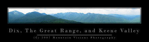


Dix Mountain, Great Range, and Keene Valley (bite size)

1. Great Range Traverse, High Peaks Wilderness, Adirondack Forest Preserve, NY. The Adirondacks are generally not the type of mountains you can string multiple summits together, but the Great Range makes up for that. The elevation gain and distance are very similar to the Presidential Traverse in NH, with one exception, on the Great Range elevation is gained and lost in massive chunks over just half the trip, while the Presidential Traverse spreads it out quite evenly over the 20 miles. The minimum Great Range traverse is 22 miles long and gains and loses 18,500ft. 11.5 miles are along the spine of 9 peaks over 4,000 feet in elevation. Over those 11.5 miles just under 15,000ft is gained and lost. Because of trail head relocations and the loss of a loop option, very few people actually start at the true start. The true traditional traverse adds 2 smaller peaks, as well as the unofficial but spectacular Pyramid Peak (which is technically considered part of the Gothics, and in my opinion one of the top 5 views in the Adirondacks). The total for the true traverse is 22 miles and 19,700ft gained and lost. For the hard men and women, a slightly more contrived addition of Mt Skylight can be added making the hike 23.2 miles with over 21,900 feet of gain and loss.

In the winter the Range has an almost 0% success rate because the steep slopes and deep snow drifts are ordinary facts. Generally speaking, even the most fit hikers and mountaineers would have trouble doing the Great Range in mid winter due to the deep snow and short durations of good weather in the alpine zone. Some of the trails in winter border on technical mountain terrain, with slopes steep enough that run out falls are entirely possible. In the summer, it is water that becomes a limiting factor high on the Range.

Summary of ADK Range options:

1) Traditional traverse (includes Rooster Comb, Hedgehog, and Gothics): 22 miles, 19,700ft G/L
2) Short traverse loop: 22 miles, 18,500ft G/L
3) Long Traverse (includes Gothics, Skylight, Rooster Comb and Hedgehog): 23.2 miles, 21,900ft G/L
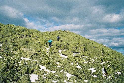

In The Mountains of NH, Men are made.
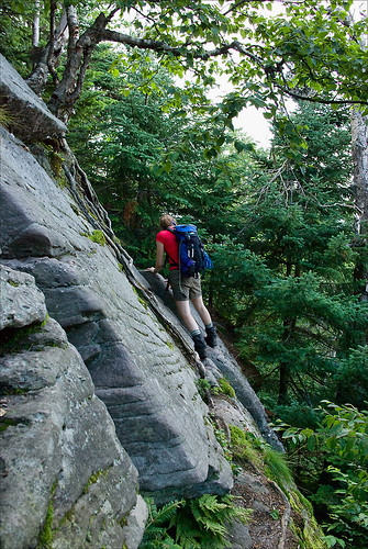
Descending Mt Adams summit cone, Northern Presidential Range, NH.

2. Presidential Traverse, Presidential Range, White Mountains, NH. The Presi Traverse is perhaps one of the most difficult hikes possible because of the weather. Although much of the trail has good footing over trails like the Gulfside and Crawford Path, nearly 15 miles of it is exposed above treeline and susceptible to some of the most consistently dramatic weather on earth. So consistent is the drama, that it is as inconsistent as you could ever dream of (you know, like an enigma wrapped in a Pandora's Box). Weather aside, the full traverse (including all summits from Madison to Webster) still involves over 23 miles and 19,000ft of gain and loss. Assuming you climb all the summits and leave the well footed trails on the spine of the range, even if the weather is perfect, a true rarity, your feet will most likely feel like you beat them with a meat cleaver at the end of your hike.
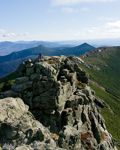

Franconia Ridge, White Mountains, NH
Franconia Ridge, Pemigewasset Loop, NH. Mt's Liberty and Flume prominent in background.

3. Pemigewasset Wilderness Loop, Pemigewasset Wilderness, White Mountains, NH.
The Pemi loop is longer than all the rest by almost 10 miles, but it has a unique (dis)advantage of having several miles of hiking done on an old railroad grade. This loop is really more about mileage than any of the others, but the scenery is so spectacular I had to include it. The basic Pemi loop gained and loses 19,400ft over 31.5 miles. The book time for this hike is a mere 20 hours, and that assumes you are hiking it in sections. However, the grades are less steep then some of the other hikes on this list, and the bulk of above treeline hiking is over one of the most heavily used and well footed trails in the White Mountains. While the Franconia Range does take the brunt of bad weather and high winds coming from the east, you spend significantly less time above and significantly more time close to the edge of treeline for weather to be an overwhelming factor in success or failure of this trip in comparison to the Presidentials, or even the Great Range. That said, many people have under-prepared for this trip, had to drop off tens of miles from the trail head and beg for a ride, or worse walk 20 miles over highways and roads to get back to their car. I've read many a trip report of people sleeping in ditches on the side of I-93 because of poor preparation and fitness. It's fine line between moving fast and light, and being under-prepared on this loop as a day hike. While the Pemi is the biggest mileage hog and least technical hike on the list, it isn't without it's aesthetic bonuses. The Franconia and Bond Ranges in themselves are among the most heavily hiked, and most beautiful ranges in the Northeastern US. Combining the two over a very long day in the mountains makes for a phenomenal double marathon like adventure.

Options for the Pemi Loop:

1) Minimal Loop: 31.5 miles, 19,400ft G/L
2) All Spur Summits Loop (includes Galehead, North Twin, West Bond): 36 miles, 21,000ft G/L


Climbing Out Of The Col
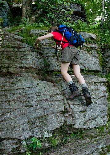
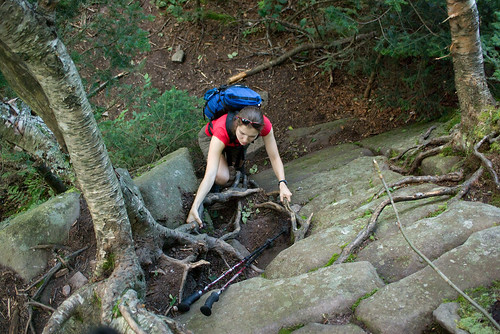
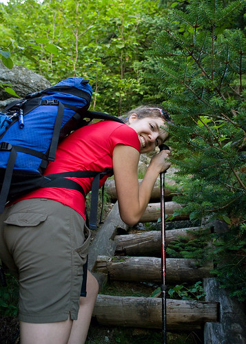
Ascending Slide Mountain on an exposed slab from the Cornell Slide Col, Burroughs Range, NY.

4. Burroughs Range Loop, Slide Mountain Wilderness, Catskill Forest Preserve, NY. The Catskills are actually a rugged eroded plateau that would look more like the high desert of Arizona and Southern Utah if the mountains were devoid of trees. The Burroughs loop is a ~13.5 mile loop, originating at Woodland Valley in the heart of the Catskills. The circuit ascends the spine of a range of 3500+ft peaks that include Whittenburgh, Cornell, and the Slide Mountain (one of only two 4000ft peaks outside of the Adirondacks, and the highest in the Catskills). The basic loop has a gain/loss of nearly 10,000ft. However, there are two optional ways to naturally extend the trip:

1) do an out and back spur to Panther Mountain adding 5 miles and 3,000ft gain and loss. Making the total distance 18.5 miles and 12,500 gained and lost.

2) spotting a second car at Fox Hollow trail head and hiking over Panther Mountain adding 6.25 miles and 4200ft gained and lost. The later makes the hike a total of 14,000ft over 19.75 miles, but also eliminates one of my favorite things about the Burrough's, the fact it is a true loop with a campground start!  Yes, you can wake up in your tent at 7am, hike the Burrough's and be back at your campsite eating a gourmet meal later that evening.

With even the hardest option on the Burroughs still being significantly easier than either the Great Range or the Presidential Traverse, should the Burroughs make 4th on this list? Absolutely. This isn't purely about difficulty or distance or elevation, it's also about the aesthetics of the hike. The Burroughs is significant for the fact that outside of the alpine regions of NY, VT, and NH, this is in my opinion the most scenic, fun, and historically significant hike that would probably please both the hard men and women who merely enjoy suffering on the trail, and those just looking for a fun challenge while still being able to enjoy themselves. Doing the minimal loop gives you unparalleled 360 views from various vantage points of the entire Catskill Forest Preserve. Beyond that, the Burrough's loop also includes enough steep climbing and scrambling to keep most hikers who prefer technical hiking terrain happy with plenty of chances to use their hands. Besides, how many great loop hikes of this magnitude start and end at a state run drive in campground?
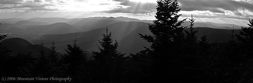

Catskill Mountain Highs...And Lows!!!
View south towards the Ashokan Reservoir from Sugarloaf Mountain, Devils Path.

5. Devil's Path, Catskill Forest Preserve, NY. The Devil's Path is consistently rated by backpacker as one of America's hardest day hikes. It's over 25 miles long, and while it can hardly be called traversing the spine, it certainly is a direct path over many of the higher peaks in the Catskills. The DP gains and looses almost 20,000ft over it's length, much of it is lost in giant chunks of a few thousand feet at a time as it dips from long flat 3000+ foot summits down into steep narrow hollows (commonly called passes or gaps out west) and immediately reascending the next mountain without any drawn out approach. Along with the challenging ascents and descents, the DP also shares similar rugged hands and feet terrain as the Burroughs Range loop. Scenically, however, the Devil's Path simply isn't on par with it's neighbor, and for this reason it falls to 5th place on my list. Most of the scenery on the Devil's Path comes on the eastern half, and in my opinion, it is largely unspectacular from Mink Hollow onward making the entire second half of the hike fairly monotonous, and much more of a grind than it needs to be. In terms of shear difficulty, however, the Devil's Path could easily rank in the top 3.

For those that prefer even more technical hikes without all the unnecessary miles on the trail, keep on the lookout for a followup of my most challenging "They Call THAT a Trail" hikes.

If you have an alternative to my top five feel free to drop me a comment or send an email!
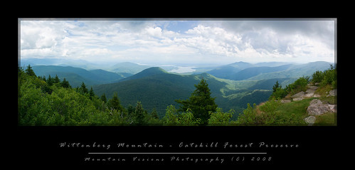
Saturday, January 10, 2009

The Burroughs Range...Deliverance In The Catskills!

"The works of man dwindle, and the original features of the huge globe come out. Every single object or point is dwarfed; the valley of the Hudson is only a wrinkle in the earth's surface. You discover with a feeling of surprise that the great thing is the earth itself, which stretches away on every hand so far beyond your ken." -John Burroughs

The Burroughs range can be summed up in a few words…The classic Catskill hike!!!!

I can and will go on about what makes it so great, but the fact is, I cannot think of a better introduction or finale to hiking the Catskills.

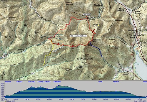
The Burroughs Range covers +/- 13 miles, and about 10,000 feet gained and lost. It summits three 3500 foot peaks including the Catskills highest, Slide Mountain at over 4000 feet, Cornell at 3870ft, and Wittenberg at 3790ft. The loop can be done as a long day hike that even a weeble-wobble, his string bean wife, and aging mutant dog can complete, or you can break it down into a backpack at a more leisurely pace.

Sometimes breaking hikes down into backpacks can be advantageous, but when you consider that you have to carry about 2x as much weight on a backpack as you do on a day hike, plus you have to set aside time find a suitable/legal camping spot, time to set up and break down camp, cook, etc, you don’t necessarily have any more time, or an easier time.

That said, the Burroughs can make for a great 2-4 day backpack. With the only issues being that there are several spots that require some difficult climbing up near vertical faces and even a spot where you must traverse an exposed ledge and then climb up either a face or a crack. In winter I believe there is a rope here, but in warm weather it must be free climbed.


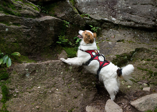
I very rarely have to help Caney climb anything that is blazed as a trail, and on the Burroughs I needed to help him three times. When you consider that he only needed help a few more times on what I consider the roughest and most fun blazed trail in NH (and perhaps the Northeast), a trail that states it is not recommended for dogs, this should be some indication of the ruggedness of the Burroughs Range.


However, if you are like me, and you think you think that hiking is more fun when you get to use your hands, then the Burroughs Range offers just enough challenge and excitement to keep a smile on your face.


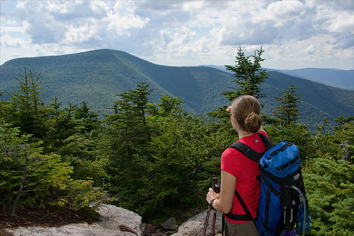
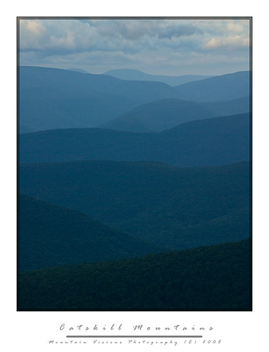
While the Catskills technically have no bald summits, the looping nature of the Burroughs Range traverse and its various exposed ledges and view points allow for nearly 360 degree views of the Catskills and beyond.

After getting chased out of NH on account of torrential rain, which can be best summed up by the NOAA weather radio reports, “we are experiencing a brief period of drier weather after 2 weeks of sustained precipitation, following this dry period continued and prolonged periods of precipitation will resume.”


Let me just say that in the days we were in NH, among what is colorfully called the “dry period”, it was anything but dry. Generally I don't run from rain, but when dry is an inch or two of rain over a few days, I'm thinking we should be building an arc rather than hiking.

When we got back home, I watched the radar for the Mount Washington region, and the radar wasn’t green or yellow, but largely orange and red, meaning severe thunderstorms. However, in the Catskills it was forecast to be cooler, drier and free of rain.

Normally I wouldn’t take a trip to the Catskills with so much time off, but the truth was I just wanted to escape the rain for a day while doing something challenging. We arrived at the trail head with no signs of rain at around 10:30am.

Aim was naively confusing us for fast hikers, and came up with a brilliant idea that if we finished our 15 mile endeavor by 6pm, we’d have plenty of time to drive down to New Paltz and get Poutine and nachos at P&G’s.

Long story short, we didn’t quite make it out by 6pm, or 8pm, or 10pm, or 12am. It was nearly 1am when we arrived at the car. Now, to be fair, we didn’t exclusively hike for 13 hours. And we did have a wrong turn that erased my shortcut.

We actually spent about 30 minutes on top of Wittenberg, and we also looked at all the campsites in the cols, for future planning of a backpacking trip.


All in all we probably ended up blowing 1-2 hours messing around, filtering water, taking some ground level macro shots, and other assorted stuff I cannot describe in a PG-13 rated blog (other than to say the flatness of a certain potential secluded campsite was well tested)!!.


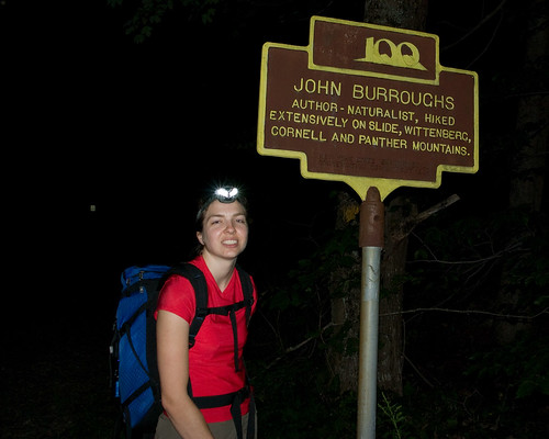
I’m sure you are still wondering what makes the Burroughs Range so special. There really isn't any singular aspect, rather it's the ability to string together 3 Catskill 3500 footers (4 if you go for Giant Ledge and Panther), a bunch of impressive views, some rugged hiking, and a long hike into a non contrived day in the mountains. Moreover, the range is named after the great American naturalist, conservationist, and essayist, John Burroughs, who spent much of his life in this area.


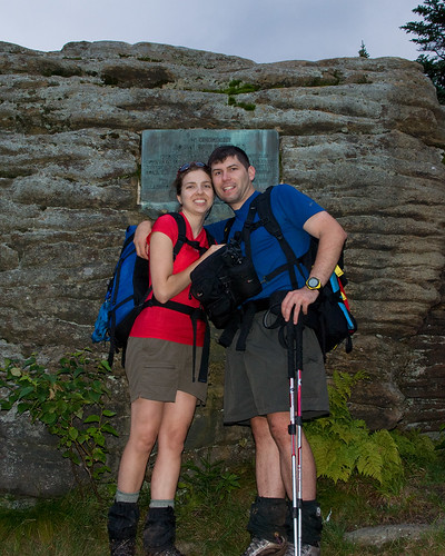
New England has Thoreau and Walden Pond, and New York has John Burroughs and his Slabsides. The summit of Slide Mountain makes special note of John Burroughs importance to both this range, and of course to the American conservation movement in general with a plaque that reads:

In Memoriam

John Burroughs

Who in his early writings introduced Slide Mountain to the world. He made many visits to this peak, and slept several nights beneath this rock. This region is the scene of many of his essays.

“Here the works of man dwindle.” In the hearts of the Southern Catskills.

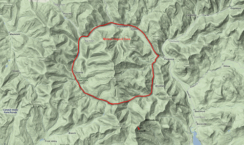
Perhaps the most interesting thing about the Burroughs Range is the fact that it surrounds the epicenter of a meteor strike As you look at a terrain map of the range you will see that Esopus and Woodland Creeks form a circle around the range, dead center of this impact site is Panther Mountain. It’s hypothesized that Panther Mountain rose from gas being forced up. Yes, rather than a crater, the impact site of this meteor actually formed an inverted relief crater.

Burroughs Meteor by you.

During the middle part of the 20th century the mountain actually had a gas pipeline that produced considerable gas output, but in that time energy was not nearly as profitable as it is today. NY is a huge gas producing state, and has many reserves that are on state owned land and not currently tapped. These reserves are currently the source of worry and debate among environmentalist, since it is well known that drilling and removal of gas and oil is not without impact. As such the government of New York has been noted to be preparing a plan to deal with the inevitable demand to access these reserves, while balancing the environmental impact.

The gas pipeline of the 1940s, however, served a greater role than energy alone. The drill cuttings, which were saved by the NY State geological survey, were tested for ore found only in meteorites. The test, along with other data, confirmed that a meteor about 1Km (1/2 mile) hit the site.

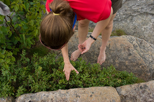
While on the summit of Wittenberg, a summit we had all to ourselves for most of the 30 minutes we spent up there, we found blueberries to supplement our lunch. I was shocked there were still berries left on this popular summit this late in the summer. I suppose all the city folk are too shy to pick some berries while hiking, too busy breaking glass bottles, and writing their names on the summit stone.

One thing we noticed almost immediately was the view down to the reservoirs was a bit strange. After all the rain we have had the reservoirs seemed to be low. Not long after this hike I read that NYC expects the reservoirs to not meet demand of city water consumption in the next few decades (or sooner) and desalination plants will be required for the first time in NYC history.


While this doesn't fully surprise me, the cost of these plants is staggering, and no doubt will put another strain on the City of New York financially after a few hundred years of essentially free water, and perhaps the best pure water supply of any major US city. The flip side of course, is NYC has been a terrible steward of the land surrounding the reservoirs, and ultimately is getting what it deserves. It's appalling to me that a city who's very existence depends on the clean water from upstate reservoirs has been so indifferent to protecting these water sources.


From the time we left Wittenberg the views were intermittent, but never quite as broadly spectacular as the broad 245* vista seen from Wittenberg's east summit. Of course often the smaller view points that followed offered a more intimate look at some of the more wild areas of the Slide Mountain Wilderness.


We were in the mid afternoon when we were descending into the long col between Cornell and Slide and about halfway through the 13 mile hike.

Cornell is a typical Catskill summit in that it is essentially a plateau with possible views from ledges off to the sides of the trail. There was no true summit viewpoint, but several spots close to the summit offered nice views into the Slide Mountain Wilderness, both towards Slide and back at Wittenberg.

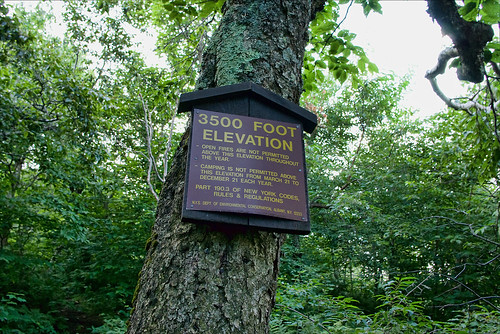
The col between Cornell and Slide is a rarity in that it's long but generally flat (in terms of mountains, not plains). It straddles the 3500ft mark, which for the Catskills is a zone of protection. For 9 months per year there is no camping above 3500ft to protect the much more fragile plants and soil higher up on the mountains. In winter, camping is allowed at all elevations, however, the col often legally dips just enough below 3500ft to offer camping in all seasons and a few of the best campsites in the col seem to be right at the 3400 foot mark.

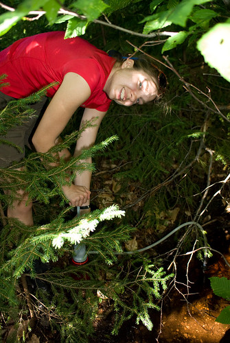
Better than legal and somewhat decent camping, is the fact there are several water sources. The Catskills are somewhat rare in the fact that springs are often found high on the mountains, and the Burroughs Range does offer several spots to fill up, even in summer. One thing I noted though was that while the trail maps show several springs, we only found one reliable spring. This is a bit concerning since most guides note the springs are reliable, and this was a wet summer. It's possible we missed a spring, but since our goal was to mark these points on a map for future reference I'd be even more skeptical a less observant group would do a better job finding the springs.

One thing I'd like to address is something that appears to be becoming more and more of a problem. People seem to believe that since they do one or two backpacking trips a year, most likely not to the same spot, that leaving a pile of non degradable trash is acceptable practice. I guess they assume in a year or two when they return it will be gone and no harm done. The problem is those that follow you in the near future are going to a location like this col, to get away from the world, to escape things like trash and litter, and as they hike into what they assume is a wilderness campsite miles from a road after hiking thousands of vertical feet, they are greeted by a pile of MREs. Worse, this trash is a nightmare to carry out, and not many people have the desire to carry out a few smelly MRE packages over a few miles.

Why in God's name anyone thinks taking MREs on a backpacking trip is a good idea is beyond me. Sure they are easy to prepare, but then so are Ramen Noodles, or a freeze dried dinner. Yet, MREs are heavy, bulky, and when you are done there is a large pile of waste that needs to be packed out.

After crossing the col we began the ascent up Slide Mountain. Slide is the highest mountain in New York State not in the Adirondack Forest Preserve, and it's one of only two 4000 foot mountains not located in the Adirondacks. While Slide is the highest mountain in the Catskills it's still not above tree-line. And the summit itself has very limited views. Like many highest peaks, it's by far one of the least impressive, although, the hike up to it's summit from the Cornell-Slide col offers some nice views and an amazingly cool and clean spring! This was in my opinion the best spring on the whole hike, and much appreciated after 8 miles!

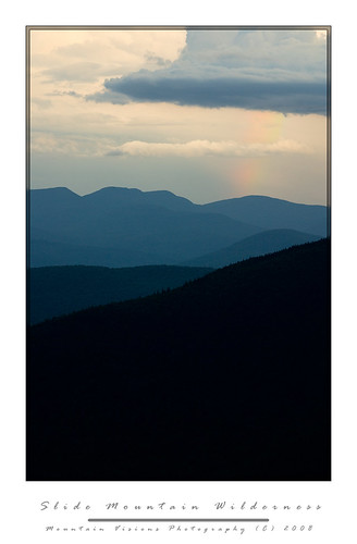
Before we reached the summit of Slide the weather looked to be changing for the worse, a cool wind, and stormy skies appeared. The weather radios were silent but the sky definitely looked as though a severe thunderstorm could roll through at any moment. Of course this severe weather is often leads to the most impressive views as it rolls over the mountains. As we climbed the stairs and ladders up the final few hundred feet to the summit of Slide, Aim commented on the rainbow out in the distance. Finally, I got to a spot with enough line of sight to pull out my 3lb carbon tripod, and mount the 55-300 and shoot the distance landscape. Unfortunately the rainbow never really became more visible, and after 15 minutes of waiting, it was clear to me that I'd run out of light long before I got a good shot. I packed up, and caught back up with Aim and Caney just below the summit.

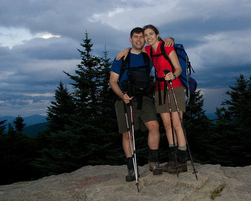
On the summit of slide we took the usual summit photos, and made some Carnation Instant Breakfast which I've found is a great way to both hydrate and get some quick nutrition on a long hike. I put as much of my gear into my pack as I could fit, still expecting the storm to pound us. Oddly though, despite the ominous skies, and thunder rumbling we never had more than a drop or two of rain on this long day.

The hike down the west side of slide offers a few off trail view points which we caught the setting sun out to the west. The trail is essentially a wide old road bed (or seems like one), I always refer to this path up the highest peak in the Catskills as the ladies route. It's generally well graded, and not too rough. Although while the trail is not steep, the footing is awful in the warm weather because of the typical Catskill slate and scree, which begs you to take a mistep and roll an ankle. Sure enough, after a full day of hiking, I found myself on my ass more times than I cared to count. In the winter this route is incredibly easy and it's no surprise that it's one of the most heavily hiked trails in the winter months. With snow cover, all that ankle breaker slate becomes a non issue, and if the trail is already broken, you can often make better time ascending Slide Mountain in winter than summer.


When we reached the Slide Mountain parking area it was well past dark, and well past our hoped for exit time, P&G's in New Paltz was now not in the plans, but since this part of the hike was new to me, we had other problems.


I'd read a few trip reports were people accessed a DEC right of way to cut some of the road walking off and also reduce some of the descent and re-ascent. Finding this was easy as pie, since it was just north of Winnisook Lake, although it was so easy that we naturally thought we were in the wrong spot. So after pulling the map and altimeter out, we proceeded up the forest road bed.


About 45 minutes later, including a 15 minute stop to change my socks (which is a real treat after a long day of hiking), we arrived at the intersection of the actual trail we would have been on if we'd continued down the paved highway, and regained the trail. We cut 500 feet of the hike and about ½ mile. Unfortunately we would give that 500ft, and perhaps a full mile back in short order.

Aim, who can actually read a map just fine, decided that the non green shaded area and old woods road that passed through it was a viable shortcut for us. After all it was now 10pm at night, 12 hours of hiking in the books, and nothing more to see. We were tired, hungry, and ready to finish this up. For whatever reason, just like the time we did Crane Mountain in April, without snowshoes and post holed 2.5 miles back to the car, I blindly followed her at the ~12 mile point of this trip.


This is one of those stories that will live in infamy. We timed the road intersection brilliantly using my altimeter, and we started down the road as happy as can be to be knocking off about a mile of the hike. As we walked down the road it became evident that one of two things was the case. 1) the whole road was private 2) one side of the road was private but the other was state land.


Me being the optimist/realist was hoping for the later, so despite the signs becoming increasingly more aggressive and less and less open to interpretation in their meaning we kept going (as if “Take Another Step And You Will Die Maggot” requires a 800 verbal SAT to figure out). All the signs seemed to be in the middle of the road, or on the right hand side of the road. But about 10 minutes down the road, the first signs on the left appeared, and they weren't friendly. So at this point it was evident we were trespassing, and evident that these people watched the movie Deliverance at least a few dozen times.

So, not wanting to walk back up the road, which was UP and curved away from where we ultimately were en route to, I decided that if we could spot the road, that we should go for it. You know, like when people would try to jump the Berlin Wall and get to the west. Of course the Beware of Dog sign was intimidating, as were the barking dogs. But more intimidating was the frequent “Beware of Large Trained Attack Dog” or “Beware of Pack of Large Attack Dogs” signs that seemed to be more frequent and with larger lettering, and I should mention, those were the signs that I can speak kindly of, there were a few others that said things I refuse to write about!


So after some time, certain I was either going to die, or go to jail as they fed Caney to a pack of wild dogs, I ran like hell back to the road, and we hauled up the road like we were on mile number 1 of this adventure. Quite frankly I didn't know Aim could run that fast, because certain she was dead I just kept running, but when I got back to precious state land, she was right behind me.


So rather than take a shortcut, we were now 45 minutes behind where we should have been, at least 500 vertical feet and 1 mile over the actual hike distance, and still about 1.5 miles from the trail head.


One thing I never see mentioned in the Burroughs Range trip reports is the final “Stairway To Heaven” it is an exercise in futility as you come close to the end of the trail. It’s probably 30 steps spaced at about a few feet apart, and each one goes up about 2 feet. At the end of 14 miles of hiking, where the trail map shows a fairly flat stretch to the car, this is demoralizing.


As we hiked down to the base and finally up this “Stairway To Heaven” I realized I was actually out of food. I almost never run out of food on a hike, but this time I was out, water was almost gone too, and I was tired. We sat on the rock steps, cursing the trail crew for what was actually incredible work, but surely this little incline should have been visible on the map. Surely someone should have mentioned it. It wasn't that it was all that hard, no, not even after 15 miles, but the fact that no one ever mentioned it was a bit shocking.

The whole trip took us about 15 hours to cover about 16 miles and around 11,000 feet gained and lost. It was by far the longest day hike Aim and I had done in some time, perhaps since the Butterfield Trail in Arkansas back in 1998, although while the Butterfield was about as long, it perhaps gained and lost no more than 1/3 the elevation of the Burroughs Range.


burroughs hike

Definitely the classic Catskill hike, complete with the usual Serpico mishap and added adventure to make it a classic day in the mountains!


Blogged with the Flock Browser