


 |
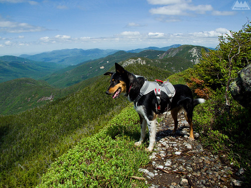
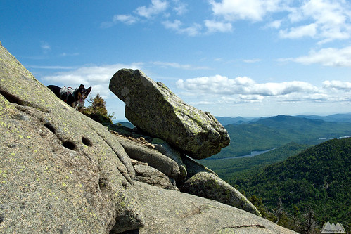
| Colvin on the northern descent of Basin Mountain with Saddleback and the Gothics in the background. |
I’ve always felt that people who have experience technical rock climbing (on real rock) tend to not have issues on rough sections of trail. For those people, the featureless rock that hikers see is filled with giant “jug” holds for the hands and feet. The southern approach of the Adirondacks Saddleback Mountain via Basin Mountain is a great example of this.
If I haven’t made it perfectly clear throughout the years, I avoid the High Peaks like a case of syphilis -especially during the warm months- and I pick my winter forays with some care as well. So quite often, my experience in the Adirondacks High Peaks Wilderness is one with a winter perspective. As a matter of fact, I’ve been up Marcy several times, but never when there wasn’t multiple feet of snow on the ground. I have no idea how hard the trail is in the summer, though I assume it’s pretty beat up and rough due to how often it is climbed.
Suffice it to say, I’ve never climbed the south face of Saddleback via Basin in all my years of hiking during the summer months, though I have been up Saddleback in the winter on several occasions.
How is it? Absolutely fun. It’s probably the best trailed hiking in the Adirondacks. Steep, technical, but the hard sections are either too easy or too short to really make you say, “wow, that was hard.” Add in the fact that Colvin isn’t Caney on the steep and technical sections; he doesn’t love climbing steep technical rock like a mountain goat or dipping his front nails over the edge of 1000ft cliffs. I note that because my difficulty rating includes assisting Colvin. These were generally short boost followed by encouraging and challenging him to climb the correct route. Nevertheless, they were an additional level of effort that most human hikers would not need to put out, unless they were climbing with children or novice mountaineers.
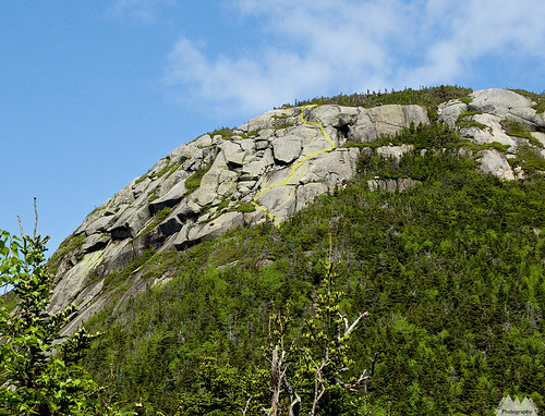 |
| Yellow line indicates the trail routing. |
I’d rate the hardest sections as low 5th class (upper 4th to 5.0-5.1 type terrain), and while there is a risk of a long fall (or rather slide), it’s not what you’d call exposed. There is never more than a few feet of air under you, or 30ft of super grippy slab below you. Steep it is, treacherous it is not. I’d personally rate something steep and treacherous, if while on it and assisting a 50lb dog, I felt any sense of fear or worry that we were getting ourselves into something that might be difficult to get out of. Perhaps I don’t have the common sense to feel that fear, but based on the amount of times I’ve shit my pants leading technical rock climbs, I’d say I am often too aware of what can go wrong. At no point did I feel that way. As a matter of fact, once Colvin was safely on the steep slabs above the craggy lower section, I descended a bit and reclimbed it via the more technical options.
 |
| Colvin on top of Saddleback, Ausable Lakes and the Colvin Range in the background. |
I was actually a bit disappointed at how easy it really was, and I was prepared for Colvin to have more trouble with the terrain. He was wearing his Ruff Wear Doubleback technical climbing harness, and I had a 40ft 8mm static line. I never even considered breaking out the 40ft rope. Had it been steeper, I could have slung a boulder with two 10 foot tied slings that double as leashes, or wedged a frost knot into a crack to haul Colvin over the steep sections. Or just simply short roped him up the hard sections.
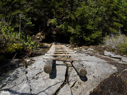 Although I enjoyed Saddleback, the highlight of the trip was watching Colvin finally get it on the 20ft ladder up Basin. Though I climbed the rungs of the near vertical ladder with with him, and held on to his assist loop just in case he panicked or slipped, he ultimately climbed the ladder without my assistance. We spent quite a bit of time on ladders a few days before on the Stimson Trail on Noonmark Mountain, and it was gratifying to see him finally get it.
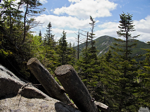
 As far as Saddleback, it was over far too fast, and just wasn’t hard enough. On the flip side, it was, almost without a doubt, the hardest climbing (on a trail) in the Adirondacks. Be careful in making assumptions though, while it was the hardest officially trailed terrain, those wanting tougher challenges that fall into the gray area of technical rock climbing and hiking can still be challenged in the Adirondacks. Just look around when on an Adirondack summit at all those wonderful expanses of bare rock, the slides. Those slides offer even more challenge, without the benefit of a blazed trail or step by step directions, yet they are generally non technical enough that specialized ropes and climbing protection can be left at home for all but the most difficult slides. Be forewarned though, having 1000ft of 60* slab under you as you approach a headwall might not be officially 5th class terrain, but it carries all the same risk and challenges.
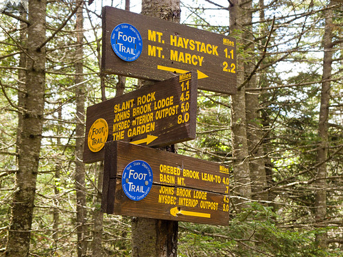 Was Saddleback worth the price of admission ($7 to park), including all the rules, regulations and crowds that come with the High Peaks? Hell yeah! But for full disclosure, I picked a good early season weekday and was on the trail at 6:50am -which was later than planned. I saw just 1 person on the trail till my last 2 miles of the day (5 people in total)! Had there been 100 people climbing those mountains, creating a wilderness conga line, I’d probably not have felt like we were on any sort of remote adventure!
 So there you go, a little more sensible perspective about the steep and fun trail over Saddleback.


