Showing posts with label forest preserve. Show all posts

Tuesday, July 14, 2026

Reasonable and perhaps even achievable goals for bikepacking in the Adirondack Forest Preserve


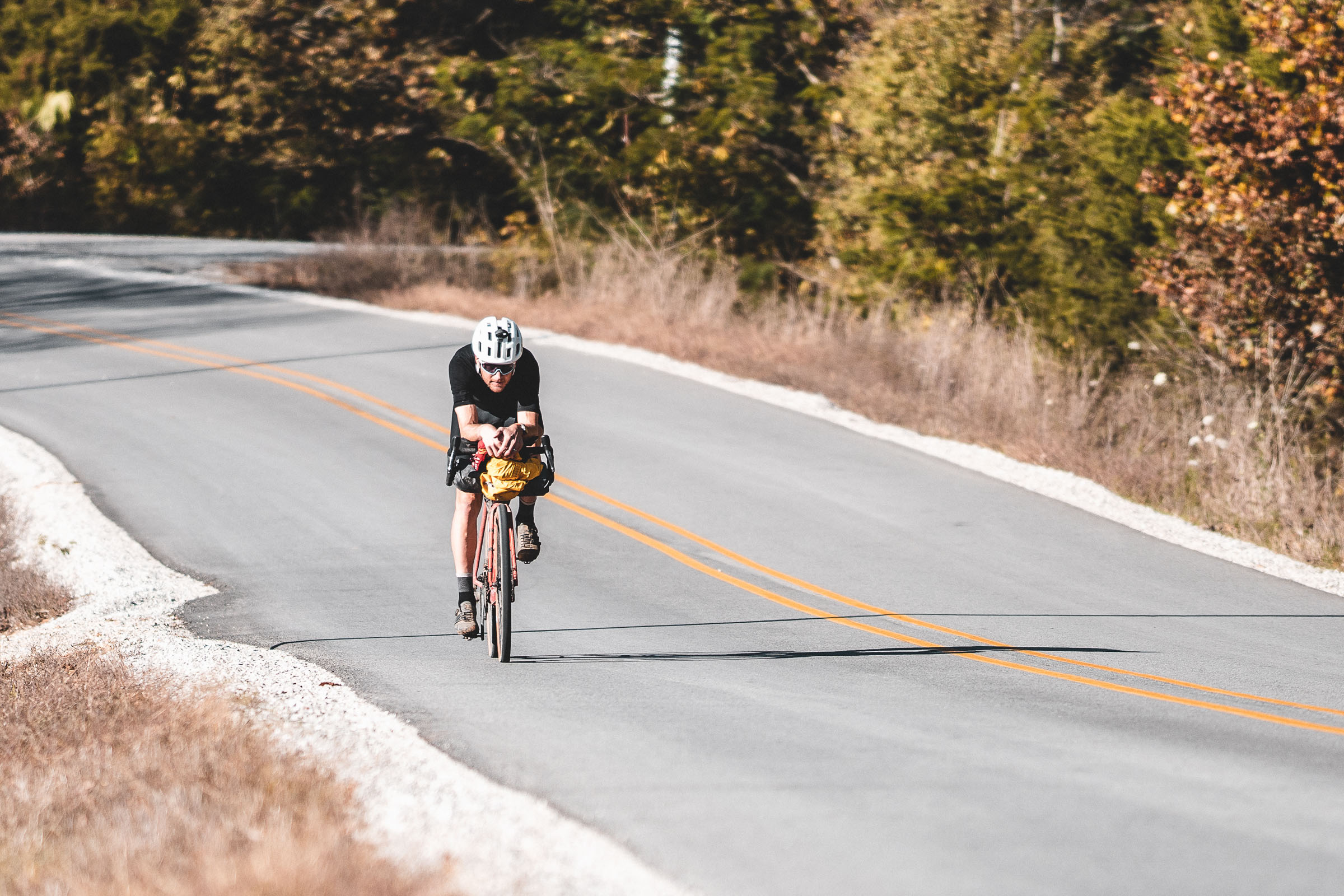
When I saw this, I thought, wow, this is precisely what we need in the Adirondacks. And this exact concept is what I personally aim to do with my exploratory rides. Map out trails that the average bikepacker can turn into a wilderness style off-road experience.

To be fair this isn't just a cycling issue, hikers need this as well.

There is really only one long distance hiking trail in the Adirondacks, the Northville Placid Trail. We can debate mid-length trails like the Cranberry Lake 50, but if a reasonably fit hiker can do it in a 2 day weekend (or an average hiker in 3), it's hardly long distance. Beyond that there are some concept trails like the NCST which has loads of road walking just to try to make a long distance trail.

Unfortunately the unit structure prevents connected long distance trails from being built because each unit needs an amended UMP before a trail can be completed (and easements need an RMP). If you know even a little about the process you know it's complicated in many ways. As a great example, you may know Lake George Wild Forest has never had a UMP. Behind the High Peaks it's the most visited single unit in the Adirondacks.

Why doesn't it have one? Well it's actually extremely complicated.

  • First off is money and resources. The DEC hasn't been funded properly since the Pataki administration and likely even then was below ideal levels, but it's never gotten better since then. At the same time the forest preserve has grown. Less money, more land to manage.
  • Second is legal battles. The Lake George unit has actually been within 1 year of finalizing a UMP multiple times and each time a lawsuit pops up.

To build multi-unit trails, you need to amend every single UMP. Seeing how tough it is to even create or amend one UMP gives you insight into amending multiple at once. If I trail were to traverse the Adirondacks, it might traverse 10+ units. Imagine trying to amend 10 UMPs all at once to build a single connected trail? It's probably not going to happen.

However, if you consider a bike can make easy work of road sections and even use them to it's advantage (resupply in towns between units), you really can navigate the unit level approach. Each unit could have a bike specific trail (ideally 2, traversing NS/EW) that traverses the unit to an egress point. What the cyclist does once they get to the end is totally up to them. But they would essentially be able to hop units creating whatever long distance route they fancied.

How is this different then what already exist? On the surface it's really not any different. However, the lack of designed for bike trails leads to unnecessary user conflicts (some made up, some real). The biggest one is that hikers suspect "their" trails are being damaged by bikes. This is both true and untrue and I'll touch on that below.

The mountain biking scene in the Adirondacks is much better than it has ever been, but most of that is dense trail systems confined to local municipal land or private land. Where the failure is at is the long distance, *"wilderness style" bikepacking. The DEC has yet to implement it's general concept for multi-use MTB trails within the forest preserve. Multiple UMP/RMP have been approved to allow better MTB access to the Forest Preserve but those concepts have never been implemented.

Some examples the Township 33 RMP (Speculator Tree Farm, where Oak Mountain is located). The Moose River Plains UMP. Speculator was approved in 2024 and the Moose River UMP almost a decade ago, complete with IMBA written concept plan for the unit. No work was ever done on the MRP beyond adding some disc to largely unmaintained trails.

In a nutshell, the concepts are this:

  • A hub and spoke model for MTB/bikepacking within the forest preserve
    • Hub: Dense concentration multi-use (but bike design) trail systems would be built around population centers or easily accessible areas. These aren't bike only trails, hikers, skiiers, and adaptive users would still have access. The bike design simply prevents erosion that is often seen on non biking trails.
    • Spoke: Longer distance "hiking style" travel trails would link to other trail systems and towns. This would allow for longer distance bikepacking routes off-pavement using the Forest Preserve. These trails would generally be existing trails that require some work to build to a multi-use standard but don't necessarily require outright new trails.

One thing it may be useful to educate the non cycling trail user groups on is that building a cycling trail to use specification mitigates trail damage by the very design. It's not anathema to the way new hiking trails are being built in the heavily traveled steep areas of the Forest Preserve (the High Peaks and surrounding mountainous units). Design matters more than use.


*I often use the term wilderness style. That's because in the Adirondacks the difference between wild forest (where bikes are legal on almost every trail) and wilderness (where bikes are not) is virtually indistinguishable to most users. Aside from that many wilderness areas were at some point heavily developed and trammeled by man. In fact, one could probably make a compelling argument that some of the most wild and least visited (most untrammeled by man today) are in the wild. This is not really any different than a wild forest with a PFAR/admin road.

Thursday, April 30, 2026

Exploring the Adirondacks by Bicycle - Bikepacking Wilcox Lake Wild Forest


With ~2 million acres of public land open to bicycles within and adjoining the Adirondack Forest Preserve, the Adirondacks are a blank canvas for exploration by bicycle. Just don't expect to ride your bike the whole time while finding which trails are rideable and which are not.

Wednesday, April 29, 2026

His Name is Marshall Church

His name, Marshall Church, loosely translated means American Wilderness. Read on for a little history lesson on why there was a continuity to my naming scheme.

Bob and George Marshall built the American wilderness movement in part based on the adventures of their youth in New York's Adirondack Forest Preserve; Senator Frank Church turned that movement into federal law protecting millions of acres with the Wilderness Act of 1964, which was heavily based on Article 14 of the New York State constitution -the Forever Wild clause.

If we peel away one more layer: It was Verplanck Colvin's surveys and lobbying for creation of the Adirondack Forest Preserve and Forever Wild that allowed the Marshall's to adventure in the Adirondacks in their formative years. The Adirondacks were in essence the birthplace of the federally conserved American wilderness and the modern conservation movement.

In total the Marshall and Church names have 3.4M federally protected wilderness acres including my favorite place that isn't the Adirondacks, the 2.3M acre Frank Church River of No Return Wilderness. However, the scope of land preserved thanks to my trail dogs namesakes (Colvin Harrison and Marshall Church) is in the millions of acres and a good part of why the US has 12% of the world's IUCN protected wild lands but only covers 6% of the earths surface.

Thursday, March 12, 2026

From a Never Bike Tourer to Bikepacking in the Adirondacks: The Full Circle Journey of Exploration and Discovery


Map of off-pavement and generally off-road bikepacking routes in the Adirondacks of New York State
Adirondack bikepacking routes I created as of Dec 31, 2025


Back in 2020 during Covid I took my bikes to Arkansas to visit family. I hadn't ridden in Arkansas in 20 years and I was excited to ride there, even if it was a long way from my old stomping grounds. I got back from a ride and a family member asked me "with all the outdoors stuff you do, have you ever done any bike touring? Would you consider it?"


Without hesitation I said, "no, absolutely not." The reason I gave was I do a lot of slow deliberate wilderness type activities and to me, riding was about going fast. 50mph descents with my hair on fire. It was about cranking through turns and maintaining a high average speed and crushing sprints where I felt the need to. Every ride was an individual time trial. I was enjoying picking off Strava KOMs (I'm a good sprinter so those flat KOMs are actually achievable) and just having fun riding. No need to burden myself with a ton of gear and turn every ride into a multi-day planning and packing event. 


Not too long after that I got more into gravel riding. Despite what the bike industry tells us, gravel isn't a new thing, when I was a student at the University of Arkansas we often rode gravel on mountain bikes, usually to bridge single track sections, sometimes to get to trails in the Ozark NF or Arkansas State Parks from campus, and after college I rode a lot of gravel on my hard tail because my back just couldn't handle the multi-use (hiking trail) single track that was the norm in New York. Plus, gravel was that sweet spot between MTB and road. It was out in nature, quieter roads, sometimes it could be chunky or even mildly technical (Vermont Class 4 roads are a great example of this), but it was still spinning gears and riding fast. 

Ted King on a paved section of the 1000 mile Arkansas High Country Race in 2020 (credit bikepacking.com)


I'm not sure how or why (besides targeted Google advertising, of course) but I saw the Arkansas High Country Race and Vermonter Ted King had won it. I thought that looked cool. They rode fast (relatively speaking), they traveled fairly light, and they looked like they were still riding hard. It erased my pre-conceptions of a bike tourer having 100L of panniers filled with heavy cast iron. In my mind, bike touring was essentially backpacking in the 1970s. Except, like backpacking, bike touring has evolved and with it came the ultralight bikepacking. This isn't much different than the evolution of backpacking where people went from cast iron to JetBoils with titanium mugs, or 10lb canvas tents to 1lb frameless tarp tents, and external framed packs to carry that load to lighter, more compact and nimble internal frame packs. 


Bikepacking is a volatile term. Sometimes it's used to blanket describe riding a bike to multiple points over multiple days. To others its covering the same terrain in the same style you would backpack. Too me, bikepacking is anywhere you NEED to use a water filter. So gravel roads or even paved roads in the middle of nowhere can be bikepacking. Bike touring is anywhere you simply fill your water from a hose, fountain machine, or buy bottles. I realize people can and will endlessly debate what it means to them, and I'm not here to tell you what it is or it isn't. That's up to you. I once debated someone that said if you weren't literally pushing or even carrying your bike for most of the trip, it was bike touring. To me, if I'm carrying my bike half the trip, I'd rather leave it home and go backpacking. I didn't buy a bike, deal with all the mechanical nuance and cost, just to need a pair of hiking boots. I want to ride it!


(credit bikepacking.com and Restrap)

So how did I get from "hell no" to "maybe I'll try it" to "I'm all in" and now creating routes in the vast Adirondack Wilderness? Well, sadly my dog Colvin, died in 2023. In his early years we did some mountain biking, but by the time I got back into riding, even though he was still bagging difficult peaks for a 10yo dog in 2020, it was too much to ask of him to ride with me. His final years were spent hiking, sometimes very hard peaks or routes which he enjoyed, and that was best for him. I'd ride on rest days for him but we focused on getting him out into the mountains and local trails as much as possible. About 7 months later in the summer of 2023 I got my next gen trail dog, Marshall. By 2024 I realized this was the time to get back into mountain biking and off-road bikepacking and make use of Marshall's endless energy. He is my first truly high energy dog in the sense he doesn't have a chill switch. It's go, go, go. 


My name is Marshall...You have a small window (about 5 years, ages 2-7) to ride hard with your dog. Hard? This absolutely doesn't mean abuse them with overuse, it just means where they can ride* day to day and recover optimally. Where riding at 20mph for short stretches and 15-30mi days are not pushing them to the limit. After that window you need to start considering the dogs recovery much more, mayber sticking to more technical single track where you are riding much slower and even moving on to a cart and bike touring. I will say people tend to overthink how fast a MTBer is riding. Typically average speed is under 10mph for the day, usually between 6-10mph for single track trails. That is a 6-10min mile, and trust me, your dog isn't working that hard in proper temps running 10 min miles over a typical 10-20mi day if they are already properly conditioned.  A 10min mile is 250min or about 4 hours of activity over an 6-8 hour day of riding if you stop and smell the roses, filter water, go for a swim, and take some photos.  Again, not a serious strain on a properly conditioned dog in the optimal age range. Add in a backpack like the K9 Sportsack and you can ride probably around 40-45mi on the high end if you bag the dog for long gravel descents, pavement, and long flat stretches of gravel. 

*when I use the term ride, I'm riding and the dog is running or the dog may be in the Sportsack, but he's never at the wheel, my dog training skills only go so far and he loves to run as much as I love to bike


Well, that is the backstory on how I got into bikepacking and why I began developing routes in the Adirondack Forest Preserve. I'll be posting those routes here along with maps, route GPX, photos and trip reports. 


As a side note: I've gotten some mild natured hate from some gate keepers in the Adirondack cycling community. Don't ruin a good thing for us was the consensus. But I promise you this, in 3 years of Adirondacks bikepacking, mostly on weekends, I have NEVER seen another cyclist either day riding or bikepacking. NOT. ONE. What that tells me is not only are ADK backpackers a secretive bunch (afterall, to get mad means you do ride, but to see no evidence means you keep it quiet), but they may not even exist at all in numbers necessary to prove they do. I guess what I'm saying is I understand the sentiment but I don't believe sharing my routes is going to change bikepacking in the Adirondacks dramatically in the near future. And if it does long term, it will likely mean better infrastructure and more potential route terrain. I do, however, hope it changes the anti-bike culture in the Adirondacks which is sort of ingrained in people due to the Forever Wild wilderness ethic that permeates folks who know of and love the Adirondacks. 

Saturday, September 24, 2011

Long term consequences of improper streambed reconstruction in the Adirondacks post-Irene

Stream reconstruction on Styles Brook. Jay, NY. All photos courtesy Adirondack Council.
The Adirondacks are unique in concept and design, and because of the very nature of the patch work of public and private lands, the suspending of the permit process following Irene was both necessary and dangerous.

While people refer to the Adirondacks as a park, they really are nothing more than patches state forest preserve co-mingling with perhaps the nations most regulated zoning laws on private land.

Gulf Brook. Keene, NY. 
This, however, is a problem because, perhaps, no where else does there need to be such a fine balance between the needs of the people that live and work within the blue line and remaining true to article 14 of the New York State constitution. The the APA and article 14 are perhaps an impediment to life in this region, but they have prevented the Adirondacks from becoming another Catskills of the state. The idea that regulations have hindered growth is foolish, rather, they have made the Adirondacks relevant to both tourist and exploiters alike. They have also made the Adirondacks relevant in the hearts and minds of people from all over.

When Governor Cuomo announced a suspension of APA permits for rebuilding, I winced. Not out of selfishness, no doubt did cleanup and rebuilding need to be swift and without "unnecessary" red tape, but like with anything in life, it needed to be done correctly.

Following that bold announcement, the DEC did enact detailed guidelines, but many towns and DOT divisions either didn't receive them or chose to ignore them. It's human nature to be given a long leash and stretch it as far as you can.

At issue is the fact that permitting processes have not been entirely suspended. Water quality standards are still in effect. Dredging and channelization should only be occurring where there is "imminent threat to life, health, property, the general welfare and natural resources." The straigtening of channels and other man made changes to various brooks and rivers is actually potentially a threat to human lives and property, under far less intense conditions than Irene brought.

During Irene, nature showed us how in control it still is despite our technology and repeated attempts to control it. The DEC, despite budget and staffing cuts, still employs many intelligent and passionate people capable of making correct decisions necessary for long term success. Many of those people live, work or recreate in the towns affected by Irene flooding, and they certainly do not want to hamper the process of reconstruction and flood prevention. So it amazes me that the town supervisors and residents are so gung-ho about ignoring APA-DEC warnings and doing their own thing with the idea it can be fixed later.


Roaring Brook, now a ditch with water.
Fixing it later means fixing it FOLLOWING the rest of this years tropical storm season and next springs melt off. Fixing it correctly the first time means less chance of future flooding from insignificant rain falls. Remember this storm was a 500 year flood, not a regular occurrence, even in a region that is one of the wettest in the US.

Unfortunately, the towns and DOT divisions are intent on assuaging the fears of the residents -whom are also their constituents. However, to even have a shot at protecting those areas from Irene like flooding ever again, it is estimated some water ways would have to be 20ft deep and 200ft wide and constantly redredged. This simply isn’t practical, and the state would be better off relocating those residents and businesses within the 100 year flood zone to a different location. Furthermore, even heavily controlled waterways still are subject to flooding. Quite simply, water doesn't play nice with human interference, and trying to make it do so is only going to lead to bigger problems.

Entirely forgetting about the potential environmental impacts of improper stream bed restoration, which include reducing or eliminating trout habitat  and preventing tree regrowth on the banks of these brooks and rivers. Historically we've seen what bad flood control projects lead to, just look at Katrina. The Army Corps of Engineers is often at fault for massive flooding due to poor engineering and planning. It’s entirely possible that these poorly engineered flood control systems and stream reroutes that the DOT is doing, could actually cause flooding issues on much smaller floods than letting the streams naturally flow, or at most reverting them to pre-Irene state.

I sincerely hope these towns in the Adirondacks aren't attempting a quick fix, only to deal with bigger problems in a few years!


-
-
The Adirondack Councils statement of concern can be found here.

Friday, September 9, 2011

Scars of Irene on the Adirondack backcountry

This video is from the Adirondack Wild Center based in Tupper Lake, NY.

The aerial and ground based HD video is pretty compelling in both terms of destruction and the natural beauty of the Adirondacks. While watching it I couldn't help but be reminded why no matter where I am, I always seem to compare it to America's first wilderness -the Adirondacks.

Combined with the still images of the backcountry from the previous post, this should really start to put together the pieces of the puzzle that merely reading written reports left us unable to do.

Also of note, it appears this video was shot several days after the initial destruction, so things look pretty clean and orderly in the towns, in spite of the level of damage. Much of which was caused by relatively small streams jumping their banks. In Keene it was Gulf Brook, a stream that is less than 20ft wide most of the year, and that you can almost jump across in many sections just a few miles from Keene.

Those watching this from other parts of the country or world should be aware that the video covers a very small section of the New York State Forest Preserve, mainly the Eastern High Peaks Wilderness and surrounding towns. Though this is the most popular part of the Adirondacks, there are millions of acres that were largely unscathed from Irene, and also offer tremendous scenic beauty.

Wednesday, June 22, 2011

Hating on the Adirondacks infamous Shorey Shortcut

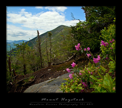
Mount Haystack - Adirondacks, NY
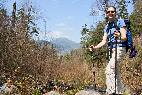
Spring views of Mount Haystack from the Shorey Shortcut

By Adirondack -and Northeastern US- standards the Shorey Shortcut is a pretty tame trail. No mud pits to wallow in, bogs to wade through, or talus fields to hop over. No 1000ft dry slabs with (unecessary) cables or steep muddy runout slabs without cables, and no viscous scrambles through boulder fields with rocks the size of houses. Yet, this trail is infamous- perhaps even hated- throughout the hiking populous.

Barbara McMartin, in her Discover the Adirondacks guide book series, hates on the trail. Barbara wasn’t exactly an explorer confined to the most well footed trails. Her guidebooks are filled with adventurous, off the beaten path and often trailess hikes that are devoid from many guidebooks. I should note, Barbara was a damn good descriptive writer as well. Some people hate that she turns what might be a paragraph in the ADK guidebooks into 3 pages in her books, but like Don Mellor and Paul Jamison, she fills her guides with superb writing and historical narrative. So, I was expecting the Shorey Shortcut to certainly be everything it is famed to be.

What’s more, in spite of not being horrific in any way, the Shorey Shortcut even has a few unique views, and some some nice glacial erratics to keep things interesting. Calls to replace this trail have been sounded for some time, though they seem to be based on folklore more than reality. Shorey Shortcut is the trail version of the fishing tales, “the one that got away.”

My guess is the misnomer is the issue. "Shortcut" implies some sort of shorter route, and the Shorey Shortcut is neither shorter, nor gives any sort of elevation edge to the trails it accesses.

Most people comment that it "needlessly" ascends a virtually view less nubble, only to descend again; so what? It"s called hiking, and if you are on the Shorey Shortcut you hiked at least 6.9 miles from somewhere to get there. What is a couple of hundred feet of generally pleasant hiking over a nubble in the scheme of things?

Since I don't hike in the eastern high peaks often in the summer, my experience on the Shorey Shorcut was limited to winter. Terrain in summer and winter is vastly different. What might be a 20ft ledged scramble in summer is a 5ft ledge in mid winter. A long rock slab might be an easy snowshoe slope in winter, or it could be a sheet of ice with ascent made easy via crampons. If the snow is very deep, what might be a scrub covered mountain side in summer, could now be a completely snow covered 1000ft slope that requires technical skills to ascend or descend. Low angle ladders all but disappear, while vertical ladders shrink or aren’t needed. Mud pits, boulders, roots and scrub are usually below several feet of snow, usually frozen. Some trails are easier, some harder. The change is drastic indeed, so it’s never fair to comment on a trail based on winter or summer hiking alone.

Now with more perspective I can say, enjoy the hike. The Shorey Shortcut is just another Adirondack connector trail, and undeserving of it's infamy. And quite frankly, I’d take the Shorey Shortcut long before the more traveled Orebed Trail.

Wednesday, November 3, 2010

Beam Me Up Spotty!

The Spot personal locator beacon has grown a strong following over the years, such a reputation in fact as a bare bones PBR with a twist that even this, "I escape to the mountains to escape technology like this" backcountry purist has considered one.

As I noted in my prior post, shit happens! While a lot of rescues are avoidable, not all are negligent, and some of us aren't particularly good at sticking to plans. Plans are for work, projects, corporate planning, not for getting out into the mountains. Spot seems like a great way to deviate from plans, yet let someone know where you are headed. Using Spot messaging service you can ping location updates, non emergency help pings to your contacts, and full out SOS to the GEOS International Emergency Response Center. Say I had no particular reason to return home on a Monday, or worse I simply underestimated the difficulty of a hike and decided to spend another night out, I always envisioned being able to send an OK ping and be done with it.


On Sunday, October 17th one of the short falls of relying on something like Spot and it's bare bones limitations can be seen from the DEC Region 5 Ranger Activity Report below:


Town of Newcomb, High Peaks Wilderness Area On Sunday, October 17, 2010, at 3:43 pm, the DEC Dispatch Center in Ray Brook received a call from a woman requesting assistance in locating her husband in the vicinity of Moose Pond. Mathew Crowell, 29, of Syracuse, NY, had been hunting in the area for several days and reported his location each morning and evening using his Spot Locator. Mr. Crowell had not reported in since 10:00 am on Saturday. Mrs. Crowell became concerned that her husband might be injured after learning of the presence of snow in the higher elevations. A DEC Forest Ranger responded and located Mr. Crowell’s car at the Moose Pond Trail Head and started to search the 6 miles of trail into Moose Pond. At 6:05 p.m. the Forest Ranger heard a shot and found the subject in good shape, at the last spot location he had sent to his wife. According to Mr. Crowell, he had sent his wife points from the Spot Locator throughout his trip but obviously the signal didn’t get out due to the steep drainages. Always provide someone at home with your itinerary and when you expect to return. Electronic devices are useful in providing information and communicating with people outside the backcountry – be aware of their limitations.

What this highlights is two things 1) the reason I like a Spot is because of my inability to stick to itineraries. I don't veer from them every trip, but it's not uncommon for me to do so. Spot proved here that when everything is OK, that it might not be the best option for this sort of thing since I would probably use it quite similarly to how this hunter was using it. 2) It shows the limitations of both Spot and satellite based navigation as a sole form of backcountry navigation or communications.

I still like Spot for it's one way only communication, which I find is probably a reasonable compromise for most purist. However, I don't find it to be terribly reassuring that it isn't able to consistently send out pings. In the eastern US forest we have extremely thick forest cover even in fairly open terrain, this often at times creates problems with GPS signal reception, the same signals Spot uses to locate and transmit. Add in steep drainages, canons, cliffs, frequent cloud cover and other features very often found and this device might not be useful when it's really needed. Spot starts looking pretty flaky as a surefire option for location and rescue.

The flip side of this of course, is that if the hunter was pinging his wife his location 2X a day, she should have been able to inform Rangers of his last coordinates and made locating him somewhat easier. So even in the worst case of it working poorly it certainly can be useful in narrowing a search area down.

Thursday, March 18, 2010

Governor Paterson declares war on ENCON...

Starting with Governor Paterson forcing the Department of Environmental Conservation (aka. DEC or ENCON) to illegally scrap the float plane ban on Low's Lake, followed by Paterson leaving The Nature Conservancy with 81,000 acres of land the state agreed to buy and incorporate into the forest preserve, and now Paterson outright decimating the DEC's budget to the point it compromises the ability to carry out it's duties is absolutely shameful.

New York has been graced by many governors whom have taken great pride in preserving and enhancing New York's environment, park system, and forest preserve. RecentlyMario Coumo, George Pataki, and Elliot Spitzer (primarily as attorney general) have been praised highly for their work. On the other hand, David Paterson appears to have the opposite goal, to leave a legacy as New York's least environmentally friendly governor.

A lot of people are unaware how much the DEC does within the state. While the Forest Rangers and ECOs (environmental conservation officers) are a big part of the DEC, it is far more than that.

The DECs mission:


"To conserve, improve and protect New York's natural resources and environment and to prevent, abate and control water, land and air pollution, in order to enhance the health, safety and welfare of the people of the state and their overall economic and social well-being."


DEC is responsible for administration and enforcement of the Environmental Conservation Law. The Department's major responsibilities as assigned in Environmental Conservation Law are:

  • Regulate the disposal, transport and treatment of hazardous and toxic wastes in an environmentally sound manner;
  • Manage the state program for oil and chemical spills;
  • Provide for the abatement of water, land and air pollution, including pesticides;
  • Monitor environmental conditions and test for contaminants;
  • Encourage recycling, recovery and reuse of all solid waste to conserve resources and reduce waste;
  • Administer fish and wildlife laws, carry out sound fish and wildlife management practices, and conduct fish and wildlife research;
  • Manage New York's marine and coastal resources;
  • Conduct sound forestry management practices on state lands, provide assistance to private forest landowners and manage fire prevention and control efforts;
  • Manage the Adirondack and Catskill forest preserves and recreational facilities, including campsites and the Belleayre Mountain ski center;
  • Protect tidal and freshwater wetlands and flood plains;
  • Promote the wise use of water resources;
  • Administer the wild, scenic and recreational rivers program;
  • Regulate mining, including reclamation of mined lands, extraction of oil and gas, and underground storage of natural gas and liquefied petroleum gas;
  • Inform the public about environmental conservation principles and encourage their participation in environmental affairs.
Worst of all, of the $1 billion dollars Paterson is slashing from the state agency budget over50% of it comes from the DEC. How is this equitable? And does it put everyone at risk? Remember the DEC doesn't just steward your state wild lands, it is also the protector of your backyard environment, the water your drink and the air your breathe.

Governor Paterson hasn't stopped there, he is proposing to wipe out New York's state park system. The oldest park system in the US, and a system that didn't even close a single park during the Great Depression, in fact a great deal of New York's state park system was created during the Great Depression.

Ironically, in a time of economic crisis New York State parks reached record attendance last year, and like the Forest Preserve are a major tourist attraction for New Yorker's and those from other states and regions.

"State lawmakers said they would fight to restore funding for parks, which reached record attendance levels last year at nearly 56 million visitors, up by 1.9 million from 2008. The parks represent a major tourism draw across the state, said Assembly Tourism and Parks Committee Chairman Steve Englebright, D-Suffolk County."
--Politics On The Hudson

It could be fairly argued that the Forest Preserve and park system are two of the least economically prejudiced outlets for entertainment, exercise and recreation the state offers it's residents. Park fees while increasing are generally modest, and the forest preserve is free (well fee free, we all pay for it in our taxes) to the people of New York. That is to say, all New Yorker's regardless of income, education, sex, or race can enjoy recreating in the park and forest system without undue restrictions. Where else can a family of 5 spend a week during the summer camping and recreating for a few hundred dollars including transportation, camping and food cost?

Ironically, Governor Paterson is also proposing a soda tax to reduce obesity in the state. If I understand this correctly he is closing places for people to recreate (aka. exercise and become fit), , while at the same time penalizing them for being (possibly) unhealthy. Honestly the only thing left to tax after this is the air we breathe, which unfortunately might not be worth much when Paterson is done hacking the Department of Environmental Conservation budget.

Sadly, New York has no ability to recall a governor, and although it's possible Paterson will eventually have to resign or be impeached for the mounting list of improprieties he appears to be so fond of, it is evident we are more then likely stuck with the pinnacle of incompetence at the helm for the duration of his term.

The state legislature, while equally spineless, incompetent and corrupt, is our last resort. However, unlike Paterson, they do actually have to answer to the people at some point if they want to continue in politics. The only thing we can do is contact our state representatives and tell them to take a stand against Paterson. Those elected officials certainly don't want to be associated with anything that is the spawn of Paterson's incompetence.


From the Adirondack Councils website:

How Would Your Office Operate With A 70% Budget Cut?

This is the crisis the Department of Environmental Conservation (DEC) is facing. In FY 2009-2010, DEC received a 30% cut to their nonpersonal service (NPS) budget. The Governor’s 2010-2011 budget proposal recommends and additional 40% reduction, putting a severe strain on out of office meetings, field visits and other travel and related expenses for DEC staff.

Severe Cuts To The DEC Budget

DEC is being disproportionately cut. Out of the $1 billion in agency cuts proposed by Governor Paterson, over $500 million comes from DEC, which is already hamstrung by staff reductions. Over 135 DEC employees recently accepted the early retirement package, representing over 13% of all workers who took the buyout and whose positions have now been eliminated.

The popular and successful Assistant Ranger program at DEC is in jeopardy due to the proposed
nonpersonal service cuts. Despite a sufficient level of staff for this program, it may end without sufficient funding to provide uniforms and other necessary supplies and travel expenses.

What You Can Do

Restore the cuts to DEC and ensure that all New Yorkers will enjoy a healthy environment that is properly managed. You must adequately fund DEC’s staffing and NPS budgets.


www.adirondackcouncil.org

The Adirondack Council is a member based not-for-profit organization dedicated to preserving the ecological integrity and wild character of the Adirondack Park. The Adirondack Council does not take government funding or make endorsements.


Information on Governor Paterson's planned park closures can be found HERE.


Saturday, March 13, 2010

Colvin's First...


Colvin and Aim on the eastern viewpoint of the 3140ft Overlook Mountain.

Well it's been a month since we got the next generation trail dog. He is definitely in some ways an improved Caney, and in others a work in progress.

It's been a good month though, he has plenty of toys, and is getting lots of attention so he (knock on wood) hasn't been destructive to anything that isn't his. He is definitely a chewer though! He's pretty much house broken too. After Aim was having some issues with taking him out FREQUENTLY the first few days he has only had one accident in 3 weeks, which I am still convinced was because we were cooking and not paying attention to him. Or at least not paying attention to him asking us to go out. Caney was visibly spiteful, I think Colvin might not have that trait!

Colvin's First Summit
Colvin and Aim playing on the summit of Overlook Mountain, Colvin's first summit!

Training has been going well. He's smart, but he isn't Caney smart. Caney was a sponge, even if he chose to not perform a command or "stupid pet trick", he learned them almost instantly and was eager to show you at least a few times he could do it. Colvin definitely takes a bit longer, and then he too decides sometimes to not "remember" what he clearly knows. We have come, sit, and down pretty well sorted out in theory. Working on heel (or at least loose leash walking since I never really understood the purpose of heel anyway to a suburban or rural dog, I'm sure it's useful in dense urban areas) and stay. However, doing them with distractions is still not a sure thing, Colvin is much more easily distracted than Caney was, partially because he is more fit and more energetic. Lately the cat has been getting put in the crate while we work on things so we have one less distraction. It seems like Jasper doesn't really appreciate anyone else playing with his dog.

Speaking of the cat, Jasper and Colvin are doing great together, although unlike Caney and Jasper whom sort of shared a bond and were very gentle in their play; Colvin and Jasper play much too rough. I'm definitely concerned one of them is going to get hurt, but they both do like each other, and Jasper definitely is the instigator if Colvin happens to not show any interest. After Jasper warmed up to Colvin you could definitely see he is the type of cat that does need a dog to keep him occupied. He really hadn't had a dog to play with since about last winter when Caney first became really sick.

Colvin's First Summit Colvin has definitely been racking up the miles, he's logged at least 10 and as many as 20 miles a week since the second week we had him, he's been to both the Adirondack and Catskill Forest Preserves, summited a 3000ft peak, and been off the leash on the trail. His weatherproof fur is awesome, Caney was (once again) a sponge. He soaked up rain, mud, and water like he was the Shamwow, although somehow he never looked dirty. Colvin on the other hand barely gets wet even in the rain, and then he is dry in 5 minutes. Colvin's front paws are huge, which of course is great in the snow. Caney had tiny paws. I'm also hoping Colvin's larger paw surface area will distribute the abuse of New Hampshire talus better than Caney's paws did.

Oh, and he's been to the vet where they ooohed and ahhhed over how handsome he is. Other than the thermometer up the butt, the blood draw, the vaccines, and the nail clipping (Colvin has black nails so I am skittish about cutting them myself, yet!) he said it was tons of fun. Other than the $350 bill for a well pet checkup, we agreed as well!

All in all it's been a good first month, hopefully by next month we will have all the commands down and can really start hitting the trail, I know he is going to be a great dog while mountain biking because he loves to run!

Monday, May 5, 2008

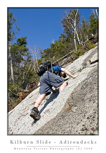
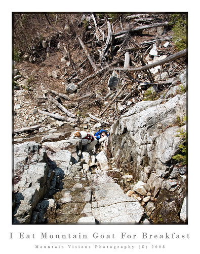
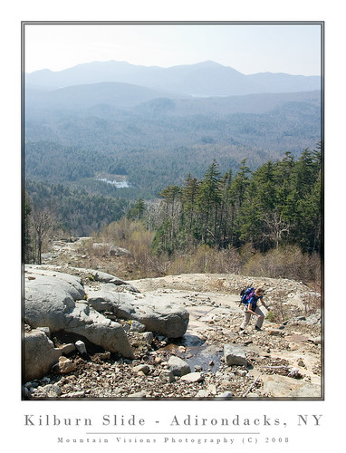
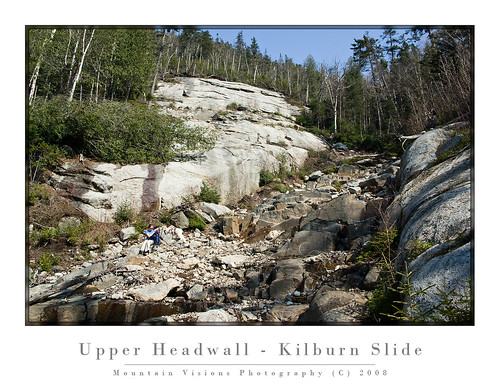
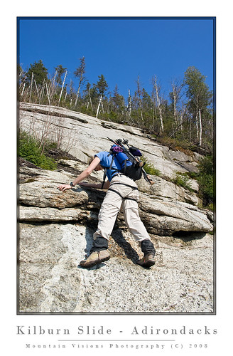
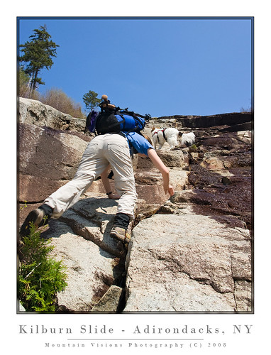
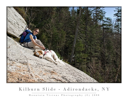
Climbing Kilburn Slide (And A Battle With A Rabid Tree)


It's been about 6 years since I first visited Kilburn Slide. We did it to sort of kill a day before some technical rock climbing the next day. It was rainy the day we climbed it, and the views were non existent.

Turn the page to 2008 and once again it was a day killer. Aim needed some new boots and the Mountaineer in Keene Valley happened to have the Raichles she was interested in. Her 10 year old Raichles started to crumble and boots became priority #1. So I figured something easy and fun Saturday after losing part of the day to boot fitting.

Of course after having weeks of sunny weather it was supposed to rain all weekend and the forecast just got worse the closer it got. Hahahahahaha, guess what? The weather forecast was WRONG.

So by the time we set up camp it was around noon. We headed towards Whiteface from Jay to the Monument Falls parking area and the whole time it continued to clear to the point the skies were mostly blue. Not believing for a moment this would last I was getting nervous that we wouldn't get up the slide in time to beat the rain.

What a surprise after the doomsday report convinced me that my second time up I'd have the same views as the first. Not even close. The slide has great views of Whiteface from the base. While the slide curves out of site of Whiteface, as you steeply climb you get great views of Lake Placid and many other mountains the further up you go, and it never rained.

Some people reading this might be asking, "what the heck is a slide".

Well in the Adirondacks slides are a fairly common anomaly of natural forces. Adirondack soil is about as poor as exist on earth. It's why the indigenous Indians who lived near what is now the Blue Line (the boundary of the Forest Preserve) only came to this region in the warm weather to hunt. The soil did not farm well, and winters were brutal.

The thin, weak layers of soil, typically over sheer mountain slopes are prone to being washed away in sustained torrential rain storms. These storms come frequently enough during hurricane season, or during Noreasters.

After several days of rain, the soil becomes so saturated that it and everything attached to it just slides down the mountain, leaving what Barbara McMartin termed, "natures gift to hikers." It takes a few years for the slides to get really clean but once they do they are excellent for climbing. Many are gradual slopes in the 30-60 degree range, whiles others have vertical 4th or 5th class headwalls.

The slides can be skied in winter (by experienced backcountry skiers), and in summer most can be climbed by any hiker capable of reaching the base. The more technical slides typically require just basic rock climbing skills and are usually low 5th class.

The beauty of slides, provided the exposure doesn't frighten you, is that they offer views for the entire climb. The downside is they rarely end at a summit, and generally require either a steep descent down the slide, or a bushwhack to the top of the mountain, and a return via a trail.


The climb up Kilburn was great. Way more interesting than last time but like every hike or climb this one wasn't without incident.

Pretty early into the hike to the slide Aim was attacked by a tree. I've never seen anything so viscous in the forest. Not even the porcupine that attacked Caney could match this rabid tree. Large branches, with sharp pointy tips, and whip like reflexes. She battled it but the tree fought dirty. I mean really dirty, I cannot even speak of some of the things it did. Finally the fight turned into a girl fight complete with all the fixins. Hair pulling, scratching, and eye gouging. Man was there eye gouging. Problem is trees don't have eyes so you can guess what happened. Yep, Aim was defeated and the tree stood victoriously over her lifeless teary eyed body, almost saying, "hey girly, you were barking up the wrong tree."

In his mom's honor Caney pee'd right on that tree, with his best stream of concentrated super Wonder Dog pee, and Aim was able to flee.

Well, our two days in the Daks turned to a single day and a sleepless night for Aim. When she woke me up Sunday morning the eye wasn't looking so good. We packed up and had a spirited drive down 73 back to the Northway and home.

Off to the urgent care center where it was confirmed Aim is blind, not from the fight with the tree, just blind! Which explains why she is married to me. After a few test it was also confirmed she had 1 or 2 corneal abrasions. Nothing serious, but serious enough for her to get a day off from work. Hmm, if I got a day off for every abrasion I got I'd got a lot more abrasions.

The good news is Caney is now in second place for consecutive days without need of medical assistance for illness or injury. Me, I'm going on 17 full months, Caney 2 full weeks, and Aim's streak of 5 years is long gone. Today she is at 1 day!!! Let's just say Caney is cherishing every moment , and confident that if he can hold on for just a few more months I will do something stupid!!!

technorati tags:, , , , , , , , , , , , , , , , , ,

Blogged with Flock

Wednesday, April 30, 2008

Chaos On Crane and Oooo Sable In The AMR

Busy weekend for me in the Daks.

Seems like I hiked a lot more than 15 miles over 2 days. I shot over 8GB of images over that time (lots of brackets of 16MB images), most in poor lighting and after a few days I've finally made some progress.

Saturday was a great easy hike in the Adirondack Mountain Reserve, which is publicly accessible private land owned by the Au Sable Club.

After leaving a few minutes later than I intended, I met John and Joanne at the parking area a few minutes after 9am and we headed for some of the most spectacular (and most accessible) scenery in the Adirondack lowlands. Lots of waterfalls and chasms, streams and rivers. Just a beautiful place.

We kinda hit the lighting just wrong, and our overcast day turned a bit too sunny for even the usable diffused light provided by cloud cover. It was still very dead out there, as the trees hadn't even begun to bud. It looked like what I affectionately call the skeleton forest. Black flies and bugs were non existent which made the day ever more enjoyable. Great day though and lots of fun to just kick back and talk photography while taking our time, even if we didn't have the best lighting.

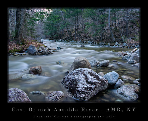
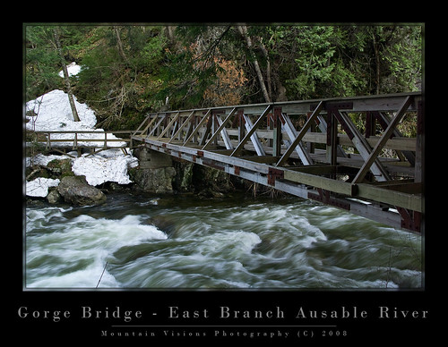
My partners left me at about 4:30pm, and I headed about a mile up trail to Wedge Brook and Wedge Brook Falls. I noted a few spots I'd like to hit with better lighting on the way down, and got to the falls. Beautiful place but despite spending an hour playing around I left with nothing that I liked. On the way back I shot a few frames of the East Branch Ausable River and some spring runoffs down the gorge walls.


After a few more shots on Gill Brook and the Ausable River, I got back to the car around 8:30pm and was back home by 10pm.


Sunday, Aim, Caney and I headed for Crane Mountain. Our last trip there in 2000 or 2001 ended in Caney losing his pack around the lake. I listened to Aim and didn't carry snowshoes and the spur trail was covered with 4 feet of snow making the 1 mile hike an incredible post hole fest. Lesson learned from that experience...when in doubt carry snowshoes even in April, and DO NOT PUT THE KEYS IN YOUR DOGS PACK!!!!

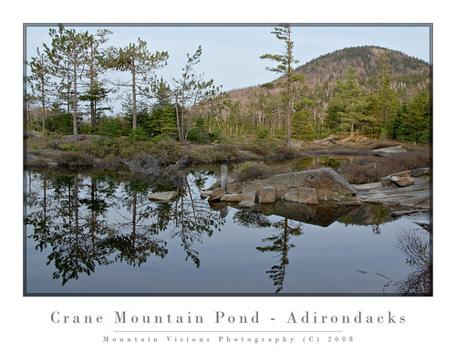
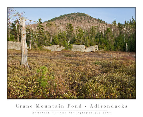
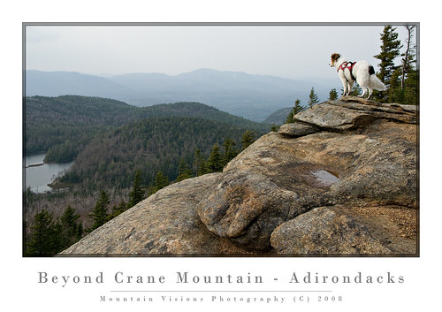
The 2008 Crane adventure was quite nice, although covered with blowdown from the uncharacteristic ice storms we had this winter, and the trail was at times poorly marked, lots of route finding, and some bushwhacking to get back. For an easy 3.5 mile hike we ended up hiking about 5 miles and it felt like much more. Overall great day but the black flies were out, and lightly biting at times on the hike up. On the return they mysteriously disappeared.

One disheartening thing about Crane Mountain was the trash situation around the pond. Typically the southern and western Adirondacks seem to suffer more from irresponsible and just downright lazy disgusting people who feel that it's too much effort to carry out the stuff they brought in.

Unfortunately, this attitude is contagious and trash left behind signals to the next user group that it's OK. Then things go out of control and the DEC is forced to make changes that affect everyone.

I'm hoping to organize a work crew to go in and clean this area up. Anyone reading this who is interested should drop me an email. I figure 4 or more people could circle the lake in an afternoon, disperse some of the poorly built campsites and partially burned wood, burn any burnable trash and pack out the many plastic bottles, and bits of broken glass.


To anyone reading this looking for information on campsites (and I know you do because of I see your search strings to get to my site) please have some respect for yourself. Yes for yourself, and pack out what you bring in. Keep in mind that the trash you leave can only end up 2 places, in the forest, or in the pond. And that in either place it will remain there pretty much permanently.

While one bottle, one wrapper, one cigarette butt might seem harmless, the cumulative effects are not. And it's pretty selfish and just plain disrespectful to literally destroy someplace that you, and others that follow you, obviously thought enough off to expend your sweat and energy to hike into.

The 6.5 million acres that forms the Adirondack Forest Preserve might seem inexhaustable, but if enough people carelessly abuse it out of nothing more than laziness, we will be left with nothing but a giant wilderness landfill.

Give a hoot, don't pollute.

technorati tags:, , , , , , , , , , , , , , , ,

Blogged with Flock

Tuesday, February 26, 2008

These Mission Plans Will Self Destruct in 5-4-3-2...


If you get no further than these words never forget..."there is more to life than the High Peaks Wilderness."

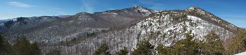
Even Dave was commenting on how crowded the Adirondacks can be before this trip, but I noted it's more that people flock to a few thousand acres of a nearly 4 million acre wilderness. If you seek solitude it surely can be found merely by crossing the High Peaks Wilderness off your itinerary and exploring some of the most diverse and most intact wilderness in the lower 48.
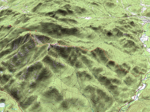
I don't really know exactly what to pin the collapse of this trip on but I certainly won't deny any responsibility in it's outcome.

Everything seemed planned well but at was a series of little issues that led to a complete failure.

The most important of which was the success of the trip required that we make it to a certain point the first day. There really wasn't a well thought out plan B for the first day. As I hadn't expected there to be a problem.

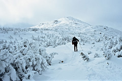
Secondly, route finding. For those seeking solitude, even Bald Peak is a reasonable overnight or single day objective. The reason, beyond Blueberry Cobbles there are very few tracks if any at all, and honestly I'm not even certain there were tracks up Bald Peak. The bigger problem was the before Blueberry Cobbles the previous groups seemed to have equal issues staying on the route as we did. So there would be false trails that ended in a return trip. This route finding cost us at least 1 hour, maybe more.
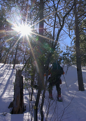
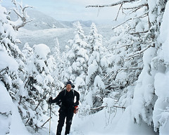
The fresh snow that fell the previous night was both a positive and a negative. On the positive end it allowed for us to avoid hiking on what was probably an icy trail below, on the negative end it meant we had to break trail. In spots the snow was soft and 3-4ft deep, in others it was either icy hard windblown or not very deep at all.

Finally, I have felt like I was getting sick for the past week. So Aim being "Miss Herbal" supplement pharmacist forced some echinacea tablets on me. I'm fairly confident they made me "more" jittery than I usually am the night before a trip. I fell right asleep Friday night but about 1 hour later I woke up and never fell asleep again. My heart seemed to be racing and I just couldn't fall asleep.
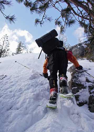
And the wild card that may or may not actually be the case, over estimating my fitness! It's hard to tell going on 1 hour of sleep, but I think my mind forgot how heavy a 40lb+ winter overnight pack is. And while some people are wondering how can you forget, let me give the men out there an example. You lift weights regularly for 6 months eventually benching 200 pounds, then the summer comes and you spend less time in the gym and more outdoors, when you head back indoors to the gym and weights, where do you put that bench press? Yep, right at 200 pounds, why? Not because you're stupid, but because your mind doesn't realize that your body hasn't bench pressed in 6 months, you only remember how relatively easy the number 200 was. It's not until you lift it the first time that you go, "holy shit batman, this is heavy."
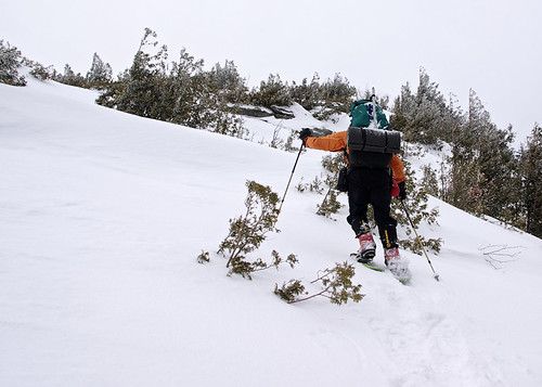
So starting out with 1 hour of sleep, carrying a 40 pound plus pack just isn't going to be a great start. Usually my trips start out with not too much sleep the night before but usually 1 hour into the trip I am feeling better and just the excitement of being out in the wilds invigorates me enough to get through the day. Not this time, I felt like crap from the start and felt worse the more we hiked.
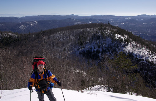

By the time we got to Blueberry Cobbles it was apparent I was not going to feel any better, and we were 1/3rd into the 6 mile hike to our 1st camp.

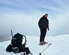
After some serious route detours we finally made it to the base of Bald and it's exposed rocky slabs to the summit. I grew tired of hiking with my MSR Denali snowshoes up the rock and at times icy slabs, so I stopped and switched to crampons. It was nice to not have to slide back with each step. When you are already tired, every bit of traction you can get is a plus.
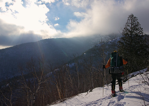
There are only two styles of snowshoes I'd attempt to use on slabs with mixed rock, snow and ice, and both are made by MSR. I have the original Denali's, which many old timers snubbed their noses at back in the late 1990s when they came to market. Cheap plastic snowshoes, can't be any good. Well, 10 years later my Denali's are still ticking and unlike the only school shoes, I don't baby them. Rocks, talus, slabs, stream crossings, etc, these things just take the abuse.
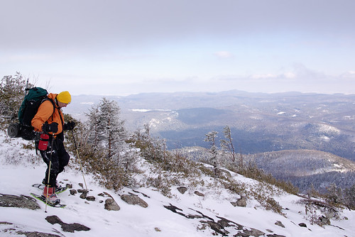
MSR has come out with several evolutions of the Denali's mostly all are 90% of the original design that I have. For the most part the only improvement was the heel riser which raises your heel when climbing consistently steep slopes.

Dave, however, was using a brand new design, the Denali Lightning, that has some pluses and some negatives over my shoes. Pluses, even more aggressive traction that seemed to have less problems going up the mixed conditions rock slabs often found in the Adirondacks, the heel riser is built in, and the weight is perhaps a little less based on the flotation.
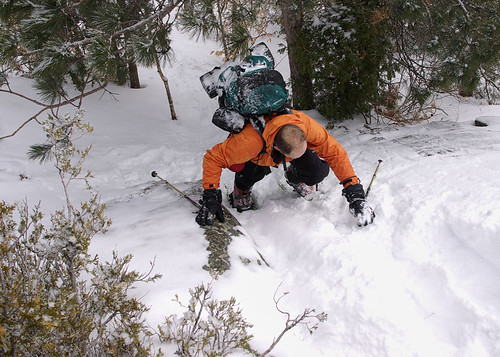
The negatives of the Denali Lightning are: 2 strap binding which doesn't hold the foot as well, the shoe is larger (25 inches vs. my 22 inch Denali's), while the decking is elevated and not bound on like the old school snowshoes, it is still a tarpaulin type material (probably Halpalon) that will eventually wear out over rocky terrain or trudging through spruce traps, and finally the size of the shoe isn't modular. Meaning the 25in flotation is set. My Denali's can go to 26 and 30inches with the additional tails.

Once we topped out on Bald Mountain 2 hours behind schedule and only 2 hours till sundown it seems to be prudent not to continue ahead. So we decided to back track and camp in one of the small cols that we passed on the ascent. Having taken nearly 5.5 hours to go the 4 miles and 2700ft ascent it didn't seem like a good choice to descend 500ft, and then reascend 1500ft to get to our planned camp 1.
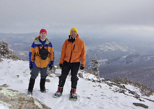
My feelings on keeping yourself out of trouble are this, one bad decision usually doesn't lead to a tragedy but a series of bad decisions tend to end badly. The original goal was to be at Bald by 1pm and at Camp 1 by 4pm. We were way behind schedule and already new the conditions and potential places to camp if we back tracked. We didn't know the conditions ahead, and route finding would probably only become worse, as would trail breaking since undoubtedly no other group had passed Bald Mountain!

So Dave begrudgingly agreed to head back down. Definitely a disappointment for us both but I think the correct move.
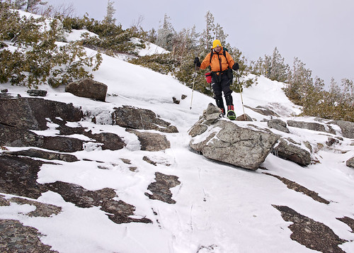
We camped in the first depression below Bald Mountains final ascent. I'd actually had the ridge just above where we camped in mind so we could catch the sunrise, but with the forecast of 25mph winds overnight it seemed like a better choice to take the protected option.
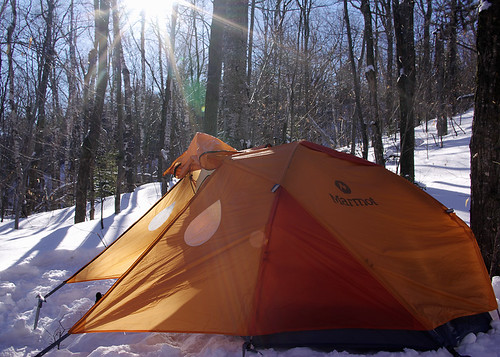
We packed out a tent platform using out snowshoes, but a rarity for the Northeast, the snow never seemed to consolidate. Even after letting it sit for the usual 20 minutes after we stopped flattening the area we still ened up with very soft unconsolidated snow.

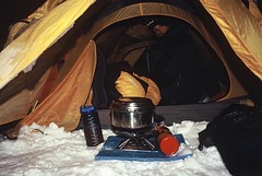
After setting up the tent the first order was to rehydrate. We were guinea pig testing my MSR hanger that I've only used once in more moderate weather. It's a titanium hanging kit that attaches to the Superfly canister stove.

Being a notorious vestibule cooker over the years I wanted something even more storm proof. Something that also increased the overall comfort level while camping in any winter weather, and something that would further reduce the amount of clothing we needed to carry on winter trips.

The hanging stove worked beautifully with the help of lots of research. I'll blog separately on it's wonders but lets just say it's superior to sitting outside in the wind and cold while wearing 10lbs of clothing just to melt snow and eat dinner. And the added bonus, is the tent hits about 35-40F and is bone dry, allowing your gear to actually thaw and even dry.
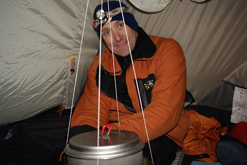
Oddly, I really wasn't hungry so I mostly drank lots of tea, apple cider, and ate just my freeze dried dinner rather than the whole meal of beef stew, mashed potatoes, and chicken noodle soup.

After 3.5 hours of melting snow, cooking, and rehydrating we hit the sack at 9pm. The Marmot Swallow is a huge 3 season tent, but with winter bags and bivy sacks it's just barely adequate for winter use. Still it vents well, and is big enough but moving around to get things setup is a real pain. My verdict on it, is that it's a n adequate all season tent, provided you don't get socked in with a heavy wet snow. The flat area just above the main vestibule would not do well to shed heavy wet snows. So this tent might be more of a all conditions summer tent (as marmot does market it) rather than a true winter tent.

Once we got things together we both slept like rocks. The overnight lows were just above 0F, and the morning temps at 7am were about 15F. Once the stove and the sun got going in the tent it was well over 40F as we were eating breakfast.

My boots seemed a little tight in the toes on the hike in so heated the liner just at the toes in a plastic bag in the boiling water for 10 minutes. The liner was pretty well perfectly heated and I simply crammed my foot in and stretched the toes a bit. 10 minutes later my toes had a little extra wiggle room on the downhills, so nice!!

We were on the trail before 9:30am after a little delay due to Dave spilling 16 ounces of tea in the tent and on my camera gear. Thankfully my Lowepro 65AW and my camera (a Pentax K10D) are both highly weather proof. I simply tossed the camera bag in the snow, camera and all, I we cleaned up the tent. Eventually I hung the 65AW and camera on a tree to completely dry out in the morning sun.
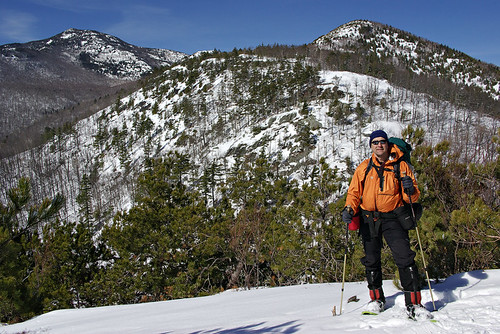
The hike out was a perfect day. Low 30s and perfectly blue skies, just a light breeze.

So while the trip as planned was a complete failure, it was a good workout, a good test trip, and overall two good days in the mountains. I think my brain just might remember for a few weeks how much energy it takes to carry that multi day winter pack compared to a 20lb winter day pack, and perhaps be a little more lenient in planning my next few overnighters. My knee was sore Saturday night, but only at the tibial screw site, and Sunday morning it felt like a $40,000 knee. So it's a work in progress, if only real work was this much fun!!! Besides, the planned trip will still be there next winter; yes, there will be a part deux!

And for Dave, a few shots of our 2005 trip to Marcy and Haystack (since I never sent him these):
technorati tags:, , , , , , , , , , , , , , ,

Blogged with Flock