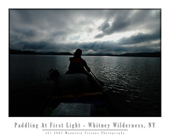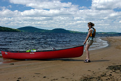
Wednesday, April 29, 2026
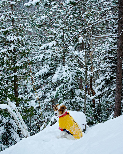
His Name is Marshall Church
Technorati: Adirondacks, adventure dog, Bob Marshall, forest preserve, Forever Wild, Frank Church River of No Return Wilderness, George Marshall, trail dog, traildog, Verplanck Colvin
Thursday, March 12, 2026
From a Never Bike Tourer to Bikepacking in the Adirondacks: The Full Circle Journey of Exploration and Discovery
|
|
| Adirondack bikepacking routes I created as of Dec 31, 2025 |
Back in 2020 during Covid I took my bikes to Arkansas to visit family. I hadn't ridden in Arkansas in 20 years and I was excited to ride there, even if it was a long way from my old stomping grounds. I got back from a ride and a family member asked me "with all the outdoors stuff you do, have you ever done any bike touring? Would you consider it?"
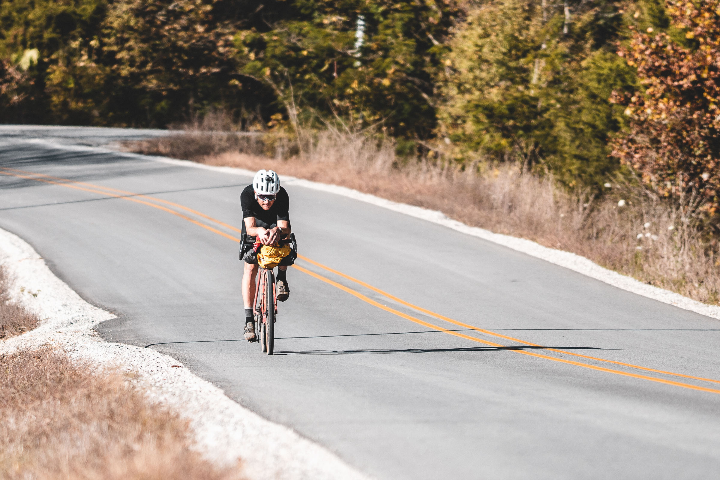
Without hesitation I said, "no, absolutely not." The reason I gave was I do a lot of slow deliberate wilderness type activities and to me, riding was about going fast. 50mph descents with my hair on fire. It was about cranking through turns and maintaining a high average speed and crushing sprints where I felt the need to. Every ride was an individual time trial. I was enjoying picking off Strava KOMs (I'm a good sprinter so those flat KOMs are actually achievable) and just having fun riding. No need to burden myself with a ton of gear and turn every ride into a multi-day planning and packing event.
Not too long after that I got more into gravel riding. Despite what the bike industry tells us, gravel isn't a new thing, when I was a student at the University of Arkansas we often rode gravel on mountain bikes, usually to bridge single track sections, sometimes to get to trails in the Ozark NF or Arkansas State Parks from campus, and after college I rode a lot of gravel on my hard tail because my back just couldn't handle the multi-use (hiking trail) single track that was the norm in New York. Plus, gravel was that sweet spot between MTB and road. It was out in nature, quieter roads, sometimes it could be chunky or even mildly technical (Vermont Class 4 roads are a great example of this), but it was still spinning gears and riding fast.
![]() |
| Ted King on a paved section of the 1000 mile Arkansas High Country Race in 2020 (credit bikepacking.com) |
Bikepacking is a volatile term. Sometimes it's used to blanket describe riding a bike to multiple points over multiple days. To others its covering the same terrain in the same style you would backpack. Too me, bikepacking is anywhere you NEED to use a water filter. So gravel roads or even paved roads in the middle of nowhere can be bikepacking. Bike touring is anywhere you simply fill your water from a hose, fountain machine, or buy bottles. I realize people can and will endlessly debate what it means to them, and I'm not here to tell you what it is or it isn't. That's up to you. I once debated someone that said if you weren't literally pushing or even carrying your bike for most of the trip, it was bike touring. To me, if I'm carrying my bike half the trip, I'd rather leave it home and go backpacking. I didn't buy a bike, deal with all the mechanical nuance and cost, just to need a pair of hiking boots. I want to ride it!
| (credit bikepacking.com and Restrap) |
So how did I get from "hell no" to "maybe I'll try it" to "I'm all in" and now creating routes in the vast Adirondack Wilderness? Well, sadly my dog Colvin, died in 2023. In his early years we did some mountain biking, but by the time I got back into riding, even though he was still bagging difficult peaks for a 10yo dog in 2020, it was too much to ask of him to ride with me. His final years were spent hiking, sometimes very hard peaks or routes which he enjoyed, and that was best for him. I'd ride on rest days for him but we focused on getting him out into the mountains and local trails as much as possible. About 7 months later in the summer of 2023 I got my next gen trail dog, Marshall. By 2024 I realized this was the time to get back into mountain biking and off-road bikepacking and make use of Marshall's endless energy. He is my first truly high energy dog in the sense he doesn't have a chill switch. It's go, go, go.
You have a small window (about 5 years, ages 2-7) to ride hard with your dog.
Hard? This absolutely doesn't mean abuse them with overuse, it just means
where they can ride* day to day and recover optimally. Where riding at 20mph
for short stretches and 15-30mi days are not pushing them to the limit. After
that window you need to start considering the dogs recovery much more, mayber
sticking to more technical single track where you are riding much slower and
even moving on to a cart and bike touring. I will say people tend to overthink
how fast a MTBer is riding. Typically average speed is under 10mph for the
day, usually between 6-10mph for single track trails. That is a 6-10min mile,
and trust me, your dog isn't working that hard in proper temps running 10 min
miles over a typical 10-20mi day if they are already properly
conditioned. A 10min mile is 250min or about 4 hours of activity over an
6-8 hour day of riding if you stop and smell the roses, filter water, go for a
swim, and take some photos. Again, not a serious strain on a properly
conditioned dog in the optimal age range. Add in a backpack like the K9
Sportsack and you can ride probably around 40-45mi on the high end if you bag
the dog for long gravel descents, pavement, and long flat stretches of
gravel. *when I use the term ride, I'm riding and the dog is running or the dog may be in the Sportsack, but he's never at the wheel, my dog training skills only go so far and he loves to run as much as I love to bike
Well, that is the backstory on how I got into bikepacking and why I began developing routes in the Adirondack Forest Preserve. I'll be posting those routes here along with maps, route GPX, photos and trip reports.
As a side note: I've gotten some mild natured hate from some gate keepers in the Adirondack cycling community. Don't ruin a good thing for us was the consensus. But I promise you this, in 3 years of Adirondacks bikepacking, mostly on weekends, I have NEVER seen another cyclist either day riding or bikepacking. NOT. ONE. What that tells me is not only are ADK backpackers a secretive bunch (afterall, to get mad means you do ride, but to see no evidence means you keep it quiet), but they may not even exist at all in numbers necessary to prove they do. I guess what I'm saying is I understand the sentiment but I don't believe sharing my routes is going to change bikepacking in the Adirondacks dramatically in the near future. And if it does long term, it will likely mean better infrastructure and more potential route terrain. I do, however, hope it changes the anti-bike culture in the Adirondacks which is sort of ingrained in people due to the Forever Wild wilderness ethic that permeates folks who know of and love the Adirondacks.
Technorati: Adirondacks, backpacking, bike touring, bikepacking, cycling, exploration, forest preserve, Forever Wild, RidewithGPS, routes, wilderness
Saturday, September 24, 2011
Long term consequences of improper streambed reconstruction in the Adirondacks post-Irene
![]() |
| Stream reconstruction on Styles Brook. Jay, NY. All photos courtesy Adirondack Council. |
![]() | |
| Gulf Brook. Keene, NY. |
![]() |
| Roaring Brook, now a ditch with water. |
-
-
Technorati: Adirdonacks, Adirondack Park, APA, Article 14, Ausable, Cuomo, DEC, forest preserve, Forever Wild, Keene, Keene Valley
Friday, January 1, 2010
So Long 2009...Starting the New Year Right, In the Adirondacks!

Well, 2009 is history and I am on my way to starting 2010 in similar fashion to 2008, which while not an amazing year, was a pretty darn good one in comparison.
While I didn't start off the New Year exactly like 2008, complete with a 1.5 hour drive in the snow, followed by a 4 mile sunrise hike with no sleep, I'm hoping to make up for it with quantity over quality. Yes, I am an American...more is more, and less is less, quantity over quality always reigns supreme. So, instead of last years one and done till the next weekend, I'm shooting for a consecutive days of Y2X record. And since records are established purely with the idea they will be broken, I'm off to start the year with 3.5 days in the Adirondacks, snowshoeing, hiking, and getting intimate with my Pentax 645N and some good old fashioned film.
I'm gonna go all Ansel Adam's on the Adirondacks with a bag full of Fuji Neopan Acros 100, a roll or two of Neopan 400, and perhaps a roll of Ilford Delta 3200 for star trails or moonlight shots under the very full moon. I'm even going to bring the magic 645N interchangeable film back, so I can shoot all 3 films as the need arises. To be honest, I don't know a damn thing about shooting landscapes in black and white, and that is appealing. Sure I mess around with it, I even occasionally create a nice looking color channel conversion from a film or digital color image, but I rarely bothered with shooting straight black and white. My philosophy has always been shoot color and do a high quality conversion. But truth be told, I'm tired of digital workflow, sick of Lightroom, and having a blast doing my own black and white developing for pennies on the roll.
By night I'll be chilling (or rather warming) by a wood stove, and drying out my gear as I read a book, while nursing a Lake Placid Brewery Ubu Ale. Then maybe on Sunday night shoot some star trails if the weather looks good enough to leave my trusty medium format workhorse outside. With a little luck, I'll finish reading Verplanck Colvin's biography, Footsteps Through the Adirondacks; which leads me to resolutions!
As far as New Years resolutions, they are completely pointless. As pointless as saying I'm sorry when someone dies, or God bless you when someone sneezes. Of course you are sorry, and around the 1800s AD it was learned our souls don't fly out of our bodies when we sneeze. Jan 1st is a day like any other. You don't need a change of calendar to start something different, only the desire to make it happen, whether it is Jan 1st, Jan 20th, February 7, March 18th, April 1st, July 31st or November 6th...you get the point.
So instead of laying out a list of mangy laundry like the rest of the detritus of the blogosphere, I'm just gonna finish off Colvin's biography which I started months ago. I tore through the first few hundred pages when I got the book, and then put it down reluctantly at about the 75% point, only to have it sit on my nightstand for the last 2.5 months. Right now I use mostly as a way to level out my pile of books so that my phone (aka. alarm clock) doesn't fall between the stacks. The cover jacket has gotten quite ragged from me hitting the snooze button, or throwing the phone off the nightstand while searching in vain for a virtual snooze button on a virtual alarm clock.
So how bad is this book that I have relinquished it to a pulpy level? Actually, Nina Webb did an
For those not in the know, Colvin was the father of the Adirondacks. To put this into proper light, the Adirondacks were America's first wilderness, and an experiment that has never been repeated in the world, and probably never will. If you take that last statement to heart, Verplanck Colvin was the father of the American wilderness as well. The Wilderness Act of 1964, almost 80 years after the establishment of "Forever Wild" in the New York constitution, was based on what Colvin fought for in the Adirondack Forest Preserve for over 20 years of his life.
It goes without saying, if not for Verplanck Colvin, I would have far less to blog about, far less to Resolute to resolve my resolution, and confident in the outcome, I'll be packing away Adirondack Explorations: Nature Writings Of Verplanck Colvin.
Technorati: 645N, Adirondacks, Ansel Adams, Delta 3200, Forever Wild, Fuji Neopan, hiking, New Year Resolutions, Nina Webb, Pentax, Ubu Ale, Verplanck Colvin, wilderness
Friday, February 6, 2009
Too Big, Too Much...Is Big Tupper Unstoppable?
When you look at a state like Vermont, one of the things that makes it Vermont is the size of things. Its not necessarily easy to explain but you know Vermont when you are in Vermont.
The Adirondacks are similar. One of the few places in this part of the country that doesn't look the same as everywhere else. To a large degree this alone is something that makes the Adirondacks have some appeal. The fact that in many ways the Adirondacks are more wild today than they were 120 years ago is also somewhat special. Many biologist have noted that the Adirondacks are one of the largest intact biomes in the US.
Tupper Lake is one of the more developed and densely populated areas in the Adirondacks, but it's surrounded by some of the more wild wilderness areas.
As we've been taught through experience, nothing done at the hand of man is inconsequential on the natural world. We certainly have come a long way to understanding ways to lessen the impact but this is still largely a game of chance. Nature is resilient, and if left alone it almost always makes a comeback. Occasionally nature slaps us right back for tampering with it, but all too often it seems we refuse to heed the warnings, and push it to the breaking point.
Would this be good for the local economy? Maybe. Why only maybe? Because the Catskills have long had these grand plans of a big boom, and short term success has always been followed by a period of bust. Unlike, the Catskills the Adirondacks have been much better planned thanks to the APA. And while I've noted time and again that the the APA is either loved or hated with a passion by the people who care about the Adirondacks, there is no doubt APA oversight has been a model for master planning, and the sole reason the Adirondacks don't look like the Catskills.
Short term the economy will benefit through construction jobs and service jobs, but what will be the long term guarantee that this development will be good for the Adirondack Park in general 20,30,40 years down the road.
Recently we've all been forced to come to realize that big business and it's investors are greedy. Think about the mortgage industry, everyone was making money, and no one cared that this giant smoke and mirrors scheme could not go on forever. Certainly the government didn't either; rising home prices were good for taxes, increased home ownership was good for taxes, everyone was a winner!
If we've learned nothing else it's that business needs to regulated because business has one priority, making money! There is nothing wrong with that priority, after all if you wanted me to invest in your business I'd expect a return. The issue is when profit comes at the expense of common sense, decency and ethics. All too often the quest to turn a profit comes with the sacrifice of basic principles which unfortunately have resultant collateral damage.
So, I sincerely hope that whatever compromise is eventually reached is done with some forward thought to what this will do to one of the last remaining great wilderness areas in this part of the country, not just short term but a generation or two down the road.
Controversial project in Adirondacks still aliveParks agency says firm wants to push ahead with Big Tupper plan | ||
|
| ||
| By LEIGH HORNBECK, Staff writer
Last updated: 6:42 p.m., Thursday, February 5, 2009 | ||
| RAY BROOK — Talks have stalled, but the biggest housing proposal ever made in the Adirondack Park is still on the table, a spokesman for the Adirondack Park Agency said today.
Closed-door efforts to resolve objections to the 700-unit project planned for 4,600 acres around the Big Tupper Ski Area have been on hold since last fall. The proposal by Pennsylvania-based Preserve Associates surfaced in 2006. Plans called for hotels, estate homes, hundreds of condos, a golf course, marina and a shooting range. The centerpiece would be reopening Big Tupper, which closed in 1999. Reaction was mixed. Some thought it would revitalize Tupper Lake, a community of 3,600 people in Franklin County. Others said it would destroy the rural beauty of the area. The APA began holding hearings in front of an administrative law judge in the spring of 2007, but they were delayed twice at the request of Preserve Associates, which then asked to move into private mediation with 32 groups that had a say in the proceedings. Mediation was "suspended indefinitely" in October at the request of Preserve Associates, according to APA spokesman Keith McKeever. Despite the delay, McKeever said the company has not withdrawn its application. "It is the agency's understanding that the project sponsor wants to continue in mediation and continues to prepare revised drawings and analyses to address the 10 issues raised in the (hearings)," McKeever said. Preserve Associates spokesman Michael Foxman could not be reached for comment. |
Technorati: Adirondacks, ADK, APA, Big Tupper Ski Area, Forever Wild, Lake Placid, New York State, Ray Brook, Saranac Lake, Tupper Lake
Tuesday, February 26, 2008
These Mission Plans Will Self Destruct in 5-4-3-2...
If you get no further than these words never forget..."there is more to life than the High Peaks Wilderness."
Even Dave was commenting on how crowded the Adirondacks can be before this trip, but I noted it's more that people flock to a few thousand acres of a nearly 4 million acre wilderness. If you seek solitude it surely can be found merely by crossing the High Peaks Wilderness off your itinerary and exploring some of the most diverse and most intact wilderness in the lower 48.
I don't really know exactly what to pin the collapse of this trip on but I certainly won't deny any responsibility in it's outcome.
Everything seemed planned well but at was a series of little issues that led to a complete failure.
The most important of which was the success of the trip required that we make it to a certain point the first day. There really wasn't a well thought out plan B for the first day. As I hadn't expected there to be a problem.
Secondly, route finding. For those seeking solitude, even Bald Peak is a reasonable overnight or single day objective. The reason, beyond Blueberry Cobbles there are very few tracks if any at all, and honestly I'm not even certain there were tracks up Bald Peak. The bigger problem was the before Blueberry Cobbles the previous groups seemed to have equal issues staying on the route as we did. So there would be false trails that ended in a return trip. This route finding cost us at least 1 hour, maybe more.
The fresh snow that fell the previous night was both a positive and a negative. On the positive end it allowed for us to avoid hiking on what was probably an icy trail below, on the negative end it meant we had to break trail. In spots the snow was soft and 3-4ft deep, in others it was either icy hard windblown or not very deep at all.
Finally, I have felt like I was getting sick for the past week. So Aim being "Miss Herbal" supplement pharmacist forced some echinacea tablets on me. I'm fairly confident they made me "more" jittery than I usually am the night before a trip. I fell right asleep Friday night but about 1 hour later I woke up and never fell asleep again. My heart seemed to be racing and I just couldn't fall asleep.
And the wild card that may or may not actually be the case, over estimating my fitness! It's hard to tell going on 1 hour of sleep, but I think my mind forgot how heavy a 40lb+ winter overnight pack is. And while some people are wondering how can you forget, let me give the men out there an example. You lift weights regularly for 6 months eventually benching 200 pounds, then the summer comes and you spend less time in the gym and more outdoors, when you head back indoors to the gym and weights, where do you put that bench press? Yep, right at 200 pounds, why? Not because you're stupid, but because your mind doesn't realize that your body hasn't bench pressed in 6 months, you only remember how relatively easy the number 200 was. It's not until you lift it the first time that you go, "holy shit batman, this is heavy."
So starting out with 1 hour of sleep, carrying a 40 pound plus pack just isn't going to be a great start. Usually my trips start out with not too much sleep the night before but usually 1 hour into the trip I am feeling better and just the excitement of being out in the wilds invigorates me enough to get through the day. Not this time, I felt like crap from the start and felt worse the more we hiked.
By the time we got to Blueberry Cobbles it was apparent I was not going to feel any better, and we were 1/3rd into the 6 mile hike to our 1st camp.
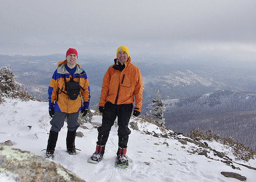
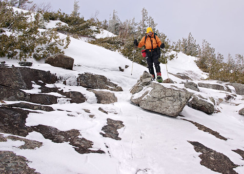
After some serious route detours we finally made it to the base of Bald and it's exposed rocky slabs to the summit. I grew tired of hiking with my MSR Denali snowshoes up the rock and at times icy slabs, so I stopped and switched to crampons. It was nice to not have to slide back with each step. When you are already tired, every bit of traction you can get is a plus.
There are only two styles of snowshoes I'd attempt to use on slabs with mixed rock, snow and ice, and both are made by MSR. I have the original Denali's, which many old timers snubbed their noses at back in the late 1990s when they came to market. Cheap plastic snowshoes, can't be any good. Well, 10 years later my Denali's are still ticking and unlike the only school shoes, I don't baby them. Rocks, talus, slabs, stream crossings, etc, these things just take the abuse.
MSR has come out with several evolutions of the Denali's mostly all are 90% of the original design that I have. For the most part the only improvement was the heel riser which raises your heel when climbing consistently steep slopes.
Dave, however, was using a brand new design, the Denali Lightning, that has some pluses and some negatives over my shoes. Pluses, even more aggressive traction that seemed to have less problems going up the mixed conditions rock slabs often found in the Adirondacks, the heel riser is built in, and the weight is perhaps a little less based on the flotation.
The negatives of the Denali Lightning are: 2 strap binding which doesn't hold the foot as well, the shoe is larger (25 inches vs. my 22 inch Denali's), while the decking is elevated and not bound on like the old school snowshoes, it is still a tarpaulin type material (probably Halpalon) that will eventually wear out over rocky terrain or trudging through spruce traps, and finally the size of the shoe isn't modular. Meaning the 25in flotation is set. My Denali's can go to 26 and 30inches with the additional tails.
Once we topped out on Bald Mountain 2 hours behind schedule and only 2 hours till sundown it seems to be prudent not to continue ahead. So we decided to back track and camp in one of the small cols that we passed on the ascent. Having taken nearly 5.5 hours to go the 4 miles and 2700ft ascent it didn't seem like a good choice to descend 500ft, and then reascend 1500ft to get to our planned camp 1.
My feelings on keeping yourself out of trouble are this, one bad decision usually doesn't lead to a tragedy but a series of bad decisions tend to end badly. The original goal was to be at Bald by 1pm and at Camp 1 by 4pm. We were way behind schedule and already new the conditions and potential places to camp if we back tracked. We didn't know the conditions ahead, and route finding would probably only become worse, as would trail breaking since undoubtedly no other group had passed Bald Mountain!
So Dave begrudgingly agreed to head back down. Definitely a disappointment for us both but I think the correct move.
We camped in the first depression below Bald Mountains final ascent. I'd actually had the ridge just above where we camped in mind so we could catch the sunrise, but with the forecast of 25mph winds overnight it seemed like a better choice to take the protected option.
We packed out a tent platform using out snowshoes, but a rarity for the Northeast, the snow never seemed to consolidate. Even after letting it sit for the usual 20 minutes after we stopped flattening the area we still ened up with very soft unconsolidated snow.
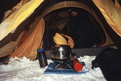
After setting up the tent the first order was to rehydrate. We were guinea pig testing my MSR hanger that I've only used once in more moderate weather. It's a titanium hanging kit that attaches to the Superfly canister stove.
Being a notorious vestibule cooker over the years I wanted something even more storm proof. Something that also increased the overall comfort level while camping in any winter weather, and something that would further reduce the amount of clothing we needed to carry on winter trips.
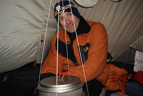
The hanging stove worked beautifully with the help of lots of research. I'll blog separately on it's wonders but lets just say it's superior to sitting outside in the wind and cold while wearing 10lbs of clothing just to melt snow and eat dinner. And the added bonus, is the tent hits about 35-40F and is bone dry, allowing your gear to actually thaw and even dry.
Oddly, I really wasn't hungry so I mostly drank lots of tea, apple cider, and ate just my freeze dried dinner rather than the whole meal of beef stew, mashed potatoes, and chicken noodle soup.
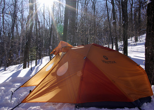
After 3.5 hours of melting snow, cooking, and rehydrating we hit the sack at 9pm. The Marmot Swallow is a huge 3 season tent, but with winter bags and bivy sacks it's just barely adequate for winter use. Still it vents well, and is big enough but moving around to get things setup is a real pain. My verdict on it, is that it's a n adequate all season tent, provided you don't get socked in with a heavy wet snow. The flat area just above the main vestibule would not do well to shed heavy wet snows. So this tent might be more of a all conditions summer tent (as marmot does market it) rather than a true winter tent.
Once we got things together we both slept like rocks. The overnight lows were just above 0F, and the morning temps at 7am were about 15F. Once the stove and the sun got going in the tent it was well over 40F as we were eating breakfast.
My boots seemed a little tight in the toes on the hike in so heated the liner just at the toes in a plastic bag in the boiling water for 10 minutes. The liner was pretty well perfectly heated and I simply crammed my foot in and stretched the toes a bit. 10 minutes later my toes had a little extra wiggle room on the downhills, so nice!!
We were on the trail before 9:30am after a little delay due to Dave spilling 16 ounces of tea in the tent and on my camera gear. Thankfully my Lowepro 65AW and my camera (a Pentax K10D) are both highly weather proof. I simply tossed the camera bag in the snow, camera and all, I we cleaned up the tent. Eventually I hung the 65AW and camera on a tree to completely dry out in the morning sun.
The hike out was a perfect day. Low 30s and perfectly blue skies, just a light breeze.
So while the trip as planned was a complete failure, it was a good workout, a good test trip, and overall two good days in the mountains. I think my brain just might remember for a few weeks how much energy it takes to carry that multi day winter pack compared to a 20lb winter day pack, and perhaps be a little more lenient in planning my next few overnighters. My knee was sore Saturday night, but only at the tibial screw site, and Sunday morning it felt like a $40,000 knee. So it's a work in progress, if only real work was this much fun!!! Besides, the planned trip will still be there next winter; yes, there will be a part deux!
And for Dave, a few shots of our 2005 trip to Marcy and Haystack (since I never sent him these):
technorati tags:ADK, Adirondacks, Bald Mountain, RPR, Rocky Peak, Rocky Peak Ridge, Blueberry Cobbles, Hiking, Climbing, mountaineering, NY, Giant Mountain Wilderness, hanging stove, MSR, Denali, Ascent
Blogged with Flock
Technorati: Adirondacks, ADK, backpacking, camping, climbing, DEC, forest preserve, Forever Wild, hiking, K10D, Keene Valley, mountaineering, New York, Noonmark, photography, snow, snowshoe, treeline
Friday, January 4, 2008
Mountain Visions New Years Day (almost) Sunrise On Rooster Comb
Leaving home at 3:30am and heading for Keene Valley for a 6:00am start, I thought I might sneak in a New Years sunrise before the weather turned snowy. Sometimes you just don't luck out. Despite the weather looking like it would cooperate and solid selection on the mountain, the sun never rose.
Well, obviously it rose, or you wouldn't be reading this, it just wasn't visible through the thick cloud cover.
After consulting my memory and then National Geographic Topo! Norteast I settled on a few possible options. The criteria were decent views, less than 3.5 miles and fairly easy to ascend. Afterall, I was hiking on 24 hours without sleep by the time I got back down. Rooster Comb, Hopkins, Noonmark, and Cascade all came to mind.
After checking out the azimuth of the sunrise and using the line of sight tool on the Topo! to make sure I had a clear view of the heading, I opted for Rooster Comb which was a fairly short 1:15 minute drive from home.
Rooster Comb is the traditional start of the Great Range Traverse and a mere 2700ft compared to the 4000ft height of the rest of the peaks beyond Hedgehog Mountain. It's about 3 miles from the trail head and a fairly nice hike with a lot of switch backs. The mountain has a nice open summit with 270* views, but the views are about average because the surrounding peaks block out any significant long range views. However, you peer right down Keene Valley, and the sun just happened to be rising behind the valley.
After putting on my boots and gaiters I was a little ahead of schedule but the weather wasn't looking like the 10am snow start that was predicted. After listening the the comedy channel on Sirius for a few minutes longer we started out at 5:50am. By the time we signed in at the register and I adjusted my poles and snowshoes it was 6am.
The issue wasn't getting to the summit early for me, but for Caney. He doesn't have a winter coat grown in yet and he gets cold easily when not moving, so getting there without too much standby time is key.
The weather was great, I hiked in my usual goretex bibs, and a thin base layer top under my goretex shell. Warm enough to unzip the pit zips and hike gloveless without a hat. When I left at 3:30a the temp in Lake Placid was about 18F so I'm guessing it was about 15-20F when we started, and windless.
After about 45minutes it was light enough to hike sans headlamp, but it was also snowing quite hard. Then just as I'd given up hope for a clean sunrise the snow stopped and it seemed to be getting clearer.
As we approached the summit, I could see some orange around the horizon but the sunrise was not to be. While it stopped snowing for about 45 minutes, it never cleared up and that faint orange glow behind the clouds was as good as it got.
We spent 25 minutes up there, of course the wind really picked up after sunrise (gusting to 25mph in Plattsburg at sea level), but nothing ever got photographically interesting. The trip down is fairly steep at the top, and well below the summit there are several chances to cut the switch backs and go cross country to link up with the trail. We really cut a few minutes off here and there and the deeper powder (about 3ft+) was more interesting then the well packed trail.
The hike out was very snowy with perhaps an inch falling. The poor weather was a great test for the weathproofness and usability in the cold of the K10D, as I looked to salvage the morning from a photographic standpoint . The camera and FA 28-70 f/4 lens handled the weather quite well, and even on digital this lens as been a workhorse for me since I bought it in 1998. (perhaps one of the best 28-70 zooms made from a performance to size standpoint, and only a stop slower but much lighter than most "pro" 2.8 zooms which I prefer not to carry while hiking).The drive home was spoiled by flat landers and downstaters. Yep, I'm a geographic bigot and proud of it. If you can't handle the snow don't come to the North Country! My drive time doubled as people made their way home to their meager existence, in a life of expensive misery, in the sprawling metropolis of downstate NY and the equally crappy New Jersey.
So Happy New Year!!!
(Day 1 of 365...and I'm 1/1, solid 1.000 batting average, undefeated!!...if I could only keep this average till next Jan 1st I'd litterally be a happy camper).

technorati tags:Rooster Comb, ADK, Adirondacks, Noonmark Mountain, Hedgehog, Giant Mountain, Snow Mountain, Chapel Pond, Keene Valley, hike, backpack, photography, mountaineering, Mountain Visions, Pentax, K10D, weather sealed, NY, New York, downstate, North Country, sunrise, snowshoe
Blogged with Flock
Technorati: Adirondacks, ADK, backpacking, Forever Wild, Hedgehog, K10D, Keene Valley, New York, Noonmark, Pentax, photography, Rooster Comb, snow, Snow Mountain, wilderness conservation
Tuesday, August 14, 2007
The Whitney Wilderness
“I date from Little Tupper Lake, and a finer lake it would be hard to find. No desolate lines ofdrowned lands here. All as it came from the hands of nature. Have been out this morning deer hunting, so to speak. Laid off for four mortal hours waiting for a deer to attempt the crossing of Dukett’s Bay. No deer came. But there came a loon, and he settled within ten rods of the canoe, raised himself on hind legs (they are very hind, and he has no others), turned his white, clean breast to me and gave me his best weird, strange song. Clearer than a clarion, sweeter than a flute, load enough to e heard for miles...”
From Nessmuk’s Adirondack letters
Cruise of the Sairy Gamp, 6
Forest and Stream, Sept. 13, 1883
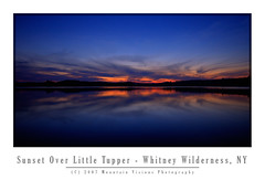
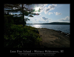
Acquired by the state in 1998-1999, Aim, Caney, and I were among the first legal public paddlers to use Little Tupper Lake and the Whitney Canoe Area in the summer of 1999. It wasn't in a guide book yet, and there was little info, we just happened to drive by the headquarters while going to Lake Lila.
I'd venture to say, over the years, we've logged more nautical miles in the Whitney Canoe Area than anywhere else in the park. Probably in excess of 200 miles. I'd further be willing to bet that every mile on Little Tupper is worth 1.5 miles on any other regularly paddled lake. The wind seems to blow southwest in the morning but in the evening (just in time for the paddle out) it seems to come from the east. I'm guessing this phenomenon is more than just bad luck. Most likely the wind is being generated by adiabatic cooling off the summits of the high peaks after the sun gets low on the horizon.
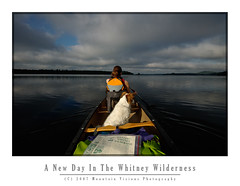
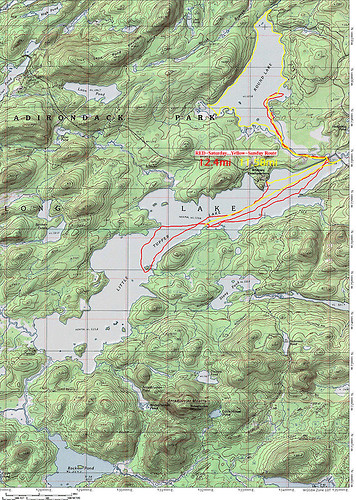
This weekend we added another 25 miles of paddling to our Whitney Wilderness odometer. In typical fashion we were the first ones in Saturday morning, and the last out after dark Sunday night. Headlamps safely packed in the dry bags we had no choice but to paddle in the dark on a moonless night.
Formerly part of Whitney Park, owned by the Whitney's (of Mary Lou Whitney socialite fame), Gov. Pataki acquired this well logged but fairly pristine tract of land using funds from the Environmental Protection Fund and Clean Water Clean Air Bond Act.
The Whitney's still have a presence in the William C. Whitney Wilderness that is more than the legacy of a name. They own the only two private residences in the wilderness. Camp On The Point, and Camp Francis. They also still own extensive tracts of land forming the southern border of the Whitney Wilderness which comprises the rest of Whitney Park.
In terms of land acquisitions this is about as big as it gets. The Whitney area was logged, lightly mined and has a (unimproved) logging road system, but is essentially pristine in nature.
It supports multiple types of recreation, including skiing, paddling, hiking and horseback riding. As a wilderness, it is motorless, and mountain bikes are also prohibited.
The Whitney Wilderness is so pristine in fact, that Little Tupper Lake is one of the last bodies of water in the northeastern US to retain it's original native trout population. It's an example to me, and hopefully to others, how logged land is far better than paved land with a mini mall on it. Left alone in 20 years only the astute hiker or paddler could tell the difference between land that was logged in a environmentally conscious fashion and native forest. In 50-100 years even they might have a hard time determining just how wild the land was when it was acquired. Those sandy hard packed and shadeless logging roads have a constant tendency to grow in and become the most pleasant grassy woods roads.
All the bodies of water in the WWW are natural and free of man made impoundments. The only dam within the wilderness is located at the Round Lake/Round Lake Stream outlet, and it only serves to raise the water level a maximum of 2-3 feet.
In itself the Whitney Area is an impressive acquisition but when combined with adjoining state lands the magnitude of this purchase really begins to take hold.
The Whitney Canoe Area adjoins Like Lila Primitive area, and as of 2007 also links to Bog Lake, Clear Pond, and the Oswegatchie via Lake Lila. This essentially opens up multi-day wilderness traverses within this part of the park and makes it far more than the weekend paddlers paradise it has been for many years.
It's now possible to travel for 40-80 miles in several directions with a few short portages. Linking rivers, lakes, ponds and streams, there are numerous options for long distance paddles. And with the exception of the Beaver River, all on Forest Preserve land, or lands with easements.
In 2001 the state began negotiations to purchase the Round Lake Tract from International Paper. Round Lake, a largely a undeveloped wilderness lake, adjoins Little Tupper Lake via a large navigable outlet.
The shoreline of Round Lake was leased from IP to various hunting clubs, but other than some dirt woods roads, and some old razed and largely removed hunting camps it is essentially undeveloped and primitive in nature.
While I'm not entirely sure when it became legal to paddle Round Lake (in 2004 the state still advised against it) this weekend was our first trip to Round Lake. With it's undeveloped irregular shoreline it is a great addition to the Whitney Wilderness. Furthermore, it adds a connection to Tupper Lake and the Bog River from the east via a technical whitewater paddle down the outlet to the Bog River.
Round Lake itself is about 1/3 the size of the 6 mile Little Tupper Lake but the shape and irregularity of the lake and the outlet offer quite a bit of paddling. Like Little Tupper, Round Lakes orientation and shape make it prone to wind. The lake is longest in a southwest direction and gets hit with the same winds as Little Tupper.
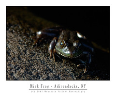
Various frogs, loons, beaver, bats, and fox were all seen on or near Round Lake. There were signs of racoons in a stump at Round Lake Stream outlet which was filled with mussel shells.
The state recently finished building primitive campsites on the lake, eleven in total, some of which have yet to be camped on. It appeared sites 1 and 11 were essentially brand new. Quite a treat it is to camp on squishy ground in established campsites, I remember back in 1999 many of the now hardened Little Tupper sites were so similar. Several of the sites were in a odd fashion built on the sites of the former camps. I note this to be odd because the state rarely uses old hunting camps or homesteads as campsites.
In 8 years we have a lot of fond memories of little Tupper, including the first time Caney put his head under the water to get a stick. It might seem trivial but it still amazes us when he essentially snorkels for sticks or frogs. This weekend he decided to fish for fresh water mussels while we slept. We know because he had mussels on up high above the shoreline as we were loading the boat.
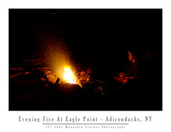
Over the years we've explored every cove and outlet on Little Tupper. We've explored Rock Pond and it's outlets. We've hiked into Bum Pond and paddled most the the way to Charlie Pond. We've had a bear in our site once, and just this weekend a fox ran right up to me as I sat by the fire.
Of course some of our strangest memories of Little Tupper have to do with the winds. Little Tupper is a natural wind tunnel, shallow (about 18 feet deep), narrow and long it sucks the prevailing southwest wind up. It doesn't take much for this shallow lake to create white caps and strong winds can be dangerous. We've stood on the shore of our campsite quite a few times watching less fit and less experienced paddlers struggle to find refuge from the wind. Often they are in over loaded boats that ride low to the water line, or trailing a boat with children or enough gear for a month. Waves rocking the boat and wind pushing them into the shoreline, or worse, into the middle of the lake as they battle.
We've watched, and were prepared to go out and rescue, two young girls foolishly paddling around the lake on one of the windiest days I can recall. I sometimes like the battle the wind, paddle through the chop, but that day Aim and I got beat pretty badly and were lucky to be close to our favorite campsite when we called it quits. I was certain for a while those girls were going to swamp or just run out of energy before they made it across. The girls eventually did make it across the 1/2 mile wide section of the lake about 30 minutes later.
Although we've explored quite a bit over the years, we've still yet to link Lake Lila and Little Tupper. We've yet to hike to the summit of Antediluvian Mountain, or complete the paddle to Charlie Pond among many other things. Round Lake and it's outlet, Round Lake Stream, also beg for more exploration with tales of narrow gorges and Class V rapids. Now that the Whitney Wilderness is safely under the protection of Article 14, and part of the Forest Preserve, we can take our time knowing it will be there, as it is today, for generations to come.
William C. Whitney and his family were great stewards to this land, and now the public has the opportunity to enjoy it as well.
technorati tags:ADK, Daks, Adirondacks, Whitney, wilderness, canoe, paddle, paddling, hiking, Round Lake, Eagle Point, Pentax, K10D, Article 14, Forest Preserve, Forever Wild, Little Tupper Lake, Tupper, Rock Pond, Lake Lila, sunset, sunrise, primitive, camping, campsite
Blogged with Flock
Technorati: Adirondacks, ADK, APA, camping, canoe, DEC, Forever Wild, K10D, Lake Lila, Little Tupper Lake, loon, map, paddling, Pentax, photography, Round Lake, Whitney Wilderness, wilderness conservation
Monday, August 6, 2007
Jordan River Recon
The Jordan River was once one of the most sought after paddles in the Adirondacks. Despite the fact that most of the river is entirely navigable flat water above the first mile of the Class II-IV rapids at it's mouth, it could not be paddled without tremendous risk.
The risk wasn't of dangerous rapids or wild forest, but men with shotguns guarding the mouth and patrolling the banks. The Adirondacks, a 6.5 million acre forest preserve in Northern New York State, are mostly owned by a relatively few groups. Currently a little more than 60% is state land (about 3.5 million acres), "forever wild" by the state constitution, and free for the use of all. This comprises the largest wilderness east of the Rockies, and the entirety of the wild lands within the Blue Line are bigger than Yosemite, Grand Canyon and Yellowstone Parks combined.
Of the 2.5 million private acres remaining most are owned by logging companies, or large hunting and game clubs. For the most part the Adirondacks are still sparsely developed, and wilder today than when Article 14 of the New York State constitution was originally ratified.
Of course, the patchwork of public and private land within the Blue Line can at times create problems. The state has an aggressive land acquisition fund, and pursues purchases of private land, to expand the public holdings within the Blue Line of the forest preserve. The patchy nature of the land rights within the Blue Line can be a problem for the adventurous.
The late Paul Jamison, professor of english and author of Adirondack North Flow, was one of most accomplished modern Adirondack adventurers on waters within the Blue Line. His short but compelling description of the Jordan River's wild nature made me want to paddle it. However, just like in Jamison's day the river was off limits because of the hunting clubs assertion that portage through the rapids and around the dam was illegal since they owned the land surrounding the lower portion of the river.
By common law this assertion is wrong. But by fear of death or imprisonment this assertion still stands today. Many "navigable" Adirondack rivers are off limits because of the landowners assumed power. This is despite the fact that common law states that travel on a navigable river cannot be impeded just because a section is unnavigable. One section (or sections) where a river must be bypassed using the minimum shoreline necessary is entirely legal. And while in most cases if a NYS DEC Ranger is called to the scene the paddlers rights will be upheld, if the NYS Police arrive on scene you might be taken to jail, even if no charges are actually brought.
This fear keeps many stretches of beautiful river free from public use. In Jamison's day, while the hunting and game clubs were active along the lower Jordan River, it was even more compelling.
The landowners actually know they do not have a right to prevent navigation on a navigable river, and it is why every trespassing case has been settled before court. Once in the courts this will be appealed to the state supreme court, where undoubtedly precedent will be set opening the way for not only a few brave paddlers here and there, but an onslaught of paddlers empowered by legal precedent and excited to find new adventures on once forbidden water.
In the case of the Jordan River, the state recently acquired easements, which now allow a legal portage trail from Carry Falls Reservoir to the Jordan River above the dam.
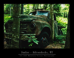
While this carry isn't easy due to it's length it is not a difficult portage. It's around 2.5-3 miles. Lots of ups and downs on a rutted sandy ATV road. Regardless, it certainly beats the alternative of tracking your boat upstream and portaging around the rapids. And certainly beats being shot or arrested for trespassing.
The Jordan River is not for everyone, but it is close to my ideal river paddle. It's about 20 feet wide on average and meanders north and south as much as travels east to west. It's shoreline is filled with giant pines, and lush vegetation. It has many many dead end coves. These coves can be like a river maze, sometimes you make a wrong turn and end up back where you were a few minutes before. At times you turn so sharply you feel like you are looking the at the back end of the boat. And dead fall? Well it's choked with sweepers and strainers. There are times you are lucky if you paddle 5 minutes between obstructions. Each time your precariously exit the boat, onto the downed trees and haul the boat, and it's cargo (about 120lbs) up and over the obstruction. Sometimes giant pines, sometimes smaller trees. Sometimes a combinations of both. Oh, and if you are lucky enough to not have a stretch of dead fall you just might encounter beaver dams one after another.
This might sound terrible but really it's what a wild river is. I'd compare it's scenery with that of the Oswegatchie which is very similar in nature, although a little wider.
While the Oswegatchie is filled with dead fall and beaver dams (last trip we hit 19 beaver dams over 14 miles) it isn't remote. Sure the interior above High Falls, some 14 miles in, is fairly remote, but because of the lack of portaging (it's a car top put in) the river at times can be crowded. Despite the long upstream paddle, any reasonably fit paddler can make it upstream to High Falls in a day, and blow down is often removed or carry trails around the larger strainers and rapids are established. There are also numerous pages of guide book material on the Oz, in contrast to the Jordan, which even in Jamison's book only has about 1 page.
Paddling on the Jordan is an amazing feeling, knowing you will most likely not see another person even if you spent weeks on it. Within a few minutes we saw almost every type of river flora native to the Adirondacks, a water skimming red frog, a great blue heron, snake trails over the sand, and just the beauty of an untrammeled river.
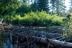
Unfortunately, we also ran into dead falls quite quickly. Our trip up the Jordan only netted us 1 linear mile of hard paddling. Not much cruising beyond the first 1/3 mile. We'd probably have only averaged about 1.5 miles per hour had we kept paddling into the darkness.
While we usually get a dawn start for our paddling adventures, Aim's been working a lot of overtime and didn't want to go up Friday night. Unfortunately, Carry Falls Reservoir is about the furthest location from where we live to paddle within the park. About a 2:45 minute drive, so even getting on the road by 6am just doesn't give you enough time for a location you've never been to before.
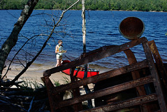
After we located the legal portage which is not currently listed anywhere on the web, nor in a guidebook, and then we scouted it (essentially walking about halfway to the Jordan without the boat), we killed an additional 2 hours. By the time we arrived at the river put-in it was nearly 4pm and we didn't get on the water till 4:15.
Caney was immediately at home. He loves these meandering rivers and creeks, complete with the dead falls and all the bugs. He'll swim endlessly chasing surface bugs after working his way up stream against the current and then shooting down with it. Dead falls don't bother him a bit either. Even at 8, those obstacles are the equivalent of a playground to a child.
We decided a little over 1 hour into paddling the Jordan that we were not going to make it very far with the remaining light. And considering the difficulty or the river and the length of the return portage, continuing further on upstream Sunday was not an option. We looked for a campsite on the Jordan but decided to head back to Carry Falls and camp on the beach.
Neither of us wanted to make that portage again that night, but I figured hard work Saturday night would pay off with a day of relaxing Sunday and short paddle out.
It was hard but seemed shorter than the way in, I think largely because it was slightly more downhill. We arrived back at Carry Falls in complete darkness, walking better than half the portage trail by the light of our headlamps. Between searching for the portage route and the actual portage we walked far more than we paddled.
When we got back to Carry Falls we loaded the boat and turned the headlamps off, paddling only by starlight on the perfectly still and silent water. It was a very peaceful way to get back in the boat and finish the active part of our day.
At camp we set up the tent, cooked dinner and watched this stars and meteor showers. Aim hit the sack early. I spent next few hours taking starlight photos in the cool summer evening weather.
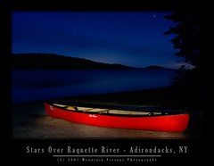
The thing I love about Adirondack summer nights is the fact that unless you are hardy, most nights it's cold enough to wear a nice fleece and maybe even a hat. The bugs are usually long gone when the temps hit 50F and on this clear night on the Raquette it was 49F for the low. I never got cold enough to put on my fleece but I had just about everything else on as I sat on the beach watching the stars while my camera was recording timed exposures.
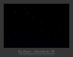
Sunday went as planned. Sleep late, swim, eat, swim, lay in the sun, swim, eat, swim, run around the beach, race the dog for the stick in the lake, swim, lay in the sun. While I walked more than I paddled Saturday, I most likely swam more than I paddled Sunday. The dog is fast, but I've got a text book Australian crawl, which is simply more efficient than his dogie paddle.
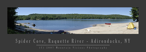
Packing up in the late afternoon sun and paddling out at a leisurely pace. At times there were so few signs of life from our beach front camp that I'm sure to the few passing paddlers and boaters it looked like our crew drank the coolaid.
When Jamison's description of the Jordan River instantly took hold when we both first saw the Jordan, it was clear this was a river worth the hard work to earn the satisfaction of it's wilderness beauty. I suppose some places charge you a monetary fee for access to the wonders they behold, it's clear the only fee to paddle the Jordan is the determination to put in a long day of hard work.
I'm looking forward to returning to the Jordan, with the foresight of the length of the portage and the difficulty of upstream travel we should have fewer problems paddling far deeper on our next attempt. No doubt it will be difficult, but we've paddled many creeks and outlets equally hard just for the fun of exploration, only to paddle back out the same day. Just the serenity and accomplishment of navigating such a infrequently traveled, remote (by Adirondack standards) and beautiful unspoiled wilderness river will be more than worth the effort when we return.
technorati tags:Jordan River, ADK, Daks, Adirondacks, paddle, paddling, panorama, portage, carry, Carry Falls Reservoir, Raquette, River, star, trails, Star trails, astro photography, night, deadfall, strainer, canoe, expedition, Forest Preserve, Forever Wild, Paul Jamison, Adirondack, North Flow, Old Town, abandoned, decay, wilderness, mountains,Pentax, photography, K10D, Mountain Visions, wilderness conservation
Blogged with Flock
Technorati: Adirondacks, ADK, canoe, Carry Falls, forest preserve, Forever Wild, Jordan River, map, paddle, paddling, Pentax, photography, wilderness conservation