Showing posts with label paddling. Show all posts

Tuesday, June 20, 2017

Spring 2017: Whitewater Paddling and Camper Van Build

It's been a busy Spring, not so much on the water, where I was hoping we'd have had more time to progress this year. Unfortunately, most of our free weekend days -the days we can paddle- have been eaten by the albatross of van life. Well, at least for a few more months, and then the van will be complete and we'll have a bit more freedom to roam and explore new places to paddle, climb,hike and just tour around.

Along the way, we've had a few days that we got on the water and definitely had some fun. And while the Deerfield, an old favorite and our home river is back in the mix. Most of the rivers we've run we first descents for us. Much like onsighting in climbing, you only run a river once blind, and those are the most fun descents. Of course, unlike rock climbing, the nature of rivers change with the flow, so to some extent, every descent is a first descent.

Here's a little slice of our Spring 2017...

The van (aka. Henry Van Hoevenberg):

Factory denim being reinstalled over the 1/2in polyiso board.

The inside of the van was stripped to the sheet metal to get the insulation and flooring installed.

Polyiso with 3M or Loctite contact cement in the center and Great Stuff Pro Gaps and Cracks on the edges. The contact cement allowed the board to attach to the van without elaborate bracing while the Great Stuff cured, forming a moisture tight bond.

$8 swap...replaced the factory incadascent bulbs with LEDs. 1/4 the power consumption for the same lumen output.

JBL and Infinity Speakers all around. Not the most high end system but good enough for a 16 year old van.

Templating out the cockpit headliner sound deadener. Every little bit helps.

The core of my power system. Noco Genius Gen4 40amp AC charger, and 4x100AH (400ah) AGM batteries. I'll also be charging off a CTEK DC/DC converter off the alternator and a solar panel on the roof.
6x9 Infinity's in the doors.

Rusty bolts under the seats. Seats were removed to install insulation and sound deadener in the cockpit floor. Also we'll be replacing the passenger seat base with a swivel seat and we swapped out the factory vinyl seats with OEM fabric seats with arm rest.


EZ-Cool unerlayment being installed.
Cargo area insulated. Poly iso on walls, EZ-Cool + polyiso + 1/2in plywood  + Vinyl flooring is the rear floor. Walls are poly iso, thinsulate and the factory denim.
Rear side windows don't open, so now they don't exist.We sealed them with Reflextix, Thinsulate,Polyiso foam board and FRP board.

Finished sealed windows.


The fun stuff (aka. whitewater paddling):

We found some bigger water this Spring, bigger than even the Dead River at 3500. We ran some old summer favorites at Spring high water levels and a new run, the Schroon at what appears to be a not often run 7ft. It seems most folks are spending time paddling more seasonal stuff and usually hit the Schroon at around 3.5-4ft during the summer months.
Permanent Rapids on the Saranac River. Our first run in an OC in 2017.

Big hit in Zoar Gap at 1500cfs. Notice how calm Colvin (our dog) is.
Little Missy aka. Big Drop at 6.9ft on the Schroon. This was a blast to run and at this level around a IV.

Take a look at the vertical gain over those waves on the wave train following Big Drop. I'd guess the waves were in the 4-5ft range. 

Thursday, January 19, 2017

Monday, October 17, 2016

Surfing and Swimming the Lower West River (R2)

Surfing and Swimming the West River from Mountain Visions on Vimeo.
I've become quite adept at finding gentle keeper hydraulics. This benign hole spiced up the lower West River a bit during the first day of 2016 West Fest in Jamaica, Vermont and sent me for a much needed swim. The lower section, between Jamaica State Park and the Route 100 bridge, is pretty tame in a raft, but we wanted to get our dog out and decided to run the lower section with him. One of the main reasons we got the raft was so we could bring him along and the cool thing about whitewater is you don't need class IV water to practice class IV moves. On day two we ran the upper section, which is somewhat technical class III. Although we had no problems with it, I'd be hesitant to bring the dog due to the potential for some technical swims, especially through the Dumplings.

Wednesday, September 28, 2016

Keeper Hydraulics on the Dead River: What It Feels Like To Be Stuck In A Washing Machine

Setting up for the shuttle Saturday morning. Our tiny Nine.Five is the raft on top of the 13ft raft on top of the van.

Ever wonder what tossing your cat in a top loading washing machine would feel like? ---NOTE: I'm being facetious, I would never put my cat -and probably not your cat- in a washing machine, but this is the internet and some idiot will be offended that I used literary license to set the stage for the rest of the blog.---

Last weekend we ran the Dead River at 3500cfs (technically about 3550 with the Spencer Stream inflow). It was arguably our hardest river run to date. Slightly more technical than the Indian River (Hudson River Gorge, Indian Lake, NY), much longer, and the waves were at times much higher. Though, I never found it as fast as the Indian. Like the Indian, the Dead is not particularly technical, perhaps just a handful or must do moves over 16 miles. It was definitely a fun and challenging run for us in our first full year of whitewater.  And probably about the max I'd feel comfortable with paddling without the safety net of partners in other boats.

The Dead River in The Forks, Maine is perhaps the Northeast most sustained whitewater run with a class IV-V rating at flows above 5500. At those flows there is also one nasty keeper hydraulic, which has been responsible for at least two deaths and a few guides losing their jobs. Fortunately, at 3500 it's just starting to form and not really too much of an issue. Unfortunately, it's sort of at the end of a bunch of rapids (well, a bunch of harder rapids, because the Dead is 16 miles of almost non stop rapids). So, it's very easy to let your guard down. In fact, this happens quite a bit. People think they passed it. And I did too. 

When most people think of whitewater, they think of bombing down a river like a chicken without a head. But, it's really a highly skilled game with lots of nuances and ever changing conditions. Learning to read a river and adjusting to the different currents, cross currents and features, and applying the correct strokes, angles, edge and maneuvers is really quite exhilarating. It's a chess match. My goal is to become a competent R2 rafter up to class V and a competent OC boater at least to class 3+. To do that requires a lot more than just bombing down the river and hoping for the best.  So while practicing technique on our home rivers, we've also been trying to run as many new rivers as possible.

Our original plan for Evil Nasty Hole was to run right of river center and deal with the other hole on that section of river, FBI hole -also a strong hydraulic, but one that is borderline fun at almost all levels once formed. By staying river center to right of center down the "boiling wave train" we'd be clear of Evil Nasty and perhaps skirt FBI on the left. For some reason I assumed with passed the aptly named keeper hole, Evil Nasty (also called Unemployment Hole), and we were sort of going down the left side of the river in a relaxed fashion. 

Lots of waves indicate a wave train which is generally not formed by rocks, but rather a slow down of the water in front of you, perhaps a pool or change in gradient or difference in width of the river. Waves are only an issue if two or fewer waves are seen in a row because one or two can be formed by a rock or other obstruction. As we got closer I noticed the big wave in front and called out lets head left, which was the river edge closest to us. Then at the last minute we decided to go right, which was the original plan. Still not 100% aware that this was definitely Evil Nasty. Within seconds we were sure it was, based on the cliffs down river left, and the big wave to our left. We tried paddling hard right using a combination of draws and forward strokes. In hindsight, back ferrying would have been our best option, but alas, this is where first year whitewater paddlers get into trouble. Instinctively we should have back paddled into a back ferry towards river right, using the force of the current to move us right while not getting significantly closer to the hole and most likely missing the hole. We ended up just catching the right edge of Evil Nasty because we tried to paddle down river cross current. Doh! Rookie mistake.

What lulled me (and really us) to sleep was the river description was for the 5500 flow level. The river to the center simply didn't have that big nasty looking wave train, in fact, the commercial rafts love wave trains because they look nasty and are fun with big splashes, but usually aren't the slightest bit technical, and they all went river left (one going into Evil Nasty after we left) since the wave trains simply weren't there. 

I'd say being caught in Evil Nasty at 3500 for two minutes was a fun experience, but it also was the first keeper hole we have been in, and as such, I learned just how nasty such a hole can be. If you aren't failing your probably aren't pushing yourself, and you probably aren't going to progress. Getting caught in the hole while not planned and technically a failure on our part for several reasons, definitely was a learning experience. 

I do hope to go back to the Dead for a two day release at 2400cfs (Class II+) and run it with our hardshell OC2, and also do it again at 3500cfs (Class III+) with our Aire Nine.Five raft. I'd also like to be good enough in the raft to run it R2 at 5500 (Class IV) next year by the end of the year. Not to mention I'd like to give the Kennebeck (Class IV) a run as well. Hopefully by that point we have another 30 river days under our belts, perhaps a swift water rescue course and maybe some paddling partners to give us a little more safety margin. 

Our campsite at River Drivers
After Evil Nasty you have the hardest part of the river in front of you, Little and Big Poplar Falls. Two solid class 3 sections with big waves and some maneuvers to line them up. Those went perfectly and we ran good lines. We took out almost directly at our campsite (200ft portage to our campsite) at Webbs/River Drivers campground, a small low key family operation. River Drivers no longer guides rafts or has a restaurant on site, but it's the sort of unpretentious, low key, no frills sort of place I like to stay. If you need more fancy digs, Northern seemed like a swanky place to stay (hot tub, pool, onsite restaurant, etc) and other rafting outfits also provide camping. Downsides of River Drivers, there is a logging operation
Best part of owning a raft, it doubles as camp furniture!
on site and because they are dog friendly (which is awesome) there is also the potential to step in dog poop (mostly from their 3 big, friendly, and well behaved labs). Like all rafting campgrounds, quiet hours are whenever till two ours before shuttle time, so don't count on sleeping too much, but this isn't a River Driver issue, you'll find it anywhere. They also offer a shuttle most weekends the Dead runs, and it's I believe $10 a person, $5 per boat and a $5 surcharge for the raft (don't use that as a basis for budgeting, I know it was $30 for two of us and a raft, the raft was extra). It was a friendly operation which I'll definitely use again, and I hope they continue to offer camping and shuttle service.

The rest of the trip was awesome filled with generally great weather, and included a stop in Portland, Maine, where we were compelled to indulge in some fresh Maine lobster. 
Andy's Pub in Portland. Lobster tacos, tenderloin and lobster and mussels marinara. The lobster tacos were incredible.


Evil Nasty Hole - Dead River, Maine from Mountain Visions on Vimeo.

Ever wonder what it would be like to put your cat (or yourself, for the cat lovers out there) in a top loading washing machine? There is really only one keeper hydraulic on the Dead River, it's aptly named Evil Nasty Hole, and this is it. At 3500cfs it's pretty tame, only keeping us for a little under 2 minutes and not really being a drowning machine that can form at 5000cfs.. The record, if you care, is 10 minutes in Evil Nasty, we barely even get a participation ribbon. The Dead is 13 miles of essentially non stop rapids, so I sort of let my guard down when we got to this point.. I did tell my partner​ I thought we should head left, but we then decided to move river center (as originally planned) and skirt it on the right. As you can see, we didn't quite get out of it's re-circulation.. Next time we go left (or way right).

Wednesday, June 30, 2010

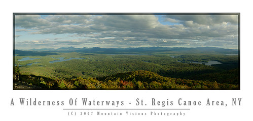
The Adirondack Mountains...A Wilderness Of Waterways

"New York's Adirondacks are rugged and dramatic, but what distinguishes them from the mountain ranges in Vermont and New Hampshire is their waters, the hundreds of lakes and ponds and miles and miles of rivers that the others simply do not have". - THE NEW YORK TIMES
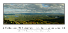
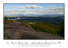
Panorama From St Regis Mtn. (39 megapixels)

What the New York Times said has always been my thoughts when trying to explain the Adirondacks to people not familiar with the region. Sure there are mountains, beautiful rugged mountains at that, but it is the view from the summits of those mountains that is unlike most other places east or west of the Mississippi. I'm sure most people look out and see the other mountains, their next High Peak to bag on the way to a 46'er patch, but my primary interest when I look out is all that water!

Climbers look out at summits and cliffs looking for their next climbing objective, paddlers look out from summits in search of their next paddle. To me it's always been a wilderness of waterways first, with some mountains mixed in for fun during the winter months! The Adirondacks are one of the few publicly accessible places I can think of with such a mix of mountain and water, that is what makes them unique to me!

There are still dozens of bigger bodies of flat water with wilderness character, or perhaps even completely wilderness that we haven't yet paddled. My goal this year was to spend time on some of those, as well as some of the places we have only been to one or two times over the last 10 years. While we've paddled all the "old classics" time and again, it's nice to know there are many more future classics on the horizon!

The list this year includes the Grass River and Grass River Flow, Deer River and Deer River Flow, St Regis River and Santa Clara Flow, Madawaska Flow and Quebec Brook, Stillwater Reservoir, return trips to both ends of the Osgood River, perhaps a fall trip down the Fulton Chain after the summer tourist and motor boats have long gone. We might even look at pond hopping the Pigeon Lake Wilderness, but perhaps that is for next year. Of course, it's been almost 5 years since our last trip to the incredible Oswegatchie, this time though, instead of the usual 14 mile upstream paddle to High Falls, I think we'll do it as a paddle/backpack into some of the off river ponds!

With some regret, I'm putting the crown jewel of Adirondack river paddles, the Jordan River, off for one more year till we perhaps have a lighter 2 person boat or second single seater; both options would be better suited for pulling over obstacles on the beautiful -but blowdown choked- meandering wilderness river. It's been almost 3 years since we first paddled the Jordan but rest assured, we will paddle the entirety of the Jordan soon enough. The late Paul Jamieson made sure the once inaccessible river was indelibly ingrained in my imagination.

Monday, June 21, 2010

Garnet Lake Is A Southern Adirondack Gem


After 10 years of paddling in the Adirondack's we still haven't come close to paddling every reasonably accessible body of water, and that is a nice thing. This weekend we knocked another paddle off my list, Garnet Lake. A nice little lake I'd had on my list for a few years, Garnet is about 50% state owned shoreline and 50% private.

Although this is a nice short drive from home (about 1 hour, including 25 miles of winding secondary and dirt roads) it just isn't a big enough lake to really bother for a weekend trip. Aim and I easily knock out 15-20 miles a day in the Old Town Scout, which is pretty decent considering our high volume, gently rockered all purpose boat isn't the fastest on the water. Of course, we have been known to beat sleek sea kayaks on 14 mile flatwater paddles while paddling the Scout! Bearing that in mind, a 2 mile by 1/2 mile lake really isn't going to keep us busy for too long. However, every year we try to do our first paddle someplace cozy while we get our sea legs (and arms) back in shape.


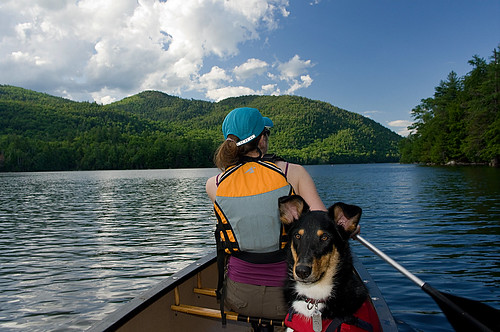
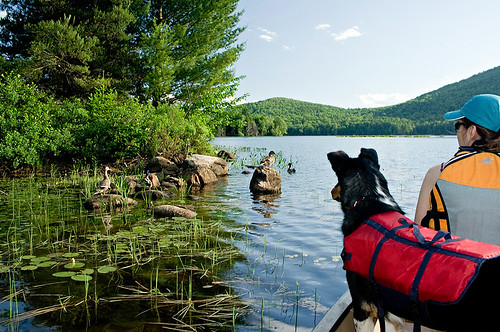
Aside from our first paddle of the year, this was also Colvin's first paddle of his entire life! It wasn't without some fear that we undertook this first paddle, but Colvin did great in the boat, and he is just a weekend away from being able to swim. The first day we paddled with him without his PFD (or rather CFD) because I'm pretty confident if we rolled he'd have figured out how to swim really quickly. On day two we decided to put it on him because I've had some people tell me that they were able to get their dog swimming faster by putting a PFD (that's a life jacket to all you land lubbers) on them for the first few swims. I think as soon as he learns to swim we are going to have a hard time keeping him out of the water!


Other than peeing in the boat (our fault, he did try to tell us he had to go), Colvin actually did much better than Caney at listening to us, and of course he stayed in the boat and didn't swim the entire time we paddled. We didn't have a single group ask us if we were tormenting the poor dog by making him swim along side the boat like we did the first few years with Caney!

Garnet Lake, despite it's relatively small size, does have quite a bit of shoreline due to it's irregular shape and many coves. Almost 6 miles to be exact, and 2/3 of that is ringed by mountains making it quite scenic. The near 3000ft mountains thrust up 1500ft from the lakes 1400ft base elevation directly from the shoreline. The lake had quite a bit of wildlife, although we didn't see much. Some paddlers told us they spotted bald eagles on the southern terminus, we saw beaver lodges and other signs of beavers, and there were a pair of loons on the lake that we spotted several times. We also saw the less interesting ducks and geese.

Although the paddling is limited, the lake does have 2 short hikes that originate from it's shores. The first to Round Pond (one of many in the Adirondacks) and the second to Lizard Pond. The Lizard Pond hike is only accessible to those with a boat since the trail head is isolated and across the lake. Both hikes are less than 2.5 miles in each direction. I've definitely got Lizard Pond on my list as a paddle/backpack combo at some point in the future.

Saturday we set up camp at a pull-in site. We day paddled the state owned 2/3s of the shoreline and looked at the various campsites and trail heads. Most of the limited campsites were filled assuring us we made the right decision to car camp rather than canoe camp. After paddling and playing with Colvin in the water for most of the afternoon it started lightly raining when we got back to camp, I didn't feel like cooking, so we headed to North Creek for some pizza. Aim and I sat outside on the deck at Pete's Ah in North Creek while Colvin sulked in the car. The plan was to have him sit outside with us, but when I went to get him I noticed a DD's iced coffee cup thrown on my drivers seat. Unfortunately the cup had remnants of the ice water and some unfinished coffee/cream in it, actually a lot more coffee and cream than I'd have hoped for since it was a bad iced coffee. He got a bit of a earful and stayed in the car while we ate. When he hasn't been exercised I understand this behavior but when he spent all day playing and he was clearly tired (aka. happy in Border Collie terms), what he did was purely about spite because he was left in the car. This isn't the first time this has happened. I no longer have satellite radio as a result of 3 different chewing incidents in the car in which he systematically dismantled my well put together satellite system.


Saturday overnight it stormed so hard that we spent a good amount of time Sunday trying to remember when it stormed harder while we were camping. It definitely came in as a top 5 storm for rainfall severity and lightening, however, we've been in much worse when wind is factored in. I'm fine with the rain in the Marmot Swallow 2P, although the fly can get a little saggy if you don't restake it after it gets wet, the tent hasn't let me down yet on many a rainy weekend (or week)! For two people (and a dog) in summer conditions it's very livable and vents extremely well, even in the rain. But when I started seeing defined streaks of lightening hitting the shoreline of the lake outside my tent window, I got a little nervous!

Sunday, after spending most of the morning piddling around camp and drying out our gear, we packed up and eventually dragged the 70+lb Scout 500ft down to the water. Once on the water we paddled the private shoreline of Garnet Lake and then headed back towards the public half for a bit more exploring. In contrast to Saturday's hazy, hot and humid, Sunday was picture perfect. Lower humidity, better visibility and a mix of sun, blue skies and puffy white clouds. On a scale of 1-10 it was a 9.5 at least. Even the bugs were at a minimum.

All things considered, our fears were a bit over done, it was a perfect 1st weekend on the water, and a fun new place to explore. Colvin did great and I think we can head to some more difficult paddles from this point forward.

Friday, July 31, 2009

Goodbye Caney "Wonder Dog"

In The Mountains of NH, Men are made.


Born: January 20, 1999  Died: July 31, 2009 at 5:25pm

Justin was his person:  June 8th 1999 - forever.

Love you, and thank you for showing us Wonder Dog one more time last weekend. You are indisputable proof that no matter how bad things are that there is no such thing as a bad day on the trail.

I miss you already but I know you are arrogantly leading the pack somewhere. Go play with your best friend Russell. Say hi to Mom (just try to pretend you know/want to heel when she walks you).  Go find Madi, she wanted a white dog, and now she has a really good one.

I always felt like you were a person trapped in a dogs body. If that is true, I will gladly be your dog next time around.

Right now I can't imagine having to go so long till we spend time on the trail together again, but we will always be closest to you when we are in the mountains.


First or Second Overnight Paddling Trip (2000)


Blogged with the Flock Browser

Wednesday, October 3, 2007

Going Vertical In The St. Regis Canoe Area


The St. Regis Canoe Area (STRCA) is a pond hoppers paradise. Having 58 ponds in 18,000 wilderness acres, the area has short -but plentiful- portages.

Out of the boat for a weekend we headed for Paul Smith's in the Northern Adirondacks which is just outside the eastern boundary to the STRCA. The goal was either a sunrise or sunset summit and we opted to leave home at around 12pm and watch the sunset.


We had great weather, although it was a bit chilly. Low 40s on the summit with a consistent 10mph breeze.

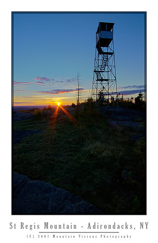
St. Regis Mountain is on the northern border of the STRCA and offers a commanding view of the "wilderness of waterways" below, as well as a nearly 360* view of the northern Adirondacks.


The hike in is a rolling 3.5 mile walk that goes vertical for the last 1 mile gaining most of the nearly 1300ft in that abbreviated stretch.

Although St. Regis summit has a fire tower, it is neither open, climbable or barely standing at this point.
 

In the States master plan and Unit Management Plans (UMP) fire towers are a grey area. The state temporaliy grandfathered them into the wilderness areas until the aerial fire survalence and modern communications systems were up and running at 100%. It has been some time since 100% operational status has been reached, and a decade or more since the last fire tower was last staffed. However, the St Regis firetower has been left to be an eyesore and eventually fall to the ground.

My feelings are if the State/DEC/APA feels it needs to go then tear it down and fully remove it from the summit. If it wants to keep it then let a private group restore it as has been done on the other towers in the non wilderness areas.

However, the current state of purgatory this tower is in is a disgrace. Barely standing, and with no lower laddering to even allow people to ascend part way like most closed towers allow.

Personally, I don't believe these belong in wilderness areas. However, I also don't have a major problem with them if they are restored. Regardless, a decision on the status of this tower would be appreciated.


Blogged with Flock

Wednesday, August 22, 2007

All Is Good On The Osgood

The Osgood River is the purest sense of a dichotomy. The scenery, wildlife and feel of the paddling would make you believe you were deep in the heart of a boreal wilderness. Then the wind dies down, and you hear Rt. 30 with one of the longest straight strectches of pavement in the Blue Line, busling with speeding traffic from Paul Smiths, Tupper Lake and Saranac Lake to Malone outside the Blue Line.

Buried with work, we got a late start Friday night. Pulled into the put-in at 2am to the sound of rain drops on the roof. No chance to set up my tent, and too tired to, we slept soundly, if not coldly, in the car.

I woke up Saturday at 6am to continued rain, fog and 40F temps. Back to sleep till 10am when it when it stopped raining, although still looked cold and dreary.

Aim wasn't too happy about putting in. She is the definition of a fair weather paddler. 75F and sunny, or turn the car around and head home. Unfortunately, in the Daks, rain and occasional barely 60F summer days are part of the game, otherwise, expect to paddle once or twice a summer at most.

Really it wasn't the rain, cloud cover or damp coldness that was disheartening, rather, the fact that you couldn't escape the bitter wind blowing from the north. It had the end of October crisp chill to it.

After we unloaded an older couple pulled up with a car top canoe. They came down to the water bundled up, looked at us shivering and shook their heads. "We're headed home, too cold out there for us."

Aim gave me a look when they said that like, "can we please go home!"

Not a chance. I told her this is good practice for October paddling and to suck it up.

Caney was already in the water swimming, he approved of the St Regis, and said this looked like a good river to paddle.
Admittedly it was darn cold. I was wearing my neoprene socks under my sandals, I had on my goretex shell, a t-shirt, and a long sleeve base layer under my PFD. Typically I don't wear this much even for October paddling and I was still chilly.

I stayed chilled all day, and was convinced my thermometer didn't work. 61F? I've never been cold unless I was wet in temps that mild. Yet, even after the sun decided to do it's thing, I was still never really warmed up all day.

Eventually we got on the water and the cool temps didn't seem so awful as we paddled upstream on the St Regis River towards Meacham Lake. Our destination was the the mouth of the Osgood River at the southern shore of Meacham Lake.
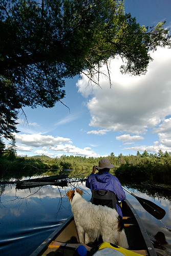
From the descriptions the Osgood looked like one of those 30 foot wide meandering rivers with a crooked course and beaver dams that I love so much. Even more so it looked like a place that didn't see much traffic. Really there was nothing super appealing in the descriptions for the average paddler. No great views, no amazing campsites, no waterfalls, just a nice meandering river surrounded by a boreal forest.

Most the the Adirondacks, which are part of the Candian Shield and not the Appalachians like the rest of the Northeastern US, straddle a transition zone of mountains and lakes that is unique toeastern North America. The region lies in the transition zone betweenthe eastern deciduous and boreal forest ecosystems. The Osgood is actually above the transition zone and almost entirely boreal. The fully boreal biome of the Adirondacks below 4000ft is rather small and isolated. Much of the public holdings are recent, and part of the Champion Lands purchases in the last few years. Paddling the Osgood, like the Jordan, you immediately see the difference in the nature of the forest compared to most other places within the Blue Line.
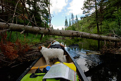
I'm pretty social out in the wilds but at times I like the peace of knowing I'm somewhat alone, even if only in theory. Sometimes it's nice to be the only boat on a particular body of water. Looking at the maps the Osgood looked like the ticket, and of course the weather meant there would be few day paddlers coming from Meacham Lake as well.
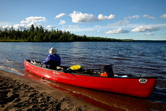
Well, the Osgood was exactly what I'd envisioned; other than the sound of the road.

When viewing the river corridor on a map, the west bank is within 3/4-1.5 miles of the river but not closer until below Barnum Pond. Yet, you could hear trucks, and motorcylces for that 3/4 mile minimum distance whenever the blustery winds died down. Now to the east the river is not bordered by a paved road for many many miles. Actually, it's all forest preserve land to the rivers east.
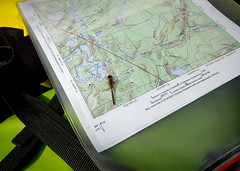
Perhaps on a less beautiful flow this would have been enough to spoil the paddle but the Osgood was simply too beautiful with flower covered boreal shorelines, and spectacular wildlife.
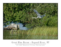
We saw at least 6 great blue heron, 1 egret, deer, a baby beaver on a giant beaver dam/lodge, countless whiskey jacks (gray jays), wood ducks, mallard ducks, and many more species of birds than I know the names of. This is all despite a 10am start Saturday and a late start Sunday as well.

While beaver activity in this area could be seen, there were very few dams. The fact that the boreal forest lining the shores was mostly conifers made it tough for the beavers to slow us down. Beavers prefer hardwoods and with the relative lack of options quickly eat themselves out of house and home before that can create too much trouble for paddlers.
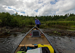
Despite the lack of hardwoods, we saw one of the most innovative beaver dams I've ever seen. It was a dam and lodge built into one. As we approached it on the paddle out Sunday we saw a small baby beaver walking around on top and eventually go down into the lodge. Mom and dad must have been off looking for hardwoods to to repairs on the breached river left edge of the dam.
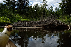
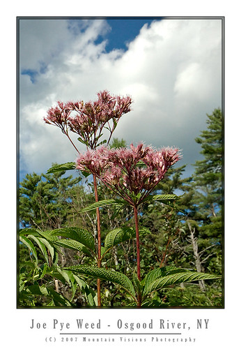
The flora on this river refused to be second fiddle to the abundant wildlife. I'd venture to say we saw nearly every type of equatic plant native to the northern Adirondacks. From carnivorous pitcher plants, to candy apple red cardinal flowers, to joe pye weed, to pickerelweed , water lily, water hemlock, and countless others.
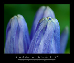
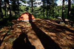
Saturday we camped high on a narrow esker that separated the river from a pond. Our campsite, wholey exposed to the north wind, was a bit chilly but made for excellent camping. I commented to Aim that it felt like we were on a Adirondack alpine summit. The ferocity and coldness of the wind had that unmistakable alpine feel. The winds, according to the weather station in Saranac Lake, were gusting to 29mph.
Despite the previous nights rain we got a fire going faster than I've ever seen. The dry wind coming from the north dried out every bit of wood and fed the fire with enough air to have it blazing in minutes. Rarely have I seen a fire take off with such little effort.

The wind eventually died down enough that it was just a slight breeze at times. It actually felt warmer as we ate dinner despite the fact that the temperature dropped from 61F when we got to camp to 55F while we were eating.
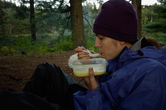
Sunday after sleeping in late, we had a late breakfast including fresh blueberries picked from around the camp. Such a nice addition to my otherwise bland cereal.


Despite the less than perfect summer weather - it was perfect October weather, and our 5th rainless weekend in a row - the Osgood was truly a spectular river. Most of the shoreline is within the forest preserve and on the stretch we paddled we only saw a few posted signs, and 2 actual private residences. The rest of the river and shoreline was superbly wild in nature. With a set of earplugs, I'd paddle the Osgood over the Oswegatchie, an Adirondack benchmark for scenic wild rivers, any day of the week and twice on Sunday.

technorati tags:, , , , , , , , , , , , , , , , , , , , , , , , , , , , , , , , , , , ,

Blogged with Flock

Tuesday, August 14, 2007

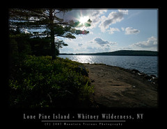
The Whitney Wilderness

“I date from Little Tupper Lake, and a finer lake it would be hard to find. No desolate lines ofdrowned lands here. All as it came from the hands of nature. Have been out this morning deer hunting, so to speak. Laid off for four mortal hours waiting for a deer to attempt the crossing of Dukett’s Bay. No deer came. But there came a loon, and he settled within ten rods of the canoe, raised himself on hind legs (they are very hind, and he has no others), turned his white, clean breast to me and gave me his best weird, strange song. Clearer than a clarion, sweeter than a flute, load enough to e heard for miles...”

From Nessmuk’s Adirondack letters
Cruise of the Sairy Gamp, 6
Forest and Stream, Sept. 13, 1883


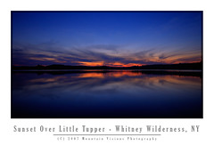
Acquired by the state in 1998-1999, Aim, Caney, and I were among the first legal public paddlers to use Little Tupper Lake and the Whitney Canoe Area in the summer of 1999. It wasn't in a guide book yet, and there was little info, we just happened to drive by the headquarters while going to Lake Lila.

I'd venture to say, over the years, we've logged more nautical miles in the Whitney Canoe Area than anywhere else in the park. Probably in excess of 200 miles. I'd further be willing to bet that every mile on Little Tupper is worth 1.5 miles on any other regularly paddled lake. The wind seems to blow southwest in the morning but in the evening (just in time for the paddle out) it seems to come from the east. I'm guessing this phenomenon is more than just bad luck. Most likely the wind is being generated by adiabatic cooling off the summits of the high peaks after the sun gets low on the horizon.

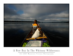
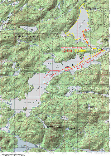
This weekend we added another 25 miles of paddling to our Whitney Wilderness odometer. In typical fashion we were the first ones in Saturday morning, and the last out after dark Sunday night. Headlamps safely packed in the dry bags we had no choice but to paddle in the dark on a moonless night.

Formerly part of Whitney Park, owned by the Whitney's (of Mary Lou Whitney socialite fame), Gov. Pataki acquired this well logged but fairly pristine tract of land using funds from the Environmental Protection Fund and Clean Water Clean Air Bond Act.

The Whitney's still have a presence in the William C. Whitney Wilderness that is more than the legacy of a name. They own the only two private residences in the wilderness. Camp On The Point, and Camp Francis. They also still own extensive tracts of land forming the southern border of the Whitney Wilderness which comprises the rest of Whitney Park.

In terms of land acquisitions this is about as big as it gets. The Whitney area was logged, lightly mined and has a (unimproved) logging road system, but is essentially pristine in nature.

It supports multiple types of recreation, including skiing, paddling, hiking and horseback riding. As a wilderness, it is motorless, and mountain bikes are also prohibited.


The Whitney Wilderness is so pristine in fact, that Little Tupper Lake is one of the last bodies of water in the northeastern US to retain it's original native trout population. It's an example to me, and hopefully to others, how logged land is far better than paved land with a mini mall on it. Left alone in 20 years only the astute hiker or paddler could tell the difference between land that was logged in a environmentally conscious fashion and native forest. In 50-100 years even they might have a hard time determining just how wild the land was when it was acquired. Those sandy hard packed and shadeless logging roads have a constant tendency to grow in and become the most pleasant grassy woods roads.

All the bodies of water in the WWW are natural and free of man made impoundments. The only dam within the wilderness is located at the Round Lake/Round Lake Stream outlet, and it only serves to raise the water level a maximum of 2-3 feet.

In itself the Whitney Area is an impressive acquisition but when combined with adjoining state lands the magnitude of this purchase really begins to take hold.

The Whitney Canoe Area adjoins Like Lila Primitive area, and as of 2007 also links to Bog Lake, Clear Pond, and the Oswegatchie via Lake Lila. This essentially opens up multi-day wilderness traverses within this part of the park and makes it far more than the weekend paddlers paradise it has been for many years.

It's now possible to travel for 40-80 miles in several directions with a few short portages. Linking rivers, lakes, ponds and streams, there are numerous options for long distance paddles. And with the exception of the Beaver River, all on Forest Preserve land, or lands with easements.

In 2001 the state began negotiations to purchase the Round Lake Tract from International Paper. Round Lake, a largely a undeveloped wilderness lake, adjoins Little Tupper Lake via a large navigable outlet.

The shoreline of Round Lake was leased from IP to various hunting clubs, but other than some dirt woods roads, and some old razed and largely removed hunting camps it is essentially undeveloped and primitive in nature.

While I'm not entirely sure when it became legal to paddle Round Lake (in 2004 the state still advised against it) this weekend was our first trip to Round Lake. With it's undeveloped irregular shoreline it is a great addition to the Whitney Wilderness. Furthermore, it adds a connection to Tupper Lake and the Bog River from the east via a technical whitewater paddle down the outlet to the Bog River.

Round Lake itself is about 1/3 the size of the 6 mile Little Tupper Lake but the shape and irregularity of the lake and the outlet offer quite a bit of paddling. Like Little Tupper, Round Lakes orientation and shape make it prone to wind. The lake is longest in a southwest direction and gets hit with the same winds as Little Tupper.

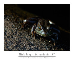
Various frogs, loons, beaver, bats, and fox were all seen on or near Round Lake. There were signs of racoons in a stump at Round Lake Stream outlet which was filled with mussel shells.

The state recently finished building primitive campsites on the lake, eleven in total, some of which have yet to be camped on. It appeared sites 1 and 11 were essentially brand new. Quite a treat it is to camp on squishy ground in established campsites, I remember back in 1999 many of the now hardened Little Tupper sites were so similar. Several of the sites were in a odd fashion built on the sites of the former camps. I note this to be odd because the state rarely uses old hunting camps or homesteads as campsites.

In 8 years we have a lot of fond memories of little Tupper, including the first time Caney put his head under the water to get a stick. It might seem trivial but it still amazes us when he essentially snorkels for sticks or frogs. This weekend he decided to fish for fresh water mussels while we slept. We know because he had mussels on up high above the shoreline as we were loading the boat.

Over the years we've explored every cove and outlet on Little Tupper. We've explored Rock Pond and it's outlets. We've hiked into Bum Pond and paddled most the the way to Charlie Pond. We've had a bear in our site once, and just this weekend a fox ran right up to me as I sat by the fire.
Of course some of our strangest memories of Little Tupper have to do with the winds. Little Tupper is a natural wind tunnel, shallow (about 18 feet deep), narrow and long it sucks the prevailing southwest wind up. It doesn't take much for this shallow lake to create white caps and strong winds can be dangerous. We've stood on the shore of our campsite quite a few times watching less fit and less experienced paddlers struggle to find refuge from the wind. Often they are in over loaded boats that ride low to the water line, or trailing a boat with children or enough gear for a month. Waves rocking the boat and wind pushing them into the shoreline, or worse, into the middle of the lake as they battle.

We've watched, and were prepared to go out and rescue, two young girls foolishly paddling around the lake on one of the windiest days I can recall. I sometimes like the battle the wind, paddle through the chop, but that day Aim and I got beat pretty badly and were lucky to be close to our favorite campsite when we called it quits. I was certain for a while those girls were going to swamp or just run out of energy before they made it across. The girls eventually did make it across the 1/2 mile wide section of the lake about 30 minutes later.

Although we've explored quite a bit over the years, we've still yet to link Lake Lila and Little Tupper. We've yet to hike to the summit of Antediluvian Mountain, or complete the paddle to Charlie Pond among many other things. Round Lake and it's outlet, Round Lake Stream, also beg for more exploration with tales of narrow gorges and Class V rapids. Now that the Whitney Wilderness is safely under the protection of Article 14, and part of the Forest Preserve, we can take our time knowing it will be there, as it is today, for generations to come.
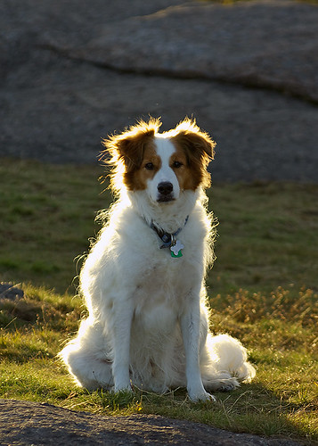

William C. Whitney and his family were great stewards to this land, and now the public has the opportunity to enjoy it as well.


technorati tags:, , , , , , , , , , , , , , , , , , , , , , , ,

Blogged with Flock