Showing posts with label canoe. Show all posts

Monday, November 22, 2010

Phil Brown Fought the Law, and the Law....

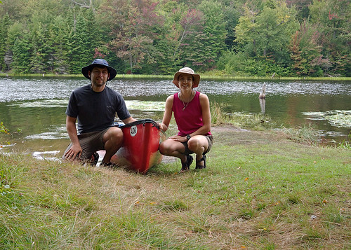
She Said: Is That A Boat, Or Are You REALLY Happy To See Me?
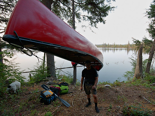
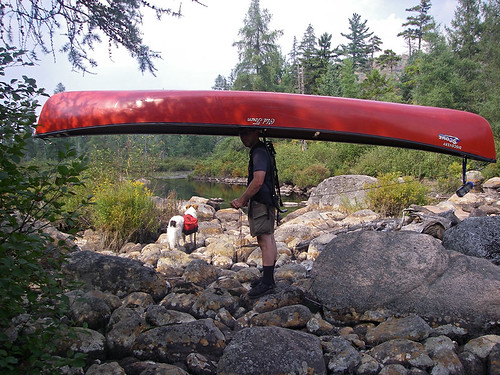
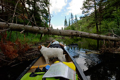
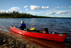
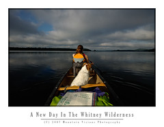
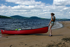
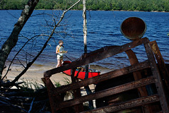
Almost the end of a short day of paddling and a long day of portaging, camp is across the lake!


...well we'll find out just what the law is and how it pertains to paddlers, thanks to our fearless editor of the Adirondack Explorer.

Phil Brown, editor of the Adirondack Explorer, and a pretty good writer and outdoorsman, doesn't just talk the talk, he walks the walk and paddles the boat. As a result, the Brandreth Park Association (which appears to be a single person or family) and Friends of Thayer Lake have decided to make an example of Phil Brown in order to keep its waters safe from navigation by the rest of the paddling community. Phil, of course needed a lesson, after all, his pen is mightier than the potentially illegal signs and barriers that shoreline owners have erected to illegally prevent navigation.

First, Phil is hardly a criminal. The New York State Department of Environmental Conservation has already informed the above groups that paddlers DO have a right to paddle through the private shoreline in question. All Phil did was exercise his legal rights and remind others about their rights. Secondly, if you've ever read Phil's columns or blog post then you know he doesn't tiptoe around controversial topics. This was clearly no different.

Brown said he paddled through the private land and wrote about it because he believes the public has a right to. “The Lila Traverse is one of the best wilderness canoe routes in the Adirondacks,” he said. “Replacing a long slog on foot with an hour or so of great canoeing only makes it better.” - via Syracuse.com

The issue at hand is centuries old common law which has been upheld in various state courts of law, but the Adirondacks seem to be an exception to this. As a matter of fact, the famous author and paddling advocate, Paul Jamison, remarked how the laws of navigation within the Adirondack Park were strangely different from outside of it. The reason this is odd is that the majority of the land within the Adirondack Park is state forest preserve -Forever Wild- and owned by the people of the state for free use. However, much of that land is in a piecemeal checker board layout that means quite a bit of private land borders state lands. Often and in-holding separates two parcels of state land. This of course causes quite a bit of contention in many cases.

Oddly, in the Adirondacks it is assumed that if a body of water, though accessible and navigable without need to trespass on land, is surrounded by private property, the water is off limits to boaters. However, in the rest of the state people regularly paddle and boat through waters surrounded by private shorelines without incident.

The issue is sticky, but has centuries old legal precedent because: 1) water was/is essential for transportation and commerce; 2) you technically cannot own water or the water bed of navigable water ways, in such cases the state owns the stream bed and it must be left open to public egress. Thus, it's generally accepted that provided you remain below the high water mark of a generally navigable waterway you have the right to travel on that waterway, even if you have to exit your boat due to temporary obstructions, low water levels, or to line your boat downstream or upstream. Keep in mind there are lots of little exceptions that prevent this from being a free for all. As an example, just because I can paddle into an outlet less lake without stepping on land, it doesn't mean I am not trespassing. If the lake is surrounded by private land with no outlet or egress to state land, it's off limits. Likewise, if a body of water isn't considered navigable during median flow, it is off limits. The key thing I'm trying to point out about navigation rights is that they are in fact about navigation and commerce, not the erosion of people's property rights as the Brandeth Park and Thayer Lake groups would have you believe.
 
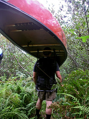
Harrington Brook Portage
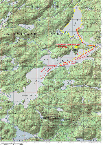
This particular issue resonates deeply with me, and is more than just an opportunity to stand on my soapbox. In 2007 my wife and I were one of the first groups to paddle the not yet officially opened Whitney Traverse, which essentially allows you to paddle from Little Tupper to either Lake Lila, the Bog River, or a complete circle from Round Lake. Truthfully, you can essentially go anywhere within hundreds of miles via various options, but those are the basic options that make up the trip. Regardless of how far you travel, you always have to portage over several sections of land when starting from Little Tupper Lake, but one section is clearly avoidable just by looking at the map.


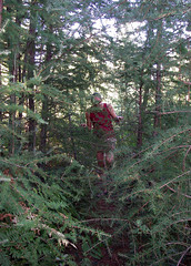
Hey!! Is this the trail? Uh, yeah, right through those trees!!! (literally)
Portage path from Lilypad Pond
On our trip in 2007, I briefly considered doing what Phil Brown did. Quite frankly, I wasn't planning on doing it to make a point or exercise my rights, portaging the only expedition sized boat we had was no easy task. We did the trip over 9 full days, of which only 4 involved real travel, it was a leisurely excuse to do something challenging yet also relax deep in the Adirondack wilderness at locations that were really not ideally accessible on a weekend trip. Despite the leisurely nine day itinerary, we actually covered tremendous ground on travel days. As an example, the first three days we just decompressed while moving a grand total of 10 of 75+ total miles. However, moving 150+lbs of boat and equipment is a heck of challenge, and while I genuinely enjoyed it, I'm a paddler, not a pack mule. As a paddler, I know portaging (also called carries in this part of the world) is part of any long distance paddling trip, but it eats time, energy, has most risk of injury necessitating rescue, can lead to bears or animals scavenging your food stores, and is really the hardest part of any multi-day expedition. As a straight paddle my wife and I could have easily covered the 75 miles in three days, perhaps even two days fully loaded. It was the overland travel that really slowed things down.


Paddle and Portage: 2007 ADK Lake Traverse
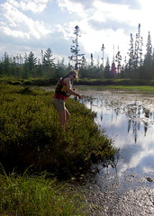
Pulling 150lbs over low water mud
In the end, I wasn't 100% sure of the navigability of the bodies of water in question; 2007 was one of the lowest water years I have seen in a decade of Adirondack paddling, and old timers commented that by historical measures it was extremely low. While on Hardigan Pond we had to resort to pulling our canoe over mud flats that formed when the water receded, I certainly didn't want to get us into a sketchy situation on private property. That factor alone caused us to paddle a measly half mile across a pond only to unpack an entire boat, hoist it overhead and return for the rest of the gear on a second trip, a method known as a double carry! If my memory is correct, it worked out to be about 2.25 land miles through thick spruce thickets and horrendous brush on a yet unmarked and not fully cut portage trail. The alternative was a pleasant paddle surrounded by private land.

A Dream Is Like A River...Ever Changing As It Flows..
Portage to Harrington Brook


Often legal action is threatened but never used when the outcome is uncertain, in this case it's clear the plaintiffs could lose. As a matter of fact, it seems unlikely they will win because while they chose Phil Brown, they are really taking on the state of New York and legal precedent. I'm genuinely hoping Brandeth Park Association and Friends of Thayer Lake played their cards poorly in this last ditch effort, and when the gavel drops we have a definitive ruling that upholds the rights of navigation for paddlers and other boaters inside and outside the Blue Line!

Good luck Phil Brown!

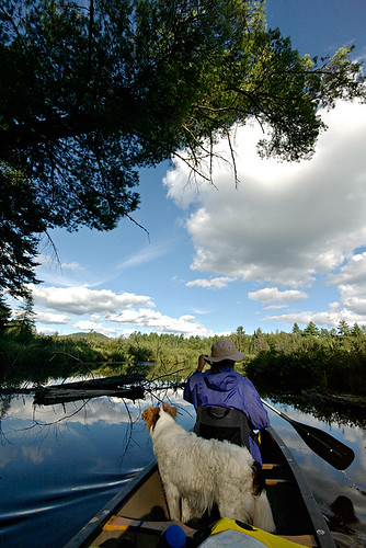
Phil Brown paddling the meandering scenic  Shingle Shanty Brook

For more on this issue:

http://www.syracuse.com/news/index.ssf/2010/11/adirondack_landowners_sue_padd.html

Wednesday, September 26, 2007

Going Up Lila's Dirty Crack

It's been about 15 months since my last rock climb. Actually, just top roping with my sister in the Daks. An easy 5.6 crack that I'd led in better climbing shape, but that I was almost terrified to top rope.

Climbing with my sister is no easy task, she has the attention span of a gnat, and typically space cases don't make the safest partners. So in June 2006, I had no choice but to complete the climb as I'd rather have fallen on a run out X rated lead then to test my sisters attention span. Of course, by finishing the climb I was left to be lowered, which was perhaps as pleasant as a slow painful death. (sorry Heather but climbing with you is scary).

My friend Daniel and I on the other hand have at least attempted quite a few climbs, even if we haven't actually completed many of them. A few here and there being remote, and not often climbed. Of course thats part of the adventure and getting down for us has always seemingly been harder than the climbing.

Daniel is unhappily back for 3 months on the east coast at Princeton. I don't think he dislikes the east coast, but Princeton isn't San Francisco with the Sierra and Cascade Ranges a short drive away, nor is it even Boston or NY with the Gunks, Daks, White and Green Mountains all within a few hours drive. Princeton from an outdoor standpoint is about 7 hours from any (by east coast standards) real mountains, and at least 2 hours from the Gunks.

Of course he wasted no time getting out, back east for 3 days and he was on a bus to Albany Friday morning with a 5am alpine start. Me, I got an early start for myself, and was done with a half day of work by 11:30am, just in time to drive the few blocks to the bus station and pick him up.

Off to LL Bean for my 3rd water filter this year (long story). In an enigma wrapped in a Pandora's box I've now spent $200 this year on water filtration and still only have 1 semi working filter.

A quick stop home to load his gear in dry bags, switch cars, and load the boat we were off to the Adirondacks at 2pm.

Making pretty good time we drove the 145 miles to lake Lila in almost exactly 2:20 which isn't bad considering the last ~10 miles are over dirt roads.

The parking lot was already 3/4 full. Truly amazing for a Friday afternoon in early fall. While Aim and I have been to the lake once already this year while on our canoe traverse, we've always avoided it because of the insane crowds. Somehow, despite paddling typically every weekend most years, over the last 7 years we only have paddled Lake Lila two times.

Lila is a place where families flock to, apparently for the fine white sandy beaches, and perhaps the small mountain. It's however, not in my opinion, so nice that people should endure the stress of driving the 10 miles of dirt roads only to find out that the parking lot is full. Or get on the lake to realize that all the 20 something sites are taken. That alone is a reason to avoid it.

WARNING TO THOSE LOOKING TO PADDLE/CLIMB LAKE LILA: If the lot is full you MUST drive at least the 5.5 miles back to Sabitis Road to park and walk back to the lake since the access road is private and no parking is allowed.

We were on the water a bit after 5pm and paddled to the only site we've ever stayed at since it is usually open.

Of course fate would have it that we should have listened to the people coming out and gone directly to site 5 where they just broke camp. Our planned site, complete with a nice beach, large campsite and nice tent pad, not to mention a great view of the sunset was already taken. We checked the next site and were not impressed.

We paddled back across the lake toward site #5, or something nearby as the sun was setting in front of us. Neither one of us had much sleep so we were more talkative than actually trying to get to camp. At times we even just stopped on the stillness of the water. After the sun went down I figured it was time to get a move on it. I wanted to at least find camp before we needed headlamps, since as always they were packed deep in the packs.
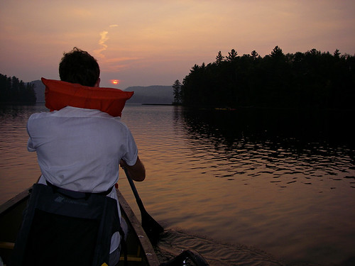
I decided with how late it was to skip 5 and head for the lean-to and it's nearby campsites. At the lean-to someone had set up a tent inside. Extremely rude to do on a busy weekend, and actually illegal. If you want to tent, you should camp on a site, if you want to sleep in a lean-to then you should do so.

We ended up at site #8 which is actually the old tennis courts of the great camp owned by the Webbs before the state purchased the land in the early 1980s. The states policy is to allow nature to reclaim itself so the great camp, which had no unique or valuable historical significance, was burned to the ground. It now serves as a nice grassy campsite overlooking the lake. The tennis courts are similar, only they have no open view of the lake.

So we set up camp, cooked dinner and started a fire. We ended up not going to bed till just after midnight, a long day.

Saturday we didn't emerge from our nylon cocoons till the wee hours of early afternoon. Despite attempts by various hikers to wake us up, we successfully managed to sleep till about 11:30am. So take that your rude inconsiderate noise makers who get up at a reasonable hour! And to the sun, your were no match for the darkness of the inside of a sleeping bag.

After brunch and sorting out the climbing gear we headed toward the Nehasane train station which was built by the Webb's so they could access their camp nearly a century ago. As most rail traffic through the Daks was stopped by the 1970's, the Remsen-Lake Placid line is now a travel corridor for snow mobiles in winter, and part of the portage to Bog Lake as well in summer. It's still a DOT right of way and I assume if necessary could one day be reopened to rail traffic, however, the tracks are not in great shape and the whole line would probably have to be rebuilt.
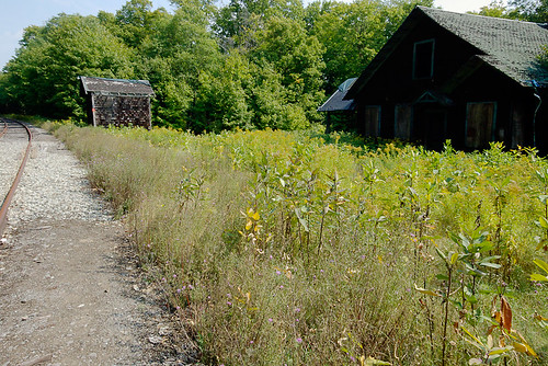
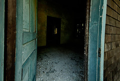
The rail station is on it's last leg and those wishing to visit it, and enter it should do so soon and with caution. The roof has been tarped, and the floors are rotten in places, but Daniel walked in at least to the first room without any problems.
We were off to the cliffs which are just a short walk down the tracks. On our way we passed GreyL from adkforums who has been spending most of the month in the Daks camping and paddling. He was also interested in the cliffs, and was camped at the site next to us. A pleasant guy who stopped by to chat a few times.

When we got to the field with the concrete foundation we started the bushwhack up to the cliffs. A fairly short but steep hike through the forest that essentially covers the same elevation as Mt Frederica's 1.5 mile trail, about 500ft, but in just 1/2 mile or so. It looked like it would rain but we figured we'd scout out the cliffs no matter what.

At the base we saw what looked like a climb in the 5.4-5.6 (G) range. A dirty irregular crack on the 70* slabs that form part of the mountain face. While this was most likely not a first ascent, it was clearly not too often climbed. The crack was filled with moss, dirt, grass and small saplings, and the base was not trampled. Of course this area has been sparsely climbed and the guidebook list the general cliffs but not individual climbs.

So Daniel suited up and I realized my nut tool was at camp. Typically the leader doesn't need a nut too since he is placing pro, rather than removing it, but since the climb was dirty I figured he might need it to clean out the crack.
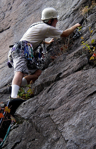
Off he went, and right away was using that nut tool to get deep into the crack to place solid gear. Clearly this climb had maybe seen a few ascents, or perhaps none at all.

Daniel made fairly quick work of the lead, despite needing to clean out the crack before placing gear. Some of the rock was loose, but carefully climbing nothing sizable fell. Overall despite the hollow sound in some spots, the rock seemed relatively solid.

I tied in and began climbing the 100ft 5.4, which was a mix of face and crack.

We had two ropes but decided we could get down on one, so I left my rope at the base instead of trailing it. This would come back to be a bad choice, but one that was easily fixed.

The first thing I noticed when I started climbing was that I forgot how tight climbing shoes are. Designed to be as snug as possible they are a big difference from the sandals I'd walked/portaged and hiked around in all summer. After a few minutes the shoes stretched a bit and the throbbing pain went away -or my feet just became numb enough to not notice.
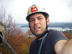
At the top we realized a problem. There were no sizable trees close to the edge, nor were they spaced properly to build a double anchor, and in the one spot there was a nice tree it was over a nice sharp edge. Good tree + sharp edge = bad rappel. Daniel kept me on belay as I explored the cliff top with my climbing shoes, which don't offer the best traction on leaves, dirt and angled mossy cliff tops. It appears I was able to learn something from my minor near fatal slip and fall on the Trap Dike.
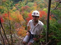
After a little searching we found a nice hardwood that was much more stable than the obvious pine we initially looked at. Problem was it added 20 feet to the cliff edge and unlike in the Gunks, or even more popular cliffs in the Daks where the cliff edges are clear from repeated use, this was filled with downed trees, saplings, and sticks. I set up an anchor and Daniel cleared the path of the rope.

To be safe since we weren't sure I we'd hit ground on rappel, I lowered him off with a Munter Hitch off the anchor. This gave us the full 200ft of the rope, which we knew was plenty.

When he got down he realized the ropes were too short for rappel, so he attached the rope using an EDK (Euro Death Knot) aka. the overhand. With plenty of tails, and two similarly sized ropes the EDK isn't really the death knot, but people apparently tied it incorrectly at times with short tails, and because the knot tends to flip once or twice when loaded, if you leave less than 12-18 inches it might flip open.

Having rappelled for the first time off the EDK in the Daks, in 33F temps and pouring rain while ice climbing, I trusted it for it's speed and safety. The speed factor of tying an overhand is much faster than a rewoven figure 8 or a fisherman's, and much more intuitive than a square knot. Safety comes from the fact that the EDK is less prone to being stuck in cracks while you pull the ropes. A stuck rope is by far one of the most dangerous things that can happen to a climbing team.

While I futzed with the fisherman's in that 33F February rain many years ago, refusing to rappel off the EDK, as my partner smugly waited for me to give in, I realized I was a lot colder than I was scared of my partners greater experience and confidence in the overhand knot. Since then, I am a convert.

Because of the distance of the rappel anchor from the cliff edge and all the brush I wanted to get the knot as close to the edge as possible. Off I went with the knot at the cliff edge but the blue rope was tangled on a ledge and in spots stuck in a crack. I got to the ledge tied off with a prussik and reflaked the rope. A few minutes later I was down and we were headed back to camp after completing our first successful remote climb in 3 years.

The threatening rain never came and we walked back via a different route, which was actually longer rather than the shortcut I'd envisioned. GreyL stopped by and we chatted about the climb as we ate and started a fire.

In bed much earier (well 10:30 rather than midnight) we decided that we'd get up and watch the sunrise from the lake shore. A head to the pillow decision changed that when I blabbered out, "why not get up 30 minutes earlier and go for the summit". Daniel of course agreed but I think we both had doubts we'd actually get up at 5:30am to do the summit. So the summit was the plan with a lake side viewing as backup plan B. Plan C was of course to sleep until noonish and then head home.

I woke up about 5 minutes before the 5:30a alarm, and to my surprise, I was wide awake and all set to go. Since we decided to go after going to bed we still had to pack our stuff. 15 minutes later we were right on schedule. We left camp at 5:50 and were on the summit by 6:25 using a combination of jogging and speed hiking, we covered the 1.5 miles and 500ft in just 35 minutes. That gave us 20 minutes to get setup and enjoy the pre-rise sky.

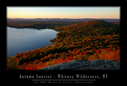
The sunrise wasn't spectacular, oddly because the sky was just too darn clear. No clouds, not much haze, and not even the usual mist coming off the lakes with the warm morning (about 51F). Still it was worth the short hike to see it.
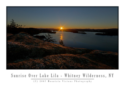
An hour later we were on our way down with intentions of going back to bed, but we never did as we both felt pretty awake and energized and really only could think about breakfast.
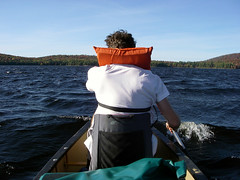
After breakfast, and some spider web photography we broke camp and paddled the west shore of Lake Lila as the wind pounded us from the north east. Skies were cloudless and the cool breeze made the warm air seem quite comfortable. We had some issues finding the Shingle Shanty Brook outlet but after trekking through the marshy grass we found our mistake. The outlet comes in from the left but turns sharply right at it's exit in the lake, from the boat it looks like a dead end.
After we ate lunch on one of those nice fine white sand beaches we found the outlet and paddled up to the first full beaver dam. Daniel was impressed by the fact the beavers were able to raise the water level about 3ft.
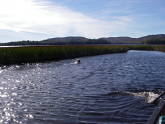
The trip back the wind was coming nicely from the north, which is typical since we were at the south end of the lake. A nice hard paddle back into 1 foot swells and we arrived at the takeout much later then we intended.

All in all it was a great trip. 3 days of nice weather, a little climbing, a little hiking and a bit of paddling to get to it all. In all we paddled 13 miles, rock climbed a dirty 100ft pitch, hiked about 6 miles, and portaged 1.5 miles.

technorati tags:, , , , , , , , , , , , , , , , , , , , , , , , , , , , , , , , ,

Blogged with Flock
Monday, September 10, 2007

ADK Canoe Traverse By The #'s

Back from 10 days in the Adirondack backcountry. 10 days without a road, power line, motorized vehicle, and aside from 2 cameras and a GPS (most useless/unused item I carried as usual) any electronic devices, or contact with the outside world.

This trip really let us get intimate with the Forest Preserve. While much of the land wasn't true virgin wilderness, it was beautiful, fairly pristine, and at the end of the day, wild, public, and remote enough to make you feel like you accomplished something while going somewhere. Sure some might be disheartened by clear cuts and logging roads, but try portaging through a Walmart, and then rethink your disdain for the lumber industry who owns a considerable portion of the 40% of private land in the Forest Preserves 6 million acres.

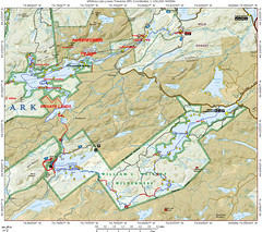
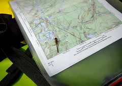
I attached a map of this trip, it's a general map but even with the latest Topo Software the rate at which land is acquired and added to the forest preserve the maps are just inaccurate. All the land we traveled through is legally fully state land, and the route is more accurate than the various trails on the ADK Topo Map 3D CDs which were just released a few months ago. Many logging roads are missing, and many that are shown on the maps don't exist anymore (if ever). While the USGS perhaps did the finest cartography of any nations lands, it simply fell behind over the last 50 years and most topo maps are borderline useless and hopelessly outdated.

On the map below red dashes are portages, solid red is hiking, blue dashes are paddling. Anytime you see a solid red between bodies of water it was a portage, however, we might have hiked it on an off day or it just blended together and looks solid. All the portages were "double carries".
For non paddlers that means 1 trip with gear, return to start, get more gear/boat, and back to the next leg. basically, each portage/carry is x 3. To do single carries means a super light boat, well established smooth trails, and a short supply of gear (aka, "light is right" philosophy); we had none of the former, so we doubled. No shame in working hard, and far better than sitting home and wondering what could have been done with a lighter boat and fewer carries.


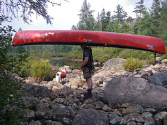
I have to thank Eric from KnuPack Systems. Simply put, carrying a 75lb boat was almost fun with his portage system (and I'm almost completely serious). I used an old Kelty Super Tioga that I bought for $5 and added his $45 retrofit kit. It didn't fit, nor was it guaranteed to, but with some last minute sanding I got it to fit. The bottom line, best $50 I ever spent. After a few hiccups, I actually preferred carrying the boat to the dry bags. Those still using yokes, or portage carts (absolutely no way a cart would work on the trails we did) need to get a KnuPac kit. Controlling the boat with a big external frame and some tag lines with the weight on your hips is amazing. It's like being a puppeteer. I actually beat Aim by 2 minutes on the Lily Pad Pond-Shingle Shanty portage, one of the roughest on the trip. the boat simply cleared a path thought the forest and I just followed it (ok sounds easy, but not really that easy). 5.5 total miles of carrying 80lbs (2 lbs of ballast on the stern +3lbs for the frame) and not a single back or neck ache once everything was fully adjusted.

Of course a full detailed trip report with photos will follow at some point in the near future.....
BY THE #'S
  • 10 total days
  • 73.33 total miles traveled (hiked, paddled, portaged)
  • 16.12 miles portaged/carried (no you didn't misread this, we did carry 150+lbs of gear, including a 75lb 16foot boat 16.12 miles over rough terrain on NOT yet established trails)
  • 6.88 miles of various hiking including (former) logging road exploration, former great camps, abandoned train stations, view points, summits, etc

  • 1 the amount of times the boat drifted away while not tied/removed from the water (hey the takeout was rocky/bouldery and rough, and it was a protected area so we figured it would be fine for a few minutes)
  • 100m the distance I had to swim to get the boat
  • 9 days of fair weather
  • 1 day of rain
  • 8 wind days (white caps on the lakes)
  • 90+ liters of water Aim filtered
  • 3000 meters swam (swam just about every day, and generally not to chase runaway boats)
  • 0 active roads seen or crossed
  • 0 motorized vehicles seen/heard in 8 of 10 days (day 10 saw a float plane land on Lows 2 X, heard logging while on Clear)
  • 4 rest days/ 0 mile days (not exactly true, we paddled, swam or hiked each and every day but stayed 2 nights at the same camp on rest days)
  • 6 travel days
  • 5000 saw strokes (okay, I have no idea, but I cut a lot of wood, including some on the portage "trails")
  • 1 leech bite (over 10 days this is an amazingly low #)
  • 2 the amount of hours it took me to realize the leech was on me
  • 2 the amount of hours it took to stop profusely bleeding after I removed it (there was blood pooling in the bottom of the boat that I had to sponge out)
  • 5 blisters
  • 50+ cuts (per person) from briers, thorns, branches, entire trees, and assorted trail debris
  • 1 perplexed look on the rangers face day 1 when we informed him of our plans while sitting on the rocks by our campsite getting some sun (hey, I understand, I look like a meatball and Aim like a string bean, neither like we could carry enough or move far enough to complete this trip)
  • 1 relaxed look when that ranger realized we had fully researched our plan and we're aware of the difficulty
  • 1 perplexed look on my face when the ranger said "yeah, someone flagged the trail to Harrington but we don't know who?" Huh? isn't that the DEC's (rangers) job?
  • 1 hour of paddling head on into 2 foot swells on lows lake with a 10-15mph head wind the lake literally looked like class III whitewater as we paddled into it
  • 3 # of officially marked portages
  • 9 # of total portages
  • 0 people seen on our portages
  • 0 people seen on interior lakes that required portaging
  • 4 # of touring kayaks we beat from Grass Pond on the 12 mile trip out Sunday morning into a slight head wind and pouring rain with a loaded open high volume tripping canoe!!!
  • 4:15 min time is took to paddle 12 miles and portage .53miles (total) from Grass Pond to Hitchins.
  • 1 # of chipmunks I was forced to kill because people fed them (a fed animal is a dead animal)
  • 1? # of chipmunks that broke into my parked car, ate all the sunflower seeds, pooped on the seats, ate gum, rummaged through the glove compartment, and slept in the backseat for several days!!!
  • 110 percent satisfaction of the efficiency we got everything done on travel days
  • 10/10 fun factor on this trip!!!


technorati tags:, , , , , , , , , , , , , , , , , , , , , , , , , , , , , , , , , , , , , , , , , , , , , , , , ,

Blogged with Flock
Wednesday, August 22, 2007

All Is Good On The Osgood

The Osgood River is the purest sense of a dichotomy. The scenery, wildlife and feel of the paddling would make you believe you were deep in the heart of a boreal wilderness. Then the wind dies down, and you hear Rt. 30 with one of the longest straight strectches of pavement in the Blue Line, busling with speeding traffic from Paul Smiths, Tupper Lake and Saranac Lake to Malone outside the Blue Line.

Buried with work, we got a late start Friday night. Pulled into the put-in at 2am to the sound of rain drops on the roof. No chance to set up my tent, and too tired to, we slept soundly, if not coldly, in the car.

I woke up Saturday at 6am to continued rain, fog and 40F temps. Back to sleep till 10am when it when it stopped raining, although still looked cold and dreary.

Aim wasn't too happy about putting in. She is the definition of a fair weather paddler. 75F and sunny, or turn the car around and head home. Unfortunately, in the Daks, rain and occasional barely 60F summer days are part of the game, otherwise, expect to paddle once or twice a summer at most.

Really it wasn't the rain, cloud cover or damp coldness that was disheartening, rather, the fact that you couldn't escape the bitter wind blowing from the north. It had the end of October crisp chill to it.

After we unloaded an older couple pulled up with a car top canoe. They came down to the water bundled up, looked at us shivering and shook their heads. "We're headed home, too cold out there for us."

Aim gave me a look when they said that like, "can we please go home!"

Not a chance. I told her this is good practice for October paddling and to suck it up.

Caney was already in the water swimming, he approved of the St Regis, and said this looked like a good river to paddle.

Admittedly it was darn cold. I was wearing my neoprene socks under my sandals, I had on my goretex shell, a t-shirt, and a long sleeve base layer under my PFD. Typically I don't wear this much even for October paddling and I was still chilly.

I stayed chilled all day, and was convinced my thermometer didn't work. 61F? I've never been cold unless I was wet in temps that mild. Yet, even after the sun decided to do it's thing, I was still never really warmed up all day.

Eventually we got on the water and the cool temps didn't seem so awful as we paddled upstream on the St Regis River towards Meacham Lake. Our destination was the the mouth of the Osgood River at the southern shore of Meacham Lake.

From the descriptions the Osgood looked like one of those 30 foot wide meandering rivers with a crooked course and beaver dams that I love so much. Even more so it looked like a place that didn't see much traffic. Really there was nothing super appealing in the descriptions for the average paddler. No great views, no amazing campsites, no waterfalls, just a nice meandering river surrounded by a boreal forest.

Most the the Adirondacks, which are part of the Candian Shield and not the Appalachians like the rest of the Northeastern US, straddle a transition zone of mountains and lakes that is unique toeastern North America. The region lies in the transition zone betweenthe eastern deciduous and boreal forest ecosystems. The Osgood is actually above the transition zone and almost entirely boreal. The fully boreal biome of the Adirondacks below 4000ft is rather small and isolated. Much of the public holdings are recent, and part of the Champion Lands purchases in the last few years. Paddling the Osgood, like the Jordan, you immediately see the difference in the nature of the forest compared to most other places within the Blue Line.

I'm pretty social out in the wilds but at times I like the peace of knowing I'm somewhat alone, even if only in theory. Sometimes it's nice to be the only boat on a particular body of water. Looking at the maps the Osgood looked like the ticket, and of course the weather meant there would be few day paddlers coming from Meacham Lake as well.

Well, the Osgood was exactly what I'd envisioned; other than the sound of the road.

When viewing the river corridor on a map, the west bank is within 3/4-1.5 miles of the river but not closer until below Barnum Pond. Yet, you could hear trucks, and motorcylces for that 3/4 mile minimum distance whenever the blustery winds died down. Now to the east the river is not bordered by a paved road for many many miles. Actually, it's all forest preserve land to the rivers east.

Perhaps on a less beautiful flow this would have been enough to spoil the paddle but the Osgood was simply too beautiful with flower covered boreal shorelines, and spectacular wildlife.

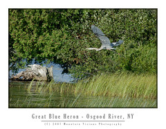
We saw at least 6 great blue heron, 1 egret, deer, a baby beaver on a giant beaver dam/lodge, countless whiskey jacks (gray jays), wood ducks, mallard ducks, and many more species of birds than I know the names of. This is all despite a 10am start Saturday and a late start Sunday as well.

While beaver activity in this area could be seen, there were very few dams. The fact that the boreal forest lining the shores was mostly conifers made it tough for the beavers to slow us down. Beavers prefer hardwoods and with the relative lack of options quickly eat themselves out of house and home before that can create too much trouble for paddlers.

Despite the lack of hardwoods, we saw one of the most innovative beaver dams I've ever seen. It was a dam and lodge built into one. As we approached it on the paddle out Sunday we saw a small baby beaver walking around on top and eventually go down into the lodge. Mom and dad must have been off looking for hardwoods to to repairs on the breached river left edge of the dam.

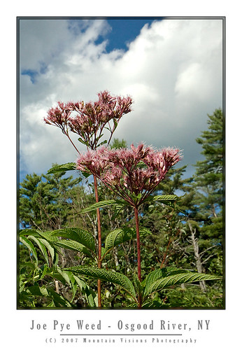
The flora on this river refused to be second fiddle to the abundant wildlife. I'd venture to say we saw nearly every type of equatic plant native to the northern Adirondacks. From carnivorous pitcher plants, to candy apple red cardinal flowers, to joe pye weed, to pickerelweed , water lily, water hemlock, and countless others.

Saturday we camped high on a narrow esker that separated the river from a pond. Our campsite, wholey exposed to the north wind, was a bit chilly but made for excellent camping. I commented to Aim that it felt like we were on a Adirondack alpine summit. The ferocity and coldness of the wind had that unmistakable alpine feel. The winds, according to the weather station in Saranac Lake, were gusting to 29mph.

Despite the previous nights rain we got a fire going faster than I've ever seen. The dry wind coming from the north dried out every bit of wood and fed the fire with enough air to have it blazing in minutes. Rarely have I seen a fire take off with such little effort.

The wind eventually died down enough that it was just a slight breeze at times. It actually felt warmer as we ate dinner despite the fact that the temperature dropped from 61F when we got to camp to 55F while we were eating.

Sunday after sleeping in late, we had a late breakfast including fresh blueberries picked from around the camp. Such a nice addition to my otherwise bland cereal.


Despite the less than perfect summer weather - it was perfect October weather, and our 5th rainless weekend in a row - the Osgood was truly a spectular river. Most of the shoreline is within the forest preserve and on the stretch we paddled we only saw a few posted signs, and 2 actual private residences. The rest of the river and shoreline was superbly wild in nature. With a set of earplugs, I'd paddle the Osgood over the Oswegatchie, an Adirondack benchmark for scenic wild rivers, any day of the week and twice on Sunday.

technorati tags:, , , , , , , , , , , , , , , , , , , , , , , , , , , , , , , , , , , ,

Blogged with Flock

Tuesday, August 14, 2007

The Whitney Wilderness

“I date from Little Tupper Lake, and a finer lake it would be hard to find. No desolate lines ofdrowned lands here. All as it came from the hands of nature. Have been out this morning deer hunting, so to speak. Laid off for four mortal hours waiting for a deer to attempt the crossing of Dukett’s Bay. No deer came. But there came a loon, and he settled within ten rods of the canoe, raised himself on hind legs (they are very hind, and he has no others), turned his white, clean breast to me and gave me his best weird, strange song. Clearer than a clarion, sweeter than a flute, load enough to e heard for miles...”

From Nessmuk’s Adirondack letters
Cruise of the Sairy Gamp, 6
Forest and Stream, Sept. 13, 1883


Acquired by the state in 1998-1999, Aim, Caney, and I were among the first legal public paddlers to use Little Tupper Lake and the Whitney Canoe Area in the summer of 1999. It wasn't in a guide book yet, and there was little info, we just happened to drive by the headquarters while going to Lake Lila.

I'd venture to say, over the years, we've logged more nautical miles in the Whitney Canoe Area than anywhere else in the park. Probably in excess of 200 miles. I'd further be willing to bet that every mile on Little Tupper is worth 1.5 miles on any other regularly paddled lake. The wind seems to blow southwest in the morning but in the evening (just in time for the paddle out) it seems to come from the east. I'm guessing this phenomenon is more than just bad luck. Most likely the wind is being generated by adiabatic cooling off the summits of the high peaks after the sun gets low on the horizon.

This weekend we added another 25 miles of paddling to our Whitney Wilderness odometer. In typical fashion we were the first ones in Saturday morning, and the last out after dark Sunday night. Headlamps safely packed in the dry bags we had no choice but to paddle in the dark on a moonless night.

Formerly part of Whitney Park, owned by the Whitney's (of Mary Lou Whitney socialite fame), Gov. Pataki acquired this well logged but fairly pristine tract of land using funds from the Environmental Protection Fund and Clean Water Clean Air Bond Act.

The Whitney's still have a presence in the William C. Whitney Wilderness that is more than the legacy of a name. They own the only two private residences in the wilderness. Camp On The Point, and Camp Francis. They also still own extensive tracts of land forming the southern border of the Whitney Wilderness which comprises the rest of Whitney Park.

In terms of land acquisitions this is about as big as it gets. The Whitney area was logged, lightly mined and has a (unimproved) logging road system, but is essentially pristine in nature.

It supports multiple types of recreation, including skiing, paddling, hiking and horseback riding. As a wilderness, it is motorless, and mountain bikes are also prohibited.


The Whitney Wilderness is so pristine in fact, that Little Tupper Lake is one of the last bodies of water in the northeastern US to retain it's original native trout population. It's an example to me, and hopefully to others, how logged land is far better than paved land with a mini mall on it. Left alone in 20 years only the astute hiker or paddler could tell the difference between land that was logged in a environmentally conscious fashion and native forest. In 50-100 years even they might have a hard time determining just how wild the land was when it was acquired. Those sandy hard packed and shadeless logging roads have a constant tendency to grow in and become the most pleasant grassy woods roads.

All the bodies of water in the WWW are natural and free of man made impoundments. The only dam within the wilderness is located at the Round Lake/Round Lake Stream outlet, and it only serves to raise the water level a maximum of 2-3 feet.

In itself the Whitney Area is an impressive acquisition but when combined with adjoining state lands the magnitude of this purchase really begins to take hold.

The Whitney Canoe Area adjoins Like Lila Primitive area, and as of 2007 also links to Bog Lake, Clear Pond, and the Oswegatchie via Lake Lila. This essentially opens up multi-day wilderness traverses within this part of the park and makes it far more than the weekend paddlers paradise it has been for many years.

It's now possible to travel for 40-80 miles in several directions with a few short portages. Linking rivers, lakes, ponds and streams, there are numerous options for long distance paddles. And with the exception of the Beaver River, all on Forest Preserve land, or lands with easements.

In 2001 the state began negotiations to purchase the Round Lake Tract from International Paper. Round Lake, a largely a undeveloped wilderness lake, adjoins Little Tupper Lake via a large navigable outlet.

The shoreline of Round Lake was leased from IP to various hunting clubs, but other than some dirt woods roads, and some old razed and largely removed hunting camps it is essentially undeveloped and primitive in nature.

While I'm not entirely sure when it became legal to paddle Round Lake (in 2004 the state still advised against it) this weekend was our first trip to Round Lake. With it's undeveloped irregular shoreline it is a great addition to the Whitney Wilderness. Furthermore, it adds a connection to Tupper Lake and the Bog River from the east via a technical whitewater paddle down the outlet to the Bog River.

Round Lake itself is about 1/3 the size of the 6 mile Little Tupper Lake but the shape and irregularity of the lake and the outlet offer quite a bit of paddling. Like Little Tupper, Round Lakes orientation and shape make it prone to wind. The lake is longest in a southwest direction and gets hit with the same winds as Little Tupper.

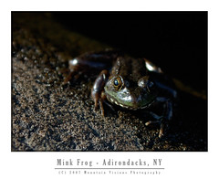
Various frogs, loons, beaver, bats, and fox were all seen on or near Round Lake. There were signs of racoons in a stump at Round Lake Stream outlet which was filled with mussel shells.

The state recently finished building primitive campsites on the lake, eleven in total, some of which have yet to be camped on. It appeared sites 1 and 11 were essentially brand new. Quite a treat it is to camp on squishy ground in established campsites, I remember back in 1999 many of the now hardened Little Tupper sites were so similar. Several of the sites were in a odd fashion built on the sites of the former camps. I note this to be odd because the state rarely uses old hunting camps or homesteads as campsites.

In 8 years we have a lot of fond memories of little Tupper, including the first time Caney put his head under the water to get a stick. It might seem trivial but it still amazes us when he essentially snorkels for sticks or frogs. This weekend he decided to fish for fresh water mussels while we slept. We know because he had mussels on up high above the shoreline as we were loading the boat.

Over the years we've explored every cove and outlet on Little Tupper. We've explored Rock Pond and it's outlets. We've hiked into Bum Pond and paddled most the the way to Charlie Pond. We've had a bear in our site once, and just this weekend a fox ran right up to me as I sat by the fire.

Of course some of our strangest memories of Little Tupper have to do with the winds. Little Tupper is a natural wind tunnel, shallow (about 18 feet deep), narrow and long it sucks the prevailing southwest wind up. It doesn't take much for this shallow lake to create white caps and strong winds can be dangerous. We've stood on the shore of our campsite quite a few times watching less fit and less experienced paddlers struggle to find refuge from the wind. Often they are in over loaded boats that ride low to the water line, or trailing a boat with children or enough gear for a month. Waves rocking the boat and wind pushing them into the shoreline, or worse, into the middle of the lake as they battle.

We've watched, and were prepared to go out and rescue, two young girls foolishly paddling around the lake on one of the windiest days I can recall. I sometimes like the battle the wind, paddle through the chop, but that day Aim and I got beat pretty badly and were lucky to be close to our favorite campsite when we called it quits. I was certain for a while those girls were going to swamp or just run out of energy before they made it across. The girls eventually did make it across the 1/2 mile wide section of the lake about 30 minutes later.

Although we've explored quite a bit over the years, we've still yet to link Lake Lila and Little Tupper. We've yet to hike to the summit of Antediluvian Mountain, or complete the paddle to Charlie Pond among many other things. Round Lake and it's outlet, Round Lake Stream, also beg for more exploration with tales of narrow gorges and Class V rapids. Now that the Whitney Wilderness is safely under the protection of Article 14, and part of the Forest Preserve, we can take our time knowing it will be there, as it is today, for generations to come.


William C. Whitney and his family were great stewards to this land, and now the public has the opportunity to enjoy it as well.


technorati tags:, , , , , , , , , , , , , , , , , , , , , , , ,

Blogged with Flock
Monday, August 6, 2007

Jordan River Recon

The Jordan River was once one of the most sought after paddles in the Adirondacks. Despite the fact that most of the river is entirely navigable flat water above the first mile of the Class II-IV rapids at it's mouth, it could not be paddled without tremendous risk.

The risk wasn't of dangerous rapids or wild forest, but men with shotguns guarding the mouth and patrolling the banks. The Adirondacks, a 6.5 million acre forest preserve in Northern New York State, are mostly owned by a relatively few groups. Currently a little more than 60% is state land (about 3.5 million acres), "forever wild" by the state constitution, and free for the use of all. This comprises the largest wilderness east of the Rockies, and the entirety of the wild lands within the Blue Line are bigger than Yosemite, Grand Canyon and Yellowstone Parks combined.

Of the 2.5 million private acres remaining most are owned by logging companies, or large hunting and game clubs. For the most part the Adirondacks are still sparsely developed, and wilder today than when Article 14 of the New York State constitution was originally ratified.

Of course, the patchwork of public and private land within the Blue Line can at times create problems. The state has an aggressive land acquisition fund, and pursues purchases of private land, to expand the public holdings within the Blue Line of the forest preserve. The patchy nature of the land rights within the Blue Line can be a problem for the adventurous.

The late Paul Jamison, professor of english and author of Adirondack North Flow, was one of most accomplished modern Adirondack adventurers on waters within the Blue Line. His short but compelling description of the Jordan River's wild nature made me want to paddle it. However, just like in Jamison's day the river was off limits because of the hunting clubs assertion that portage through the rapids and around the dam was illegal since they owned the land surrounding the lower portion of the river.
By common law this assertion is wrong. But by fear of death or imprisonment this assertion still stands today. Many "navigable" Adirondack rivers are off limits because of the landowners assumed power. This is despite the fact that common law states that travel on a navigable river cannot be impeded just because a section is unnavigable. One section (or sections) where a river must be bypassed using the minimum shoreline necessary is entirely legal. And while in most cases if a NYS DEC Ranger is called to the scene the paddlers rights will be upheld, if the NYS Police arrive on scene you might be taken to jail, even if no charges are actually brought.

This fear keeps many stretches of beautiful river free from public use. In Jamison's day, while the hunting and game clubs were active along the lower Jordan River, it was even more compelling.

The landowners actually know they do not have a right to prevent navigation on a navigable river, and it is why every trespassing case has been settled before court. Once in the courts this will be appealed to the state supreme court, where undoubtedly precedent will be set opening the way for not only a few brave paddlers here and there, but an onslaught of paddlers empowered by legal precedent and excited to find new adventures on once forbidden water.

In the case of the Jordan River, the state recently acquired easements, which now allow a legal portage trail from Carry Falls Reservoir to the Jordan River above the dam.

While this carry isn't easy due to it's length it is not a difficult portage. It's around 2.5-3 miles. Lots of ups and downs on a rutted sandy ATV road. Regardless, it certainly beats the alternative of tracking your boat upstream and portaging around the rapids. And certainly beats being shot or arrested for trespassing.

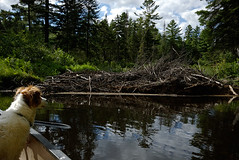
The Jordan River is not for everyone, but it is close to my ideal river paddle. It's about 20 feet wide on average and meanders north and south as much as travels east to west. It's shoreline is filled with giant pines, and lush vegetation. It has many many dead end coves. These coves can be like a river maze, sometimes you make a wrong turn and end up back where you were a few minutes before. At times you turn so sharply you feel like you are looking the at the back end of the boat. And dead fall? Well it's choked with sweepers and strainers. There are times you are lucky if you paddle 5 minutes between obstructions. Each time your precariously exit the boat, onto the downed trees and haul the boat, and it's cargo (about 120lbs) up and over the obstruction. Sometimes giant pines, sometimes smaller trees. Sometimes a combinations of both. Oh, and if you are lucky enough to not have a stretch of dead fall you just might encounter beaver dams one after another.

This might sound terrible but really it's what a wild river is. I'd compare it's scenery with that of the Oswegatchie which is very similar in nature, although a little wider.

While the Oswegatchie is filled with dead fall and beaver dams (last trip we hit 19 beaver dams over 14 miles) it isn't remote. Sure the interior above High Falls, some 14 miles in, is fairly remote, but because of the lack of portaging (it's a car top put in) the river at times can be crowded. Despite the long upstream paddle, any reasonably fit paddler can make it upstream to High Falls in a day, and blow down is often removed or carry trails around the larger strainers and rapids are established. There are also numerous pages of guide book material on the Oz, in contrast to the Jordan, which even in Jamison's book only has about 1 page.

Paddling on the Jordan is an amazing feeling, knowing you will most likely not see another person even if you spent weeks on it. Within a few minutes we saw almost every type of river flora native to the Adirondacks, a water skimming red frog, a great blue heron, snake trails over the sand, and just the beauty of an untrammeled river.

Unfortunately, we also ran into dead falls quite quickly. Our trip up the Jordan only netted us 1 linear mile of hard paddling. Not much cruising beyond the first 1/3 mile. We'd probably have only averaged about 1.5 miles per hour had we kept paddling into the darkness.

While we usually get a dawn start for our paddling adventures, Aim's been working a lot of overtime and didn't want to go up Friday night. Unfortunately, Carry Falls Reservoir is about the furthest location from where we live to paddle within the park. About a 2:45 minute drive, so even getting on the road by 6am just doesn't give you enough time for a location you've never been to before.

After we located the legal portage which is not currently listed anywhere on the web, nor in a guidebook, and then we scouted it (essentially walking about halfway to the Jordan without the boat), we killed an additional 2 hours. By the time we arrived at the river put-in it was nearly 4pm and we didn't get on the water till 4:15.

Caney was immediately at home. He loves these meandering rivers and creeks, complete with the dead falls and all the bugs. He'll swim endlessly chasing surface bugs after working his way up stream against the current and then shooting down with it. Dead falls don't bother him a bit either. Even at 8, those obstacles are the equivalent of a playground to a child.

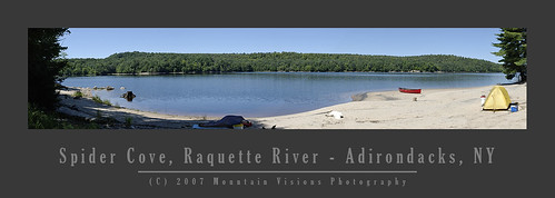
We decided a little over 1 hour into paddling the Jordan that we were not going to make it very far with the remaining light. And considering the difficulty or the river and the length of the return portage, continuing further on upstream Sunday was not an option. We looked for a campsite on the Jordan but decided to head back to Carry Falls and camp on the beach.

Neither of us wanted to make that portage again that night, but I figured hard work Saturday night would pay off with a day of relaxing Sunday and short paddle out.

It was hard but seemed shorter than the way in, I think largely because it was slightly more downhill. We arrived back at Carry Falls in complete darkness, walking better than half the portage trail by the light of our headlamps. Between searching for the portage route and the actual portage we walked far more than we paddled.

When we got back to Carry Falls we loaded the boat and turned the headlamps off, paddling only by starlight on the perfectly still and silent water. It was a very peaceful way to get back in the boat and finish the active part of our day.

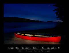
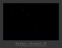
At camp we set up the tent, cooked dinner and watched this stars and meteor showers. Aim hit the sack early. I spent next few hours taking starlight photos in the cool summer evening weather.

The thing I love about Adirondack summer nights is the fact that unless you are hardy, most nights it's cold enough to wear a nice fleece and maybe even a hat. The bugs are usually long gone when the temps hit 50F and on this clear night on the Raquette it was 49F for the low. I never got cold enough to put on my fleece but I had just about everything else on as I sat on the beach watching the stars while my camera was recording timed exposures.

Sunday went as planned. Sleep late, swim, eat, swim, lay in the sun, swim, eat, swim, run around the beach, race the dog for the stick in the lake, swim, lay in the sun. While I walked more than I paddled Saturday, I most likely swam more than I paddled Sunday. The dog is fast, but I've got a text book Australian crawl, which is simply more efficient than his dogie paddle.

Packing up in the late afternoon sun and paddling out at a leisurely pace. At times there were so few signs of life from our beach front camp that I'm sure to the few passing paddlers and boaters it looked like our crew drank the coolaid.

When Jamison's description of the Jordan River instantly took hold when we both first saw the Jordan, it was clear this was a river worth the hard work to earn the satisfaction of it's wilderness beauty. I suppose some places charge you a monetary fee for access to the wonders they behold, it's clear the only fee to paddle the Jordan is the determination to put in a long day of hard work.

I'm looking forward to returning to the Jordan, with the foresight of the length of the portage and the difficulty of upstream travel we should have fewer problems paddling far deeper on our next attempt. No doubt it will be difficult, but we've paddled many creeks and outlets equally hard just for the fun of exploration, only to paddle back out the same day. Just the serenity and accomplishment of navigating such a infrequently traveled, remote (by Adirondack standards) and beautiful unspoiled wilderness river will be more than worth the effort when we return.


technorati tags:, , , , , , , , , , , , , , , , , , , , , , , , , , , , , , , , , ,

Blogged with Flock