(a continuation of my DEVA series of images and trip reports)
Death Valley is far more than a hole in the ground, and I honestly didn't even see Badwater Basin in my 2 days there, nor was I upset. I did in fact have some concepts for the basin after sunset including star trails, and moon lighting on the salt flats but the wind was less than cooperative, and plans needed to be adapted.
We were just a short drive from the basin on the first day, but Devils Golf Course was much more interesting to me than the flats of the basin. Fear not, I was about -150ft below sea level so I can at least say I was lower than most places on earth ;-).
This shot is an example of forgoing sleep to get the shot. Neither of us got any sleep the night before we flew out and after shooting star trails in the canyon below here till almost midnight, then eating dinner, and getting just a few hours sleep we were back up by 5am. We were done here by 7:30am, and in the real world, one with trees and shade, we could have gone back to our tents and slept for a few hours. Unfortunately, while Death Valley isn't just a hole in the ground, it is sparsely forested, and shade is a rare commodity. So we'd just have to get by on less sleep to come home with a few good shots.
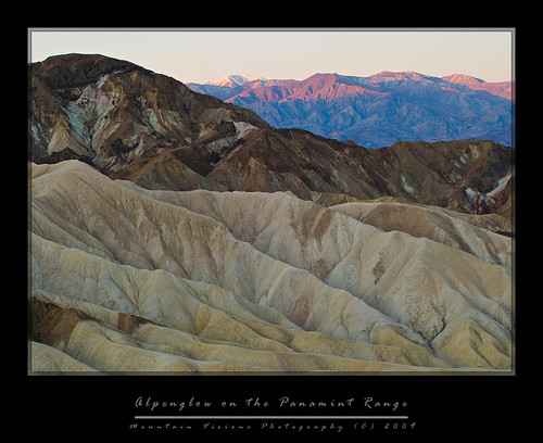
In the end it was worth it. The point this photograph was shot at was devoid of any texture within half an hour of sunrise, yet our pre sunrise arrival yielded what is a phenomenon known as alpenglow that only occurs prior to the sunrise, and is actually not light directly hitting the peaks but rather reflecting onto them.
The colors and textures of Death Valley immediately disappear upon the rise of the sun, and any chance of a meaningful photograph go with it. Within seconds of the sun rising in this shot all the color was gone on the mountains, and I was left with a cold hazy background that even the warmest of warming filters wouldn't have improved.
While the snow might not be there later in the year, I have a feeling this point, Zabriske Point, which towers above Golden Canyon, is actually a better spot later in the spring or summer. The reason of course is the first rays of sun should rise on the foreground as well as hit the Panamint Range in the background. However, the azimuth of the sunrise in March is such that the sun didn't hit this area till it was fairly high in the sky, yielding too much contrast for good photography if you were including the background mountain range across the valley.
So in the end it's a trade off, the contrast of alpenglow on snow, or a more dramatically lit foreground. Which ever you choose, this is another reason to not visit DEVA during the summer months. The days are long, and the chance to photograph is short. You'll most likely get better images in winter and early spring just because of the fewer daylight hours and lower sun angle. Of course the flowers, and snow capped mountains don't hurt either.
Monday, April 27, 2009
Sleep Deprivation In Death Valley
Tuesday, July 29, 2008
Throwing In The Towel...
I actually have a few trip reports that were waiting on photos, but they are stuck on the laptop which is short WiFi right now, and my desire to copy the blog entry's onto a memory card and load them onto my PC is pretty pathetic.
I mean lets face it, anyone that reads this blog is looking for 2 things, trip/camping info, and/or the photos. Anyone actually reading the text is in my opinion only doing so to make themselves feel like a literary genius after 5 minutes of spelling errors, misuse of homonyms, lack of spell checking, and just poor formatting (come on, how many times have I let two words run together???).
Any how, I am now up to mid June for my photos...not counting Beer Fest (Mondiale de le Biere - Montreal), and of course the rest of Heather's graduation photos, so consider this a partial update to the last real blog entry of 2008 which was the Snowy Mountain blog.
So without further delay, without all the little jibber jabber that slows down your scrolling to the maps, photos, and trip info...
Heather's Graduation



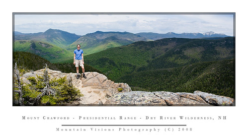
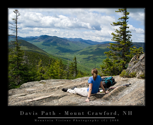
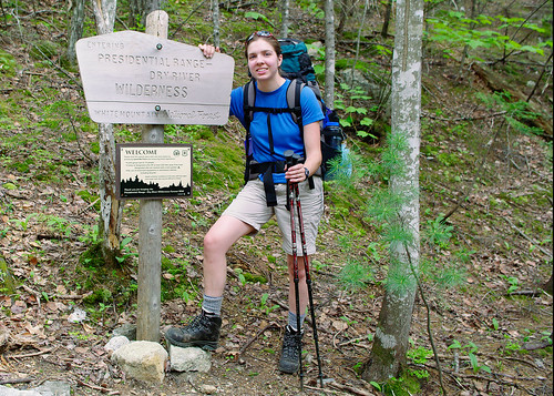
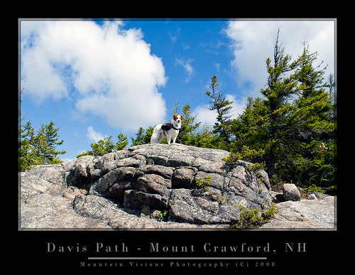
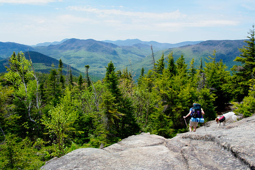
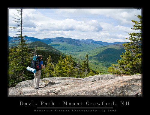
Memorial Day (revisited) The Davis Path....
June:
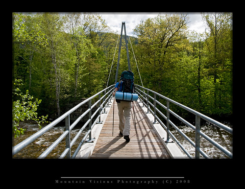
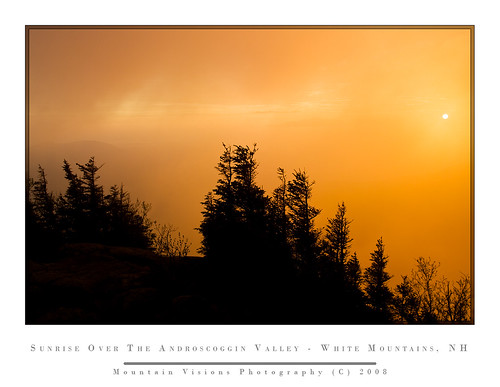
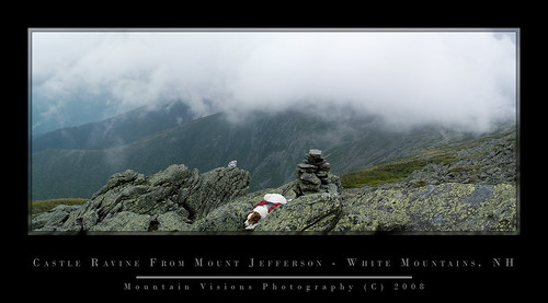
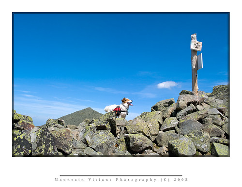
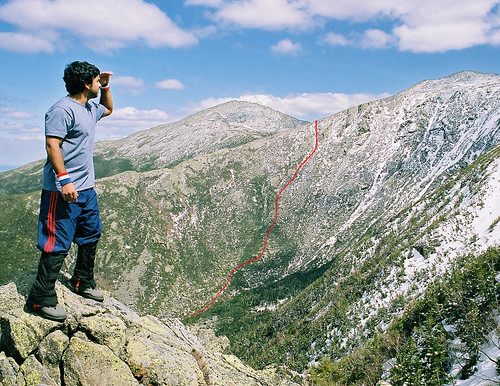
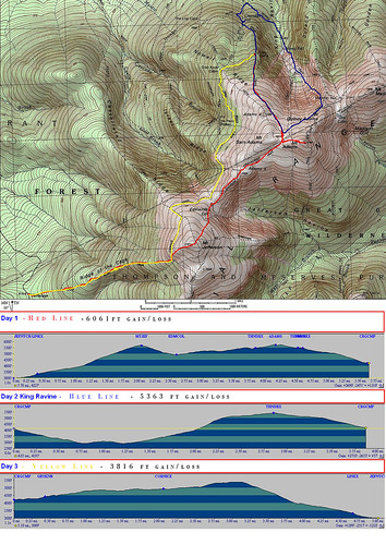
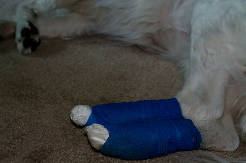
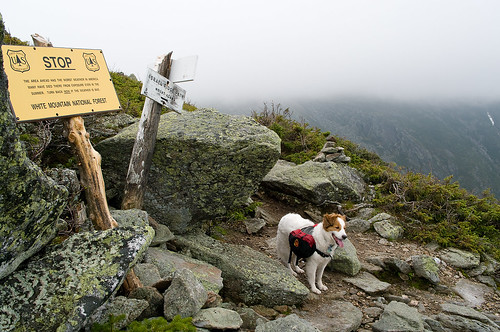
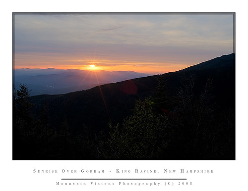
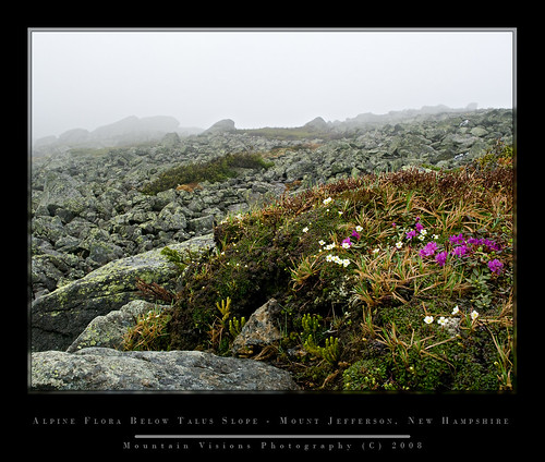
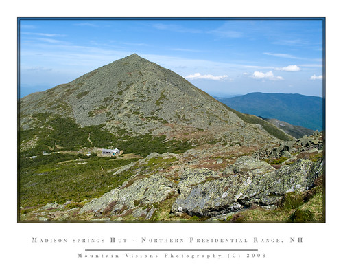
Escaping The Heat: 3 Days In the Northern Presidential's (Caps Ridge, Mt Jefferson, Adams, Madison, King Ravine)
technorati tags:New Hampshire, Presidentials, Dry River Wilderness, hiking, backpacking, climbing, Alpine Zone, K20D, Pentax, flowers, AMC, Mount, Madison, Jefferson, Adams, Washington, Madison Springs Hut, King Ravine, Davis Path, Mount Isolation, Crawford, Androscoggin, sunrise, Gorham
Blogged with Flock
Tuesday, January 15, 2008
3rd Time Is The Charm: Sunrise On Cascade Mountain
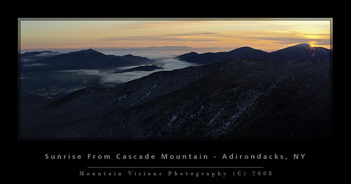
After 3 consecutive weekends of searching for a sunrise, I finally got one.
In my pursuit of sunrises, I am finally getting my fat ass in shape. After being in great shape to end the summer, my back was bothering me in October, nothing ever happened, but there is a feeling that anyone with disc issues knows, and I had it, causing me to put off my second 10 day paddling trip. It worked out because it rained torrentially for almost all 10 days.
I'm not a fair weather paddler or hiker, but 10 days of pouring rain is depressing, and even after my back was feeling like it wasn't an issue I bailed out and decided on work rather than waste a week.
Nevertheless, good intentions and excitement for winter turned to getting lazy as the winter was slow to arrive. Fitness is fleeting and once it's gone it's a pain in the butt to get it back. I'm going to venture to say, despite working out hard in November, by Jan 1st I was in the worst fitness I've ever been in.
So very slowly I am working my way into shape by chasing sunrises up some of the smaller Adirondack peaks, each one getting progressively harder (or easier if you look at it from a fitness standpoint).
Enough with the discussion of my seemingly 50 year old cardiovascular system, my weak muscles, and Krispy Kreme physique.
Sunday, I left home at 3:20am and got to the Cascade trail head at 4:55am.
After putting on my boots and gaiters, and making sure I didn't forget anything, I was on the trail by 5:20am.
I started to leave my snowshoes at the trail head, but since I took them I decided to wear them rather than lash them to my pack along with my 9lb tripod, and crampons. Big mistake! After about 2 minutes the trail turned to rock and mud. So I was forced to hike in the trees which was not too troublesome. The forest to Cascade is uniquely thin for the Adirondacks, and bushwhacking (albeit only meters from the trail) is relatively fast and unencumbered.
Walking on the frozen snow was like walking on styrofoam. No powder to be found in the Adirondacks after a week of record temps and rain.
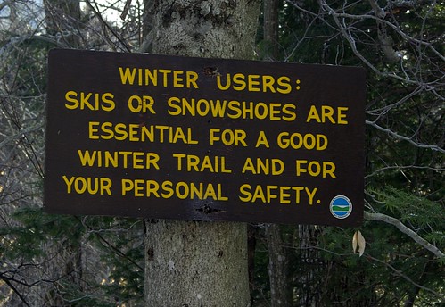
At about 3000ft, approx 900 vertical feet from the trailhead, the snow coverage was more consistent and it was back on the trail full time. By 3500ft there was snow covering all of the ground for the first time.
The hike was under a star filled sky, which occasionally found me turning my headlamp off just to take in the starlight.
At about 3700ft there is a steep rock section which in a typical winter is covered with deep snow till the top of the slab where it is a sheet of 20* ice. Unfortunately, despite the great December, the mountains resemble early November rather than January.
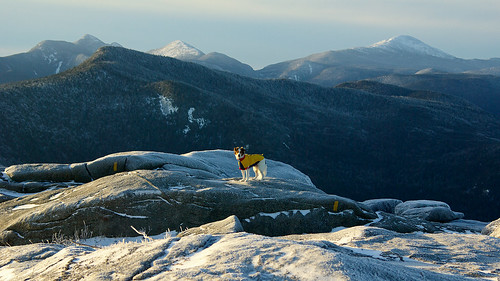
At this point I removed my snowshoes, and put on my crampons, with the snow being rock hard and bulletproof, I ditched my snowshoes deep in the trees and hiked the rest of the way in crampons.
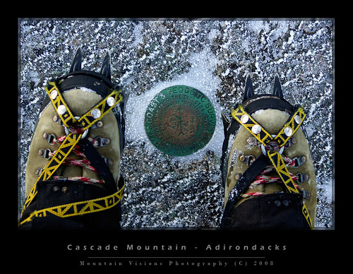
The summit of Cascade is a long fairly flat ridge, although somewhat slightly technical with a few scrambles to get to the high point. It's a typically non nondescript Adirondack summit that is often considered the easiest 4000 footer in the Adirondacks. It's not that Cascade is not a pretty summit, it actually reminds me of a mini Mount Mansfield when you come out of the scrub line on Sunset Ridge with the big expanse of exposed ridge, but it's not a conical summit like most people envision most summits to be.
What can't be minimized are the spectacular views which take in almost all of the 4000ft peaks.
I got to the summit at 7:15, although it's a bit deceiving as I wondered if stopping to photograph lower would have been better, I wasted a few minutes evaluating vantage points. For some reason I've always liked the views below the summit much better than on top.
After 45minutes up there, in what was an unusually windless day, and actually fairly warm in the sun, we headed down and I considered hiking to Porter Mountain about .7 miles further.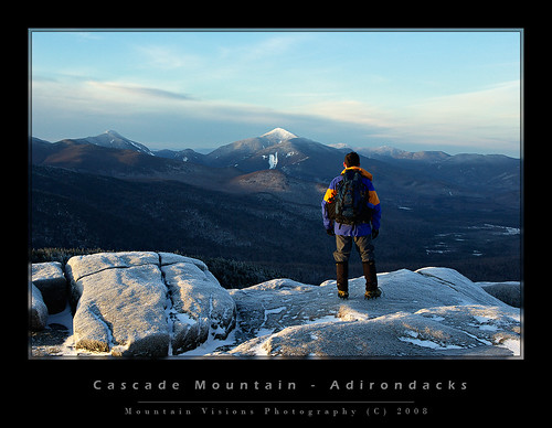
I started down the trail to Porter but about 5 minutes into it I turned around. Unfortunately while I felt great, my heels had blisters (feet need to get in shape too), and I decided to head down.
The hike out was uneventful. Other than of course the typical weekend hordes that hike to Cascades summit. The solitude of 5am starts suit me, but it's always nice to talk to a few people on the way down, and more so with the smug satisfaction of knowing it's around 8am and you are done with the day!!! In all about 12 people were hiking up on my way out.
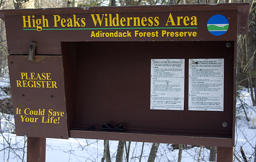
There is no such thing as a bad day in the mountains, but it's occasionally nice to see the sun rise, to see blue in the sky, and to see a few feet in front of your face. What was sad was the drive home through the mountain passes. Typically filled with waist deep snow, frozen ponds, and ice covering the cliffs, which in turn are covered by ice climbers. Instead it looked like late fall or early spring. Had I been in a coma for the last few months, I'd have guessed it was November.
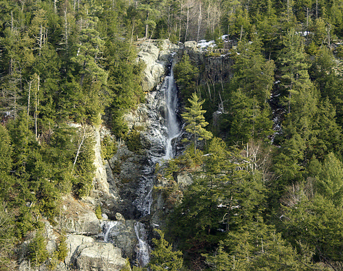
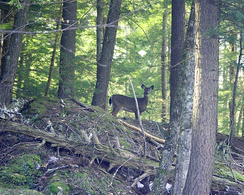
technorati tags:ADK, Adirondacks, hiking, climbing, winter, snow, snowshoe, Pentax, K10D, Blue Mountain Lake, sunrise, Fire Tower, cabin, summit, caretaker, Border Collie, dog, photography, night hiking, NY, NYS, New York, 518, upstate, North Country, Daks, DEC, forest, wilderness, Cascade Mountain
Wednesday, September 26, 2007
Going Up Lila's Dirty Crack
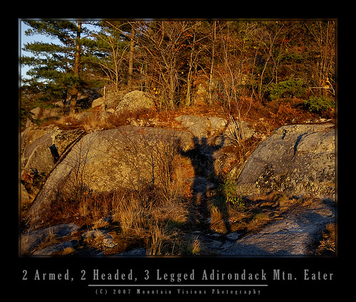
It's been about 15 months since my last rock climb. Actually, just top roping with my sister in the Daks. An easy 5.6 crack that I'd led in better climbing shape, but that I was almost terrified to top rope.
Climbing with my sister is no easy task, she has the attention span of a gnat, and typically space cases don't make the safest partners. So in June 2006, I had no choice but to complete the climb as I'd rather have fallen on a run out X rated lead then to test my sisters attention span. Of course, by finishing the climb I was left to be lowered, which was perhaps as pleasant as a slow painful death. (sorry Heather but climbing with you is scary).
My friend Daniel and I on the other hand have at least attempted quite a few climbs, even if we haven't actually completed many of them. A few here and there being remote, and not often climbed. Of course thats part of the adventure and getting down for us has always seemingly been harder than the climbing.
Daniel is unhappily back for 3 months on the east coast at Princeton. I don't think he dislikes the east coast, but Princeton isn't San Francisco with the Sierra and Cascade Ranges a short drive away, nor is it even Boston or NY with the Gunks, Daks, White and Green Mountains all within a few hours drive. Princeton from an outdoor standpoint is about 7 hours from any (by east coast standards) real mountains, and at least 2 hours from the Gunks.
Of course he wasted no time getting out, back east for 3 days and he was on a bus to Albany Friday morning with a 5am alpine start. Me, I got an early start for myself, and was done with a half day of work by 11:30am, just in time to drive the few blocks to the bus station and pick him up.
Off to LL Bean for my 3rd water filter this year (long story). In an enigma wrapped in a Pandora's box I've now spent $200 this year on water filtration and still only have 1 semi working filter.
A quick stop home to load his gear in dry bags, switch cars, and load the boat we were off to the Adirondacks at 2pm.
Making pretty good time we drove the 145 miles to lake Lila in almost exactly 2:20 which isn't bad considering the last ~10 miles are over dirt roads.
The parking lot was already 3/4 full. Truly amazing for a Friday afternoon in early fall. While Aim and I have been to the lake once already this year while on our canoe traverse, we've always avoided it because of the insane crowds. Somehow, despite paddling typically every weekend most years, over the last 7 years we only have paddled Lake Lila two times.
Lila is a place where families flock to, apparently for the fine white sandy beaches, and perhaps the small mountain. It's however, not in my opinion, so nice that people should endure the stress of driving the 10 miles of dirt roads only to find out that the parking lot is full. Or get on the lake to realize that all the 20 something sites are taken. That alone is a reason to avoid it.
WARNING TO THOSE LOOKING TO PADDLE/CLIMB LAKE LILA: If the lot is full you MUST drive at least the 5.5 miles back to Sabitis Road to park and walk back to the lake since the access road is private and no parking is allowed.
We were on the water a bit after 5pm and paddled to the only site we've ever stayed at since it is usually open.
Of course fate would have it that we should have listened to the people coming out and gone directly to site 5 where they just broke camp. Our planned site, complete with a nice beach, large campsite and nice tent pad, not to mention a great view of the sunset was already taken. We checked the next site and were not impressed.
We paddled back across the lake toward site #5, or something nearby as the sun was setting in front of us. Neither one of us had much sleep so we were more talkative than actually trying to get to camp. At times we even just stopped on the stillness of the water. After the sun went down I figured it was time to get a move on it. I wanted to at least find camp before we needed headlamps, since as always they were packed deep in the packs.
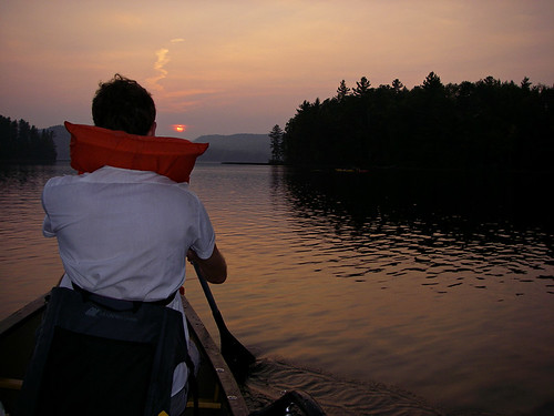
I decided with how late it was to skip 5 and head for the lean-to and it's nearby campsites. At the lean-to someone had set up a tent inside. Extremely rude to do on a busy weekend, and actually illegal. If you want to tent, you should camp on a site, if you want to sleep in a lean-to then you should do so.
We ended up at site #8 which is actually the old tennis courts of the great camp owned by the Webbs before the state purchased the land in the early 1980s. The states policy is to allow nature to reclaim itself so the great camp, which had no unique or valuable historical significance, was burned to the ground. It now serves as a nice grassy campsite overlooking the lake. The tennis courts are similar, only they have no open view of the lake.

So we set up camp, cooked dinner and started a fire. We ended up not going to bed till just after midnight, a long day.
Saturday we didn't emerge from our nylon cocoons till the wee hours of early afternoon. Despite attempts by various hikers to wake us up, we successfully managed to sleep till about 11:30am. So take that your rude inconsiderate noise makers who get up at a reasonable hour! And to the sun, your were no match for the darkness of the inside of a sleeping bag.
After brunch and sorting out the climbing gear we headed toward the Nehasane train station which was built by the Webb's so they could access their camp nearly a century ago. As most rail traffic through the Daks was stopped by the 1970's, the Remsen-Lake Placid line is now a travel corridor for snow mobiles in winter, and part of the portage to Bog Lake as well in summer. It's still a DOT right of way and I assume if necessary could one day be reopened to rail traffic, however, the tracks are not in great shape and the whole line would probably have to be rebuilt.
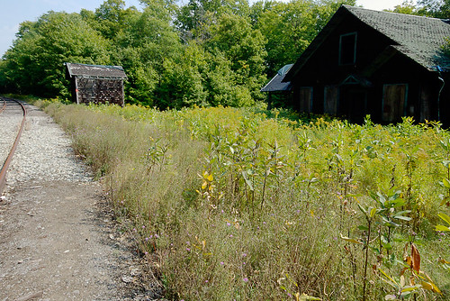
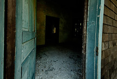
The rail station is on it's last leg and those wishing to visit it, and enter it should do so soon and with caution. The roof has been tarped, and the floors are rotten in places, but Daniel walked in at least to the first room without any problems.
We were off to the cliffs which are just a short walk down the tracks. On our way we passed GreyL from adkforums who has been spending most of the month in the Daks camping and paddling. He was also interested in the cliffs, and was camped at the site next to us. A pleasant guy who stopped by to chat a few times.
When we got to the field with the concrete foundation we started the bushwhack up to the cliffs. A fairly short but steep hike through the forest that essentially covers the same elevation as Mt Frederica's 1.5 mile trail, about 500ft, but in just 1/2 mile or so. It looked like it would rain but we figured we'd scout out the cliffs no matter what.
At the base we saw what looked like a climb in the 5.4-5.6 (G) range. A dirty irregular crack on the 70* slabs that form part of the mountain face. While this was most likely not a first ascent, it was clearly not too often climbed. The crack was filled with moss, dirt, grass and small saplings, and the base was not trampled. Of course this area has been sparsely climbed and the guidebook list the general cliffs but not individual climbs.
So Daniel suited up and I realized my nut tool was at camp. Typically the leader doesn't need a nut too since he is placing pro, rather than removing it, but since the climb was dirty I figured he might need it to clean out the crack.
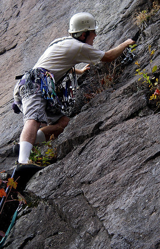
Off he went, and right away was using that nut tool to get deep into the crack to place solid gear. Clearly this climb had maybe seen a few ascents, or perhaps none at all.
Daniel made fairly quick work of the lead, despite needing to clean out the crack before placing gear. Some of the rock was loose, but carefully climbing nothing sizable fell. Overall despite the hollow sound in some spots, the rock seemed relatively solid.

I tied in and began climbing the 100ft 5.4, which was a mix of face and crack.
We had two ropes but decided we could get down on one, so I left my rope at the base instead of trailing it. This would come back to be a bad choice, but one that was easily fixed.
The first thing I noticed when I started climbing was that I forgot how tight climbing shoes are. Designed to be as snug as possible they are a big difference from the sandals I'd walked/portaged and hiked around in all summer. After a few minutes the shoes stretched a bit and the throbbing pain went away -or my feet just became numb enough to not notice.
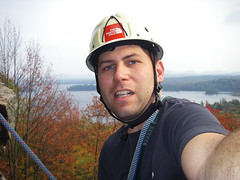
At the top we realized a problem. There were no sizable trees close to the edge, nor were they spaced properly to build a double anchor, and in the one spot there was a nice tree it was over a nice sharp edge. Good tree + sharp edge = bad rappel. Daniel kept me on belay as I explored the cliff top with my climbing shoes, which don't offer the best traction on leaves, dirt and angled mossy cliff tops. It appears I was able to learn something from my minor near fatal slip and fall on the Trap Dike.
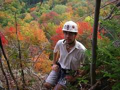
After a little searching we found a nice hardwood that was much more stable than the obvious pine we initially looked at. Problem was it added 20 feet to the cliff edge and unlike in the Gunks, or even more popular cliffs in the Daks where the cliff edges are clear from repeated use, this was filled with downed trees, saplings, and sticks. I set up an anchor and Daniel cleared the path of the rope.
To be safe since we weren't sure I we'd hit ground on rappel, I lowered him off with a Munter Hitch off the anchor. This gave us the full 200ft of the rope, which we knew was plenty.

When he got down he realized the ropes were too short for rappel, so he attached the rope using an EDK (Euro Death Knot) aka. the overhand. With plenty of tails, and two similarly sized ropes the EDK isn't really the death knot, but people apparently tied it incorrectly at times with short tails, and because the knot tends to flip once or twice when loaded, if you leave less than 12-18 inches it might flip open.
Having rappelled for the first time off the EDK in the Daks, in 33F temps and pouring rain while ice climbing, I trusted it for it's speed and safety. The speed factor of tying an overhand is much faster than a rewoven figure 8 or a fisherman's, and much more intuitive than a square knot. Safety comes from the fact that the EDK is less prone to being stuck in cracks while you pull the ropes. A stuck rope is by far one of the most dangerous things that can happen to a climbing team.
While I futzed with the fisherman's in that 33F February rain many years ago, refusing to rappel off the EDK, as my partner smugly waited for me to give in, I realized I was a lot colder than I was scared of my partners greater experience and confidence in the overhand knot. Since then, I am a convert.
Because of the distance of the rappel anchor from the cliff edge and all the brush I wanted to get the knot as close to the edge as possible. Off I went with the knot at the cliff edge but the blue rope was tangled on a ledge and in spots stuck in a crack. I got to the ledge tied off with a prussik and reflaked the rope. A few minutes later I was down and we were headed back to camp after completing our first successful remote climb in 3 years.
The threatening rain never came and we walked back via a different route, which was actually longer rather than the shortcut I'd envisioned. GreyL stopped by and we chatted about the climb as we ate and started a fire.
In bed much earier (well 10:30 rather than midnight) we decided that we'd get up and watch the sunrise from the lake shore. A head to the pillow decision changed that when I blabbered out, "why not get up 30 minutes earlier and go for the summit". Daniel of course agreed but I think we both had doubts we'd actually get up at 5:30am to do the summit. So the summit was the plan with a lake side viewing as backup plan B. Plan C was of course to sleep until noonish and then head home.
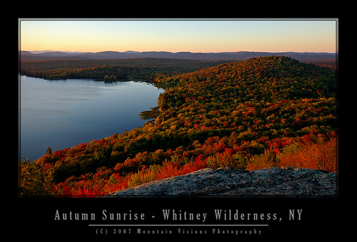
I woke up about 5 minutes before the 5:30a alarm, and to my surprise, I was wide awake and all set to go. Since we decided to go after going to bed we still had to pack our stuff. 15 minutes later we were right on schedule. We left camp at 5:50 and were on the summit by 6:25 using a combination of jogging and speed hiking, we covered the 1.5 miles and 500ft in just 35 minutes. That gave us 20 minutes to get setup and enjoy the pre-rise sky.
The sunrise wasn't spectacular, oddly because the sky was just too darn clear. No clouds, not much haze, and not even the usual mist coming off the lakes with the warm morning (about 51F). Still it was worth the short hike to see it.
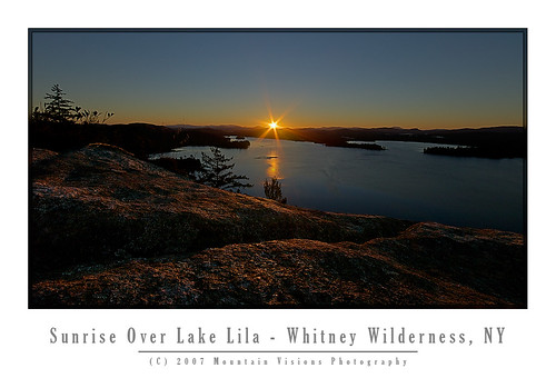
An hour later we were on our way down with intentions of going back to bed, but we never did as we both felt pretty awake and energized and really only could think about breakfast.
After breakfast, and some spider web photography we broke camp and paddled the west shore of Lake Lila as the wind pounded us from the north east. Skies were cloudless and the cool breeze made the warm air seem quite comfortable. We had some issues finding the Shingle Shanty Brook outlet but after trekking through the marshy grass we found our mistake. The outlet comes in from the left but turns sharply right at it's exit in the lake, from the boat it looks like a dead end.
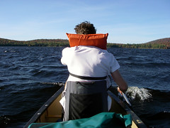
After we ate lunch on one of those nice fine white sand beaches we found the outlet and paddled up to the first full beaver dam. Daniel was impressed by the fact the beavers were able to raise the water level about 3ft.
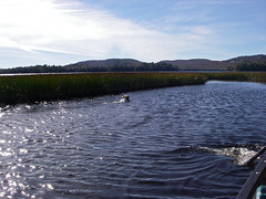
The trip back the wind was coming nicely from the north, which is typical since we were at the south end of the lake. A nice hard paddle back into 1 foot swells and we arrived at the takeout much later then we intended.
All in all it was a great trip. 3 days of nice weather, a little climbing, a little hiking and a bit of paddling to get to it all. In all we paddled 13 miles, rock climbed a dirty 100ft pitch, hiked about 6 miles, and portaged 1.5 miles.
technorati tags:Adirondacks, ADK, autumn, Lake Lila, Nehasane, Remsen, Lake Placid, Pentax, K10D, W20, Rock climbing, hiking, canoe, canoeing, camping, campsites, Smith Mountain, Mount Frederica, Mountain Visions, Wilderness, paddling, Sabatis, climbing, sunrise, sunset, Old Town, Shingle Shanty Brook, William Whitney Wilderness, Whitney, anchor, belay, The North Face, train station, Great Camp
Blogged with Flock