Showing posts with label camping. Show all posts

Wednesday, April 27, 2022

HEET: It's not just for cars! - Fueling an alcohol stove while bikepacking-

HEET it's not just for cars. If you're bikepacking in Vermont or the Adirondacks finding stove fuel might not be easy due to lack of towns, stores and service hours in the Adirondacks and the bucolic nature of Vermont just not having many large towns that you generally plan to bikepack through.  Isobutane (MSR, Snow peak, Jetboil, etc) also are often out of stock even in sprawling metropolitan areas and suburban big box stores. 

It's also tough to cook like a gourmet chef while bikepacking because it's essentially ultralight backpacking. Just add water is about as gourmet as it gets if you aren't eating at a restaurant or -more often usually- a gas station or hopefully fast food. For this reason an alcohol stove makes the most sense. Just one setting: high. Six minutes to boil a half liter. Super compact, light, cheap (you can even make one yourself from a soda can) nothing to break. 

Most importantly (and the reason for this post) is fuel is easy to find at any gas station in America. HEET is always available at gas stations, convenience stores, big box stores, grocery stores, hardware stores. HEET is cheap, burns clean, and it's sold in a size you can manage to use on a route. It only takes 1 minute more to boil 16oz using HEET over denatured alcohol but every Stewarts shop in Vermont and the Adirondacks stocks it. You'll always have a hot meal and coffee or a cuppa.
 

Tuesday, July 6, 2021

Tarps are Integral to Camping Enjoyment

Independence weekend camping setup


The lowly polyethylene tarp, not as popular as an Ez-up or as cool as a nylon parawing. But on a rainy weekend absolutely dry and makes rain nothing more than an afterthought. The plastic tarp is a perfect example of function over form. I used to think these were trashy but it's really all in the setup. I noticed most people using poly tarps sort of last minute buy them with no knowledge, plan, poles or sometimes even proper line. I own a nice wing and a nice rectangular silnylon tarp that I take backpacking and canoe camping, but I realized that nice nylon (and don't even think about silnylon) aren't really designed for the rigors of car camping or even paddle in and camp (vs paddle and portage) canoe camping.  Rigors? Being packed wet, sitting in the sun for days on end, and just generally no need for a light packable tarp unless you are using Smart car as your vehicle. 

Colvin in Dolly Sods Wilderness. It mostly rained overnight on us, but the gear pile was completely dry under the well setup silnylon tarp. We only had to spend about an hour under it over 3 days. 

You will miss out on your friends commenting how nice your MSR or even Kelty Noah's tarp is compared to the brown heavy duty polyethylene (every time I pull out the Noah's Parawing, people comment on it and it's all of $70 new), but unless they are paying you to replace it every year (depending how often your camp, and if you camp infrequently enough it doesn't matter save the money and buy a plastic tarp), just shell out $50 for 2 polys once every 5-10 years. In fact, you can buy enough polys, high strength/low stretch cord, and tarp poles to cover the biggest site in the world for less than the cost of one big backcountry tarp (before poles). 
Enjoying the fire from the cover of the tarp. In total we had 22x10ft of coverage. Including access to the fire. 


While I am a big fan of the ridge line for a lot of reasons, it's not the only setup. The big advantage of the ridge line is its like a cordalette/webolette in climbing, it gives you a master point to work off. With proper line you can hang clothes, lanterns and even multiple tarps stacked (shingled) across a site or multiple tarps separate. I highly recommend learning about climbing pulley systems. Sure you can buy some cam straps or some friction devices. But a 2:1 or 3:1 system or even a simple munter with MMO will get your ridgeline ultra tight. You can do all this with some quick links or the cheapest (real) caribiners you can find. No need for a ton of gear. You don't need pulleys or progress capture devices. 

Thursday, February 4, 2010

The Hanging Stove System, Why It Is Superior!

When I ask serious northeastern US winter backpackers and alpinist if they have ever used a hanging stove, I get the most puzzled looks. Some of these people have traveled all over the world to climb mountains ,yet they never used one.

Well, I'm letting the genie out of the bottle. I'm going to demystify the hanging system and give you a little insight as to why it makes winter camping so much easier.

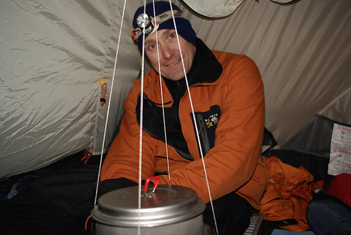
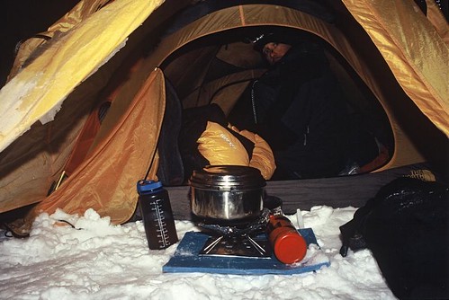
What is the purpose of the hanging stove system? Basically it eliminates the elements from your biggest winter chores; creating drinkable water through the melting of snow and ice, hydrating, and eating.

Traditionally people would sit outside their tent and melt snow, this is a process that even with the most powerful portable stoves can take hours for a group of 2-3 people. So for 2 hours or so you must wear lots of extra clothing that you probably wouldn't otherwise need to carry. Then you must eat more to generate body heat. So you have to carry even more food. All the while you are probably pretty cold.

Other options to sitting outside include cooking/melting in the vestibule of your tent. However, this isn't completely weather proof in seriously bad storms. The stove is typically more exposed to the elements and so are you. I've been a prolific winter vestibule snow melter for years as a compromise to hanging the stove inside the tent, it cost nothing, and is deemed by some to be safer. If using a white gas stove, this is still the mode of choice that I prefer. The reason of course, is even those who are at Zen with their white gas stoves, tend to have an occasional flare up, and a flare up is not a good thing if it’s in the tent, or under the closed vestibule. However, you can get the stove going safely at the edge of the vestibule, then bring it into its permanent home, get in your sleeping bag and boil away.

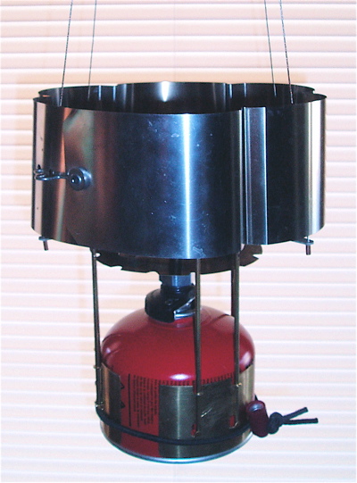
You can build a hanging stove for white gas or canister stoves like the MSR XGK or Firefly for under $20. The Superfly is my stove of choice, and I use a hanging kit made by MSR that was difficult to find, but works well enough in a tent. This setup might not be the cats meow hanging from a big wall on a portaledge though since it is pretty light, and some might say a bit flimsy looking. I mainly like it because it is compact and light. I know Bibler makes a hanging system, as does Markhill and there are a few other brands, I also think JetBoil makes some sort of hanging adapter.Also, MSR recently came out with the "Reactor" which is a brand new hanging system that isn't cheap. Actually, unless making your own, be prepared to drop about $100 on the cheapest setup, and up to $200 on more expensive ones.


My MSR branded hanging kit is a folding cross shaped piece of titanium with some metal braided cable to support the stove from a central tie in point. There is a metal contraption that keeps the flames, heat, and pot contained, and another piece of metal that keeps the canister from getting too warm.

The whole setup weighs almost nothing (lets say 4-6oz tops), and in conjunction with a Superfly probably weights half of what a comparable white gas setup weighs. I'd venture to say, space and weight considered, this is the lightest and most compact hanging stove on the market, and efficient to boot!


In the above photo the use of a conduit is seen on the MSR Superfly Ascent system

photo: (C) Chipskiff @ flickr

Finally, I use a fairly small pot, so I don’t over work the stove. I also use a 2/3 cup measuring spoon to remove water from the pot, so the pot always remains on the stove. This makes siphoning water off to make tea, or fill water bottles simple. It also makes measuring for my dehydrated meals simple.

An alternative to this would be to use a titanium or aluminum mountaineering tea kettle. These are incredibly heat efficient, and contain the water for easy pouring.

There is one draw back to butane/propane canister stoves. Below about 40F the stoves get finicky. Butane doesn’t do well in cold, and the isobutane/propane additive makes it slightly better, however, it still requires a little TLC until the stove is warmed up.

I recommend shaking the canister gently and warming it initially in your hands or sleeping bag. Bring a few chemical hand warmers, and tape one to the bottom of the canister for initial warming. Once you have some water heated, you can take a very small amount and put it in a pot top, plate or bowl, then put it under the canister for a few seconds every now and then. This keeps the mixture flowing equally. The problem is the propane on a cold canister burns off first, and the butane is left over. A little warming solves this while really firing the stove up.

I’ve found that you need to resort to constant rewarming only if you let the propane burn off initially, as the tent warms up the stove does quite well.

Some people add a heating coil to the canister, which is essentially just a wire or conduit that goes from the flame to the canister. If you set this up well, it’s probably the ideal solution. The propane and butane burn off evenly with constant heat flow, but some people are uneasy with heating a canister directly.

Speaking of directly, you can also light a lighter under it if you get desperate. I really don’t recommend this, although it isn’t nearly as dangerous as it sounds. If you are warm, just put your hand on the canister and that should be fine. Or insulate the canister and drop the hand warmer in it.

I prefer the smaller 4oz canisters, because they put less weight on the stove, and take up less space. For a group of 2, I’d say 2 canisters per night. Playing it safe, 3 per day. This obviously is quite a bit more expensive than white gas which requires about the same amount of fuel (4oz/person/day) but at a lower cost per ounce. That said, the cost is really pretty low for an occasional overnight, or even a 2 night trip when split between 2 people. This wouldn’t be my preference for long distance trips, or frequent use though.

So let me concisely explain the benefits of the hanging stove.

1) Simply more efficient (for the following reasons)

2) Weighs less

3) Burns less fuel

4) Requires you to eat less to stay equally warm, or actually far warmer because you burn fewer calories, thus you require less food.

5) Protects you from the elements in really poor conditions that you might decide to no even bother breaking out the stove (this happened to me once in Utah, we ate poptarts, and sucked down the water we had left)

6) Reduces clothing required to stay warm at camp, which is the bulk of your clothing. Keep in mind, a four season tent, properly vented, will get to between 30-40F with a hanging stove no matter how cold it is outside.

7) Actually allows clothing to dry out in the Northeast (and other wet places like the Cascades), despite the steam from the water, the air actually gets warm and dry from the stove, and condensation is all but eliminated keeping the tent interior drier.

8) Allows you to hydrate in comfort. Remember unless you are using solar stills, or drinking from a spring, all your water in winter is generally from melting snow. You are more prone to consume adequate quantities of water if you are warm and dry. Your pee definitely should be almost clear before you head to bed.

9) Being hydrated means being warmer, means hiking faster, means sleeping better.

10) Cost slightly more, but is probably more efficient per oz of fuel.

Now there is a valid counter point, some people say, “but I backpack to be one with nature, not to sit in a tent.” And that is a fair point, actually it’s a darn good argument. However, before you decide to be “one with nature” consider the fact that I outlined the benefits to the hanging system, which include carrying less weight, and thus covering more ground per trip. Basically what is comes down to is, are you backpacking/climbing or camping? If you are camping, and perhaps even making a fire, by all means my system is for the birds. If you have a goal to cover ground, or carry technical climbing equipment, then it’s vastly superior.

I have heard many arguments that don’t hold water (no pun intended). Such as drinking too much at camp means you will have to get up and pee, and thus be colder. I’ll be honest, I never get up at night at home, but I rarely don’t while camping, and laying in your bag thinking about having to pee is not good for sleep. If you are that concerned with the issue, bring a pee bottle…or be one with nature, get up for 2 minutes, pee and get back in your warm sleeping bag, fully hydrated and ready to go. Not being hydrated so you don’t have to pee is simply a boneheaded argument.

Finally of course is safety, you do need to ventilate the tent. That means that no matter how appealing it will be to seal the tent up, and just let the stove run, it’s a really bad idea. You also need to be cognizant that flare ups CAN occur with any stove no matter how often you have used it, so make sure the stove is primed properly before it gets anywhere near tent fabric, and of course make sure it stays at least a foot from anything flammable.

By no means is my (and by my, I mean my preferred system) superior in all circumstances. But for those looking to bivy in hostile climates such as exposed ledges, summits, or during severe winter storms and extreme cold, this is definitely the ticket to being more comfortable and efficient.

And one last thing, for those who have never melted snow, make sure you have water (liquid) in the put before you start melting. While you probably are doubting this, snow does burn to the bottom of the pot, and it taste horrible. Start with any water you can find, and very slowly add snow.


Monday, April 27, 2009

Sleep Deprivation In Death Valley


(a continuation of my DEVA series of images and trip reports)

Death Valley is far more than a hole in the ground, and I honestly didn't even see Badwater Basin in my 2 days there, nor was I upset. I did in fact have some concepts for the basin after sunset including star trails, and moon lighting on the salt flats but the wind was less than cooperative, and plans needed to be adapted.

We were just a short drive from the basin on the first day, but Devils Golf Course was much more interesting to me than the flats of the basin. Fear not, I was about -150ft below sea level so I can at least say I was lower than most places on earth ;-).

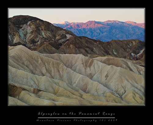
This shot is an example of forgoing sleep to get the shot. Neither of us got any sleep the night before we flew out and after shooting star trails in the canyon below here till almost midnight, then eating dinner, and getting just a few hours sleep we were back up by 5am. We were done here by 7:30am, and in the real world, one with trees and shade, we could have gone back to our tents and slept for a few hours. Unfortunately, while Death Valley isn't just a hole in the ground, it is sparsely forested, and shade is a rare commodity. So we'd just have to get by on less sleep to come home with a few good shots.

In the end it was worth it. The point this photograph was shot at was devoid of any texture within half an hour of sunrise, yet our pre sunrise arrival yielded what is a phenomenon known as alpenglow that only occurs prior to the sunrise, and is actually not light directly hitting the peaks but rather reflecting onto them.

The colors and textures of Death Valley immediately disappear upon the rise of the sun, and any chance of a meaningful photograph go with it. Within seconds of the sun rising in this shot all the color was gone on the mountains, and I was left with a cold hazy background that even the warmest of warming filters wouldn't have improved.

While the snow might not be there later in the year, I have a feeling this point, Zabriske Point, which towers above Golden Canyon, is actually a better spot later in the spring or summer. The reason of course is the first rays of sun should rise on the foreground as well as hit the Panamint Range in the background. However, the azimuth of the sunrise in March is such that the sun didn't hit this area till it was fairly high in the sky, yielding too much contrast for good photography if you were including the background mountain range across the valley.

So in the end it's a trade off, the contrast of alpenglow on snow, or a more dramatically lit foreground. Which ever you choose, this is another reason to not visit DEVA during the summer months. The days are long, and the chance to photograph is short. You'll most likely get better images in winter and early spring just because of the fewer daylight hours and lower sun angle. Of course the flowers, and snow capped mountains don't hurt either.


Blogged with the Flock Browser

Saturday, January 10, 2009

The Burroughs Range...Deliverance In The Catskills!

"The works of man dwindle, and the original features of the huge globe come out. Every single object or point is dwarfed; the valley of the Hudson is only a wrinkle in the earth's surface. You discover with a feeling of surprise that the great thing is the earth itself, which stretches away on every hand so far beyond your ken." -John Burroughs

The Burroughs range can be summed up in a few words…The classic Catskill hike!!!!

I can and will go on about what makes it so great, but the fact is, I cannot think of a better introduction or finale to hiking the Catskills.

The Burroughs Range covers +/- 13 miles, and about 10,000 feet gained and lost. It summits three 3500 foot peaks including the Catskills highest, Slide Mountain at over 4000 feet, Cornell at 3870ft, and Wittenberg at 3790ft. The loop can be done as a long day hike that even a weeble-wobble, his string bean wife, and aging mutant dog can complete, or you can break it down into a backpack at a more leisurely pace.

Sometimes breaking hikes down into backpacks can be advantageous, but when you consider that you have to carry about 2x as much weight on a backpack as you do on a day hike, plus you have to set aside time find a suitable/legal camping spot, time to set up and break down camp, cook, etc, you don’t necessarily have any more time, or an easier time.

That said, the Burroughs can make for a great 2-4 day backpack. With the only issues being that there are several spots that require some difficult climbing up near vertical faces and even a spot where you must traverse an exposed ledge and then climb up either a face or a crack. In winter I believe there is a rope here, but in warm weather it must be free climbed.
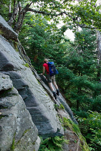
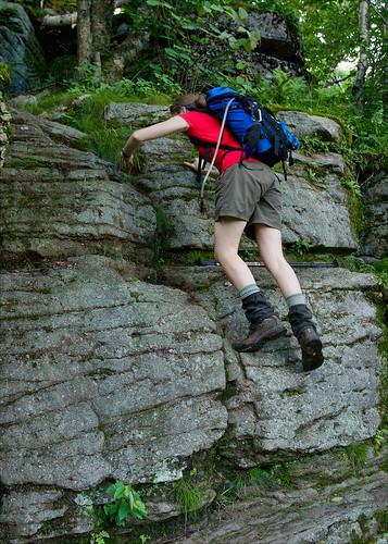


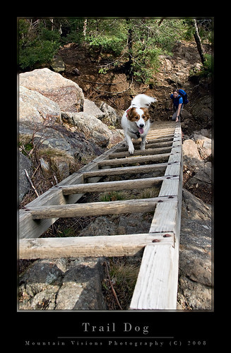
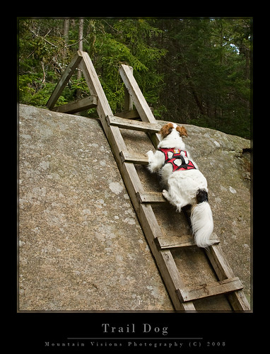
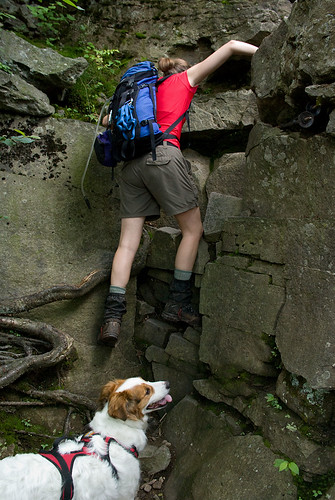
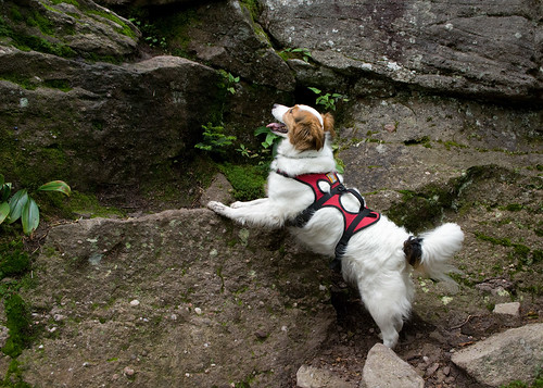
I very rarely have to help Caney climb anything that is blazed as a trail, and on the Burroughs I needed to help him three times. When you consider that he only needed help a few more times on what I consider the roughest and most fun blazed trail in NH (and perhaps the Northeast), a trail that states it is not recommended for dogs, this should be some indication of the ruggedness of the Burroughs Range.
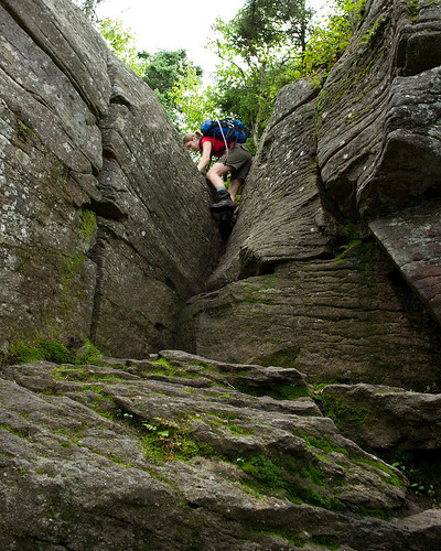


However, if you are like me, and you think you think that hiking is more fun when you get to use your hands, then the Burroughs Range offers just enough challenge and excitement to keep a smile on your face.

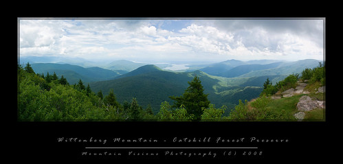
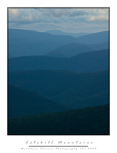
While the Catskills technically have no bald summits, the looping nature of the Burroughs Range traverse and its various exposed ledges and view points allow for nearly 360 degree views of the Catskills and beyond.

After getting chased out of NH on account of torrential rain, which can be best summed up by the NOAA weather radio reports, “we are experiencing a brief period of drier weather after 2 weeks of sustained precipitation, following this dry period continued and prolonged periods of precipitation will resume.”
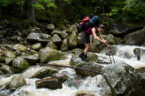

Let me just say that in the days we were in NH, among what is colorfully called the “dry period”, it was anything but dry. Generally I don't run from rain, but when dry is an inch or two of rain over a few days, I'm thinking we should be building an arc rather than hiking.
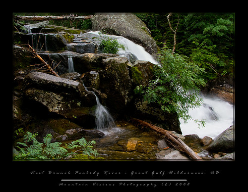
When we got back home, I watched the radar for the Mount Washington region, and the radar wasn’t green or yellow, but largely orange and red, meaning severe thunderstorms. However, in the Catskills it was forecast to be cooler, drier and free of rain.

Normally I wouldn’t take a trip to the Catskills with so much time off, but the truth was I just wanted to escape the rain for a day while doing something challenging. We arrived at the trail head with no signs of rain at around 10:30am.

Aim was naively confusing us for fast hikers, and came up with a brilliant idea that if we finished our 15 mile endeavor by 6pm, we’d have plenty of time to drive down to New Paltz and get Poutine and nachos at P&G’s.

Long story short, we didn’t quite make it out by 6pm, or 8pm, or 10pm, or 12am. It was nearly 1am when we arrived at the car. Now, to be fair, we didn’t exclusively hike for 13 hours. And we did have a wrong turn that erased my shortcut.
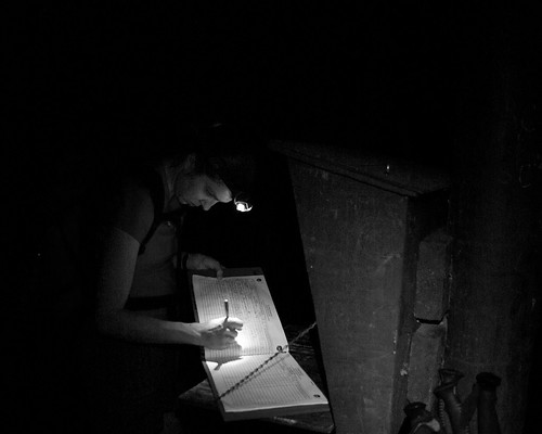
We actually spent about 30 minutes on top of Wittenberg, and we also looked at all the campsites in the cols, for future planning of a backpacking trip.
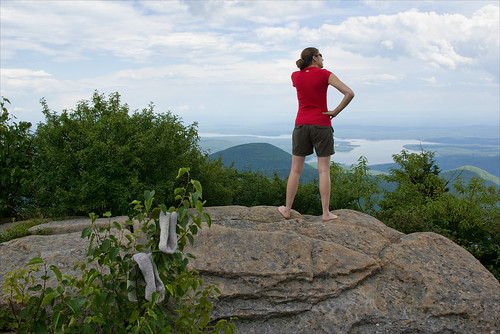

All in all we probably ended up blowing 1-2 hours messing around, filtering water, taking some ground level macro shots, and other assorted stuff I cannot describe in a PG-13 rated blog (other than to say the flatness of a certain potential secluded campsite was well tested)!!.


I’m sure you are still wondering what makes the Burroughs Range so special. There really isn't any singular aspect, rather it's the ability to string together 3 Catskill 3500 footers (4 if you go for Giant Ledge and Panther), a bunch of impressive views, some rugged hiking, and a long hike into a non contrived day in the mountains. Moreover, the range is named after the great American naturalist, conservationist, and essayist, John Burroughs, who spent much of his life in this area.
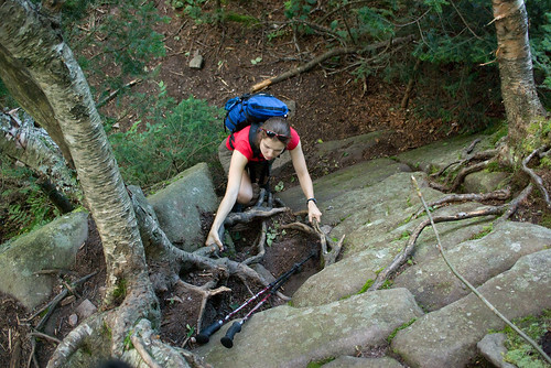

New England has Thoreau and Walden Pond, and New York has John Burroughs and his Slabsides. The summit of Slide Mountain makes special note of John Burroughs importance to both this range, and of course to the American conservation movement in general with a plaque that reads:

In Memoriam

John Burroughs

Who in his early writings introduced Slide Mountain to the world. He made many visits to this peak, and slept several nights beneath this rock. This region is the scene of many of his essays.

“Here the works of man dwindle.” In the hearts of the Southern Catskills.
Perhaps the most interesting thing about the Burroughs Range is the fact that it surrounds the epicenter of a meteor strike As you look at a terrain map of the range you will see that Esopus and Woodland Creeks form a circle around the range, dead center of this impact site is Panther Mountain. It’s hypothesized that Panther Mountain rose from gas being forced up. Yes, rather than a crater, the impact site of this meteor actually formed an inverted relief crater.
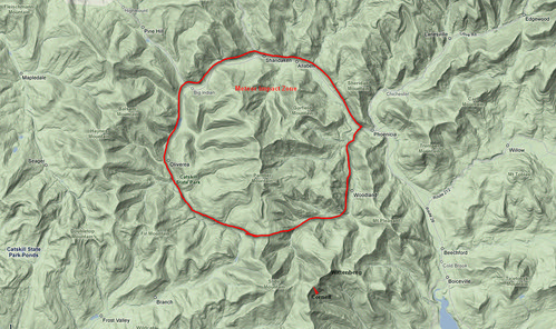
Burroughs Meteor by you.

During the middle part of the 20th century the mountain actually had a gas pipeline that produced considerable gas output, but in that time energy was not nearly as profitable as it is today. NY is a huge gas producing state, and has many reserves that are on state owned land and not currently tapped. These reserves are currently the source of worry and debate among environmentalist, since it is well known that drilling and removal of gas and oil is not without impact. As such the government of New York has been noted to be preparing a plan to deal with the inevitable demand to access these reserves, while balancing the environmental impact.

The gas pipeline of the 1940s, however, served a greater role than energy alone. The drill cuttings, which were saved by the NY State geological survey, were tested for ore found only in meteorites. The test, along with other data, confirmed that a meteor about 1Km (1/2 mile) hit the site.

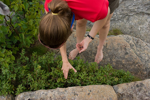
While on the summit of Wittenberg, a summit we had all to ourselves for most of the 30 minutes we spent up there, we found blueberries to supplement our lunch. I was shocked there were still berries left on this popular summit this late in the summer. I suppose all the city folk are too shy to pick some berries while hiking, too busy breaking glass bottles, and writing their names on the summit stone.
One thing we noticed almost immediately was the view down to the reservoirs was a bit strange. After all the rain we have had the reservoirs seemed to be low. Not long after this hike I read that NYC expects the reservoirs to not meet demand of city water consumption in the next few decades (or sooner) and desalination plants will be required for the first time in NYC history.


While this doesn't fully surprise me, the cost of these plants is staggering, and no doubt will put another strain on the City of New York financially after a few hundred years of essentially free water, and perhaps the best pure water supply of any major US city. The flip side of course, is NYC has been a terrible steward of the land surrounding the reservoirs, and ultimately is getting what it deserves. It's appalling to me that a city who's very existence depends on the clean water from upstate reservoirs has been so indifferent to protecting these water sources.


From the time we left Wittenberg the views were intermittent, but never quite as broadly spectacular as the broad 245* vista seen from Wittenberg's east summit. Of course often the smaller view points that followed offered a more intimate look at some of the more wild areas of the Slide Mountain Wilderness.
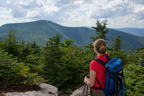


We were in the mid afternoon when we were descending into the long col between Cornell and Slide and about halfway through the 13 mile hike.

Cornell is a typical Catskill summit in that it is essentially a plateau with possible views from ledges off to the sides of the trail. There was no true summit viewpoint, but several spots close to the summit offered nice views into the Slide Mountain Wilderness, both towards Slide and back at Wittenberg.
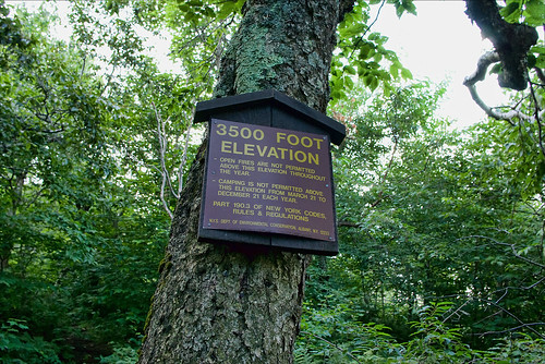
The col between Cornell and Slide is a rarity in that it's long but generally flat (in terms of mountains, not plains). It straddles the 3500ft mark, which for the Catskills is a zone of protection. For 9 months per year there is no camping above 3500ft to protect the much more fragile plants and soil higher up on the mountains. In winter, camping is allowed at all elevations, however, the col often legally dips just enough below 3500ft to offer camping in all seasons and a few of the best campsites in the col seem to be right at the 3400 foot mark.
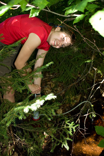
Better than legal and somewhat decent camping, is the fact there are several water sources. The Catskills are somewhat rare in the fact that springs are often found high on the mountains, and the Burroughs Range does offer several spots to fill up, even in summer. One thing I noted though was that while the trail maps show several springs, we only found one reliable spring. This is a bit concerning since most guides note the springs are reliable, and this was a wet summer. It's possible we missed a spring, but since our goal was to mark these points on a map for future reference I'd be even more skeptical a less observant group would do a better job finding the springs.
One thing I'd like to address is something that appears to be becoming more and more of a problem. People seem to believe that since they do one or two backpacking trips a year, most likely not to the same spot, that leaving a pile of non degradable trash is acceptable practice. I guess they assume in a year or two when they return it will be gone and no harm done. The problem is those that follow you in the near future are going to a location like this col, to get away from the world, to escape things like trash and litter, and as they hike into what they assume is a wilderness campsite miles from a road after hiking thousands of vertical feet, they are greeted by a pile of MREs. Worse, this trash is a nightmare to carry out, and not many people have the desire to carry out a few smelly MRE packages over a few miles.

Why in God's name anyone thinks taking MREs on a backpacking trip is a good idea is beyond me. Sure they are easy to prepare, but then so are Ramen Noodles, or a freeze dried dinner. Yet, MREs are heavy, bulky, and when you are done there is a large pile of waste that needs to be packed out.

After crossing the col we began the ascent up Slide Mountain. Slide is the highest mountain in New York State not in the Adirondack Forest Preserve, and it's one of only two 4000 foot mountains not located in the Adirondacks. While Slide is the highest mountain in the Catskills it's still not above tree-line. And the summit itself has very limited views. Like many highest peaks, it's by far one of the least impressive, although, the hike up to it's summit from the Cornell-Slide col offers some nice views and an amazingly cool and clean spring! This was in my opinion the best spring on the whole hike, and much appreciated after 8 miles!
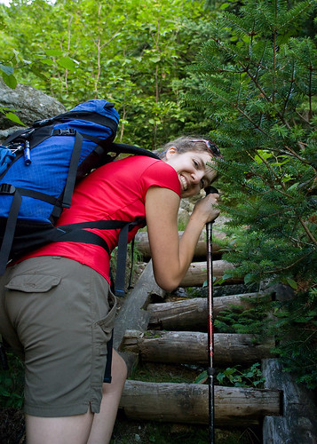
Before we reached the summit of Slide the weather looked to be changing for the worse, a cool wind, and stormy skies appeared. The weather radios were silent but the sky definitely looked as though a severe thunderstorm could roll through at any moment. Of course this severe weather is often leads to the most impressive views as it rolls over the mountains. As we climbed the stairs and ladders up the final few hundred feet to the summit of Slide, Aim commented on the rainbow out in the distance. Finally, I got to a spot with enough line of sight to pull out my 3lb carbon tripod, and mount the 55-300 and shoot the distance landscape. Unfortunately the rainbow never really became more visible, and after 15 minutes of waiting, it was clear to me that I'd run out of light long before I got a good shot. I packed up, and caught back up with Aim and Caney just below the summit.
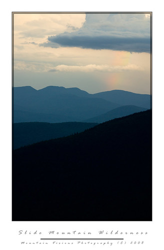
On the summit of slide we took the usual summit photos, and made some Carnation Instant Breakfast which I've found is a great way to both hydrate and get some quick nutrition on a long hike. I put as much of my gear into my pack as I could fit, still expecting the storm to pound us. Oddly though, despite the ominous skies, and thunder rumbling we never had more than a drop or two of rain on this long day.
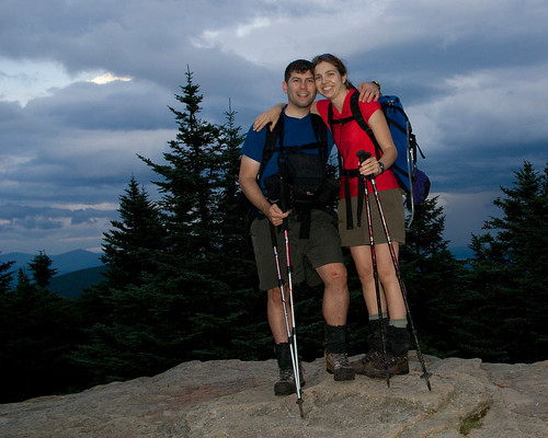
The hike down the west side of slide offers a few off trail view points which we caught the setting sun out to the west. The trail is essentially a wide old road bed (or seems like one), I always refer to this path up the highest peak in the Catskills as the ladies route. It's generally well graded, and not too rough. Although while the trail is not steep, the footing is awful in the warm weather because of the typical Catskill slate and scree, which begs you to take a mistep and roll an ankle. Sure enough, after a full day of hiking, I found myself on my ass more times than I cared to count. In the winter this route is incredibly easy and it's no surprise that it's one of the most heavily hiked trails in the winter months. With snow cover, all that ankle breaker slate becomes a non issue, and if the trail is already broken, you can often make better time ascending Slide Mountain in winter than summer.

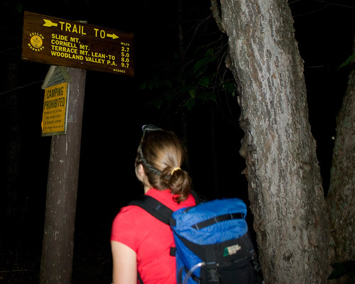
When we reached the Slide Mountain parking area it was well past dark, and well past our hoped for exit time, P&G's in New Paltz was now not in the plans, but since this part of the hike was new to me, we had other problems.


I'd read a few trip reports were people accessed a DEC right of way to cut some of the road walking off and also reduce some of the descent and re-ascent. Finding this was easy as pie, since it was just north of Winnisook Lake, although it was so easy that we naturally thought we were in the wrong spot. So after pulling the map and altimeter out, we proceeded up the forest road bed.


About 45 minutes later, including a 15 minute stop to change my socks (which is a real treat after a long day of hiking), we arrived at the intersection of the actual trail we would have been on if we'd continued down the paved highway, and regained the trail. We cut 500 feet of the hike and about ½ mile. Unfortunately we would give that 500ft, and perhaps a full mile back in short order.

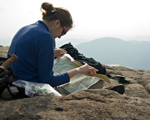
Aim, who can actually read a map just fine, decided that the non green shaded area and old woods road that passed through it was a viable shortcut for us. After all it was now 10pm at night, 12 hours of hiking in the books, and nothing more to see. We were tired, hungry, and ready to finish this up. For whatever reason, just like the time we did Crane Mountain in April, without snowshoes and post holed 2.5 miles back to the car, I blindly followed her at the ~12 mile point of this trip.


This is one of those stories that will live in infamy. We timed the road intersection brilliantly using my altimeter, and we started down the road as happy as can be to be knocking off about a mile of the hike. As we walked down the road it became evident that one of two things was the case. 1) the whole road was private 2) one side of the road was private but the other was state land.


Me being the optimist/realist was hoping for the later, so despite the signs becoming increasingly more aggressive and less and less open to interpretation in their meaning we kept going (as if “Take Another Step And You Will Die Maggot” requires a 800 verbal SAT to figure out). All the signs seemed to be in the middle of the road, or on the right hand side of the road. But about 10 minutes down the road, the first signs on the left appeared, and they weren't friendly. So at this point it was evident we were trespassing, and evident that these people watched the movie Deliverance at least a few dozen times.
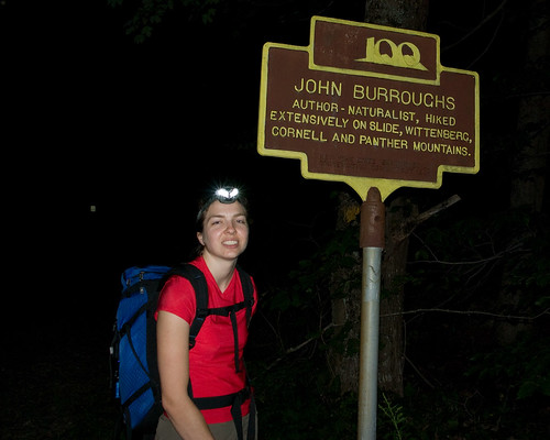
So, not wanting to walk back up the road, which was UP and curved away from where we ultimately were en route to, I decided that if we could spot the road, that we should go for it. You know, like when people would try to jump the Berlin Wall and get to the west. Of course the Beware of Dog sign was intimidating, as were the barking dogs. But more intimidating was the frequent “Beware of Large Trained Attack Dog” or “Beware of Pack of Large Attack Dogs” signs that seemed to be more frequent and with larger lettering, and I should mention, those were the signs that I can speak kindly of, there were a few others that said things I refuse to write about!


So after some time, certain I was either going to die, or go to jail as they fed Caney to a pack of wild dogs, I ran like hell back to the road, and we hauled up the road like we were on mile number 1 of this adventure. Quite frankly I didn't know Aim could run that fast, because certain she was dead I just kept running, but when I got back to precious state land, she was right behind me.


So rather than take a shortcut, we were now 45 minutes behind where we should have been, at least 500 vertical feet and 1 mile over the actual hike distance, and still about 1.5 miles from the trail head.


One thing I never see mentioned in the Burroughs Range trip reports is the final “Stairway To Heaven” it is an exercise in futility as you come close to the end of the trail. It’s probably 30 steps spaced at about a few feet apart, and each one goes up about 2 feet. At the end of 14 miles of hiking, where the trail map shows a fairly flat stretch to the car, this is demoralizing.


As we hiked down to the base and finally up this “Stairway To Heaven” I realized I was actually out of food. I almost never run out of food on a hike, but this time I was out, water was almost gone too, and I was tired. We sat on the rock steps, cursing the trail crew for what was actually incredible work, but surely this little incline should have been visible on the map. Surely someone should have mentioned it. It wasn't that it was all that hard, no, not even after 15 miles, but the fact that no one ever mentioned it was a bit shocking.

The whole trip took us about 15 hours to cover about 16 miles and around 11,000 feet gained and lost. It was by far the longest day hike Aim and I had done in some time, perhaps since the Butterfield Trail in Arkansas back in 1998, although while the Butterfield was about as long, it perhaps gained and lost no more than 1/3 the elevation of the Burroughs Range.
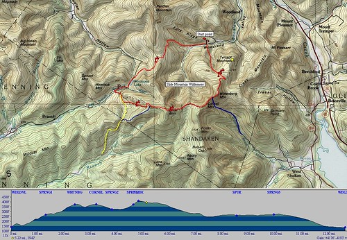


burroughs hike

Definitely the classic Catskill hike, complete with the usual Serpico mishap and added adventure to make it a classic day in the mountains!


Blogged with the Flock Browser

Saturday, October 18, 2008

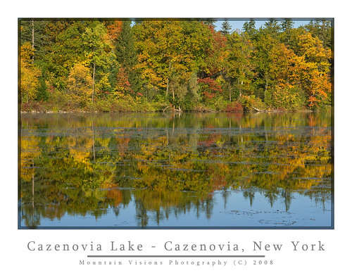
Ithaca Is Gorges: Fall In The Finger Lakes


It occurred to me that despite autumn being my favorite time of the year that I never seem to make the most of it from a photography standpoint. Last year was so dry it seemed like the colors were not very bright or long lasting.

As of Columbus Day weekend 2008 I had absolutely nothing to show for what is so far a colorful autumn.

The high peaks in the Adirondacks are already well past peak as are the upper elevations of Vermont and NH. I had already seen some great images of the snow covered summits with colorful lower elevations and knew going south was better.


Leaf season peak foliage varies by elevation and localized climate (duh, but I just wanted to impress you with my common sense wisdom). Even two areas at the same elevation and latitude can differ if one is close to the water and the other inland, or has some other factor that influences local climate. Just like chasing spring wildflower season can last weeks if you do it right, foliage season can be mapped out to catch peak after peak.

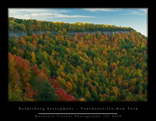
As it turned out the Heidelberg’s and Catskills are currently at peak and generally always around Columbus Day weekend.


So Saturday afternoon we headed to Thacher State Park to hike the Indian Ladder trail. The trail is almost paved in many spots, and no special hiking attire is required to hike the approximately one mile loop. Actually, it is one of the few places you will find (attractive) women hiking in heels and mini skirts!!!
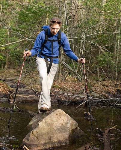
I had hiked the Indian Ladder once before on a dreary spring day and had the place to myself, but I had a feeling this trail was typically packed and devoid of any wilderness character. Sure enough it was, only making photography more difficult. Making things worse, the picturesque waterfalls I had photographed in my spring sojourn were almost totally dry.


However, the near peak colors made up for the crowds and lack of water. I came away with a few nice shots and a nice hike only a short drive from home. I often fall into the same trap as everyone else by thinking I need to go someplace far away to capture great images, the truth is, you have a unique advantage when shooting close to home in creating the very best images, since you can time everything for optimal conditions.

Since Aim did not have off Monday, I needed to decide whether to do a day hike Sunday and Monday or go camping and save fuel, carbon emissions, and maximize shooting in an ideal setting. Aim did not seem too enthused about going to the West Canada lakes wilderness, which was near, or slightly past peak for a day hike, so I decided to go camping Sunday and Monday.

Checking the foliage report showed that the Catskills were at peak, and the Finger Lakes were near peak, with the Great Lakes regions not yet peaked.

Having enjoyed, but spent so little time in the Finger Lakes over the years, I decided to go south and west and enjoy this different part of the state for a few days of off-season camping at Robert Treman State Park.

Treman, unlike the bulk of NYS Parks, and DEC campsites is opened past Columbus Day. Actually, Nov 30th! So it makes a great base camp for camping and foliage photography in what I consider one of New York States gems.


The Finger Lake region is obviously home to 5 of New York's largest lakes, but also it is home to New York’s largest wine region, and highest waterfalls. The area between this region and the Catskills is also some of New York’s most fertile farmland. New York is the #4 producer in the US of corn, and among the top in milk (#3), and apples (#2), cabbage (#3) and third in grape production. This region clearly shows the agricultural roots of NY. Fittingly, it is also home to New York’s (and perhaps the nations) best agricultural and veterinary school, Cornell University.


While if you’ve ever read any of my other trip reports you know my first love for a region of the diverse state of New York is the Adirondacks, but I’d be hard pressed to offer a better region as an example of New York than the Finger Lakes. To me the ruggedness, diversity, and refinement of the region are New York in a nutshell.

Robert H. Treman (there is also an Allan Treman a few miles north) is on the eastern edge of the Finger Lakes region, in the town of Ithaca. It is within 8 miles of 4 other state parks, and almost across the street from another equally beautiful park, Buttermilk Falls State Park.

I was actually surprised at the amount of people camping this weekend. There are 50+ sites at this park, and nearly all of them were filled. The last time we were here in September 2004, it was empty at the campground even though plenty of people were still out hiking on the trais.

The trails of these state parks are unique in themselves, they are aptly suited for those lacking either the fitness or desire to hike less civilized trails.

The trails of many of these Finger Lakes parks could actually be considered a history lesson of sorts, perhaps a great excuse for a teacher who loves to hike to organize a field trip ;-).


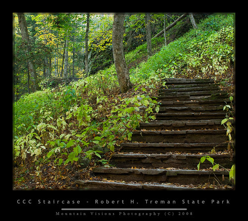
During the Great Depression, President Roosevelt started the CCC to put men to work doing something, even if most of the work that was done was essentially busy work. Still paying people to work rather than just giving them a check was better for the morale of a nation built on the puritan work ethic, and of course provided nearly of century of quality stonework that sees thousands of hikers a year.

A lot of the CCC work in the Finger Lakes is in need of serious repair, while other parts look brand new. Keeping in mind of course that this area sees a tremendous amount of water and temperature extremes resulting in many freeze/thaw cycles, that most of this stonework is still in great shape 80 years later.

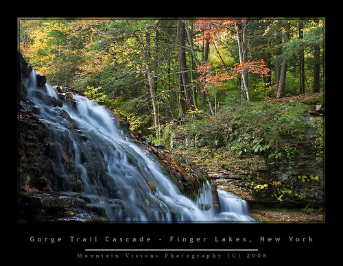
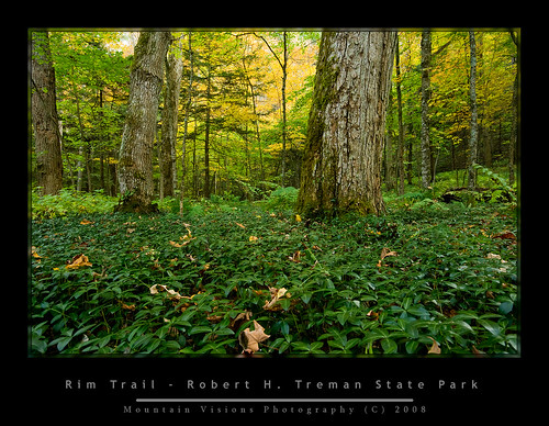
Many of the Finger Lakes state park trails have a similar and sensible naming system which goes like this: above the gorge is called the “Rim Trail” and in the gorge is called the “Gorge Trail”.


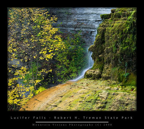
I hiked the 5 mile Rim/Gorge loop at Robert Treman, which goes to the top of Lucifer Falls, a cascade of over 112 feet. When you reach Lucifer Falls, the gorge is over 200ft deep. Along the trail, the gorge is filled with mosses, ferns, and in the warmer weather wildflowers. In the fall, the contrast of the changing leaves with the rich greens of the mosses and ferns can make for a spectacular contrast. The gorge is one waterfall or cascade after another, and honestly, if you dedicated yourself to shooting in the good light, you could spend years capturing the beauty found along this single 3-mile stretch. Although solitude and quiet contemplation you will not find during a weekend.


Monday, I woke up at 2:30am wide awake after hitting the sack at 8:30 the night before. I went back to sleep off and on till 5am when I decided to commit to the early start I had envisioned but expected not to make. It took me about 30 minutes to break down camp in the dark, and load up the Zuk.

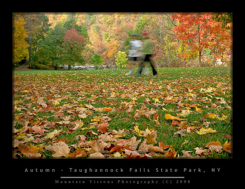
The plan was to get to Taughannock Falls State Park, about eight miles away before sunrise, unfortunately while the plan worked, the sun didn’t cooperate. Instead of the brilliant blue skies we were forecast to have, it was a hazy light overcast. This soft diffuse lighting is great for macro shots and shooting water, but not great for foliage. I wanted the soft golden morning glow and Mother Nature didn't cooperate. I almost stayed on the shores of Cayuga Lake, to photograph what looked to be an interesting purple sunrise through the haze. But we’ve all seen enough sunrises, it’s foliage we want.


Once again, you have the Rim Trail and the Gorge Trail. The last time I was at this park Aim and I did the Rim trail to the falls overlook. My goal was this time around was to go to the base of the falls. I don’t remember the distance but I think it is about a mile to the base.

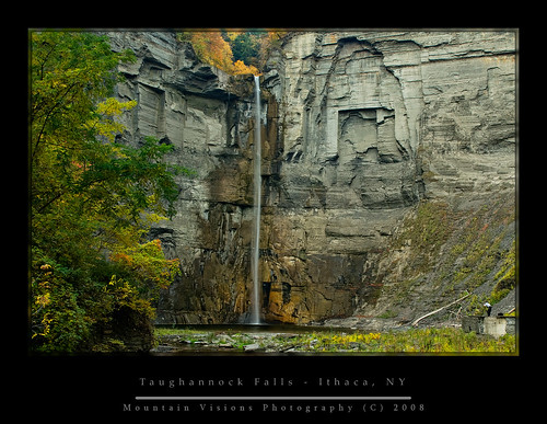
Taughannock Falls is actually New York's, and the eastern US highest waterfall. This of course can often be debated depending on how you rate the fall (there are longer cascades for instance), but Taughannock Falls is a single purely vertical drop that CANNOT be contested. No matter how you measure it, it’s going to work out to an equivalent of 215 vertical feet. How impressive is this? Well, Niagara Falls is a mere 182 feet high. Of course Niagara Falls claim to fame isn’t it’s height, or width but the sheer volume of water the that passes over the falls. Taughannock Falls by comparison is merely a trickle most of the year, and in summer nearly dries up.

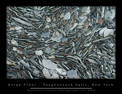
The area below the falls would make an excellent swimming hole in summer, aside from the fact that these gorges are inherently unstable. Anyone lacking the intelligence to determine where the piles of rubble at the base of the gorge came from, just needs to stand around for a while and listen for the popping, cracking, and eventually falling of the rocks above. Suffice to say while wandering around off the trail I was a bit uneasy. Having been hit in the (helmeted) head plenty of times while rock climbing, I don't take rock fall lightly.


Disappointed with the morning light, I looked around for some shots that benefited from the soft low contrast light, but eventually just headed out after having the park to myself for a few hours.

Overall a nice beautiful weekend and a change of pace for me.


Blogged with the Flock Browser

Wednesday, April 30, 2008

Chaos On Crane and Oooo Sable In The AMR

Busy weekend for me in the Daks.

Seems like I hiked a lot more than 15 miles over 2 days. I shot over 8GB of images over that time (lots of brackets of 16MB images), most in poor lighting and after a few days I've finally made some progress.

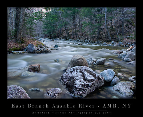
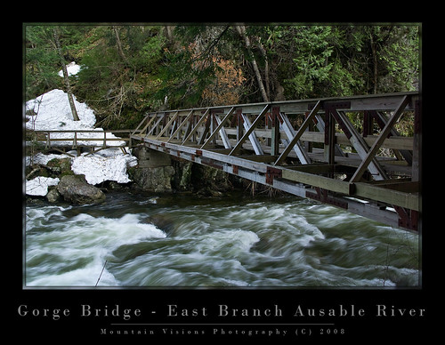
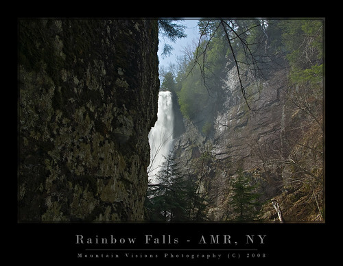
Saturday was a great easy hike in the Adirondack Mountain Reserve, which is publicly accessible private land owned by the Au Sable Club.

After leaving a few minutes later than I intended, I met John and Joanne at the parking area a few minutes after 9am and we headed for some of the most spectacular (and most accessible) scenery in the Adirondack lowlands. Lots of waterfalls and chasms, streams and rivers. Just a beautiful place.

We kinda hit the lighting just wrong, and our overcast day turned a bit too sunny for even the usable diffused light provided by cloud cover. It was still very dead out there, as the trees hadn't even begun to bud. It looked like what I affectionately call the skeleton forest. Black flies and bugs were non existent which made the day ever more enjoyable. Great day though and lots of fun to just kick back and talk photography while taking our time, even if we didn't have the best lighting.

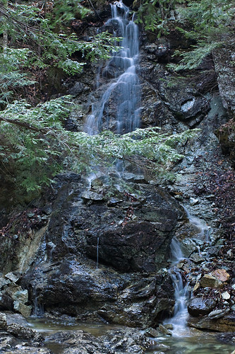
My partners left me at about 4:30pm, and I headed about a mile up trail to Wedge Brook and Wedge Brook Falls. I noted a few spots I'd like to hit with better lighting on the way down, and got to the falls. Beautiful place but despite spending an hour playing around I left with nothing that I liked. On the way back I shot a few frames of the East Branch Ausable River and some spring runoffs down the gorge walls.


After a few more shots on Gill Brook and the Ausable River, I got back to the car around 8:30pm and was back home by 10pm.


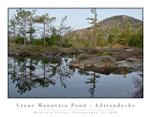
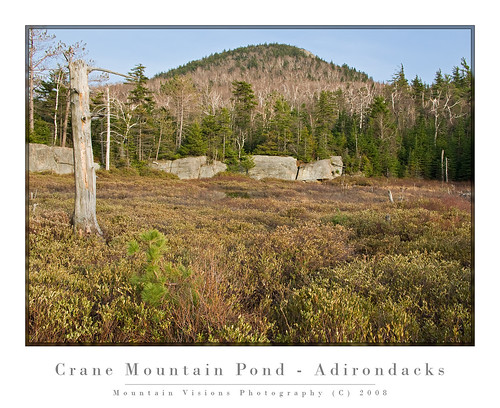
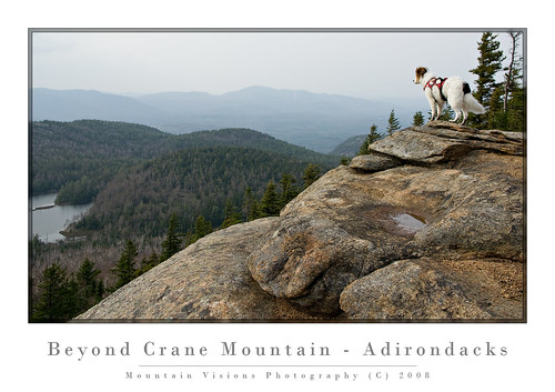
Sunday, Aim, Caney and I headed for Crane Mountain. Our last trip there in 2000 or 2001 ended in Caney losing his pack around the lake. I listened to Aim and didn't carry snowshoes and the spur trail was covered with 4 feet of snow making the 1 mile hike an incredible post hole fest. Lesson learned from that experience...when in doubt carry snowshoes even in April, and DO NOT PUT THE KEYS IN YOUR DOGS PACK!!!!

The 2008 Crane adventure was quite nice, although covered with blowdown from the uncharacteristic ice storms we had this winter, and the trail was at times poorly marked, lots of route finding, and some bushwhacking to get back. For an easy 3.5 mile hike we ended up hiking about 5 miles and it felt like much more. Overall great day but the black flies were out, and lightly biting at times on the hike up. On the return they mysteriously disappeared.

One disheartening thing about Crane Mountain was the trash situation around the pond. Typically the southern and western Adirondacks seem to suffer more from irresponsible and just downright lazy disgusting people who feel that it's too much effort to carry out the stuff they brought in.

Unfortunately, this attitude is contagious and trash left behind signals to the next user group that it's OK. Then things go out of control and the DEC is forced to make changes that affect everyone.

I'm hoping to organize a work crew to go in and clean this area up. Anyone reading this who is interested should drop me an email. I figure 4 or more people could circle the lake in an afternoon, disperse some of the poorly built campsites and partially burned wood, burn any burnable trash and pack out the many plastic bottles, and bits of broken glass.


To anyone reading this looking for information on campsites (and I know you do because of I see your search strings to get to my site) please have some respect for yourself. Yes for yourself, and pack out what you bring in. Keep in mind that the trash you leave can only end up 2 places, in the forest, or in the pond. And that in either place it will remain there pretty much permanently.

While one bottle, one wrapper, one cigarette butt might seem harmless, the cumulative effects are not. And it's pretty selfish and just plain disrespectful to literally destroy someplace that you, and others that follow you, obviously thought enough off to expend your sweat and energy to hike into.

The 6.5 million acres that forms the Adirondack Forest Preserve might seem inexhaustable, but if enough people carelessly abuse it out of nothing more than laziness, we will be left with nothing but a giant wilderness landfill.

Give a hoot, don't pollute.

technorati tags:, , , , , , , , , , , , , , , ,

Blogged with Flock