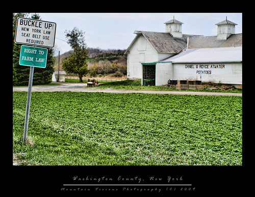
(from 1st visit of May 2009)
With the spring just taking hold at the lower elevations, and still a few weeks away up high, I've been chomping at the bit to get a little color in my life and in my photos. In a month the greens won't seem so impressive, and I'll be anxiously awaiting the late summer flowers, and then the fall foliage, but when looking out at a skeleton forest of gray and brown for the last month the green cannot come fast enough.
Heading east on Rt 146 at 4:55am the sky looked like it might become dramatic as the sun rose over the Hudson River. Of course getting up to the alarm clock at 4:30am I was certainly hoping for better light then what was before me. Because it was so warm and so breezy, the water is actually cooler than the air, and there was no dramatic morning fog and mist coming off the rivers and ponds. Now I had no lighting, and I had no early morning mist. As I drove east towards the Vermont border I wondered if I should even bother driving the 50 miles or just hit something a bit closer to home.
Something told me to keep going, and when I find that something, I am going to give it a little lecture for the bad advice. No, it wasn't a bad day, actually the weather was interesting for a hike, but depressing when you are toting 10lbs of photo gear with the intention of using it.
Believe it or not this drive northeast through Greenwhich and then Salem was a first for me. I've never been farther east than Schuylerville in Washington/Saratoga county, and it was actually quite pretty. Vermont might be known for quaintness, but New York can be quaint as well. This portion of Washington County undulating dairy country, criss crossed by the Battenkill River.
When I arrived at the Merck Forest parking area I was greeted by a swarm of black flies. Of course, I didn't have bug dope. Usually it's not needed this early in the year since the flies tend to not be aggressive this early, and fortunately while the flies were swarming, they weren't all that hungry.
6:30am is even early for the farmers on a Sunday, and I had the place to myself for more than an hour. I headed up to the live stock fields, and hung out with the ewes and lambs for a while, although I never could get a clear shot of the young lambs nursing which was truly the most interesting thing going on..
After breakfast with the sheep, I headed down Old Town Road to Clarks Clearing. With the trees not leafed out yet, the forest floor along the woods roads was covered with tiny wildflowers. I spent a little while taking some flower flower closeups of the dime sized flowers, and then continued on to Clarks Clearing. At the clearing it was starting to feel a lot like rain was imminent, but I was 2/3 of the way to Mt Antone, the 2600ft peak over the farm. I began to climb Mount Antone but ended up in the clouds. Instead of pushing my luck, on a day when I was certain not got get anything photographically interesting, I turned around.
The return trip I took the McCormick Trail, and then the Wildlife Loop, with the intention of shortcutting back to the car via the Forestry or Discovery trails. I somehow got lost on the Wildlife Trail, and ended up bushwhacking to make up some time. Of course, that didn't go as planned either. I did hit another trail as I had planned the problem was the private property markers had me confused. I expected to be on the Forestry trail, above the parking area, but I was on the Discovery trail below the parking area. The problem was I started out the bushwhack lost, and the key the staying not lost is to not get lost in the first place. (this is going to continue to sound like a Yogi-ism) The bottom line is you can know where you are going, if you don't know where you started from. Got that!
Back at the car I realized that while the Merck lands aren't exactly the pristine wilds, or the deep backcountry, this is a great place for families to come and backpack with young kids. I saw several scout troops, and a few families with very young kids who had backpacked and overnight camped. One family had an all terrain stroller to push the youngest kid. Camping here is not exactly cheap ($25 a night for tent sites) and more for the cabins, but it is on par with a state campground in cost, and the semi backcountry experience is probably well worth the added cost for a family with young kids.
All in all I hiked about 8 miles before 10am, and never actually got rained on. The Merck Forest, with it's 25 miles of trails only a 45 mile drive from home, will certainly be a place I will spend more time in all seasons.

Tuesday, May 5, 2009
Merck Farm and Forest, Right To Farm
Saturday, October 18, 2008
Ithaca Is Gorges: Fall In The Finger Lakes
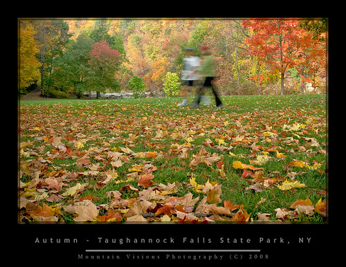
It occurred to me that despite autumn being my favorite time of the year that I never seem to make the most of it from a photography standpoint. Last year was so dry it seemed like the colors were not very bright or long lasting.
As of Columbus Day weekend 2008 I had absolutely nothing to show for what is so far a colorful autumn.
The high peaks in the Adirondacks are already well past peak as are the upper elevations of Vermont and NH. I had already seen some great images of the snow covered summits with colorful lower elevations and knew going south was better.
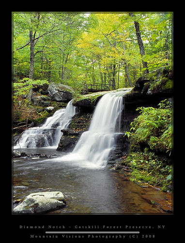
Leaf season peak foliage varies by elevation and localized climate (duh, but I just wanted to impress you with my common sense wisdom). Even two areas at the same elevation and latitude can differ if one is close to the water and the other inland, or has some other factor that influences local climate. Just like chasing spring wildflower season can last weeks if you do it right, foliage season can be mapped out to catch peak after peak.
As it turned out the Heidelberg’s and Catskills are currently at peak and generally always around Columbus Day weekend.
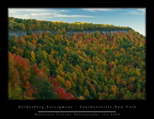
So Saturday afternoon we headed to Thacher State Park to hike the Indian Ladder trail. The trail is almost paved in many spots, and no special hiking attire is required to hike the approximately one mile loop. Actually, it is one of the few places you will find (attractive) women hiking in heels and mini skirts!!!
I had hiked the Indian Ladder once before on a dreary spring day and had the place to myself, but I had a feeling this trail was typically packed and devoid of any wilderness character. Sure enough it was, only making photography more difficult. Making things worse, the picturesque waterfalls I had photographed in my spring sojourn were almost totally dry.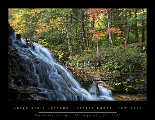
However, the near peak colors made up for the crowds and lack of water. I came away with a few nice shots and a nice hike only a short drive from home. I often fall into the same trap as everyone else by thinking I need to go someplace far away to capture great images, the truth is, you have a unique advantage when shooting close to home in creating the very best images, since you can time everything for optimal conditions.
Since Aim did not have off Monday, I needed to decide whether to do a day hike Sunday and Monday or go camping and save fuel, carbon emissions, and maximize shooting in an ideal setting. Aim did not seem too enthused about going to the West Canada lakes wilderness, which was near, or slightly past peak for a day hike, so I decided to go camping Sunday and Monday.
Checking the foliage report showed that the Catskills were at peak, and the Finger Lakes were near peak, with the Great Lakes regions not yet peaked.
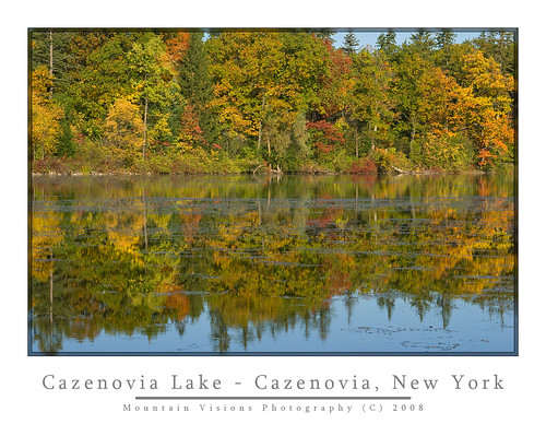
Having enjoyed, but spent so little time in the Finger Lakes over the years, I decided to go south and west and enjoy this different part of the state for a few days of off-season camping at Robert Treman State Park.
Treman, unlike the bulk of NYS Parks, and DEC campsites is opened past Columbus Day. Actually, Nov 30th! So it makes a great base camp for camping and foliage photography in what I consider one of New York States gems.
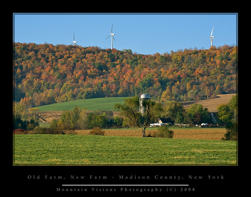
The Finger Lake region is obviously home to 5 of New York's largest lakes, but also it is home to New York’s largest wine region, and highest waterfalls. The area between this region and the Catskills is also some of New York’s most fertile farmland. New York is the #4 producer in the US of corn, and among the top in milk (#3), and apples (#2), cabbage (#3) and third in grape production. This region clearly shows the agricultural roots of NY. Fittingly, it is also home to New York’s (and perhaps the nations) best agricultural and veterinary school, Cornell University.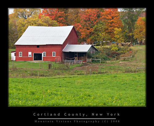
While if you’ve ever read any of my other trip reports you know my first love for a region of the diverse state of New York is the Adirondacks, but I’d be hard pressed to offer a better region as an example of New York than the Finger Lakes. To me the ruggedness, diversity, and refinement of the region are New York in a nutshell.
Robert H. Treman (there is also an Allan Treman a few miles north) is on the eastern edge of the Finger Lakes region, in the town of Ithaca. It is within 8 miles of 4 other state parks, and almost across the street from another equally beautiful park, Buttermilk Falls State Park.
I was actually surprised at the amount of people camping this weekend. There are 50+ sites at this park, and nearly all of them were filled. The last time we were here in September 2004, it was empty at the campground even though plenty of people were still out hiking on the trais.
The trails of these state parks are unique in themselves, they are aptly suited for those lacking either the fitness or desire to hike less civilized trails.
The trails of many of these Finger Lakes parks could actually be considered a history lesson of sorts, perhaps a great excuse for a teacher who loves to hike to organize a field trip ;-).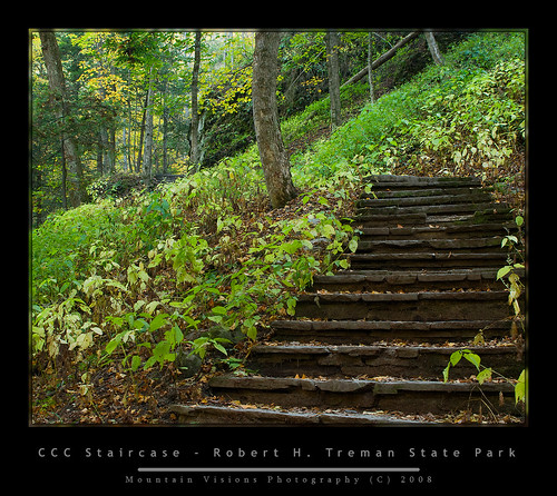
During the Great Depression, President Roosevelt started the CCC to put men to work doing something, even if most of the work that was done was essentially busy work. Still paying people to work rather than just giving them a check was better for the morale of a nation built on the puritan work ethic, and of course provided nearly of century of quality stonework that sees thousands of hikers a year.
A lot of the CCC work in the Finger Lakes is in need of serious repair, while other parts look brand new. Keeping in mind of course that this area sees a tremendous amount of water and temperature extremes resulting in many freeze/thaw cycles, that most of this stonework is still in great shape 80 years later.
Many of the Finger Lakes state park trails have a similar and sensible naming system which goes like this: above the gorge is called the “Rim Trail” and in the gorge is called the “Gorge Trail”.
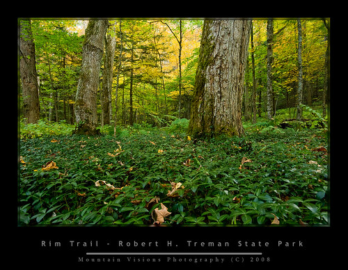
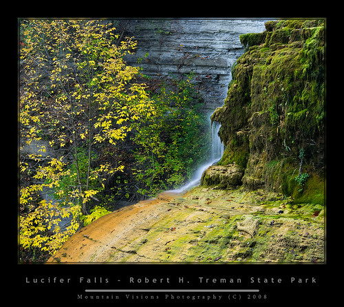
I hiked the 5 mile Rim/Gorge loop at Robert Treman, which goes to the top of Lucifer Falls, a cascade of over 112 feet. When you reach Lucifer Falls, the gorge is over 200ft deep. Along the trail, the gorge is filled with mosses, ferns, and in the warmer weather wildflowers. In the fall, the contrast of the changing leaves with the rich greens of the mosses and ferns can make for a spectacular contrast. The gorge is one waterfall or cascade after another, and honestly, if you dedicated yourself to shooting in the good light, you could spend years capturing the beauty found along this single 3-mile stretch. Although solitude and quiet contemplation you will not find during a weekend.
Monday, I woke up at 2:30am wide awake after hitting the sack at 8:30 the night before. I went back to sleep off and on till 5am when I decided to commit to the early start I had envisioned but expected not to make. It took me about 30 minutes to break down camp in the dark, and load up the Zuk.
The plan was to get to Taughannock Falls State Park, about eight miles away before sunrise, unfortunately while the plan worked, the sun didn’t cooperate. Instead of the brilliant blue skies we were forecast to have, it was a hazy light overcast. This soft diffuse lighting is great for macro shots and shooting water, but not great for foliage. I wanted the soft golden morning glow and Mother Nature didn't cooperate. I almost stayed on the shores of Cayuga Lake, to photograph what looked to be an interesting purple sunrise through the haze. But we’ve all seen enough sunrises, it’s foliage we want.
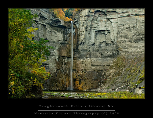
Once again, you have the Rim Trail and the Gorge Trail. The last time I was at this park Aim and I did the Rim trail to the falls overlook. My goal was this time around was to go to the base of the falls. I don’t remember the distance but I think it is about a mile to the base.
Taughannock Falls is actually New York's, and the eastern US highest waterfall. This of course can often be debated depending on how you rate the fall (there are longer cascades for instance), but Taughannock Falls is a single purely vertical drop that CANNOT be contested. No matter how you measure it, it’s going to work out to an equivalent of 215 vertical feet. How impressive is this? Well, Niagara Falls is a mere 182 feet high. Of course Niagara Falls claim to fame isn’t it’s height, or width but the sheer volume of water the that passes over the falls. Taughannock Falls by comparison is merely a trickle most of the year, and in summer nearly dries up.
The area below the falls would make an excellent swimming hole in summer, aside from the fact that these gorges are inherently unstable. Anyone lacking the intelligence to determine where the piles of rubble at the base of the gorge came from, just needs to stand around for a while and listen for the popping, cracking, and eventually falling of the rocks above. Suffice to say while wandering around off the trail I was a bit uneasy. Having been hit in the (helmeted) head plenty of times while rock climbing, I don't take rock fall lightly.
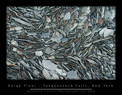
Disappointed with the morning light, I looked around for some shots that benefited from the soft low contrast light, but eventually just headed out after having the park to myself for a few hours.
Overall a nice beautiful weekend and a change of pace for me.
Sunday, April 15, 2007
Step It Up 2007
All photos (C) Justin Serpico 2007
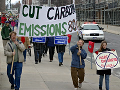
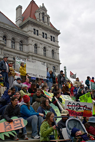
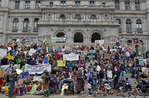
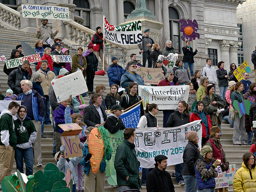
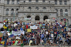
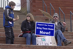
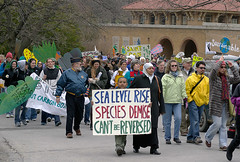
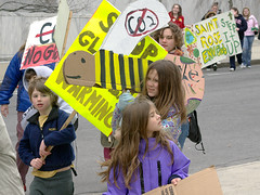
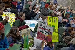
The first annual "Day of Climate Action" swept across the nation on April 14th, with over 1350 rallies to urge congress to enact sweeping changes to reduce carbon emissions 80% by 2050.
While the rally was aimed at affecting national policy change, there was a tremendous emphasis on micro change. Farmers and activist spoke about the benefits of buying food grown by local farmers and ranchers.
It's well known that people don't feel like they have an individual impact on reversing global climate change, and Step It Up 2007 was aimed at changing this feeling.
Little things like switching from incandescent light bulbs, insulating a house properly, switching to alternative energy to at least partially power a house, buying locally grown produce and meats are all ways to reduce carbon emissions.
While in urban areas completely powering a house using green energy might be impossible, it is possible to reduce carbon consumption. Using solar energy to heat the homes hot water supply is a simple and prove approach. In some areas entire housing communities are using geothermic hot water. This water still needs to be heated but it is already much warmer coming up from the ground then traditional incoming water. This reduces energy cost and carbon emissions.
The future of home energy consumption, which puts more carbon into the air then an SUV per year, is reducing grid obtained energy and making each home more energy efficient so that each little bit of energy the homeowner can produce, whether it be solar, wind, geothermal, or other sources will have a greater impact.
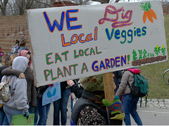
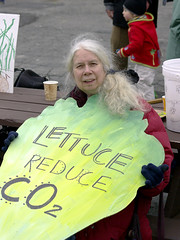
Food is another example of carbon pollution with a simple fix. The fact that it takes 36 calories of fossil fuel to transport 1 calorie of lettuce across the US is an example of how much carbon is emitted to feed this country. Most people probably never considered the impact of buying foods trucked in from far away on global warming.
Buying local foods reduces the amount of fossil fuels required to transport food, as well as supporting local growers, and keeping open space in your region.
The majority of our foods are trucked in from central locations, or from places with long growing seasons like California or Florida. Small farmers in the northeast are under extreme pressure to sell their land for development, while the nation has moved to more of a big box food supply economy.
In a push to show the quality and diversity of local foods, the Honest Weight Food Co-op of Albany, sponsored a free picnic in Washington Park prior to the march to the New York State capitol. The picnic was a showcase of local growers, with everything from free range BBQ chicken and tofu, to local produce and dairy available.
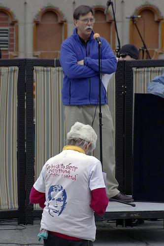
Following the march to the capitol local farmers, politicians and activist spoke about the individuals role in global climate change while pushing for national policy change.




technorati tags:Step It Up 2007, Step It Up, global warming, climate, climate change, Albany, NY, state capitol, farming, local produce, local, agriculture, CO2, carbon, emissions, pollution, green
Blogged with Flock