Showing posts with label backpacking. Show all posts

Sunday, March 15, 2026

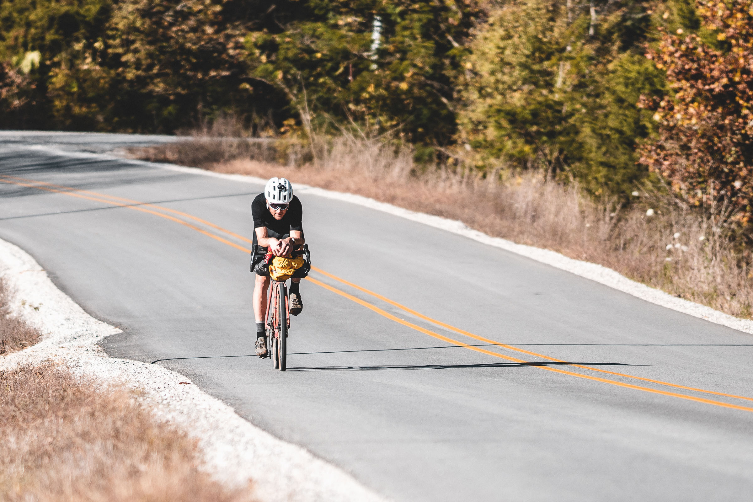
Adventures of 2025 in Images

Still far from complete but I feel like this is the bulk of what I'll post for now. Keep in mind I've added photos all the years in review from 2008-2024 over the last few months, so the album with never truly be finished. But either way, enjoy a little slice of my adventures in 2025!


Direct link to the Flickr album can be found here: 2025 in Images or you can click the highlighted links below each photo on the photo collage to see full size individual images. Order is left to right, top to bottom. So 1-5 is top row, 5-10 is the second row and so on.


1. Marshall on Hurricane, 2. Skiing with Marshall, 3. Deore Purgatory, 4. All That the Light Touches Is Yours..., 5. Love, 6. Moose River Madness, 7. Marsh and Sen, 8. Enjoying the Campfire, 9. Seneca Falls, NY -Cayuga-Seneca Canal, 10. Buc-ee's, 11. Ouachita Trail Single Track, 12. My name is Marshall..., 13. November 2025, 14. Memphis Zoo, 15. Memphis Zoo, 16. Finger Lakes - Erie Canal Trail Bike Tour, 17. Sweet Relief, 18. I'll Always Rembember Us This Way, 19. Erie Canal Bicentennial Bike Tour, 20. Mid-fat at the Lake, 21. Bikewhat....?, 22. Spring on the Erie Canal Trail - New York, 23. Marsh on Moonshine, 24. Seneca, 25. Preview to Heart of the Finger Lakes Bike touring, 26. Looking out at 2026...Let's Roll!, 27. Breaking Away, 28. The Road to Paradox, 29. Autumn sunset on Blue Mountain, 30. Mashall backpacking in the Adirondacks


1. October Roads, 2. Autumn bikepacking in the Adirondacks, 3. Autumn at the Lake, 4. 1991 Trek Multitrack 7900 on the Erie Canal, 5. Transition season in the Keene Valley -Adirondacks, NY, 6. Cup of Contemplation, 7. Adirondack Autumn Views, 8. Big Wheels Keep On Turning, 9. Camping with Dogs: Seneca, 10. The Road to Paradox Panorama, 11. Sun Beams Over the Northern Adirondacks Descending Haystack Mountain, 12. Adirondack Groads: Gravel bikepacking in the Northwest Adirondacks, 13. Aim and the Marshmallow Man, 14. Gully Piton, 15. Grass River Revival, 16. BCXC In the Western Adirondacks, 17. The Pyramid, 18. Father and Daughter, 19. Oooops.....!!!! (WATERSHED BREWING - GENEVA, NY), 20. Marshall and crew on the Crows, 21. Mountain Biking Vermont: Green Mountains Fall Foliage at Sunset, 22. Rollin out, 23. Sunset snowshoeing at Moreau, 24. Descending Sugar Hill into Watkins Glen, 25. Bikepacking: Hector Falls - Hector, NY, 26. Crooked Lake Ice Cream Company - Hammondsport, NY, 27. I Love New York - bike touring / bikepacking edition, 28. Ski Trail, 29. Overwatch: Backpacking in the Adirondacks, 30. Sunset after glow over the Northern Adirondacks (panorama)

Thursday, March 12, 2026

From a Never Bike Tourer to Bikepacking in the Adirondacks: The Full Circle Journey of Exploration and Discovery


Map of off-pavement and generally off-road bikepacking routes in the Adirondacks of New York State
Adirondack bikepacking routes I created as of Dec 31, 2025


Back in 2020 during Covid I took my bikes to Arkansas to visit family. I hadn't ridden in Arkansas in 20 years and I was excited to ride there, even if it was a long way from my old stomping grounds. I got back from a ride and a family member asked me "with all the outdoors stuff you do, have you ever done any bike touring? Would you consider it?"


Without hesitation I said, "no, absolutely not." The reason I gave was I do a lot of slow deliberate wilderness type activities and to me, riding was about going fast. 50mph descents with my hair on fire. It was about cranking through turns and maintaining a high average speed and crushing sprints where I felt the need to. Every ride was an individual time trial. I was enjoying picking off Strava KOMs (I'm a good sprinter so those flat KOMs are actually achievable) and just having fun riding. No need to burden myself with a ton of gear and turn every ride into a multi-day planning and packing event. 


Not too long after that I got more into gravel riding. Despite what the bike industry tells us, gravel isn't a new thing, when I was a student at the University of Arkansas we often rode gravel on mountain bikes, usually to bridge single track sections, sometimes to get to trails in the Ozark NF or Arkansas State Parks from campus, and after college I rode a lot of gravel on my hard tail because my back just couldn't handle the multi-use (hiking trail) single track that was the norm in New York. Plus, gravel was that sweet spot between MTB and road. It was out in nature, quieter roads, sometimes it could be chunky or even mildly technical (Vermont Class 4 roads are a great example of this), but it was still spinning gears and riding fast. 

Ted King on a paved section of the 1000 mile Arkansas High Country Race in 2020 (credit bikepacking.com)


I'm not sure how or why (besides targeted Google advertising, of course) but I saw the Arkansas High Country Race and Vermonter Ted King had won it. I thought that looked cool. They rode fast (relatively speaking), they traveled fairly light, and they looked like they were still riding hard. It erased my pre-conceptions of a bike tourer having 100L of panniers filled with heavy cast iron. In my mind, bike touring was essentially backpacking in the 1970s. Except, like backpacking, bike touring has evolved and with it came the ultralight bikepacking. This isn't much different than the evolution of backpacking where people went from cast iron to JetBoils with titanium mugs, or 10lb canvas tents to 1lb frameless tarp tents, and external framed packs to carry that load to lighter, more compact and nimble internal frame packs. 


Bikepacking is a volatile term. Sometimes it's used to blanket describe riding a bike to multiple points over multiple days. To others its covering the same terrain in the same style you would backpack. Too me, bikepacking is anywhere you NEED to use a water filter. So gravel roads or even paved roads in the middle of nowhere can be bikepacking. Bike touring is anywhere you simply fill your water from a hose, fountain machine, or buy bottles. I realize people can and will endlessly debate what it means to them, and I'm not here to tell you what it is or it isn't. That's up to you. I once debated someone that said if you weren't literally pushing or even carrying your bike for most of the trip, it was bike touring. To me, if I'm carrying my bike half the trip, I'd rather leave it home and go backpacking. I didn't buy a bike, deal with all the mechanical nuance and cost, just to need a pair of hiking boots. I want to ride it!


(credit bikepacking.com and Restrap)

So how did I get from "hell no" to "maybe I'll try it" to "I'm all in" and now creating routes in the vast Adirondack Wilderness? Well, sadly my dog Colvin, died in 2023. In his early years we did some mountain biking, but by the time I got back into riding, even though he was still bagging difficult peaks for a 10yo dog in 2020, it was too much to ask of him to ride with me. His final years were spent hiking, sometimes very hard peaks or routes which he enjoyed, and that was best for him. I'd ride on rest days for him but we focused on getting him out into the mountains and local trails as much as possible. About 7 months later in the summer of 2023 I got my next gen trail dog, Marshall. By 2024 I realized this was the time to get back into mountain biking and off-road bikepacking and make use of Marshall's endless energy. He is my first truly high energy dog in the sense he doesn't have a chill switch. It's go, go, go. 


My name is Marshall...You have a small window (about 5 years, ages 2-7) to ride hard with your dog. Hard? This absolutely doesn't mean abuse them with overuse, it just means where they can ride* day to day and recover optimally. Where riding at 20mph for short stretches and 15-30mi days are not pushing them to the limit. After that window you need to start considering the dogs recovery much more, mayber sticking to more technical single track where you are riding much slower and even moving on to a cart and bike touring. I will say people tend to overthink how fast a MTBer is riding. Typically average speed is under 10mph for the day, usually between 6-10mph for single track trails. That is a 6-10min mile, and trust me, your dog isn't working that hard in proper temps running 10 min miles over a typical 10-20mi day if they are already properly conditioned.  A 10min mile is 250min or about 4 hours of activity over an 6-8 hour day of riding if you stop and smell the roses, filter water, go for a swim, and take some photos.  Again, not a serious strain on a properly conditioned dog in the optimal age range. Add in a backpack like the K9 Sportsack and you can ride probably around 40-45mi on the high end if you bag the dog for long gravel descents, pavement, and long flat stretches of gravel. 

*when I use the term ride, I'm riding and the dog is running or the dog may be in the Sportsack, but he's never at the wheel, my dog training skills only go so far and he loves to run as much as I love to bike


Well, that is the backstory on how I got into bikepacking and why I began developing routes in the Adirondack Forest Preserve. I'll be posting those routes here along with maps, route GPX, photos and trip reports. 


As a side note: I've gotten some mild natured hate from some gate keepers in the Adirondack cycling community. Don't ruin a good thing for us was the consensus. But I promise you this, in 3 years of Adirondacks bikepacking, mostly on weekends, I have NEVER seen another cyclist either day riding or bikepacking. NOT. ONE. What that tells me is not only are ADK backpackers a secretive bunch (afterall, to get mad means you do ride, but to see no evidence means you keep it quiet), but they may not even exist at all in numbers necessary to prove they do. I guess what I'm saying is I understand the sentiment but I don't believe sharing my routes is going to change bikepacking in the Adirondacks dramatically in the near future. And if it does long term, it will likely mean better infrastructure and more potential route terrain. I do, however, hope it changes the anti-bike culture in the Adirondacks which is sort of ingrained in people due to the Forever Wild wilderness ethic that permeates folks who know of and love the Adirondacks. 

Thursday, August 18, 2011

Wool, Natures Perfect Fabric for Outdoors Lifestyles


On a 4 day backcountry winter trip this February, my polypro (DuoDry) base layer smelled so bad I couldn’t even stand my own body odor. The problem with advanced synthetic base layers isn’t breathability, it’s bacterial growth. I’ve tried almost every big name brand wicking fabric over the years. Polartec Powerdry, Patagonia Capiline, Wickers, Coolmax, DuoDry and many others. I actually find that Champion branded DuoDry or Coolmax available at your local Target store is about as good as any of them, all at a fraction of the price of the big name brands. I know the brand snobs out there are snickering, but the truth is the name on the label adds nothing to the key component of a wicking layer -it’s ability to move moisture from skin to the air, and Coolmax is by far the best at doing this.

Over the years quite a few companies have come out with fabrics that are anti-microbial, however, few actually are stink resistant. There is one fabric that can be worn pretty much indefinitely without stinking, wool!

Wool is naturally hydrophobic, which makes it a good mid and outer layer for outdoor activities. But with nanotechnology applied to the fibers that same wool can become hydrophilic and wick moisture from the skin towards the atmosphere. Bearing this in mind, it’s not surprising that my recent gear upgrade to wool base layer wicking t-shirts has proved to be a smart choice.

I purchased some Wickers wool t-shirts, which are 50% wool, 50% synthetic. The combination works sort of like a modern wool sock with it’s mix of synthetic and wool blend. It wicks moisture away from the skin rapidly while also reducing odor.

I’m very very warm natured. It gets over 60F and I am ready for winter. Even in the winter I rarely need more than a very thin base layer or two, and I’ve been seen sweating profusely in below zero ambient temps when the winds were calm. The only time I like it to be warmer is when I’m paddling, swimming or at the beach, and even then I’m content with 75-80F maximum depending on the wind.

The problem with synthetics is they act like a Petri dish for bacterial growth, and that bacteria is on both sides of the shirt. When you take the shirt off you still smell like a rotten 4 day old sausage.

At this point I’ve had the shirts for almost 6 months, and I’ve put them through the ringer. Wearing them to the gym, playing with the dog at the park (which involves me running around since he’s a herding dog), outdoor sprint intervals, short hikes, all day hikes and multi-day trips where I wore the same shirt every day. On one trip I alternated between the two shirts over 8 days, including sleeping in them. On another stretch I went 5 days of intense activity in a single shirt, including 3 over a weekend where I didn’t shower or use deodorant (typical of a 3 day backpacking trip), as well wearing the same shirt around the house, it barely smelled offensive at all. A full synthetic shirt will stink in about 1-2 hours of intense activity. After 3 days you will consider burning it!

How did it breathe? Well, my gym workout usually involves doing hill intervals on the treadmill (5-8 minutes at maximum intensity, average 10% incline, at 6.0mph average x 4-5 reps). Usually my heart rate is at or above it’s maximum (based on age) during most of the session, lots of sweat dripping! I can only compare it to my cotton t-shirts I typically wear to the gym, but I was reasonably dry by the time I left the gym, and felt much less clammy during the workouts. With the “SynWool” combination appearing to move moisture away from my skin, I was also cooler than I typically am when wearing cotton.

On the trail the shirts breathe very well. They seem to breathe as well as typical synthetics under similar conditions, but not quite as well as Coolmax. Another neat feature of Coolmax is how fast it dries out, the syn-wool t-shirts don’t dry out Coolmax fast, but dry out almost as quickly as most performance synthetics I have used. The downside is they seem to be a little more stretchy when wet, such as hiking in the rain or taking an unexpected swim.

My biggest complaint of the wool t-shirts is their shape holding. It says on the washing instructions to machine wash and hang dry, but I found drying them at the lowest setting is useful for returning shape to the shirt. The neck, especially, seems to stretch under the pack straps.

As far as the feel of the shirts, they feel a lot like a thin cotton t-shirt. They are very thin and from the start I was a little weary of them holding up over the long haul. I definitely don’t think they’d hold up to bushwhacking or rock climbing. I’ve already ripped one when I took a decent slide down some roots. My skin looked far worse than the shirt, 3 months later there is still a healing scar, but I feel like pure synthetic wouldn’t have ripped. I’ve also put holes in the belly area from the pack belt catching. Overall, while they do seem durable enough to last a single summer season, it’s just too easy to get a pull in the material, only time will tell.

In comparison, initial impressions of some of my full synthetic base layers isn’t much more confidence inspiring, yet I’ve had many thin wicking shirts for 5+ years of hard use. Some are mildly pilled but none are ripped.

At full price, wool t-shirts range from $40-60+, or about $30-50 more than a typical synthetic wicking t-shirt, and still a bit more than your overpriced synthetic luxury brands mentioned above. Of course, unlike most textiles, these mostly seem to be made in the USA -for now. Perhaps that is worth a little premium. Having payed $36 for two t-shirts, I’m pretty happy with the investment provided they hold up. But before I go buying anymore of this wonder hybrid material, I’m going to figure out just how much durability comes with this perfect combination of natural and man made fibers.

Wednesday, June 22, 2011

Hating on the Adirondacks infamous Shorey Shortcut

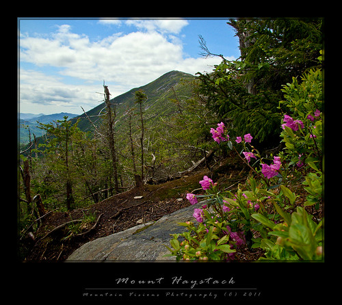
Mount Haystack - Adirondacks, NY
Spring views of Mount Haystack from the Shorey Shortcut

By Adirondack -and Northeastern US- standards the Shorey Shortcut is a pretty tame trail. No mud pits to wallow in, bogs to wade through, or talus fields to hop over. No 1000ft dry slabs with (unecessary) cables or steep muddy runout slabs without cables, and no viscous scrambles through boulder fields with rocks the size of houses. Yet, this trail is infamous- perhaps even hated- throughout the hiking populous.

Barbara McMartin, in her Discover the Adirondacks guide book series, hates on the trail. Barbara wasn’t exactly an explorer confined to the most well footed trails. Her guidebooks are filled with adventurous, off the beaten path and often trailess hikes that are devoid from many guidebooks. I should note, Barbara was a damn good descriptive writer as well. Some people hate that she turns what might be a paragraph in the ADK guidebooks into 3 pages in her books, but like Don Mellor and Paul Jamison, she fills her guides with superb writing and historical narrative. So, I was expecting the Shorey Shortcut to certainly be everything it is famed to be.

What’s more, in spite of not being horrific in any way, the Shorey Shortcut even has a few unique views, and some some nice glacial erratics to keep things interesting. Calls to replace this trail have been sounded for some time, though they seem to be based on folklore more than reality. Shorey Shortcut is the trail version of the fishing tales, “the one that got away.”

My guess is the misnomer is the issue. "Shortcut" implies some sort of shorter route, and the Shorey Shortcut is neither shorter, nor gives any sort of elevation edge to the trails it accesses.

Most people comment that it "needlessly" ascends a virtually view less nubble, only to descend again; so what? It"s called hiking, and if you are on the Shorey Shortcut you hiked at least 6.9 miles from somewhere to get there. What is a couple of hundred feet of generally pleasant hiking over a nubble in the scheme of things?

Since I don't hike in the eastern high peaks often in the summer, my experience on the Shorey Shorcut was limited to winter. Terrain in summer and winter is vastly different. What might be a 20ft ledged scramble in summer is a 5ft ledge in mid winter. A long rock slab might be an easy snowshoe slope in winter, or it could be a sheet of ice with ascent made easy via crampons. If the snow is very deep, what might be a scrub covered mountain side in summer, could now be a completely snow covered 1000ft slope that requires technical skills to ascend or descend. Low angle ladders all but disappear, while vertical ladders shrink or aren’t needed. Mud pits, boulders, roots and scrub are usually below several feet of snow, usually frozen. Some trails are easier, some harder. The change is drastic indeed, so it’s never fair to comment on a trail based on winter or summer hiking alone.

Now with more perspective I can say, enjoy the hike. The Shorey Shortcut is just another Adirondack connector trail, and undeserving of it's infamy. And quite frankly, I’d take the Shorey Shortcut long before the more traveled Orebed Trail.

Wednesday, March 30, 2011

Freedom of the Hills, An Introduction To Winter Mountaineering

The full trip report is in the process of having the images added. Here is a video of some of our hiking.

I love how at the top of Maple Ridge, Colvin encourages George to continue, "follow me George."  You can also see by his body language he is very patient and concerned when George descends the Wampahoofus trail above the tunnel (this is where you should hit mute if Top Gun lines with potential profanity offend your sensibilities).

Sorry for the crappy editing of the video (the first 30 seconds have some errors, and an extra cut where Colvin's head appears), it was my first time using the very powerful Sony Vegas, and I think some perseverance with it will yield great results in the future! Having tried quite a few professional video editing tools, Vegas seems to be the one for me. Most output formats, most intuitive (yet still insanely complicated) interface, but great coding and fast previews.

Enjoy and take a look back tomorrow for the full trip report.


Monday, June 7, 2010

Our Presidential Traverse Summed Up In a Photo!


Although Colvin had been up to Thunderstorm Junction (~5,000ft) just below the summit of Mount Adams this winter, he had never been above treeline in the snow free season. The difference between the two seasons is stark and incomparable. Having had "Wonder Dog" for 10 years I forgot that not all dogs can effortlessly cruise over boulder fields like a mountain goat. Yet, Colvin is actually way ahead of Caney in almost every milestone for a trail dog. He's hiked more miles, spent more days car camping or at a hut, and ascended higher peaks than Caney by almost 9 months! By the end of this summer he'll have paddled at least 200 miles before Caney ever saw the inside of a boat, and he's already done well mountain biking. The only thing Colvin technically hasn't done yet is a backpacking trip, although you could consider his overnight trip to Grey Knob in New Hampshire a backpack.

So my initial disappointment with his fear of negotiating the boulder fields was tempered by the fact that he actually did really well. Caney set a high bar, and it's not reasonable to compare him to any other dog. Caney's FIRST trip to NH he effortlessly summited Mt Jefferson via the 3rd class Ridge of the Caps carrying a loaded backpack without any help whatsoever. Thinking about this in hindsight it is simply remarkable, and now I realize why I was often asked as I hiked above treeline in New Hampshire with Caney what I thought was a stupid question, "how does he do scrambling on the talus?"

To be honest, I never thought Colvin could complete the traverse. When we started planning it I didn't even have him yet, and once we got him I was immediately concerned about the time frame.

Athletically any young Border Collie can hike 20 miles of easy terrain in a day. They have the VO2 max almost 4X that of Lance Armstrong's super human statistic, and were bread for consecuctive 20+ mile days over rough hilly terrain. However, heat, abrasive talus and scree on the paw pads, as well as the mental demands of ascending and descending steep bouldery terrain in 30+ mph winds and 100% humidity, is altogether another factor. At 9 months Colvin is the equivalent of a 14.5 year old child in developmental terms. Putting it into perspective, forgetting the ancillary demands of a 20 mile alpine traverse, not many 14.5 year old humans could handle 16 hours and 18,000ft gain and lost on the trail.

Regardless, as the trip got closer, I gradually started facing reality. I knew his paws at best might hold up for a minimal (summitless) traverse if I protected them with booties. After a while I realized that was probably still unlikely, so I thought we would bail at Mt Washington with or without summiting Adams and Jefferson. Technically, all the elevation gain is over by Mt Washington, and the southern traverse is really just about mileage, but the hike out via the Tuckerman Ravine snowcat trail at the base of Mount Washington is easy enough that I could have carried him out without much difficulty back to Pinkham. Whereas the hike out via the Souther Presidential's is quite a bit more demanding in the descent back to Crawford Notch.

In the end, even that plan was a bit optimistic. However, there is a silver lining, despite dropping my hat and losing a couple of minutes (as in 2 minutes), and then prodding Colvin for almost 2 miles of above treeline hiking, we beat book time from Dolly Copp over the 5,367ft Mount Madison to the AMC Madison Spring Hut by over 20 minutes. Factoring in wind and humidity (creating slick talus and wet paw pads) that is pretty impressive considering Colvin literally started turning around to tell me we should go down at treeline, at times he wouldn't even continue without me going back for him. Basically, when he was moving he was moving pretty quickly.

As we descended Madison it was clear Colvin was mentally frazzled from the stress of rock hopping over and around the jumble of boulders that is the foot path above treeline. Worse, his paws were already showing signs of abuse, and he'd been wearing booties since the start of the descent, which is most rough on the front paws.

At Madison Hut we met back up with Mandy and Kevin who were ahead of us by at least 10 minutes, I raised the white flag. Although it was much less a surrender than the right decision. It was Colvin's hardest single day on the trail (although he actually gained about the same elevation during his winter trip to Grey Knob) and his first 5000ft summit. With the return trip it was just shy of a 10,000ft gain loss day, and just shy of 10 miles. Although he only gets credit for Madison, he essentially did a half traverse.

On the way down we were able to relax, take our time, and enjoy what turned out to be a spectacular day. We spent at least 2 hours just enjoying the day stopping for lunch below the summit and then enjoying the sunshine and clearing views from Osgood Junction for almost an hour!

After our hour long break at Osgood Junction I really wanted to take the Osgood Trail down to the Great Gulf trail, and then the Great Gulf Link trail literally back to our campsite at Dolly Copp. However, as we started on the Osgood I realized the extra 2 miles might be a real issue. Besides that the Osgood continued up and down on the ridge moreso than the Daniel Webster Scout trail which was mostly a straight down descent from the junction. In reality I'm almost certain the Osgood to Great Gulf Link would have been no harder because the Great Gulf Link trail is essentially a double track forest trail for 1.5 miles. Despite that, I couldn't escape the feeling that I was pushing him a little too hard with the extra mileage and we turned around about 5 minutes down the Osgood Trail.

Overall it was a good hike, and nothing to be ashamed of. Colvin was definitely pushed to his limits, he wouldn't even get out of the car Friday night. I had to carry him to the tent, and then feed and water him in the tent because he was too sore to walk on the rough ground.

We picked up Mandy and Kevin at Crawford Notch at 9:20pm. They made excellent time and had absolutely outstanding weather from Mount Adams onward, plus they got a little taste of just how bad an average day above treeline can be in the Northern Presidential's.

Saturday we took a short walk along the river, but Colvin mostly rested in the tent while I tried to dry out our gear from a typical rainy NH/Great Gulf stay. Following the 4.5 hour drive home Saturday night he had enough energy to get his toys out of the bin, and even chase them a few times. Sunday he was ready to play indoors but still tender outside, but I thought a short lowland trail to a lake would be OK. Colvin ended up hiking/bushwhacking about 4 miles and almost did his first swim after playing in the water for about 20 minutes.

Wednesday, February 3, 2010

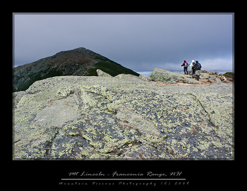
Franconia Ridge Traverse Loop


(Oct 2009)

George and I left a little later than expected, but were on the road a little before 8am. We took the scenic route to Franconia Notch and it took almost 5 hours including several stops to eat, gas, and a few detours (dirt roads that dead ended, missed turns, etc). Since we were being drenched in torrential rains that were forecast to continue all day, there was no particular rush. Hiking Saturday was out of the question, and our main hike had always been planned for Sunday.


We arrived at Lafayette Place at around 1pm, checked the radar and waited for the first break in the rain to setup our tents. We just missed the best part of the rain free window but figured it wasn't going to get any better for hours when looking at the Doppler. After setting up in increasingly soaking rain, George and I took off for North Conway for some rain killing time...food and last minute shopping.


The basic plan was to have a good meal Saturday night, and what better place than Moat Mountain smokehouse and brewery. So after a wet and harrowing drive over the Kancamagus Highway, which included rain, snow, ice and freezing temps at various elevations, we arrived in North Conway.


In the Northeast we have this thing called weather. It's not necessarily the worst weather by sheer numbers. For instance many places are colder, many are wetter, many receive more snow, many have stronger winds (although Mt Washington DOES hold the official record for highest recorded wind gust in the northern hemisphere), but what makes our weather so unique is the speed in which it deteriorates to the extremes.


After checking the latest higher summits weather report, which changed from temps in 40s and 25mph wind gust to highs in the 20s and 70mph wind gust, George was a bit worried that he might have been a little under prepared for the weather that had now been re-forecast. Fortunately, if you need gear then North Conway is the place to be. A quick lunch at Bangkok Café preceded scouring the anemic consignment shop at IME and Jim Jones clearance bin where George found some mittens, shell pants, and a neoprene face mask for less than $50.


Having killed plenty of rainy day time while shopping, we had worked up and appetite for the main course at Moat Mountain. Beer, steak, and a manly brisket chili all in honorary preparation for Sunday's Franconia Ridge traverse. As far as a chili brisket goes, can anything negative be said about a bowl of pulled beef in some liquid? Dinner was great, the beer was good, and we were back across the Kancamagus under continued downpours.


After a good nights sleep under continued rain, warming temps and increasing winds, we awoke Sunday morning to clearing skies and falling temps. A high pressure system with winds from the north was pushing in, clearing out the rain, and causing an inverted temperature profile.


Inverted temperatures are rare in the mountains, but the anomaly is such that instead of air getting colder as you increase in altitude (typically 3-4*F per 1000ft), it actually gets warmer as you go up. We saw this while driving back from North Conway across the Kancamagus Saturday night. The temperature actually went from the mid 40s in North Conway to over 50F at ~3000ft.


We started the Franconia Ridge traverse with temps in the mid 40s from Lafayette Place, crossing I-91 via the underpass, we started up the Bridle Path towards Greenleaf hut. George took the lead and set a nice pace. He hasn't hiked much and was out of shape, but including a breakfast break we made great time to 3000ft, and eventually to the Greenleaf hut at 4200ft.


Along the way to Greenleaf, starting at around 3000ft, there are some great views across to the Franconia Ridge, which the Bridle Path parallels for most of it's approach to the hut. It was fairly warm, and fairly windless at these rock outcroppings on the edge of the ravine. Looking across at the Franconia Range where the summits were under the clouds it was clear it was going to be an interesting day.


We spent way too much time messing around at Greenleaf, almost 40 minutes in total, we spent much time debating the actual temperature which was probably about 5 degrees above freezing. Finally back on the trail we lost some elevation and than began our ascent to the summit of Mount Lafayette. It was now getting progressively windier but still quite warm. We were in and out of cloud cover, as was the distant landscape. It was, as always, quite beautiful and surreal.


As we ascended above treeline the wind continued while the temperatures dropped. We met some hikers at around 4800ft descending with an injured member asking for some ibuprofen. While talking with them we inquired about the summit conditions, which they said were around 29F and windy. Another hiker had previously told us, “windy, but not knock you over windy, 40-50mph...not 70s or anything crazy...some rime ice but otherwise dry.”


As of that point the higher summits forecast was on the money, and it seemed like George was having some doubts. After all, assuming the forecast continued to pan out as promised, we had some rain/sleet followed by 70mph winds and continued falling temps on the way. We are talking wind chills approaching the single digits with hurricane force gust.


Finally, just below the summit, after filtering ice cold water in a spring/runoff, we met another hiker who had passed us while we were filtering. George asked him how the summit was, and he said he turned around just short of it; too windy, too cold. At this point George pretty much decided we were turning around at the summit, which of course I had no intention of doing. The winds were brutal, and it was cold, but neither of us was wearing all that much, and we were plenty warm. It was also dry, and the trail was mostly free of ice and snow. Basically as close to perfect as you find in these mountains, aside from the wind of course.


I convinced George that 1) we were up here to let nature beat the crap out of us 2) from the summit of Lafayette it was only about 1 mile (a fairly easy mile) less to just descend, while continuing across the ridge would be a lot more fun and marginally more difficult. 3) Even if the worst of the weather happened, we were fully prepared. He begrudgingly agreed to continue, but let me know he was sure we would not arrive at camp till midnight (and he was wrong), if we weren't killed on the ridge (obviously also wrong).


We geared up for the summit with thicker gloves and face protection. The winds were nasty, cold and blowing from the north at around a constant 50mph. There was freezing fog, and at times limited visibility. We took a few summit shots, and descended to the south with the wind at our back. Just as we dropped below the summit we saw two hikers sitting on the south side of Lafayette eating lunch in perfect calm. After a few words we walked 10m away and winds once again were pushing at our backs, but with much less force. Within a few minutes it was warm enough to remove my thicker gloves and my hat. The skies began to clear and conditions, while still variable, were greatly improving.


Other than the occasional bits of hail falling from the sky, the rest of the ridge was an enjoyable walk. The footing on the Franconia Ridge is easy, and the scenery makes the hiking a pure joy. We stopped for lunch just to the south of Lincolns summit. The winds had shifted by now, but were still mostly from the north. The skies were mostly sunny, and the views were virtually unlimited in all directions.


The rest of the ridge was uneventful other than seeing the barefoot hiker. I know people do hike barefoot, but I simply cannot imagine negotiating talus, and NH granite with my bare feet. Not to mention walking through mud and ice cold water.


The descent of the Falling Waters trail to complete our loop was as craptacular as expected. The Falling Waters trail is rooty, rutted, rugged and wet. The upper portion descends steeply, lacks views, and is dark and dank. The lower portion, while beautiful and scenic has several water crossings of Dry Brook. In low water this isn't an issue but with all the rain the lower trail was very wet, slick, and water crossings were high.


Just above the 150ft Cloudland Falls, we had to cross the brook. We were on a slick slab and George decided to throw himself down the slab while above me. In the process he took me out and we both almost slid off the slab and into the brook.


Having lost a lot of time dealing with the wetness, and slick nature of the trail, it was getting dark. We finished the 1/2 mile and 2 water crossings with headlamps.


We ran into a one last group, and they seemed a little confused, but I told them they only had 100 vertical feet till the trail head, and we were close. There was a spot the trail appeared to cross the brook, or continue on it's bank. I told George to wait while I checked it out, and then I called for him to come this way. I thought he heard me and started down the trail, turned out he didn't.


I arrived back at camp at 6:35, about 10h30m after we started, we climbed 4050 feet over 9.8 miles. At 6:45, after I'd changed my boots there was still no George at camp. 6:55 came and I knew there was no way he was that far behind. So I ran the half mile to the trail head where the couple that we passed were hiking out to. I asked them if they saw him, and they said he passed them and then started back up the Bridle Path. I was impressed; he was obviously feeling so good he decided to do it a second time. Then reality sank in, he was going in the wrong direction, which fortunately was mostly (entirely) up hill. I knew he would eventually figure it out, so I wasn't too worried. Still I ran up the trail calling out his name, and fortunately he'd figured out his mistake sooner than later.


And here lies a lesson for the kiddies: 1) never split up without clearly going over the plan 2) make sure everyone is carrying a map 3) make sure everyone is prepared to spend a night


I usually print out a map for everyone, but I forgot this time. Plus, I wasn't particularly worried since it was a simple loop hike. Because of the rushing water, George didn't hear me say “this is the right way, lets go.” However, he was fully prepared to spend a night out, and probably pretty comfortably at that.


Back at camp it was dinner time. My menu was Black bean soup with blue corn tortilla chips, reheated pad thai from lunch the previous day, Stove Top stuffing, and red wine. George had his trail comfort food of chicken and rice.


After dinner and a little down time relaxing under the stars till it was time to sack out.


I managed to get the last 2 innings of the Yankee game in my tent via my Palm Pre while roaming off Verizon. I found this ironic because George who has a Verizon phone couldn’t get service at all. Barely hanging on to the 12:01am clinching finale as the wind whipped, I was sound asleep by 12:02. I wouldn't wake up again till 8:30am, and after hitting the virtual snooze button for an 1 hour I was back to the land of the living at 9:30am.


After breakfast and drying our gear out we were off to hike a little peak south of the campground on our way back home. Mount Pemigewasset is a 2550ft peak with an open summit, and nearly 270* views of the surrounding mountainscape. The 3 mile round trip took us less about 1 hour 30 minutes, not including the 30 minute lunch at the top.


The trail up Pemigewasset is probably one of the worst trails in NH. Absolutely awful, it follows a creek bed, much of the way, and is extremely wet and hard to get a good rhythm going. On the descent I was tired of the abuse of my back and knees. The terrain was easier than the trail would suggest, so I cut cross country and mostly kept up with George who descends faster than me. Going off trail was drier, and softer, and I could get descent strides rather than tip toe between rocks.


Eventually I lost George and the trail, I then followed the creek contour down hill till the trail crossed it again close to the end of the trail. Hitting the trail wasn't a necessity but sort of important since it negated having to run across 4 lanes of highway to get back to the trailhead at the Flume Gorge visitors center. Including the bushwhack, I ended up finishing about a minute behind George.


Back on the road at 3pm we were home by 7pm, including 25+ minutes of stops.


All in all it was a good weekend, and physically my toughest weekend hiking in the mountains since early summer. Over 2 days we covered 12 miles and 12,000ft gained and lost over 12 hours of hiking. By no means record setting, or even noteworthy. Quite frankly the little hike on Monday was harder than the Franconia Loop which I rate as a beginner hike, with the caveat that it is so comparatively easy that you see vastly unprepared people hiking with nothing more than a single Poland Spring bottle. I know despite the great ridge top hiking, George was a little disappointed. I usually drag him up some semi technical scramble and this time we never had to use our hands.


Nevertheless, considering I've literally done nothing remotely exerting between July 2009 and early October 2009, while adding a solid point to my BMI, we covered a decent amount of ground, and had a good time. I hopefully gained a little more momentum towards regaining fitness so I can enjoy my time out there a lot more on future trips.


The hardest part of regaining your fitness is knowing that the first few weeks are going to suck big time. Your mind only remembers what you could do back then, your body only knows what you can do now. Retraining both isn't easy, but in a short time they meet somewhere in the middle, and eventually they trade places. Then you have to retrain your mind to realize it's not about what you can do now, but what you want to do.


I thought about Caney a lot up in NH, in part because I think the first hike he did in NH was the Falling Waters trail Memorial Day weekend 2000. While driving up Saturday on NH 25A we crossed a river access site, I thought about him and how he got in that cold water and lay down after we had a long, hot and hard weekend in the Northern Presidential's in June 2008. That weekend was just over a year ago, and he dominated the King Ravine trail (a trail the guidebook says is not recommended for dogs) on a 80F day with typically oppressive Northeastern humidity. A few months later I did it with humans without him because he was not 100%, although I wish he had come because he never really got to 100% again. That human partnered scramble took longer, there was more complaining, and they were undoubtedly less competent than my canine partner. While I've hiked with a lot of people elsewhere, I've logged more miles and had more crazy days in the White Mountains with Caney than anyone else.


Friday, July 31, 2009

Goodbye Caney "Wonder Dog"

In The Mountains of NH, Men are made.


Born: January 20, 1999  Died: July 31, 2009 at 5:25pm

Justin was his person:  June 8th 1999 - forever.

Love you, and thank you for showing us Wonder Dog one more time last weekend. You are indisputable proof that no matter how bad things are that there is no such thing as a bad day on the trail.

I miss you already but I know you are arrogantly leading the pack somewhere. Go play with your best friend Russell. Say hi to Mom (just try to pretend you know/want to heel when she walks you).  Go find Madi, she wanted a white dog, and now she has a really good one.

I always felt like you were a person trapped in a dogs body. If that is true, I will gladly be your dog next time around.

Right now I can't imagine having to go so long till we spend time on the trail together again, but we will always be closest to you when we are in the mountains.


First or Second Overnight Paddling Trip (2000)


Blogged with the Flock Browser

Tuesday, July 21, 2009

Sweet Kisses For You...Thank You Very Much

Second backpacking trip to Harriman (1999)
(photo: November 1999)

From July 12th 2009:

When we got Caney in June 1999 he came out of the box with the ability to give kisses. You would do the kissy sound, and say kisses, and he would give them. Pretty cool.

Several years down the road he realized that kisses were special and only for when you deserved them. He developed what I call "sweet kisses" and "fake kisses." He still acknowledged the kisses command, but he would not kiss your lips or face. Instead he would come up short, almost like a peck that didn't quite reach. If it did reach it was quick and half hearted, just barely a peck. Sometimes I wouldn't accept that, and I'd grab his snout and give him a big fat kiss right on his lips. Believe it or not, I've had vet techs and veterinarians comment on his lips, and for a dog they are pretty nice. I once had a vet tech give him a kiss right on the lips while he was in for an appointment. When he was a puppy they were pink so they really stood out like real lips, along with pink spots on his nose. As he got older they turned darker, as did his nose, but they are still handsome.

Today we were sitting on the shoreline of the Hudson River and just hanging ou at the Pines and Caney came over unprompted and gave me sweet kisses, and lots of them. That made me feel good because I felt like he was saying we are doing a good job, and he loves us.

What Aim and I have noticed recently, is that while he has always been nervous and less happy when we were separated, he seems to not want us to be apart at all right now. If we leave together he wants to be with us, and if we are apart he seems much more larthargic. He won't walk with me to the mail boxes, but tonight Aim came out with us, and he was eager to walk.

During the course of the day Caney made a few friends, ate a hot dog that was offered from some people BBQing on the river, and got his usual attention and compliments from strangers every time we crossed paths with someone.

He obviously didn't have a ton of desire to get in the river and swim, but he did swim for about 5 minutes, and chase a few sticks. Overall we walked about a mile through the forest along the shoreline. Not a big day for a border collie, but he had a little pep in his step and was definitely happy to be out there.

He even amazed me when Aim wanted to go down a steep shoreline embankment, I said I don't know if he can make....(and as I was in mid sentence) he shot down the near vertical incline in 3 hops. It took us quite a few more. On the way up, I was certain he would need help but he was up top giving us one more encouraging (and arrogant) look of encouragement, coupled with disappointment for his much slowy 2 legged hiking partners.

Aside from the 1lb of steak he had, the 1/4lb of ground beef, and the croissant, he had pizza with us on the deck of Nino's in Lake Luzerne. The pizza was actually pretty good but in hindsight this was way too much for him. Nevertheless, it was nice to spend a beautiful day together outdoors.

Saturday, January 10, 2009

The Burroughs Range...Deliverance In The Catskills!

"The works of man dwindle, and the original features of the huge globe come out. Every single object or point is dwarfed; the valley of the Hudson is only a wrinkle in the earth's surface. You discover with a feeling of surprise that the great thing is the earth itself, which stretches away on every hand so far beyond your ken." -John Burroughs

The Burroughs range can be summed up in a few words…The classic Catskill hike!!!!

I can and will go on about what makes it so great, but the fact is, I cannot think of a better introduction or finale to hiking the Catskills.

The Burroughs Range covers +/- 13 miles, and about 10,000 feet gained and lost. It summits three 3500 foot peaks including the Catskills highest, Slide Mountain at over 4000 feet, Cornell at 3870ft, and Wittenberg at 3790ft. The loop can be done as a long day hike that even a weeble-wobble, his string bean wife, and aging mutant dog can complete, or you can break it down into a backpack at a more leisurely pace.

Sometimes breaking hikes down into backpacks can be advantageous, but when you consider that you have to carry about 2x as much weight on a backpack as you do on a day hike, plus you have to set aside time find a suitable/legal camping spot, time to set up and break down camp, cook, etc, you don’t necessarily have any more time, or an easier time.

That said, the Burroughs can make for a great 2-4 day backpack. With the only issues being that there are several spots that require some difficult climbing up near vertical faces and even a spot where you must traverse an exposed ledge and then climb up either a face or a crack. In winter I believe there is a rope here, but in warm weather it must be free climbed.
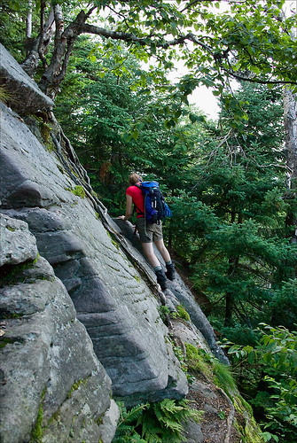
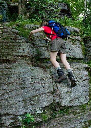


I very rarely have to help Caney climb anything that is blazed as a trail, and on the Burroughs I needed to help him three times. When you consider that he only needed help a few more times on what I consider the roughest and most fun blazed trail in NH (and perhaps the Northeast), a trail that states it is not recommended for dogs, this should be some indication of the ruggedness of the Burroughs Range.
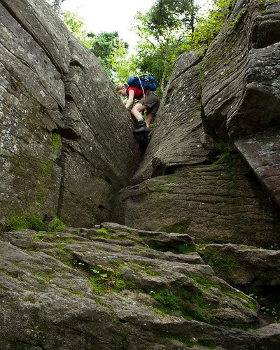


However, if you are like me, and you think you think that hiking is more fun when you get to use your hands, then the Burroughs Range offers just enough challenge and excitement to keep a smile on your face.
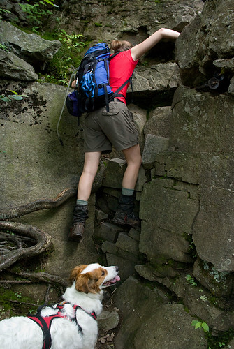

While the Catskills technically have no bald summits, the looping nature of the Burroughs Range traverse and its various exposed ledges and view points allow for nearly 360 degree views of the Catskills and beyond.

After getting chased out of NH on account of torrential rain, which can be best summed up by the NOAA weather radio reports, “we are experiencing a brief period of drier weather after 2 weeks of sustained precipitation, following this dry period continued and prolonged periods of precipitation will resume.”
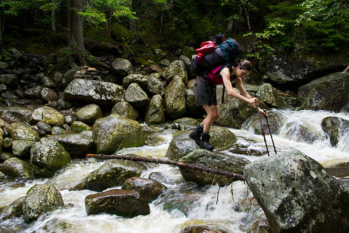

Let me just say that in the days we were in NH, among what is colorfully called the “dry period”, it was anything but dry. Generally I don't run from rain, but when dry is an inch or two of rain over a few days, I'm thinking we should be building an arc rather than hiking.
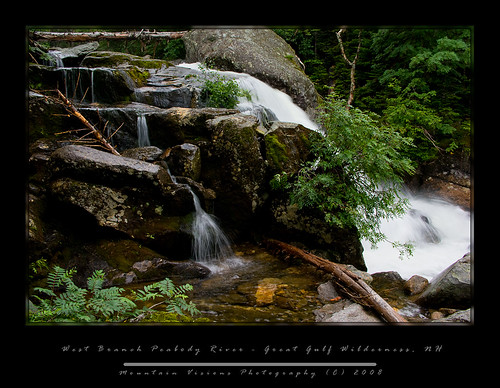
When we got back home, I watched the radar for the Mount Washington region, and the radar wasn’t green or yellow, but largely orange and red, meaning severe thunderstorms. However, in the Catskills it was forecast to be cooler, drier and free of rain.

Normally I wouldn’t take a trip to the Catskills with so much time off, but the truth was I just wanted to escape the rain for a day while doing something challenging. We arrived at the trail head with no signs of rain at around 10:30am.

Aim was naively confusing us for fast hikers, and came up with a brilliant idea that if we finished our 15 mile endeavor by 6pm, we’d have plenty of time to drive down to New Paltz and get Poutine and nachos at P&G’s.

Long story short, we didn’t quite make it out by 6pm, or 8pm, or 10pm, or 12am. It was nearly 1am when we arrived at the car. Now, to be fair, we didn’t exclusively hike for 13 hours. And we did have a wrong turn that erased my shortcut.
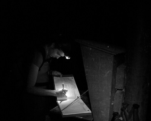
We actually spent about 30 minutes on top of Wittenberg, and we also looked at all the campsites in the cols, for future planning of a backpacking trip.
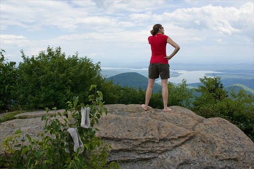

All in all we probably ended up blowing 1-2 hours messing around, filtering water, taking some ground level macro shots, and other assorted stuff I cannot describe in a PG-13 rated blog (other than to say the flatness of a certain potential secluded campsite was well tested)!!.


I’m sure you are still wondering what makes the Burroughs Range so special. There really isn't any singular aspect, rather it's the ability to string together 3 Catskill 3500 footers (4 if you go for Giant Ledge and Panther), a bunch of impressive views, some rugged hiking, and a long hike into a non contrived day in the mountains. Moreover, the range is named after the great American naturalist, conservationist, and essayist, John Burroughs, who spent much of his life in this area.

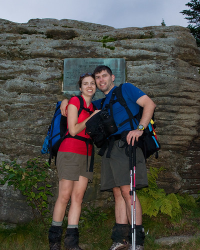
New England has Thoreau and Walden Pond, and New York has John Burroughs and his Slabsides. The summit of Slide Mountain makes special note of John Burroughs importance to both this range, and of course to the American conservation movement in general with a plaque that reads:

In Memoriam

John Burroughs

Who in his early writings introduced Slide Mountain to the world. He made many visits to this peak, and slept several nights beneath this rock. This region is the scene of many of his essays.

“Here the works of man dwindle.” In the hearts of the Southern Catskills.
Perhaps the most interesting thing about the Burroughs Range is the fact that it surrounds the epicenter of a meteor strike As you look at a terrain map of the range you will see that Esopus and Woodland Creeks form a circle around the range, dead center of this impact site is Panther Mountain. It’s hypothesized that Panther Mountain rose from gas being forced up. Yes, rather than a crater, the impact site of this meteor actually formed an inverted relief crater.
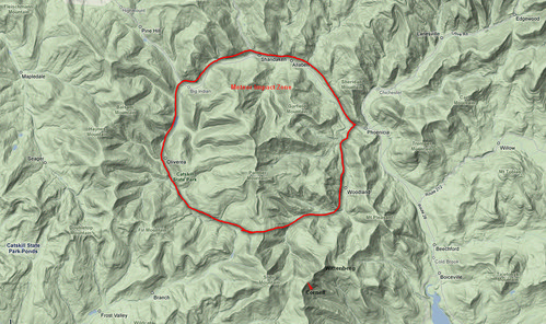
Burroughs Meteor by you.

During the middle part of the 20th century the mountain actually had a gas pipeline that produced considerable gas output, but in that time energy was not nearly as profitable as it is today. NY is a huge gas producing state, and has many reserves that are on state owned land and not currently tapped. These reserves are currently the source of worry and debate among environmentalist, since it is well known that drilling and removal of gas and oil is not without impact. As such the government of New York has been noted to be preparing a plan to deal with the inevitable demand to access these reserves, while balancing the environmental impact.

The gas pipeline of the 1940s, however, served a greater role than energy alone. The drill cuttings, which were saved by the NY State geological survey, were tested for ore found only in meteorites. The test, along with other data, confirmed that a meteor about 1Km (1/2 mile) hit the site.

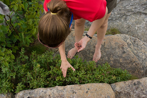
While on the summit of Wittenberg, a summit we had all to ourselves for most of the 30 minutes we spent up there, we found blueberries to supplement our lunch. I was shocked there were still berries left on this popular summit this late in the summer. I suppose all the city folk are too shy to pick some berries while hiking, too busy breaking glass bottles, and writing their names on the summit stone.
One thing we noticed almost immediately was the view down to the reservoirs was a bit strange. After all the rain we have had the reservoirs seemed to be low. Not long after this hike I read that NYC expects the reservoirs to not meet demand of city water consumption in the next few decades (or sooner) and desalination plants will be required for the first time in NYC history.


While this doesn't fully surprise me, the cost of these plants is staggering, and no doubt will put another strain on the City of New York financially after a few hundred years of essentially free water, and perhaps the best pure water supply of any major US city. The flip side of course, is NYC has been a terrible steward of the land surrounding the reservoirs, and ultimately is getting what it deserves. It's appalling to me that a city who's very existence depends on the clean water from upstate reservoirs has been so indifferent to protecting these water sources.


From the time we left Wittenberg the views were intermittent, but never quite as broadly spectacular as the broad 245* vista seen from Wittenberg's east summit. Of course often the smaller view points that followed offered a more intimate look at some of the more wild areas of the Slide Mountain Wilderness.
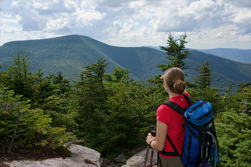


We were in the mid afternoon when we were descending into the long col between Cornell and Slide and about halfway through the 13 mile hike.

Cornell is a typical Catskill summit in that it is essentially a plateau with possible views from ledges off to the sides of the trail. There was no true summit viewpoint, but several spots close to the summit offered nice views into the Slide Mountain Wilderness, both towards Slide and back at Wittenberg.
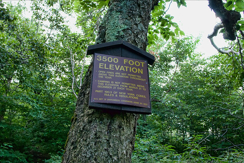
The col between Cornell and Slide is a rarity in that it's long but generally flat (in terms of mountains, not plains). It straddles the 3500ft mark, which for the Catskills is a zone of protection. For 9 months per year there is no camping above 3500ft to protect the much more fragile plants and soil higher up on the mountains. In winter, camping is allowed at all elevations, however, the col often legally dips just enough below 3500ft to offer camping in all seasons and a few of the best campsites in the col seem to be right at the 3400 foot mark.
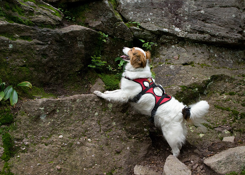
Better than legal and somewhat decent camping, is the fact there are several water sources. The Catskills are somewhat rare in the fact that springs are often found high on the mountains, and the Burroughs Range does offer several spots to fill up, even in summer. One thing I noted though was that while the trail maps show several springs, we only found one reliable spring. This is a bit concerning since most guides note the springs are reliable, and this was a wet summer. It's possible we missed a spring, but since our goal was to mark these points on a map for future reference I'd be even more skeptical a less observant group would do a better job finding the springs.
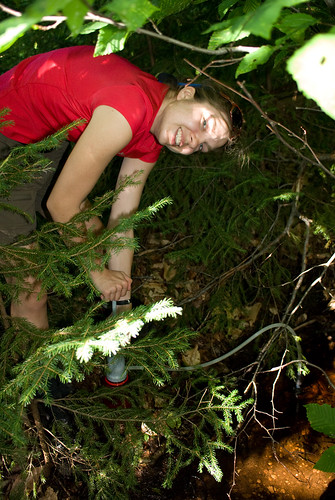
One thing I'd like to address is something that appears to be becoming more and more of a problem. People seem to believe that since they do one or two backpacking trips a year, most likely not to the same spot, that leaving a pile of non degradable trash is acceptable practice. I guess they assume in a year or two when they return it will be gone and no harm done. The problem is those that follow you in the near future are going to a location like this col, to get away from the world, to escape things like trash and litter, and as they hike into what they assume is a wilderness campsite miles from a road after hiking thousands of vertical feet, they are greeted by a pile of MREs. Worse, this trash is a nightmare to carry out, and not many people have the desire to carry out a few smelly MRE packages over a few miles.

Why in God's name anyone thinks taking MREs on a backpacking trip is a good idea is beyond me. Sure they are easy to prepare, but then so are Ramen Noodles, or a freeze dried dinner. Yet, MREs are heavy, bulky, and when you are done there is a large pile of waste that needs to be packed out.

After crossing the col we began the ascent up Slide Mountain. Slide is the highest mountain in New York State not in the Adirondack Forest Preserve, and it's one of only two 4000 foot mountains not located in the Adirondacks. While Slide is the highest mountain in the Catskills it's still not above tree-line. And the summit itself has very limited views. Like many highest peaks, it's by far one of the least impressive, although, the hike up to it's summit from the Cornell-Slide col offers some nice views and an amazingly cool and clean spring! This was in my opinion the best spring on the whole hike, and much appreciated after 8 miles!
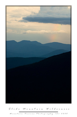
Before we reached the summit of Slide the weather looked to be changing for the worse, a cool wind, and stormy skies appeared. The weather radios were silent but the sky definitely looked as though a severe thunderstorm could roll through at any moment. Of course this severe weather is often leads to the most impressive views as it rolls over the mountains. As we climbed the stairs and ladders up the final few hundred feet to the summit of Slide, Aim commented on the rainbow out in the distance. Finally, I got to a spot with enough line of sight to pull out my 3lb carbon tripod, and mount the 55-300 and shoot the distance landscape. Unfortunately the rainbow never really became more visible, and after 15 minutes of waiting, it was clear to me that I'd run out of light long before I got a good shot. I packed up, and caught back up with Aim and Caney just below the summit.
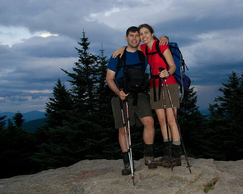
On the summit of slide we took the usual summit photos, and made some Carnation Instant Breakfast which I've found is a great way to both hydrate and get some quick nutrition on a long hike. I put as much of my gear into my pack as I could fit, still expecting the storm to pound us. Oddly though, despite the ominous skies, and thunder rumbling we never had more than a drop or two of rain on this long day.
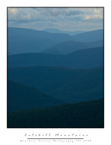
The hike down the west side of slide offers a few off trail view points which we caught the setting sun out to the west. The trail is essentially a wide old road bed (or seems like one), I always refer to this path up the highest peak in the Catskills as the ladies route. It's generally well graded, and not too rough. Although while the trail is not steep, the footing is awful in the warm weather because of the typical Catskill slate and scree, which begs you to take a mistep and roll an ankle. Sure enough, after a full day of hiking, I found myself on my ass more times than I cared to count. In the winter this route is incredibly easy and it's no surprise that it's one of the most heavily hiked trails in the winter months. With snow cover, all that ankle breaker slate becomes a non issue, and if the trail is already broken, you can often make better time ascending Slide Mountain in winter than summer.

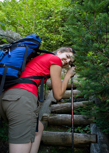
When we reached the Slide Mountain parking area it was well past dark, and well past our hoped for exit time, P&G's in New Paltz was now not in the plans, but since this part of the hike was new to me, we had other problems.


I'd read a few trip reports were people accessed a DEC right of way to cut some of the road walking off and also reduce some of the descent and re-ascent. Finding this was easy as pie, since it was just north of Winnisook Lake, although it was so easy that we naturally thought we were in the wrong spot. So after pulling the map and altimeter out, we proceeded up the forest road bed.
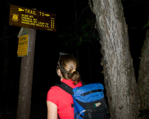


About 45 minutes later, including a 15 minute stop to change my socks (which is a real treat after a long day of hiking), we arrived at the intersection of the actual trail we would have been on if we'd continued down the paved highway, and regained the trail. We cut 500 feet of the hike and about ½ mile. Unfortunately we would give that 500ft, and perhaps a full mile back in short order.

Aim, who can actually read a map just fine, decided that the non green shaded area and old woods road that passed through it was a viable shortcut for us. After all it was now 10pm at night, 12 hours of hiking in the books, and nothing more to see. We were tired, hungry, and ready to finish this up. For whatever reason, just like the time we did Crane Mountain in April, without snowshoes and post holed 2.5 miles back to the car, I blindly followed her at the ~12 mile point of this trip.


This is one of those stories that will live in infamy. We timed the road intersection brilliantly using my altimeter, and we started down the road as happy as can be to be knocking off about a mile of the hike. As we walked down the road it became evident that one of two things was the case. 1) the whole road was private 2) one side of the road was private but the other was state land.


Me being the optimist/realist was hoping for the later, so despite the signs becoming increasingly more aggressive and less and less open to interpretation in their meaning we kept going (as if “Take Another Step And You Will Die Maggot” requires a 800 verbal SAT to figure out). All the signs seemed to be in the middle of the road, or on the right hand side of the road. But about 10 minutes down the road, the first signs on the left appeared, and they weren't friendly. So at this point it was evident we were trespassing, and evident that these people watched the movie Deliverance at least a few dozen times.
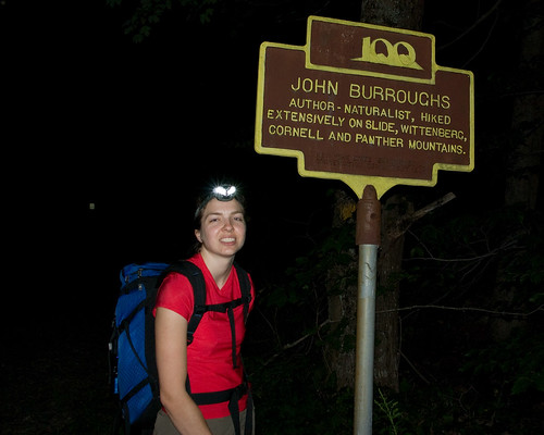
So, not wanting to walk back up the road, which was UP and curved away from where we ultimately were en route to, I decided that if we could spot the road, that we should go for it. You know, like when people would try to jump the Berlin Wall and get to the west. Of course the Beware of Dog sign was intimidating, as were the barking dogs. But more intimidating was the frequent “Beware of Large Trained Attack Dog” or “Beware of Pack of Large Attack Dogs” signs that seemed to be more frequent and with larger lettering, and I should mention, those were the signs that I can speak kindly of, there were a few others that said things I refuse to write about!


So after some time, certain I was either going to die, or go to jail as they fed Caney to a pack of wild dogs, I ran like hell back to the road, and we hauled up the road like we were on mile number 1 of this adventure. Quite frankly I didn't know Aim could run that fast, because certain she was dead I just kept running, but when I got back to precious state land, she was right behind me.


So rather than take a shortcut, we were now 45 minutes behind where we should have been, at least 500 vertical feet and 1 mile over the actual hike distance, and still about 1.5 miles from the trail head.


One thing I never see mentioned in the Burroughs Range trip reports is the final “Stairway To Heaven” it is an exercise in futility as you come close to the end of the trail. It’s probably 30 steps spaced at about a few feet apart, and each one goes up about 2 feet. At the end of 14 miles of hiking, where the trail map shows a fairly flat stretch to the car, this is demoralizing.


As we hiked down to the base and finally up this “Stairway To Heaven” I realized I was actually out of food. I almost never run out of food on a hike, but this time I was out, water was almost gone too, and I was tired. We sat on the rock steps, cursing the trail crew for what was actually incredible work, but surely this little incline should have been visible on the map. Surely someone should have mentioned it. It wasn't that it was all that hard, no, not even after 15 miles, but the fact that no one ever mentioned it was a bit shocking.

The whole trip took us about 15 hours to cover about 16 miles and around 11,000 feet gained and lost. It was by far the longest day hike Aim and I had done in some time, perhaps since the Butterfield Trail in Arkansas back in 1998, although while the Butterfield was about as long, it perhaps gained and lost no more than 1/3 the elevation of the Burroughs Range.
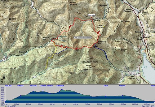


burroughs hike

Definitely the classic Catskill hike, complete with the usual Serpico mishap and added adventure to make it a classic day in the mountains!


Blogged with the Flock Browser