 |
I’ve been planning this trip with George for quite some time, but like all good trip plans there must be options B, C, D, and the nuclear option as a fail safe. And of course, safety of the group is always the most important priority. All too often a group forgets that it is only as strong as the weakest and least prepared members, and this is when bad things happen.
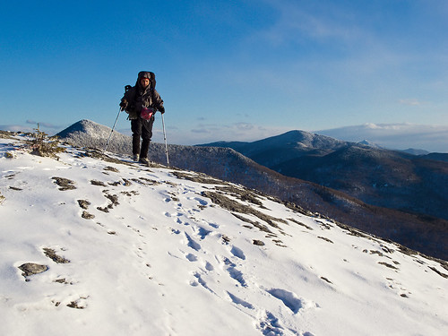
After doing the Franconia Ridge last October, George mentioned that he wanted to try Mount Washington in winter. Though Mount Washington via the Lions Head route is technically no more challenging than any other walk-up winter mountain anywhere, it does require the same gear as all higher mountaineering objectives, and there is a better than average chance you’ll need and use all of it, rather than just stow it in your pack “in case”.
Looking for something a little more moderate, that also potentially had a higher success rate and lower commitment ratio, while still getting him a taste of winter, this trip came to mind. Mount Mansfield is one of Vermont's few true alpine summits, and while the mountain is by my standards ruined due to roads, radio towers and ski resorts, it’s still a beautiful mountain with plenty of wild character on the northern, western, and eastern slopes to keep even the most puritanical of us happy. While it’s heavily used in the winter, it’s possible to avoid other groups of people by taking less traveled paths.
Though George had wanted to test out some winter backpacking/mountaineering, he had absolutely no experience beyond some tiny taste of the Northern Presidential’s late April last hurrah of winter, followed by 2 sunny, windless 60F summit days on that same trip. George had never really traveled in a winter mountainscape, he’d never been on snowshoes, and I’m not really sure if he used crampons on any of our previous shoulder season hikes.
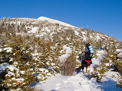 |
| Maple Ridge |
Friday we got a leisurely start, not leaving my place till 10:30am (i won’t bore you with how blessed I am to be able to leave at 10:30am and still have a full day in the mountains, refer to pretty much every other blog post where I do that). We arrived at the Mobil in Underhill at 1:30pm, changed and drove the last 10 minutes to the summer trail head. The road to the summer trail head was covered in several inches of fresh snow and ice, but was passable without resorting to 4WD. After putting our boots on, and doing a final gear check, we were on the trail by 2:45pm. My original plan was to be on the trail by 1:30-2pm at the latest. I really didn’t see this as a problem because the planned hike was less than 5 miles and we could always shorten it if need be. Besides, if my group finished a hike in the daylight, the world would surely spin off it’s axis and kill us all.
In hindsight, we should have just jogged up the Butler Lodge Trail, but I’ll be honest, what transpired was a lot more fun. Being out on an adventure, versus sprinting to a camping location, is why I strap a 50lb pack to my back and trudge up a mountain. If that wasn’t the case, I could just pull my car into a car camping site and camp without all the effort.
The Frost Trail started out pretty well, well packed but nice soft snow. George commented that his borrowed snowshoes and plastic mountaineering boots were actually pretty comfortable on the snow. A good sign for our travels.
At this point Colvin had been doing shuttle sprints for about 15 minutes. Running full blast for about 20 meters and then turning around and sprinting back. He had a weeks worth of energy he was determined to use up before we really started hiking.
Once we got to the Tear Drop intersection, the trail was now mostly unbroken. As a matter of fact, we started down what I assume was the Tear Drop briefly, before realizing that we were starting down a ski trail.
 |
| 1st viewpoint looking west |
We did fine till the first view point picking our way from blaze to blaze, definitely not following any sort of trail, but the forest was wide open, and travel was easy.
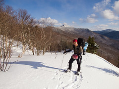 |
| First viewpoint looking South |
 |
| Map work |
Once we figured out where we were, I set a bearing towards the high point on the ridge line below the CCC road intersection. George was understandably a little uneasy going cross country. The last time we went cross country bushwhacking we were headed for the Eagle Slide in the Adirondacks. We ended up not climbing the slide because we ran out of daylight after our herd path turned out to be headed towards Bottle Slide, and we had to bushwhack through the thickest of forest back towards Eagle. What ultimately happened was we wasted 1.5 hours getting back to Roaring Brook, which in hindsight we never should have left in the first place! However, unlike our summer excursions in the dank spruce gardens of the slopes of the Adirondacks, this was open terrain where we could move just as fast off trail as on it. As a matter of fact, being able to pick our route through the more open terrain was actually our fastest snowshoeing of the trip.
Staying on bearing and on the ridge line, after about 15 minutes of hiking we got to some rocks that had a blue blaze on them. I’m pretty certain George felt a lot better seeing things were going smoothly.
Emboldened at the site of the blaze we just continued going cross country till we regained the trail some time later. Of and on we couldn’t locate a trail, cairns or blazes. At this point the ridge was quite definable, and the terrain was mostly easy.
When arrived at the first rocky sections, we removed the snowshoes for the first time and scrambled up the rocks. George was hiking off the snow for the first time in his borrowed plastics, and after going from snowshoes to snow clogged rubber on quartz, your footing feels kinda slick. It always feels weird when you take off the snow traction, and climbing a slabby quartz rock face in rigid plastic boots is certainly not easy. Ridig boots, plastic or otherwise, do best when the terrain gets steeper and more technical.
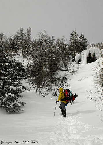 |
| Off trail ascent |
We eventually regained the trail and hit the CCC Road intersection. From this point the trail was scrub, and pretty well defined with cairns and just the gap of the vegetation. We made good time to the Rock Garden trail.
Ah, the Rock Garden. There are many many trails in the mountains that are made simply to torment weary hikers looking for a shortcut. The Rock Garden just looked like one of those trails on the map. It reminded me precisely of the Cornice Trail in the Northern Presidential’s. It looks so inviting to avoid the 500ft over the summit of Jefferson on your way back down the Caps Ridge trail, but once you are about halfway on the Cornice, you realize it would have been easier and shorter to go up and over the summit. Well, the Rock Garden probably was equally craptastic in the summer, but in the winter it was just a lightly traveled borderline bushwhack, that cut across what was in spots very steep terrain. It wasn’t only the pushing through the trees that sucked, or the need to crawl on our hands and knees wearing snowshoes with 50lb packs, but the fact that every single tree was covered in 3-4 inches of snow. Each time we pushed through the forest it dumped all that snow down our jackets and on our packs. Wearing a hood just made me feel claustrophobic, and I hate not having peripheral vision, so every few feet I got a cold snow shower down my jacket!
Still not sure how heinous a gradual downhill trail can be:
Me: “Oh, we’ll be lucky to get down this in the light (it was just before 6:30pm). I figure 1 hour at best, maybe 1.5”
George: “.7 miles, mostly level to downhill, I think an hour is way to much.”
Me: “remember the Cornice?”
George: “Yeah, you think it will be that shitty.”
Me: “worse”
So 1.5 hours of semi bushwhacking through the tree canopy, on what was a mostly down but occasionally up traverse across the drainage, getting spun around several times, we finally got down to the hut. In hindsight, continuing up the well defined Maple Ridgem, and going back down the also rarely traveled Wampahoofus trail would have been a faster option. The terrain was more open and it was entirely downhill, rather than traversing a contour line on a gradual descent with a few short ascents mixed in to keep things interesting.
One cool thing on the Rock Garden was a chasm in the rock about ¾ of the way down. There were hanging curtains of ice over it that created almost an ice cave between a cleft in two rocks. Unfortunately it was dark by this point, and we couldn’t get a photo of it. It would have made a great photo if we were there an hour before, with the setting suns golden rays hitting the ice curtains.
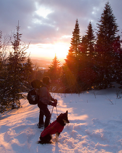 |
| Sunset over Lake Champlain |
We got to the hut at about 8-8:15 and quickly found that we were melting snow. I expected at this time of the year the creek that is next to the Butler Lodge to be our water source. However, if it was running, it was under several feet of snow and possibly ice. Without an ice axe or a shovel, there was no simple way to get to it. I always assumed melting snow was going to be our primary source of water and we quickly moved to begin that slow process.
Melting enough snow for 3 people (uh, more like 2.5 people) takes several hours. By now our short day turned into a pretty long day and we were in bed by about 12:30am, just about the time it had begun snowing quite heavily.
We woke up Saturday morning to 3-4 inches of fresh powder on the ground, more in spots where the wind blew it, as well as more falling. We didn’t have a big day planned, about 3.5 miles from Butler Lodge to Taft Lodge on the other side of Mount Mansfield, though almost 2 miles of it was exposed ridge line. We were officially woken up by a couple who stopped by the hut to have their morning coffee before continuing their day. They mentioned they rarely made it up the Frost/Maple Ridge trail in winter because it is so rarely traveled and so difficult to follow. I think George and I both felt pretty good for making as good of progress as we had the day before.
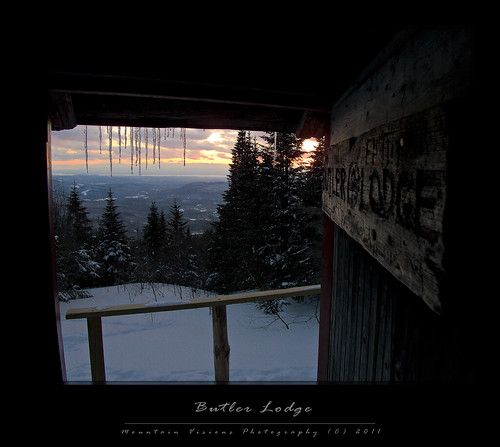 |
| Sunset at Butler Lodge |
We got up and began melting snow and storing water. Had breakfast and began packing.
 |
By the time we got on the trail it was about 2pm. The snow had stopped falling and the conditions on the ground were absolutely beautiful. 4-6 inches of fresh powder, without a snowshoe track on the trail because of the wind; what a treat this late in the season. However, the wind was brutal, and it was colder than the day before with more fleeting burst of sun.
As we hiked towards the Wallace Cutoff and the Long Trail, and on to the summit ridge, I began to question the safety of going up on the ridge. Two weeks ago the wind conditions were similar, but it was much warmer and we were somewhat protected from the wind based on the direction and the summits blocking some of it. Going up to the summit of Mount Mansfield meant even more exposure than in the Presidential’s. Mansfield is a freak of a mountain, because nothing around it is close to it’s prominence it gets severe winds similar to Mount Washington. There was absolutely nothing north or west of use that would help shelter us from the winds. Beyond that, we would be exposed and committed to the ridgeline for nearly 2 miles.
 At this point I hadn’t even put on insulated gloves or any of my insulating layers, I was still wearing my wet and frozen Gore-Tex glove shells from the day before. Nevertheless, I could feel how cold the wind was through the trees, something that typically doesn’t bother me. Thinking about the air temperature mixed with the wind chill I became concerned whether George and Colvin would be ok. George had the gear to safely get to Taft Lodge Saturday, but Sunday was actually forecast to be even more windy! Because our route back to the car traveled North and West, we would be committed to walking directly into the wind for the whole day Sunday as well.
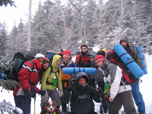 |
| 2006 Mansfield group, including Wonder Dog |
I made the decision that it just wasn’t safe for us to make the trip, George didn’t argue, and we then decided on what Plan B was. We could hike to the Taylor Lodge, which was about 3.5 miles away through the lower elevation forest. Or we could go back to Butler, unpack our gear, and day hike to the summit.
 |
We got back, spoke with a group of hikers at the lodge, and exchanged opportunities to snap group photos for each other. Once back inside the hut we then unpacked most of our camping gear, had lunch, and repacked for the summit.
We began up the Wampahoofus Trail for some ways, but not too long after beginning the ascent towards Maple Ridge we lost the trail. There was a blaze right behind us at foot level but nothing else to be found. After 10 minutes of fighting spruce branches and crawling through the snow, we decided to just ascend the path of least resistance. It was open above us, and the trail had to go in the direction of the more open forest. We got to an open area where we could see the terrain above, I pulled out the GPS and from our location took a bearing to the closest landmark, the rock tunnel.. The rock tunnel on the Wamphoofus Trail, just before the Maple Ridge intersection, was about 700ft away at a bearing of nearly true north. I assumed it was the rock wall I saw some ways up, and we ascended to that over open snow slopes. We continued to traverse up and across the very steep slope that culminated with an ice flow.
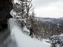 As we reached the rock band, we cut across the base of the cliff, fighting our way through the trees to more open ground above. I kept sliding back down the slope because my pack would get caught on trees. I pushed up and through the snow, the trees would literally throw me back and I’d lose my balance, sliding back down the slope. While this was arduous, we were also concerned with a long fall down the slope, which was steep enough that if not a controlled glissade could have been a dangerous fall. Eventually, I just used the trees for hand holds and for steps to propel myself through the steep snow.
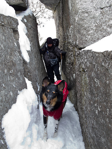 I went straight, George cut left, and while I thought there was a blaze in front of me, I lost it in the trees. George, however, confirmed it was in fact the trail, which we’d found after about .3 miles of off trail climbing.
Within a short distance George, who was leading the way, lost the trail again. There was again no sign of a blaze, but Colvin continued on. I told George to follow Colvin, but make sure he didn’t blindly follow him. As George put it (and Regan before him, and Roosevelt before him), “trust but verify.” Colvin was correct though, as he had been each time he pushed ahead over the last 2 days. He is developing quite a sense of where he needs to go, I am very very proud of how well he has developed into a great trail dog.
We finally reached the tunnel, which was pretty much on course for the bearing I had set. George found a shortcut but wasn’t sure we were on the trail. We backtracked and sure enough the trail went through the tunnel on the other side of the wall we were at. Both routes were cool, but the tunnel was more fun!
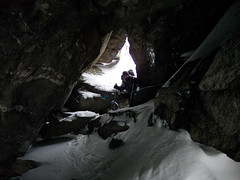 |
If you are a mountaineer, then you know that turning around that close to the summit is almost impossible to do, and even though our turn around time had passed, the descent was going to be fast and fun, and we’d have had plenty of time to get back to the hut before dark. Unfortunately, George doesn’t have that mountaineers summit sickness, although Colvin has acquired it from me. Both of us could smell the summit and wanted up, (you can see Colvin has no plans to turn around in the video). I told George that he could wait for us in the shelter of the tunnel. We’d only be about 20 minutes.
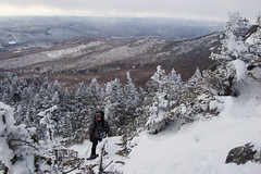 Since I often hike alone or with my trail dog, I rarely have to make decisions I don't want to partake in. Generally speaking, I don't care if it's dark, cold or I have way further to go than I expected. I'm always willing to change my plans on a whim just because I feel like it. However, when you're hiking with other people you have to consider the entire group, even if it's really not your ideal choice. The problem was I’d promised Aimee I wouldn’t leave George, even though I was quite willing to break that promise in this situation. I also needed to remove my snowshoes and put on crampons that were buried in my pack. The process was going to take 10 minutes in addition to the ascent and descent of the .4 miles round trip. I gave in to all the signals that it was time to turn around, and Colvin, George and I descended together.
The descent was in fact fast and fun. There were a few spots it was tricky but all of us had a good time glissading down the mountain. Colvin was concerned for us, but he got to run really fast in the deep snow.
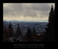 We were back at the hut well before sundown, actually 20 minutes from when we turned around. This included clearing as much of the tree canopy as we could while on the trail. Even with the summit we probably could have been back by sundown.
Although we didn’t get the summit, I (we) had an awesome time forging a path towards the summit in the beautiful winter conditions and an even more fun time on the descent.
Saturday night was the same as Friday. Melting snow, hydrating, and eating a good dinner. My tortellini and smoked salmon, with olive oil and parmesaen sauce, was definitely better than George’s freeze dried beef stew. After dinner we just relaxed for a bit, before we knew it the time was pushing 1am.
Saturday night was clear and cold, but beautiful star filled skies were above us. If not for the strong winds we could have spent more time outside the hut enjoying the stars.
The winds pummeled the hut all night, and actually made it quite drafty inside. The hut is somewhat well sealed, but there are definitely gaps in the logs and roofing in spots. Snow and wind can force through the shutter style windows as well.
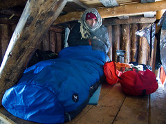 Sunday morning arrived and it was 12F inside the hut, blustery outside. We were in no rush to get out of our sleeping bags. George survived the drafty night, while Colvin and I slept quite well. I did, however, seal my sleeping bag on Saturday unlike Friday where I slept with it partially open. Colvin was wearing his K9 TopCoat Cascade suit, and his Primaloft sweater.
We burned the last of the fuel on both our stoves, about 37 total ounces over the 3 days of melting snow and cooking. This seemed like way more fuel than we should need at 4oz/person/day for white gas, but I realized Friday night we’d been lazy and just let the stove boil each pot rather than pour it off once it was melted. I think we used about 6 ozs more fuel than we should have needed.
We finally were packed at about 3pm, unfortunately I left my phone up at the hut and for some reason thought about it about 10 minutes down the trail. I unpacked everything on the trail and couldn’t find it. Then I realized I heard something fall behind the shelf when I was packing. George went back to the hut, and I followed behind him after repacking my pack. Sure enough it was behind the door where I thought it fell. Lesson learned, triple check the hut before leaving!
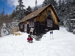 The hike out to the trail head was mostly down hill, with some level stretches throughout. However, the snow was perfect for snowshoe glissading when off trail and across the forest. George descends much faster than me, and my old man back can’t deal with the jarring of on trail descents. Packed out snow is just a little softer than the summer trail, before the snowshoe crampons bite with each step. In winter, when the ground is covered by deep snow, cutting switchbacks is perfectly acceptable. Technically there is no damage to the land, which is the primary reason to avoid it the rest of the year. I’d cut down through the forest in the steep sections and link back up with the trail. After one section where we had to re-ascend about 20ft to the trail, George stopped following me and just stuck to the trail. Fortunately this was the only time I had to re-ascend to regain the trail. I was able to actually stay in front of George with this method rather than haul ass to keep up with him.
 |
| Scary glissade through the trees |
A stop at the Underhill Mobil to change, clean up, feed Colvin, get a snack; and then we were off to the Vermont Pub and Brewery in beautiful downtown Burlington, Vermont. Burlington is a nice little city, and it has amazing views of the Adirondacks across Lake Champlain, the sixth Great Lake.
The food at VPB is standard pub fare at a fair price, nothing special. If you order right it can be pretty decent. However, the reason you go to any brewpub is generally not the food but the beer! VPB has a great collection of ever changing beers, and we each had two pints. For the non beer drinkers, VPB also has locally brewed hard ciders.
I had a half and half of the Handsome Mick’s Irish Stout and another dark beer that doesn’t appear to be on the web menu. It was good! Then I had a citrusy IPA that was even better, a great IPA in fact! George had two different beers and both were very good.
The pulled pork po’boy was nothing special. In the defense of VPB, I am a BBQ aficionado and we (my wife and I) seek out great BBQ whereever we go. So if BBQ isn’t something you are passionate about, don’t be alarmed, what I got was quite edible, just not special! George said his burger was delicious! And my sweet potato fries were also quite good. Dessert was Ben and Jerry’s Vanilla on an Apple Crisp. This was ok as well, but it reminded me why I almost never get dessert anywhere.
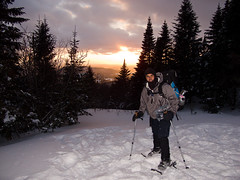 If you haven’t figured it out, this was a really fun trip where we accomplished absolutely nothing in the sense of typical hiking/mountaineering goals. However, we had a great time and George got to experience real winter. Honestly, he probably learned more than he would have on a $500 two day guided trip, so I suppose we actually did accomplish a lot. Just like with anything, you can read a lot about winter backpacking and mountaineering, but it's not until you get to apply the principals of travel, conservation of warmth, staying cool and dry, hydration, and all the other little things that you really understand what it's all about. Not sure he is going to be dropping $1500 anytime soon to fully outfit himself for winter mountaineering/backpacking, but he definitely got an idea of what it was all about, and I think he had enough fun that he might come back out again for something similar.
Colvin continued to impress me with his progression. Going from Caney to Colvin has been both easy and hard. I had a perfectly capable trail dog, Caney, that was just a genius at navigating technical mountain terrain almost without any prompting from me, simply because he loved the challenge of solving the problem. Colvin, though, just gets better and better every single trip, every single month, and this was the 1 year anniversary of his first winter overnighter in the Northern Presidential's. He has come so far in that time. In the videos you can see how he is no longer a follower but a concerned leader with confidence in his abilities. You can see how concerned he is for George, and he is getting good at finding the trail, even under 6ft of snow!. It’s very satisfying to see that, and helping him progress has been a learning process for me as well. We worked on climbing the hut loft ladder Sunday morning, and he climbed to the top on his own (with me spotting him). He’ll be climbing ladders and technical rock faces this summer, I'm sure of it!


Good read Justin. Makes me thankful I didn't try to go out last minute budget style. Could of been dangerous.
ReplyDeleteI can;t wait to get out there once the weather clears up!
-J. Harkin