Wednesday, November 24, 2010

The Northeast US Top Five Long Distance Day Hikes

I often get asked what the best hike is, what the hardest hike is, and what my favorite hike is. There are a few hikes in the region that require tremendous effort and offer great reward for that effort, and coincidentally happen to be among my favorite hikes.

I'm much less a mileage guy than an elevation, weather, scenery, aesthetics, and technical terrain guy. After all, if you just want to ambulate a long distance, put away the hiking boots and all the gear and go run a marathon. A hike like the King Ravine or Huntington Ravine, Acadia's Beehive and Precipice Trails, or an Adirondack slide such as Eagle or the Gothics north face is much more enjoyable than walking endlessly over well footed trails while buried in a tree tunnel. As such, all the hikes on this list require you to either battle the weather or ascend steep and rugged terrain, in some cases requiring you to use your hands as much as your feet. None of the hikes on this list are contrived, or require any sort of far out antics to complete. They are simply real, hard, rugged hikes through some impressive wild places. Most importantly all are aesthetically pleasing, making them more then a sufferfest without reward!


Dix Mountain, Great Range, and Keene Valley (bite size)

1. Great Range Traverse, High Peaks Wilderness, Adirondack Forest Preserve, NY. The Adirondacks are generally not the type of mountains you can string multiple summits together, but the Great Range makes up for that. The elevation gain and distance are very similar to the Presidential Traverse in NH, with one exception, on the Great Range elevation is gained and lost in massive chunks over just half the trip, while the Presidential Traverse spreads it out quite evenly over the 20 miles. The minimum Great Range traverse is 22 miles long and gains and loses 18,500ft. 11.5 miles are along the spine of 9 peaks over 4,000 feet in elevation. Over those 11.5 miles just under 15,000ft is gained and lost. Because of trail head relocations and the loss of a loop option, very few people actually start at the true start. The true traditional traverse adds 2 smaller peaks, as well as the unofficial but spectacular Pyramid Peak (which is technically considered part of the Gothics, and in my opinion one of the top 5 views in the Adirondacks). The total for the true traverse is 22 miles and 19,700ft gained and lost. For the hard men and women, a slightly more contrived addition of Mt Skylight can be added making the hike 23.2 miles with over 21,900 feet of gain and loss.

In the winter the Range has an almost 0% success rate because the steep slopes and deep snow drifts are ordinary facts. Generally speaking, even the most fit hikers and mountaineers would have trouble doing the Great Range in mid winter due to the deep snow and short durations of good weather in the alpine zone. Some of the trails in winter border on technical mountain terrain, with slopes steep enough that run out falls are entirely possible. In the summer, it is water that becomes a limiting factor high on the Range.

Summary of ADK Range options:

1) Traditional traverse (includes Rooster Comb, Hedgehog, and Gothics): 22 miles, 19,700ft G/L
2) Short traverse loop: 22 miles, 18,500ft G/L
3) Long Traverse (includes Gothics, Skylight, Rooster Comb and Hedgehog): 23.2 miles, 21,900ft G/L
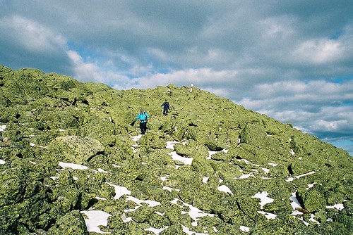

In The Mountains of NH, Men are made.
Descending Mt Adams summit cone, Northern Presidential Range, NH.

2. Presidential Traverse, Presidential Range, White Mountains, NH. The Presi Traverse is perhaps one of the most difficult hikes possible because of the weather. Although much of the trail has good footing over trails like the Gulfside and Crawford Path, nearly 15 miles of it is exposed above treeline and susceptible to some of the most consistently dramatic weather on earth. So consistent is the drama, that it is as inconsistent as you could ever dream of (you know, like an enigma wrapped in a Pandora's Box). Weather aside, the full traverse (including all summits from Madison to Webster) still involves over 23 miles and 19,000ft of gain and loss. Assuming you climb all the summits and leave the well footed trails on the spine of the range, even if the weather is perfect, a true rarity, your feet will most likely feel like you beat them with a meat cleaver at the end of your hike.


Franconia Ridge, White Mountains, NH
Franconia Ridge, Pemigewasset Loop, NH. Mt's Liberty and Flume prominent in background.

3. Pemigewasset Wilderness Loop, Pemigewasset Wilderness, White Mountains, NH.
The Pemi loop is longer than all the rest by almost 10 miles, but it has a unique (dis)advantage of having several miles of hiking done on an old railroad grade. This loop is really more about mileage than any of the others, but the scenery is so spectacular I had to include it. The basic Pemi loop gained and loses 19,400ft over 31.5 miles. The book time for this hike is a mere 20 hours, and that assumes you are hiking it in sections. However, the grades are less steep then some of the other hikes on this list, and the bulk of above treeline hiking is over one of the most heavily used and well footed trails in the White Mountains. While the Franconia Range does take the brunt of bad weather and high winds coming from the east, you spend significantly less time above and significantly more time close to the edge of treeline for weather to be an overwhelming factor in success or failure of this trip in comparison to the Presidentials, or even the Great Range. That said, many people have under-prepared for this trip, had to drop off tens of miles from the trail head and beg for a ride, or worse walk 20 miles over highways and roads to get back to their car. I've read many a trip report of people sleeping in ditches on the side of I-93 because of poor preparation and fitness. It's fine line between moving fast and light, and being under-prepared on this loop as a day hike. While the Pemi is the biggest mileage hog and least technical hike on the list, it isn't without it's aesthetic bonuses. The Franconia and Bond Ranges in themselves are among the most heavily hiked, and most beautiful ranges in the Northeastern US. Combining the two over a very long day in the mountains makes for a phenomenal double marathon like adventure.

Options for the Pemi Loop:

1) Minimal Loop: 31.5 miles, 19,400ft G/L
2) All Spur Summits Loop (includes Galehead, North Twin, West Bond): 36 miles, 21,000ft G/L


Climbing Out Of The Col
Ascending Slide Mountain on an exposed slab from the Cornell Slide Col, Burroughs Range, NY.

4. Burroughs Range Loop, Slide Mountain Wilderness, Catskill Forest Preserve, NY. The Catskills are actually a rugged eroded plateau that would look more like the high desert of Arizona and Southern Utah if the mountains were devoid of trees. The Burroughs loop is a ~13.5 mile loop, originating at Woodland Valley in the heart of the Catskills. The circuit ascends the spine of a range of 3500+ft peaks that include Whittenburgh, Cornell, and the Slide Mountain (one of only two 4000ft peaks outside of the Adirondacks, and the highest in the Catskills). The basic loop has a gain/loss of nearly 10,000ft. However, there are two optional ways to naturally extend the trip:

1) do an out and back spur to Panther Mountain adding 5 miles and 3,000ft gain and loss. Making the total distance 18.5 miles and 12,500 gained and lost.

2) spotting a second car at Fox Hollow trail head and hiking over Panther Mountain adding 6.25 miles and 4200ft gained and lost. The later makes the hike a total of 14,000ft over 19.75 miles, but also eliminates one of my favorite things about the Burrough's, the fact it is a true loop with a campground start!  Yes, you can wake up in your tent at 7am, hike the Burrough's and be back at your campsite eating a gourmet meal later that evening.

With even the hardest option on the Burroughs still being significantly easier than either the Great Range or the Presidential Traverse, should the Burroughs make 4th on this list? Absolutely. This isn't purely about difficulty or distance or elevation, it's also about the aesthetics of the hike. The Burroughs is significant for the fact that outside of the alpine regions of NY, VT, and NH, this is in my opinion the most scenic, fun, and historically significant hike that would probably please both the hard men and women who merely enjoy suffering on the trail, and those just looking for a fun challenge while still being able to enjoy themselves. Doing the minimal loop gives you unparalleled 360 views from various vantage points of the entire Catskill Forest Preserve. Beyond that, the Burrough's loop also includes enough steep climbing and scrambling to keep most hikers who prefer technical hiking terrain happy with plenty of chances to use their hands. Besides, how many great loop hikes of this magnitude start and end at a state run drive in campground?


Catskill Mountain Highs...And Lows!!!
View south towards the Ashokan Reservoir from Sugarloaf Mountain, Devils Path.

5. Devil's Path, Catskill Forest Preserve, NY. The Devil's Path is consistently rated by backpacker as one of America's hardest day hikes. It's over 25 miles long, and while it can hardly be called traversing the spine, it certainly is a direct path over many of the higher peaks in the Catskills. The DP gains and looses almost 20,000ft over it's length, much of it is lost in giant chunks of a few thousand feet at a time as it dips from long flat 3000+ foot summits down into steep narrow hollows (commonly called passes or gaps out west) and immediately reascending the next mountain without any drawn out approach. Along with the challenging ascents and descents, the DP also shares similar rugged hands and feet terrain as the Burroughs Range loop. Scenically, however, the Devil's Path simply isn't on par with it's neighbor, and for this reason it falls to 5th place on my list. Most of the scenery on the Devil's Path comes on the eastern half, and in my opinion, it is largely unspectacular from Mink Hollow onward making the entire second half of the hike fairly monotonous, and much more of a grind than it needs to be. In terms of shear difficulty, however, the Devil's Path could easily rank in the top 3.

For those that prefer even more technical hikes without all the unnecessary miles on the trail, keep on the lookout for a followup of my most challenging "They Call THAT a Trail" hikes.

If you have an alternative to my top five feel free to drop me a comment or send an email!

Monday, November 22, 2010

Phil Brown Fought the Law, and the Law....

She Said: Is That A Boat, Or Are You REALLY Happy To See Me?
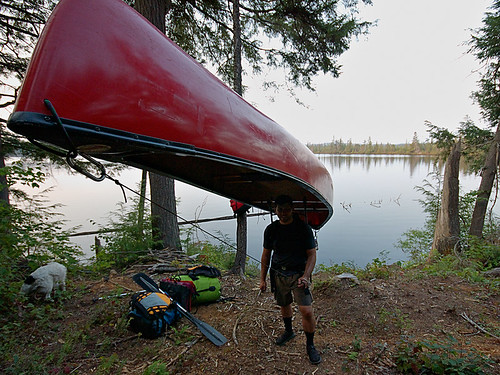
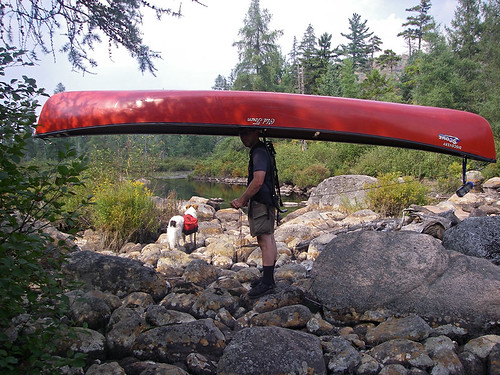
Almost the end of a short day of paddling and a long day of portaging, camp is across the lake!


...well we'll find out just what the law is and how it pertains to paddlers, thanks to our fearless editor of the Adirondack Explorer.

Phil Brown, editor of the Adirondack Explorer, and a pretty good writer and outdoorsman, doesn't just talk the talk, he walks the walk and paddles the boat. As a result, the Brandreth Park Association (which appears to be a single person or family) and Friends of Thayer Lake have decided to make an example of Phil Brown in order to keep its waters safe from navigation by the rest of the paddling community. Phil, of course needed a lesson, after all, his pen is mightier than the potentially illegal signs and barriers that shoreline owners have erected to illegally prevent navigation.

First, Phil is hardly a criminal. The New York State Department of Environmental Conservation has already informed the above groups that paddlers DO have a right to paddle through the private shoreline in question. All Phil did was exercise his legal rights and remind others about their rights. Secondly, if you've ever read Phil's columns or blog post then you know he doesn't tiptoe around controversial topics. This was clearly no different.

Brown said he paddled through the private land and wrote about it because he believes the public has a right to. “The Lila Traverse is one of the best wilderness canoe routes in the Adirondacks,” he said. “Replacing a long slog on foot with an hour or so of great canoeing only makes it better.” - via Syracuse.com

The issue at hand is centuries old common law which has been upheld in various state courts of law, but the Adirondacks seem to be an exception to this. As a matter of fact, the famous author and paddling advocate, Paul Jamison, remarked how the laws of navigation within the Adirondack Park were strangely different from outside of it. The reason this is odd is that the majority of the land within the Adirondack Park is state forest preserve -Forever Wild- and owned by the people of the state for free use. However, much of that land is in a piecemeal checker board layout that means quite a bit of private land borders state lands. Often and in-holding separates two parcels of state land. This of course causes quite a bit of contention in many cases.

Oddly, in the Adirondacks it is assumed that if a body of water, though accessible and navigable without need to trespass on land, is surrounded by private property, the water is off limits to boaters. However, in the rest of the state people regularly paddle and boat through waters surrounded by private shorelines without incident.

The issue is sticky, but has centuries old legal precedent because: 1) water was/is essential for transportation and commerce; 2) you technically cannot own water or the water bed of navigable water ways, in such cases the state owns the stream bed and it must be left open to public egress. Thus, it's generally accepted that provided you remain below the high water mark of a generally navigable waterway you have the right to travel on that waterway, even if you have to exit your boat due to temporary obstructions, low water levels, or to line your boat downstream or upstream. Keep in mind there are lots of little exceptions that prevent this from being a free for all. As an example, just because I can paddle into an outlet less lake without stepping on land, it doesn't mean I am not trespassing. If the lake is surrounded by private land with no outlet or egress to state land, it's off limits. Likewise, if a body of water isn't considered navigable during median flow, it is off limits. The key thing I'm trying to point out about navigation rights is that they are in fact about navigation and commerce, not the erosion of people's property rights as the Brandeth Park and Thayer Lake groups would have you believe.
 
Harrington Brook Portage
This particular issue resonates deeply with me, and is more than just an opportunity to stand on my soapbox. In 2007 my wife and I were one of the first groups to paddle the not yet officially opened Whitney Traverse, which essentially allows you to paddle from Little Tupper to either Lake Lila, the Bog River, or a complete circle from Round Lake. Truthfully, you can essentially go anywhere within hundreds of miles via various options, but those are the basic options that make up the trip. Regardless of how far you travel, you always have to portage over several sections of land when starting from Little Tupper Lake, but one section is clearly avoidable just by looking at the map.


Hey!! Is this the trail? Uh, yeah, right through those trees!!! (literally)
Portage path from Lilypad Pond
On our trip in 2007, I briefly considered doing what Phil Brown did. Quite frankly, I wasn't planning on doing it to make a point or exercise my rights, portaging the only expedition sized boat we had was no easy task. We did the trip over 9 full days, of which only 4 involved real travel, it was a leisurely excuse to do something challenging yet also relax deep in the Adirondack wilderness at locations that were really not ideally accessible on a weekend trip. Despite the leisurely nine day itinerary, we actually covered tremendous ground on travel days. As an example, the first three days we just decompressed while moving a grand total of 10 of 75+ total miles. However, moving 150+lbs of boat and equipment is a heck of challenge, and while I genuinely enjoyed it, I'm a paddler, not a pack mule. As a paddler, I know portaging (also called carries in this part of the world) is part of any long distance paddling trip, but it eats time, energy, has most risk of injury necessitating rescue, can lead to bears or animals scavenging your food stores, and is really the hardest part of any multi-day expedition. As a straight paddle my wife and I could have easily covered the 75 miles in three days, perhaps even two days fully loaded. It was the overland travel that really slowed things down.


Paddle and Portage: 2007 ADK Lake Traverse
Pulling 150lbs over low water mud
In the end, I wasn't 100% sure of the navigability of the bodies of water in question; 2007 was one of the lowest water years I have seen in a decade of Adirondack paddling, and old timers commented that by historical measures it was extremely low. While on Hardigan Pond we had to resort to pulling our canoe over mud flats that formed when the water receded, I certainly didn't want to get us into a sketchy situation on private property. That factor alone caused us to paddle a measly half mile across a pond only to unpack an entire boat, hoist it overhead and return for the rest of the gear on a second trip, a method known as a double carry! If my memory is correct, it worked out to be about 2.25 land miles through thick spruce thickets and horrendous brush on a yet unmarked and not fully cut portage trail. The alternative was a pleasant paddle surrounded by private land.

A Dream Is Like A River...Ever Changing As It Flows..
Portage to Harrington Brook


Often legal action is threatened but never used when the outcome is uncertain, in this case it's clear the plaintiffs could lose. As a matter of fact, it seems unlikely they will win because while they chose Phil Brown, they are really taking on the state of New York and legal precedent. I'm genuinely hoping Brandeth Park Association and Friends of Thayer Lake played their cards poorly in this last ditch effort, and when the gavel drops we have a definitive ruling that upholds the rights of navigation for paddlers and other boaters inside and outside the Blue Line!

Good luck Phil Brown!

Phil Brown paddling the meandering scenic  Shingle Shanty Brook

For more on this issue:

http://www.syracuse.com/news/index.ssf/2010/11/adirondack_landowners_sue_padd.html

Wednesday, November 17, 2010

Post Sunset Moonrise Over the Adirondacks Crane Mountain

Crane Mountain Moonrise, Adirondack Mountains

I'd moan about how hard landscape photography is, that if you're standing on a wind blown summit at sunset it means you have to hike back in the dark...but I confess, I'd have it no other way. I love hiking at night! In fact so much so that following this wonderful scene, which didn't end with this photograph, I didn't turn on my headlamp until I reached the slab below the pond outlet, just shy of half way back. Much of that time the 3/4 moon cast a shadow in my path as I walked through the forest. Hiking by the glow of the moon is really very peaceful, even more so than via headlamp, and it's nice to get lost in the solitude of the softly lit darkness.

Darkness though is what makes November a depressing month in this part of the world, the sun only shines about 30% of possible daylight hours, and daylight is only about 9-10 hours at the start of the month. The positive is that provided you can see the sun, you don't have to wait 18 hours between nautical twilight's like in the summer. Photography is best done at the ends of the day, and November is temperate enough that spending an entire 10 hour visible light day outdoors isn't all that hard most days if you get a sunny day. Or you can time a sunset blitz hike like this ascent of Crane Mountain, and still be home in time to eat dinner at a reasonable hour, rather than midnights like you do in the summer!

I have a few "local" places where I can gain some reasonable elevation since moving to Saratoga County a few years ago, although I do miss my 30 minute drives to challenging 3,000ft+ single summit days in the Catskills, 90% of the time I'm glad to be at the foothills of the Adirondacks even if it means the same drive gets me only 1500 foot single summit days. Crane Mountain is not only a favorite semi local hike (about ~55 miles and 50 minutes) but it's a favorite hike overall in the Adirondacks. Barbara McMartin once said it was among the most beautiful summit views in ALL the Adirondacks, and although I never found the distant views to be amazing, I've always loved the general challenge of the rugged trails and steep cliffs that make Crane Mountain.

Crane is not only a great hiking mountain, but it's home to a hot bed of new Adirondack rock and ice climbing route activity. In the last 10 years Crane has seen dozens of new rock routes and tens of ice routes, some of the ice is 3-4 pitches in length.

In the trail register many people complain of the sparsely marked trails, and the first time hiker might have to be careful, more so after dark. The mountain sees at least a few dozen hikers and climbers a weekend, creating a well worn though still rugged foot trail. Though with a little care, a map, and just basic route finding skills you should be able to figure it out. Although I know the mountain well now, it was just as poorly marked the first time I hiked it!

Unfortunately, hiking isn't all glorious sunsets, moonrises, and pleasant walking via the glow of the moon. About 1/3 of the way down the very steep outlet trail, I took a pretty decent fall on one of the many sections with deep dry leaf cover over roots and slabby ragged boulder piles. This time of the year dry leaves have become waxy, and the combination of dry waxy leaves and steep descents make it like walking downhill on ball bearings. I took a jump down from one boulder into a crevasse between two boulders and the next thing I knew I was on the ground several feet below my target with my elbow and arm bleeding. The arm will heal, but I lost Black Diamond Flicklock pole when my feet came out from under me and the pole snapped in defense of my fall. One of the reasons the Flicklocks are great poles, and hadn't yet made it to the graveyard of poles in my garage, is unlike most poles with expander nuts, the expanderless Flicklocks hardly ever (perhaps never) collapse. The downside is they are made from thin gauge aluminum and are the only poles I have ever owned that I have bent...over and over and over again! They are easy enough to rebend, but at $90 a pair, I wish they were just a bit more sturdy!

Alas, it was a small price to pay for an almost summer like mid autumn day in the Adirondacks.


Wednesday, November 3, 2010

Beam Me Up Spotty!

The Spot personal locator beacon has grown a strong following over the years, such a reputation in fact as a bare bones PBR with a twist that even this, "I escape to the mountains to escape technology like this" backcountry purist has considered one.

As I noted in my prior post, shit happens! While a lot of rescues are avoidable, not all are negligent, and some of us aren't particularly good at sticking to plans. Plans are for work, projects, corporate planning, not for getting out into the mountains. Spot seems like a great way to deviate from plans, yet let someone know where you are headed. Using Spot messaging service you can ping location updates, non emergency help pings to your contacts, and full out SOS to the GEOS International Emergency Response Center. Say I had no particular reason to return home on a Monday, or worse I simply underestimated the difficulty of a hike and decided to spend another night out, I always envisioned being able to send an OK ping and be done with it.


On Sunday, October 17th one of the short falls of relying on something like Spot and it's bare bones limitations can be seen from the DEC Region 5 Ranger Activity Report below:


Town of Newcomb, High Peaks Wilderness Area On Sunday, October 17, 2010, at 3:43 pm, the DEC Dispatch Center in Ray Brook received a call from a woman requesting assistance in locating her husband in the vicinity of Moose Pond. Mathew Crowell, 29, of Syracuse, NY, had been hunting in the area for several days and reported his location each morning and evening using his Spot Locator. Mr. Crowell had not reported in since 10:00 am on Saturday. Mrs. Crowell became concerned that her husband might be injured after learning of the presence of snow in the higher elevations. A DEC Forest Ranger responded and located Mr. Crowell’s car at the Moose Pond Trail Head and started to search the 6 miles of trail into Moose Pond. At 6:05 p.m. the Forest Ranger heard a shot and found the subject in good shape, at the last spot location he had sent to his wife. According to Mr. Crowell, he had sent his wife points from the Spot Locator throughout his trip but obviously the signal didn’t get out due to the steep drainages. Always provide someone at home with your itinerary and when you expect to return. Electronic devices are useful in providing information and communicating with people outside the backcountry – be aware of their limitations.

What this highlights is two things 1) the reason I like a Spot is because of my inability to stick to itineraries. I don't veer from them every trip, but it's not uncommon for me to do so. Spot proved here that when everything is OK, that it might not be the best option for this sort of thing since I would probably use it quite similarly to how this hunter was using it. 2) It shows the limitations of both Spot and satellite based navigation as a sole form of backcountry navigation or communications.

I still like Spot for it's one way only communication, which I find is probably a reasonable compromise for most purist. However, I don't find it to be terribly reassuring that it isn't able to consistently send out pings. In the eastern US forest we have extremely thick forest cover even in fairly open terrain, this often at times creates problems with GPS signal reception, the same signals Spot uses to locate and transmit. Add in steep drainages, canons, cliffs, frequent cloud cover and other features very often found and this device might not be useful when it's really needed. Spot starts looking pretty flaky as a surefire option for location and rescue.

The flip side of this of course, is that if the hunter was pinging his wife his location 2X a day, she should have been able to inform Rangers of his last coordinates and made locating him somewhat easier. So even in the worst case of it working poorly it certainly can be useful in narrowing a search area down.

Monday, November 1, 2010

I Ain't No Hollaback Kid...City Kids Don't Hollaback, Yo! Do you?

I will never forget the following sentence long as I live.

"Growing up in the city you never holler back." - three lost geniuses
I'm going to preface this post by saying that there is a reason I don't typically poke fun at backcountry accidents, injuries, bad luck or marginally stupid decisions that occur in the wilds. Quite simply, shit happens and karma is a bitch. But even karma has to give me a break on this one.

Per the New York State DEC Region 5 Ranger Activity Report for October:

Town of Indian Lake, Jessup River Wild Forest. On Sunday, October 10, 2010, at 2:00 am, the DEC Dispatch Center in Ray Brook received a call from the DEC Lewey Lake Campground reporting 3 overdue hikers. David Ciaccia, 23, and Samantha Ciaccia, 22, both of Conshohocken PA, and Abagail Kite, 23, of Owins Mills, MD, had not returned from a day hike of Watch Hill. DEC Forest Rangers responded and searched through the night, covering most of the ground around Watch Hill while repeatedly calling out the names of the three hikers. At 8:30 am, the Rangers located the subjects in good condition. They reported that it had gotten dark as they were returning to the campground and they did not have flashlights, so they lost the trail. When asked if they could hear Forest Rangers calling for them, they said they had but stated that “growing up in the city you never holler back”. Always carry a flashlight or headlamp. Remember that the sun sets earlier in the fall and plan trips accordingly. If lost, help searchers found you by staying in one place; starting a fire or make noise; and answer searchers calls.

Now, one wouldn't say I grew up in the "city" but in terms of growing up in an urban environment, few would argue that fact. I'll be perfectly blunt, I've never heard of Conshohocken, Pennsylvania or Owins Mills, Maryland; as a matter of fact, I didn't know Pennsylvania had a city NOT named Pittsburgh, Harrisburg or Philadelphia. So I did a little search, and it turns out these lost souls had about as much urban upbringing as me. They were suburban urbanites. That is they grew up a stones throw but not quite in the city itself..

So moving on from that little point of conjecture, let me get to the real question. Did any of you who actually grew up in the 'burbs of a major city learn that, "growing up in the city you never holler back." And if you did, can you possibly point me to some place this little piece of urban wisdom is outlined, certainly future generations will want to know about how young urban hipsters lived back in the year 2000.

Assuming this is some sort of rule, would this rule apply while being lost in a 3 million acre forest preserve, so far from a city that the stars are insanely bright due to the lack of urban light pollution? A place that has a permanent resident population about the same as Wyoming, the CONUS least densely populous state? I guess I am asking, what possibly would motivate you at the age of 22 and 23 to not holler back?
 
Dear Karma gods, please bless my wife, but as she noted...

"They were "city kids" lost in the woods, did they think people were coming to kill them by calling out their names? How did they know all their names?"

I don't know? I'm sure no one can actually answer this, not even the 3 geniuses who caused the DEC Forest Rangers to spend a night searching the woods within earshot of the NOT SO lost hikers.

As you know, I am not a fan of charging for search and rescue because I feel it's counter productive, and most likely will cause people do delay the inevitable, ultimately causing deaths and/or more risk to rescue crews. Not to mention the fact that outdoor activities funnel far more revenue into a region than rescues pull out. That said, even I would have loved to have seen the DEC have the power to charge these people for a search. I bet you that would get some holler back!

This also leads me to wonder if they were sitting there in absolute silence? I mean if they were talking, Rangers probably would have heard them. So my guess is they were just sitting there hoping to not be found out of embarrassment and came up with a lame excuse.

Once DEC dispatch is called a log is created. Even if you walk out on your own, once a Ranger is sent to assist you get into the activity report for the month. So, even if you are embarrassed for getting lost and having people out calling your name, you might as well stand up and say, "hey, we are over here." Chances are the rescuers have food, warm liquids, and warm clothing packed in case you need them. Damn, if Rangers are looking for me and I know they have a thermos of warm soup or Starbucks hot cocoa, you can bet I'm gonna be hollering back!

And if you are raising city kids, please remind them that when lost in the forest that they should always holler back!